Dunnville is a community near the mouth of Grand River in Haldimand
County, and is only a few kilometers from Lake Erie. Dunnville was one
of the early thriving centers of Upper Canada and Ontario. Following the
American Revolution, a six-mile strip of land on both sides of the Grand River
from its mouth to its sources was opened up to settlement by displaced members
of the Six Nations Confederacy. The land was granted to the Iroquois tribes by
the British to compensate the Confederacy for land lost in the United States
during the revolution.
The British originally intended the land to
remain in the hands of the Indians, but Mohawk Chief Joseph Brant wanted to
open it up to settlement in order to create a source of revenue. Brant
persuaded the Six Nations to surrender large blocks of land. Many of the early
European arrivals were United Empire Loyalists.
By 1825, twenty-five people lived around Dunnville with a grist mill, a
saw mill, and a distillery owned by Squire Anthony who was perhaps the first
settler in the area. William Hamilton Merritt is called the Father of Canadian
Transportation. With his vision and energy, the Feeder Canal connected
Dunnville to the rest of the Welland Canal which flowed from Port Dalhousie on
Lake Ontario to Welland. Large amounts of timber were shipped by scows from the
Grand River to Buffalo and other markets for use as fuel for the new and
growing railroads. The initial Dunnville Dam was finished in 1829, in time for the opening
of the Welland Canal in November of that year. The project brought laborers to
the area, creating a need for farm produce and housing. The damming of the river provided a reliable
source of power which supported mills and businesses including a tannery and a cloth
factory. Dunnville was also served by the Buffalo, Brantford and Goderich
Railway and was an important port which warranted its own government customs
office.
By 1907, Dunnville had four large textile
mills. Textiles continued to fuel the town’s development for many years.
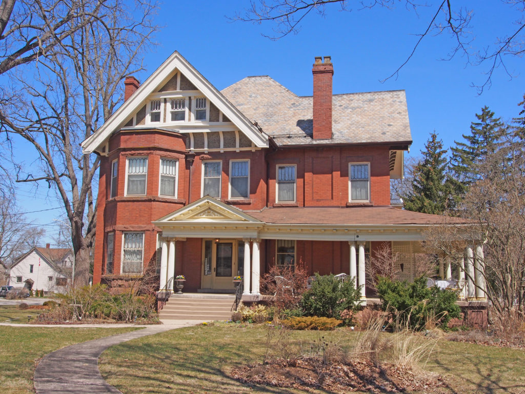
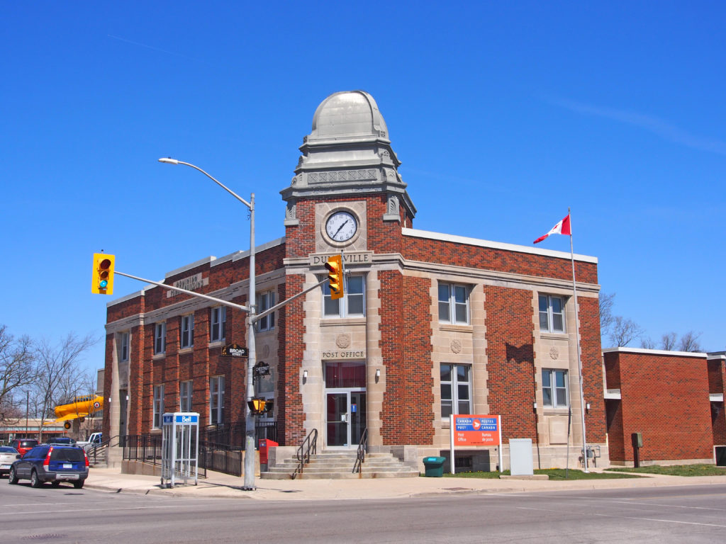
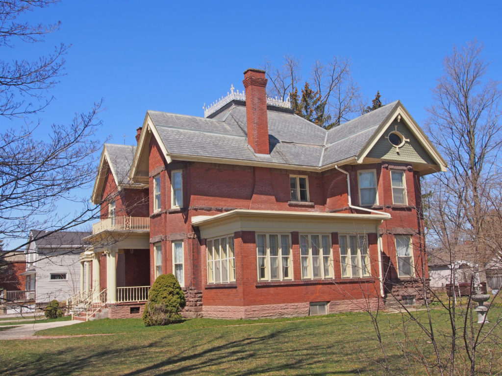
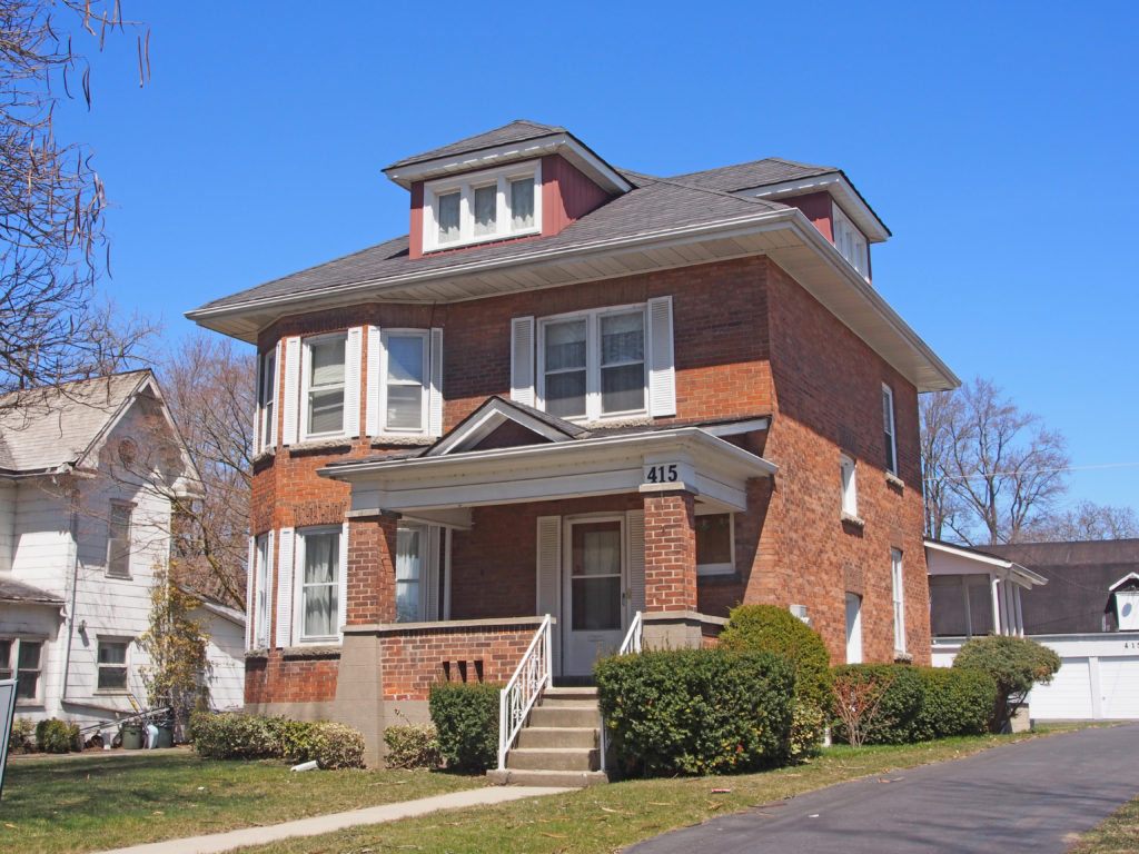
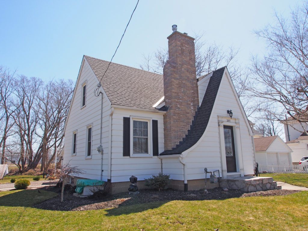
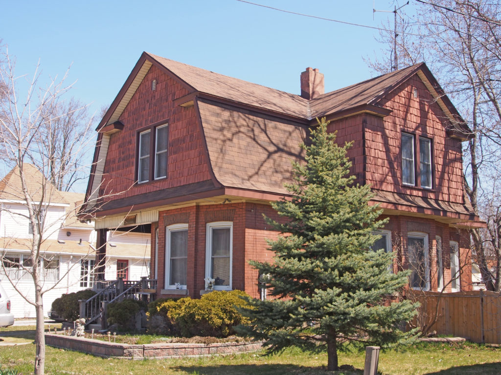
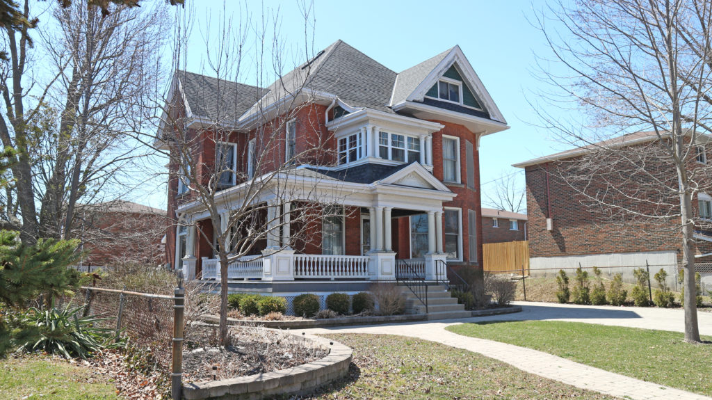
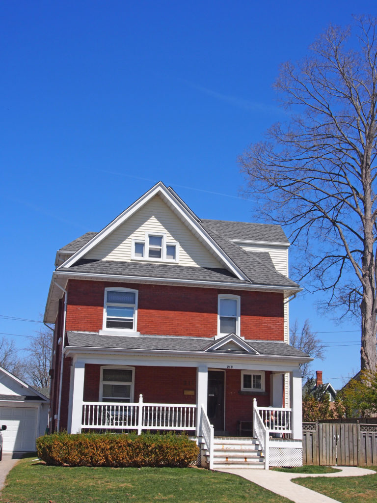
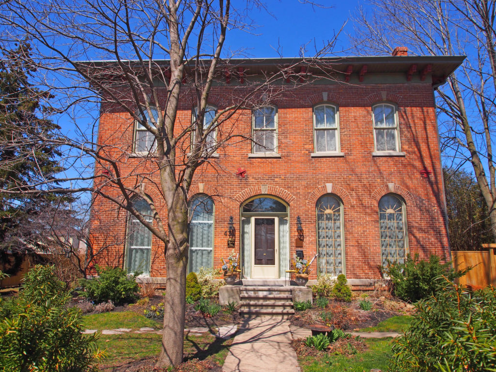
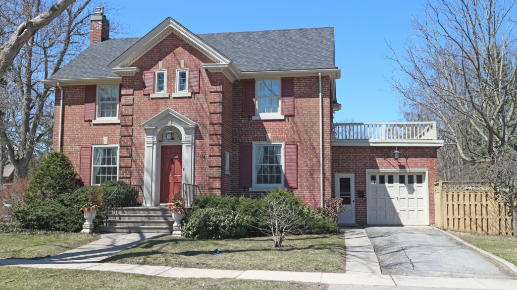
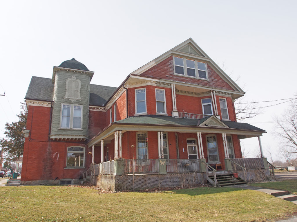
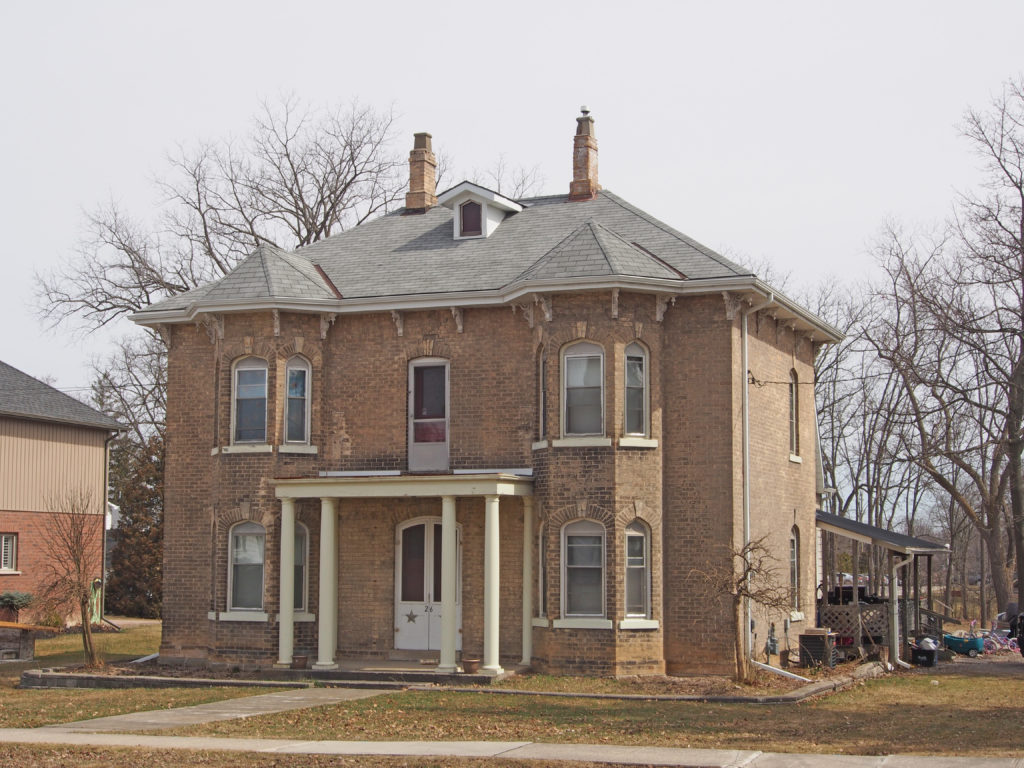
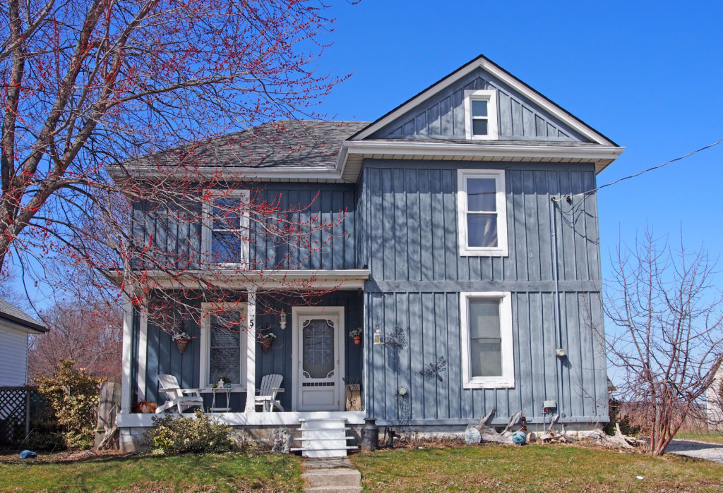
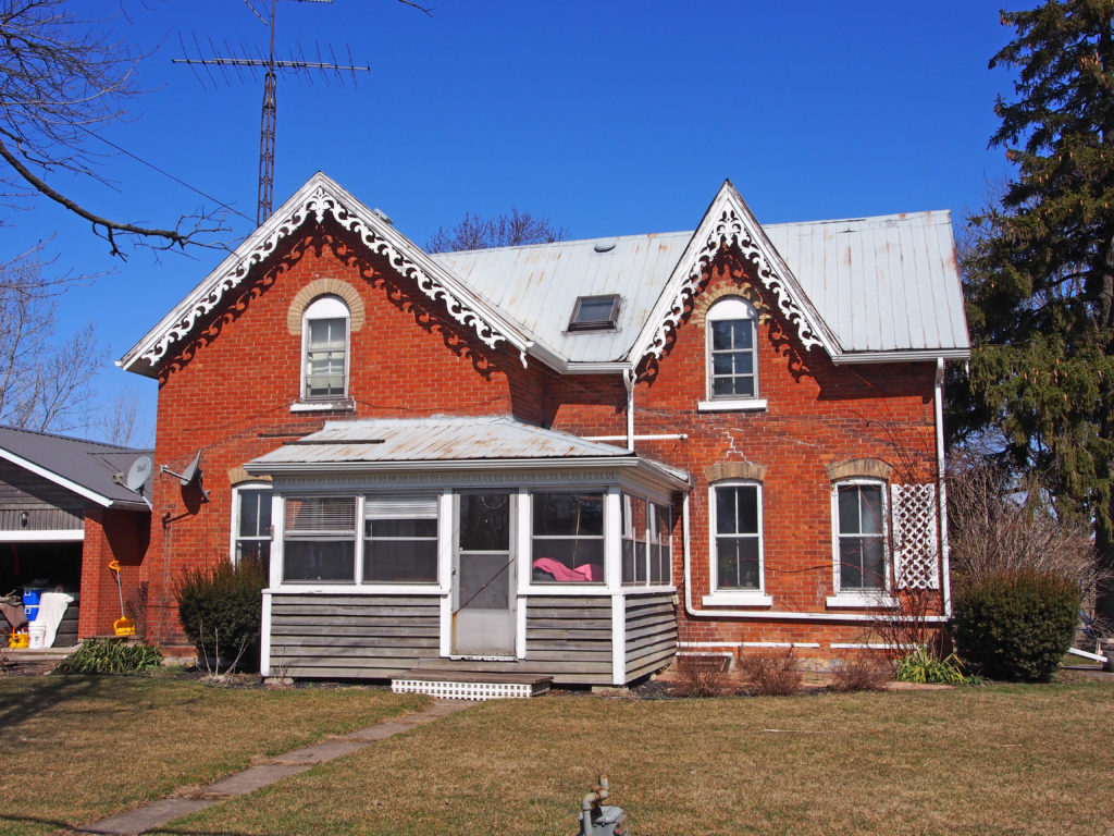
241 Broad Street West – The Lalor Estate is a two-and-a-half-storey residence with a four-gable roof and a wraparound veranda with fluted columns. This Edwardian structure was built in 1905. Its builder was Francis Ramsey Lalor, a prominent Dunnville businessman, politician, philanthropist, and entrepreneur. His business interests included two dry goods stores, a grocery store, an apple evaporator, natural gas wells, the F.R. Lalor Canning Factories, the F.R. Lalor Ashes Company, and the Monarch Knitting Mills. The exterior walls are red brick. There is a two-storey bay window, Tudor-style timbering in the gable, a pediment above the entrance with a decorative tympanum, and sidelights beside the front door.201 Broad Street East – Dunnville Post Office119 Broad Street East – widow’s walk with iron cresting, dormer, Ionic pillars, circular window in side gable415 Niagara Street – dormers in hip roof, two-storey bay window307 Niagara Street307 Tamarac Street – Neo-Colonial – gambrel roofLock Street – wraparound veranda213 Lock Street – Edwardian – Palladian window431 Queen Street – George Sime emigrated from Scotland to Canada in the 1840s and settled in Dunnville. He was a tanner and courier by trade; he was a respected businessman and prominent landowner involved in local politics. He built this two-storey home in 1869 in the Italianate style of architecture. The hipped roof has projecting eaves with paired cornice brackets. The keystone above the entrance has a thistle; there are sidelights and a transom surrounding the door. The middle keystone on the upper storey has the date.304 Church Street – two-storey frontispiece with quoins and cornice return on gable48 North Shore Drive – Gothic
Early patterns of settlement in Haldimand County are still visible in the landscape and architecture, spanning from the pre-Contact era to the proclamation of the Haldimand Land Grant for the Six Nations and the subsequent migration of Loyalist settlers – Americans, largely of German descent and Mennonite tradition. Throughout the 1800s, immigration from the British Isles contributed significantly to the area’s development, as did the small but industrious Black community of the late nineteenth century – many descended from ex-slaves of the American South. Since the post-war years of the twentieth century, a significant stream of immigration from the Netherlands has also added to our ever-expanding mosaic of cultural identity, as have the age-old traditions of our Indigenous neighbors – the Six Nations and New Credit communities.
Following the American Revolution, Sir
Frederick Haldimand, Governor-in-Chief of Canada, granted in 1784 to the Six
Nations of the Iroquois a tract of land extending for six miles on both sides
of the Grand River from its source to Lake Erie. This grant was made in
recognition of their services as allies of the British Crown during the war,
and to recompense them for the loss of their former lands in northern New York
State. In later years, large areas of this tract, including portions of the
present counties of Haldimand, Brant, Waterloo and Wellington, were sold to
white settlers.
By 1853, Cayuga had lumber yards, a foundry,
and a glass factory.
At its height, York had twenty businesses that included mills, inns,
shoemakers, general stores, blacksmiths, and a lumber yard. It had a two-room
school house and two churches.
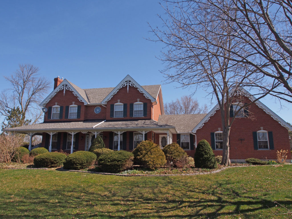
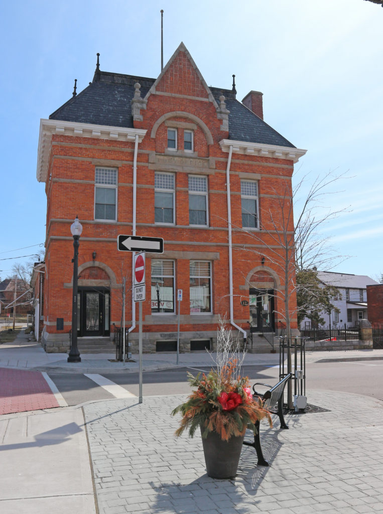
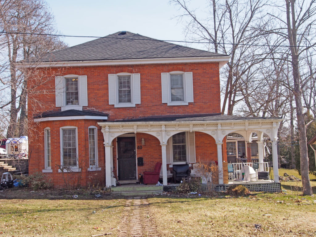
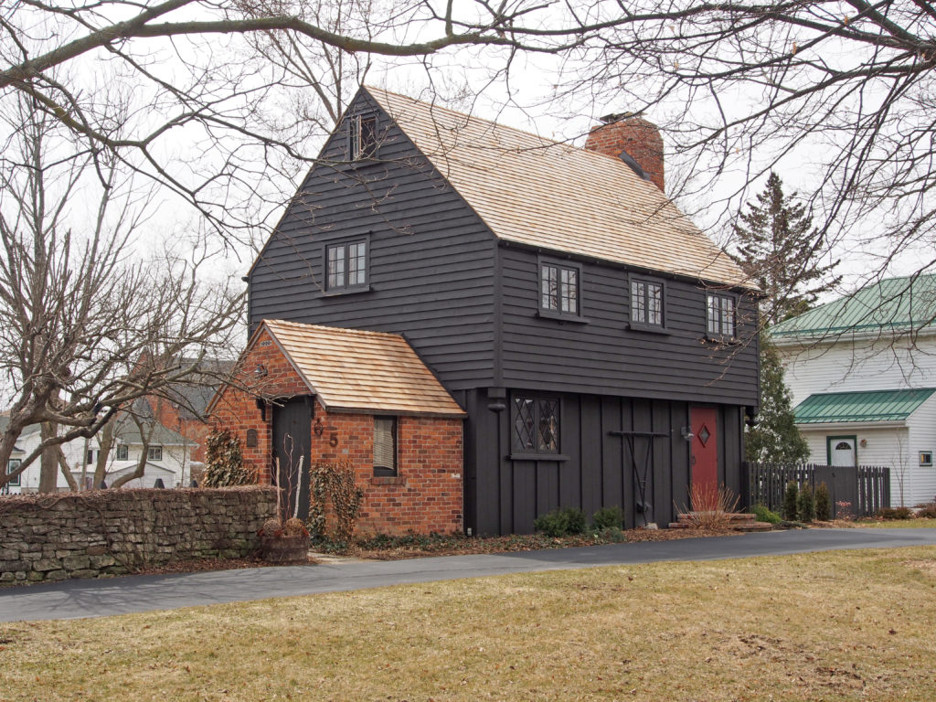
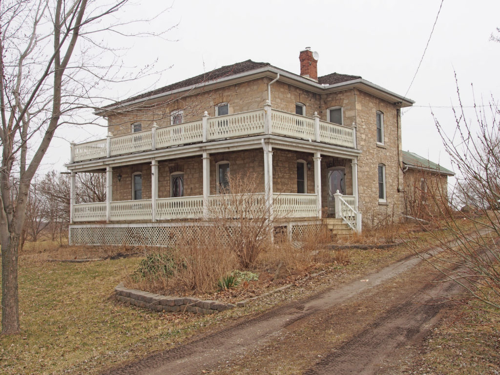
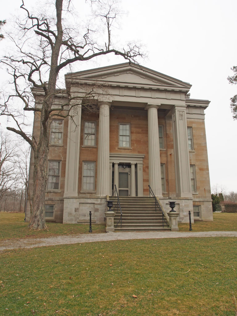
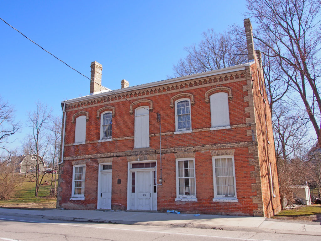
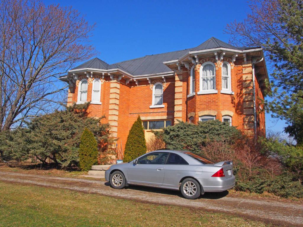
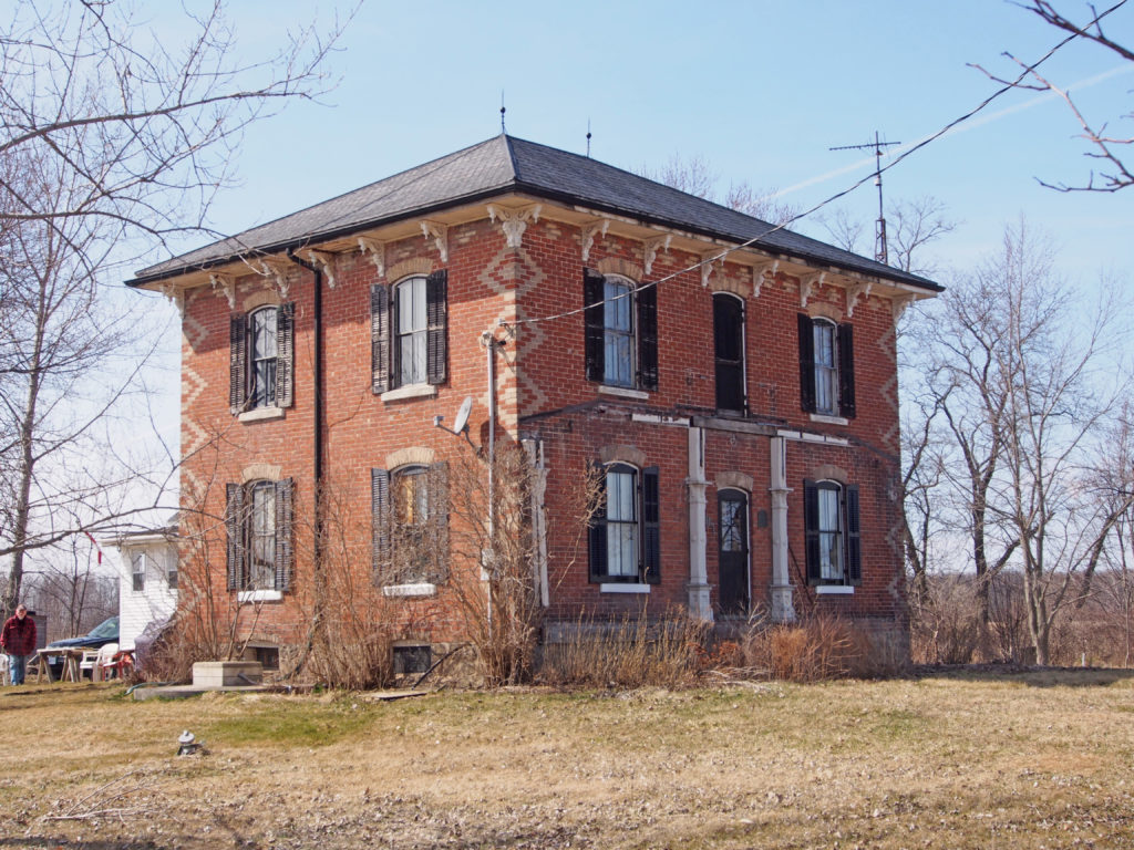
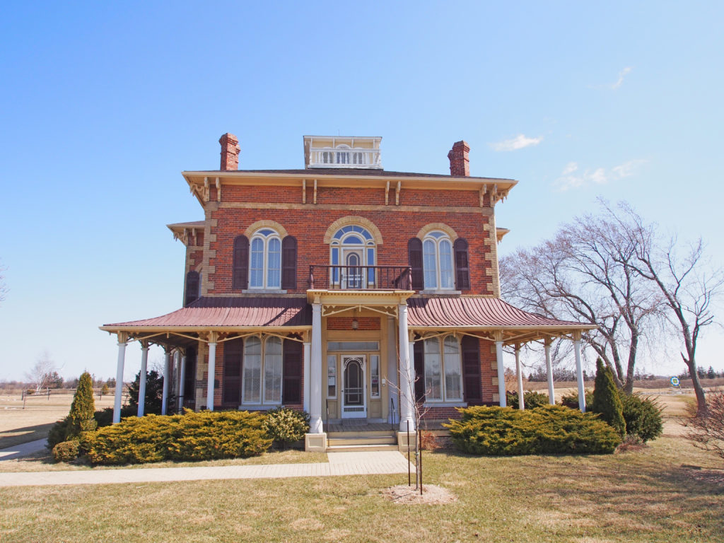
1 Cayuga Street North – Greek Revival – pediment above Doric pillars, keystones, quoins12 Cayuga Street North – Post Office31 Cayuga Street taken from Mohawk Street – Edwardian with bay windows, turret in wing55 Munsee Street – Jailer’s Residence – 1877 – Italianate style, low hipped roof, overhanging eaves with brackets, a bullseye windowMunsee Street – Italianate, paired cornice brackets41 Echo Street – Italianate, dormer in attic40 Ottawa Street – hipped roof, bay window26 Tuscarora Street – hipped roof, cornice brackets, two-story bay windows5 Mohawk Street – The Duff House – replica of a 17th century New England Garrison style house – steep pitched cedar-shake A-roof, second story overhang, double casement wooden windows17 Winnett Street – gable roof, balanced facade, side sun room with balcony above4104 Highway 3 – Campbell-Pine House – c. 1895 – limestone farmhouse with hipped roof, two-story veranda; a large portion of Donald Campbell’s 1847 stone cottage is incorporated into the walls of the house. Donald Campbell was one of the earliest settlers of North Cayuga Township; he operated a steam sawmill on the premises.243 Haldimand Highway 54 – Ruthven Estate, the main house and wing, c. 1845, was designed by the master building/architect John Latshaw. Ruthven Park is a 1,500-acre country estate. The house is in the Greek Revival style with a broad staircase leading to a front landing with classical columns. The south wing was added c. 1860, the south-east wing c. 1880, and the east wing c. 1884. It was the former home of five generations of the Thompson family from the 1840s to 1990s. David Thompson came to the area and started a saw mill in 1834, and added a grist mill in 1836. David was instrumental in the laying out of the former 1200-acre town of Indiana. He eventually owned two sawmills, as well as a gristmill, carding mill, cooperage, and several stores. Overall, Indiana supported over thirty industries and was the largest industrial town in Haldimand County in the mid-nineteenth century.39 Front Street South, York – The Enniskillen Lodge, formerly the Barber Hotel, was built in 1862 for Mr. Daniel Barber, a prominent local hotelier. Large Georgian style windows, doors, and brick detailing are spaced and designed symmetrically. It has a projected cornice with dentils, Regency four-panel door with sidelights and rectangular transom, hood molds over windows, horizontal banding, and corner quoins.2389 Haldimand Road 9 – Italianate – cornice brackets, corner quoins, two-story bay windows
Haldimand County is a
municipality on the Niagara Peninsula in Southern Ontario, on the north shore
of Lake Erie, and on the Grand River. Haldimand was first created as a county
in 1800, from a portion of Norfolk. It was named after the governor of the
Province of Quebec Sir Frederick Haldimand. From 1974 to 2000, Haldimand County
and Norfolk County were merged to form the Regional Municipality of
Haldimand-Norfolk.
The population
centers in Haldimand are Caledonia, Dunnville, Hagersville, Jarvis and Cayuga.
Most of Haldimand is agricultural land, although some heavy industry, including
the Nanticoke Generating Station, is located here. Some of the smaller
communities within the municipality are Byng, Canborough, Canfield, Cheapside,
Fisherville, Kohler, Lowbanks, Nanticoke, Rainham Centre, Selkirk, South
Cayuga, Sweets Corners, and York.
The first white
inhabitants of Rainham were Jacob Hoover with his sons Abraham, David, Benjamin
and Daniel who came from Pennsylvania in 1791, traveling in wagons in which
they carried all their moveable possessions.
They purchased
about 2,500 acres of land from the government. The Hoovers were Mennonites of
Swiss descent. The Hoovers were a thrifty and industrious family and soon had
large clearings. They became wealthy as they were the first settlers who had
any surplus produce to sell to others who came a few years later.
Manufactured
items were very expensive so the settlers made as many items as they could.
Many of them made their own harness of basswood bark boiled in lye which was a
fair substitute for leather.
The township
covers about 25,000 acres with stiff clay soil that is very productive and well
cultivated. Fisherville and Rainham Centre are the only villages wholly in the
township. Fisherville is the center of the German settlement and has a
population of about one hundred and fifty people.
Nanticoke is located
on the western border of Haldimand County. Nanticoke is located directly across
Lake Erie from the United States city of Erie, Pennsylvania. Unlike the
majority of Haldimand or Norfolk County, Nanticoke is a highly industrialized
community. This community is southeast of Simcoe in neighboring Norfolk County
and south of Brantford. Nanticoke’s residential area is bordered on the west by
the Nanticoke Industrial Park, home to the U.S. Steel Canada Lake Erie Works
and a number of smaller businesses.
The Esso
Refinery Nanticoke is on the northeast, and the Nanticoke Generating Station is
on the southeast. Nanticoke used to be a bustling farming and fishing community
inhabited since the late eighteenth century. Nanticoke adapted to the
Industrial Revolution and became a desired spot for heavy industry.
In 1974,
Nanticoke was incorporated as a city within the Regional Municipality of
Haldimand-Norfolk through the amalgamation of the towns of Port Dover and
Waterford, the village of Jarvis, and parts of the townships of Rainham,
Townsend, Walpole and Woodhouse. In 2001, the town and all other municipalities
within the region were dissolved and the region was divided into two single
tier municipalities with city-status but called counties. What was the city of
Nanticoke is now split between Haldimand County and Norfolk County. Wind
Turbines were installed in November 2013.
Cheapside is located
in the Regional Municipality of Haldimand-Norfolk and is part of the City of
Nanticoke. I n 1854 David Silverthom settled here and opened the
first store. He was bought out in 1860 by William Pugsley who called the place
Cheap Corner. When the post office opened around 1865 the postal department
proposed the present name which was accepted by residents.
Lake Erie
shoreline, quiet roads and countryside make Selkirk a haven for travelers.
Selkirk is located forty-five kilometers southwest of Hamilton and a short
drive from Dunnville, Cayuga, Port Dover and Simcoe. Selkirk
is the oldest village in Walpole Township. Settled by the Hoover family around
1800, the village was the site of a mill and an important center for the local
farming community. When the post office opened in 1831 the village was
called Walpole. In 1855, the village was renamed Selkirk, in honor of Thomas
Douglas, Lord Selkirk, who once owned land in the area.
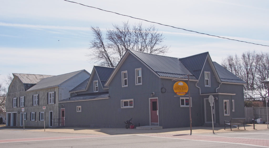
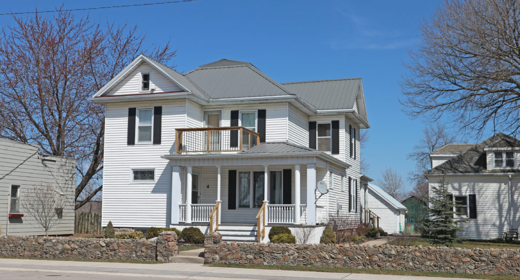
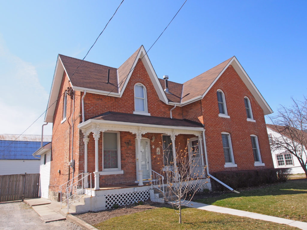
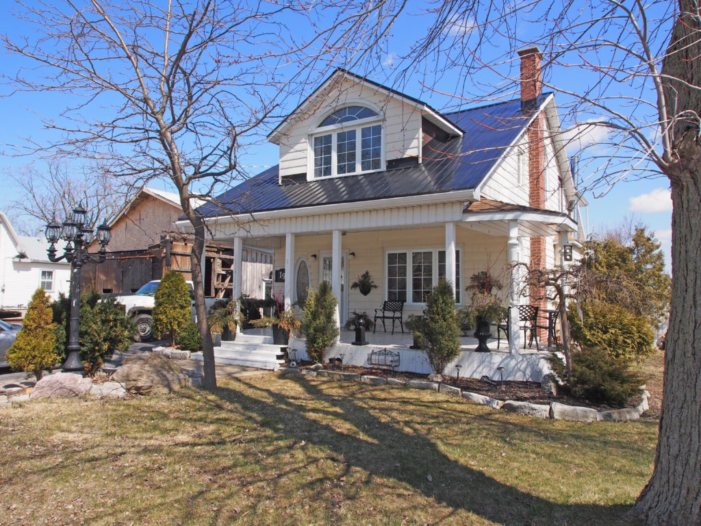
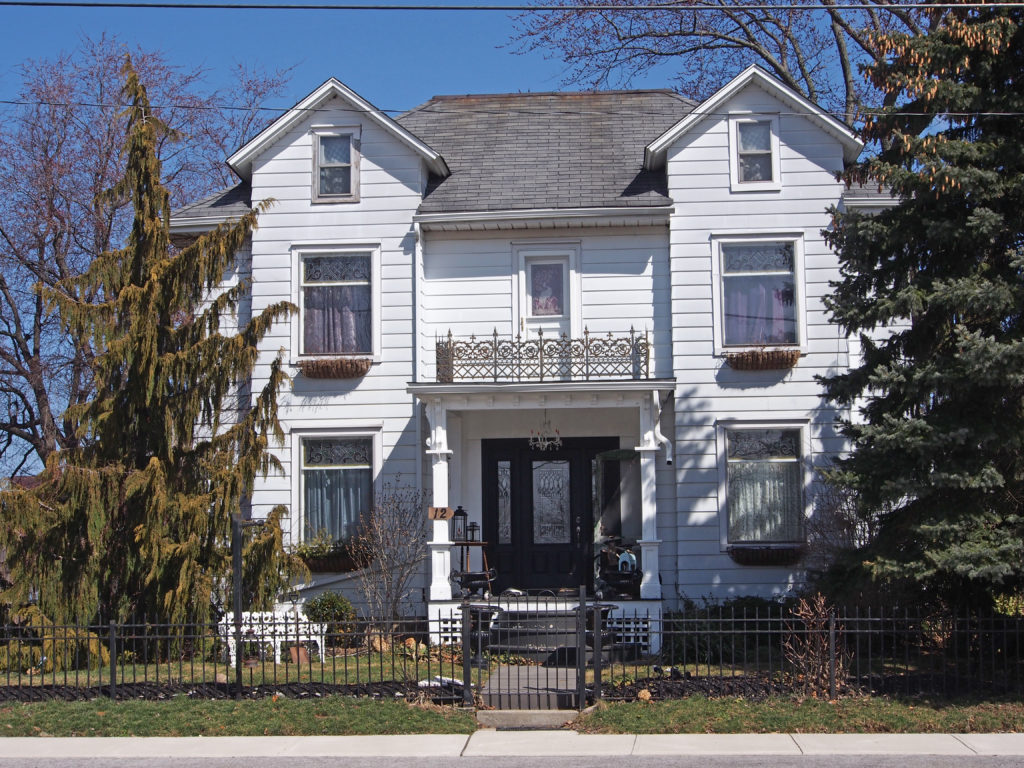
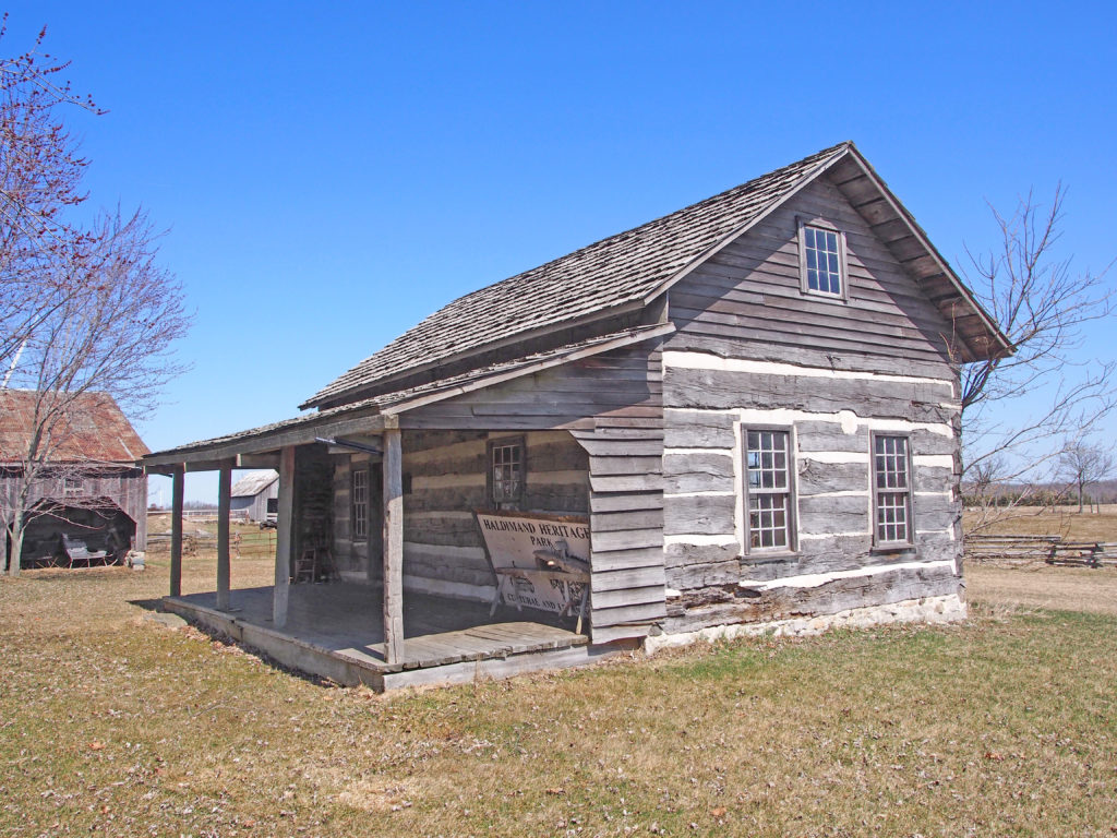
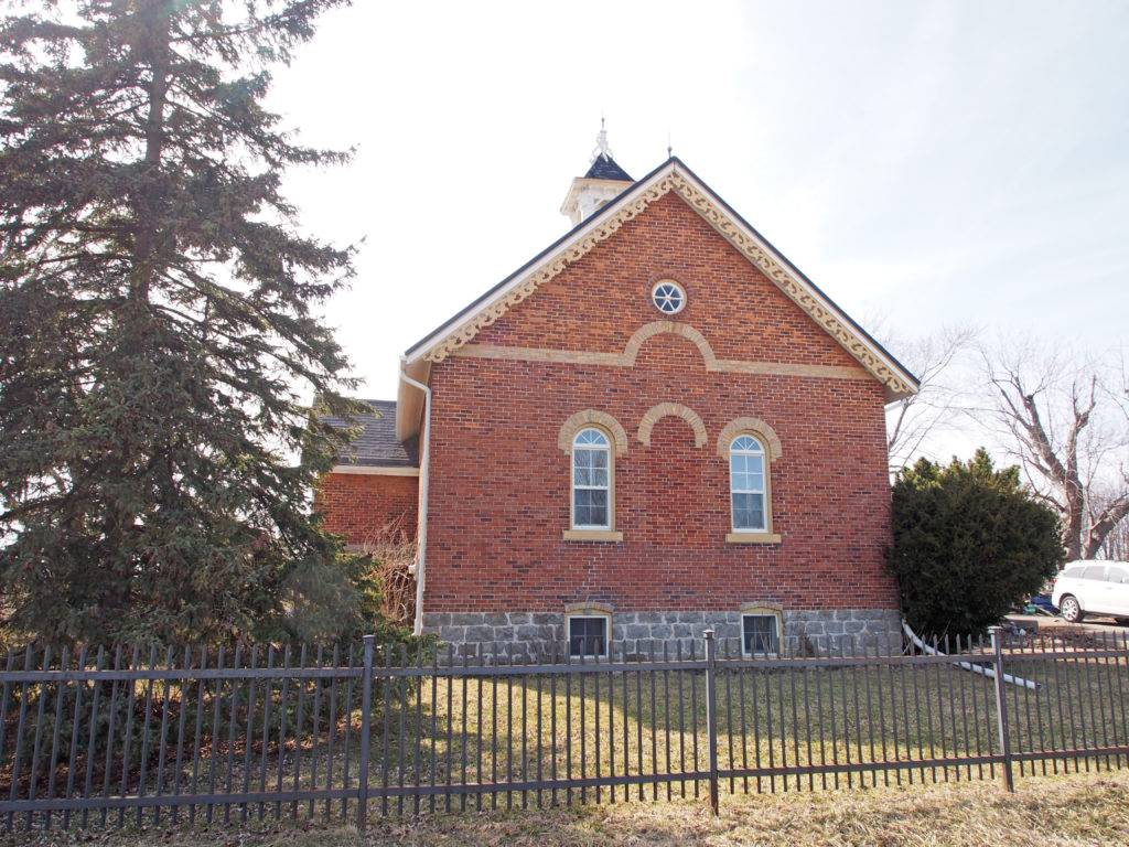
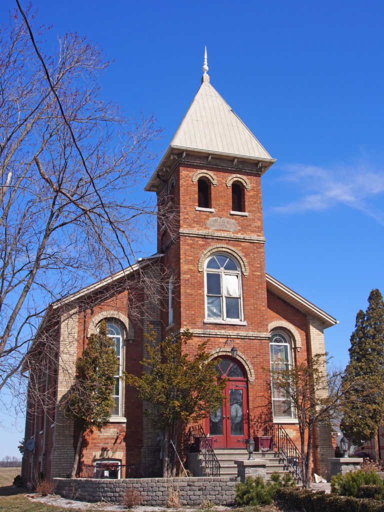
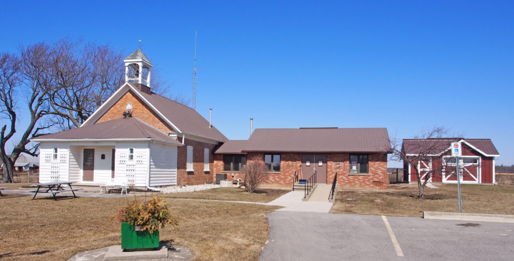
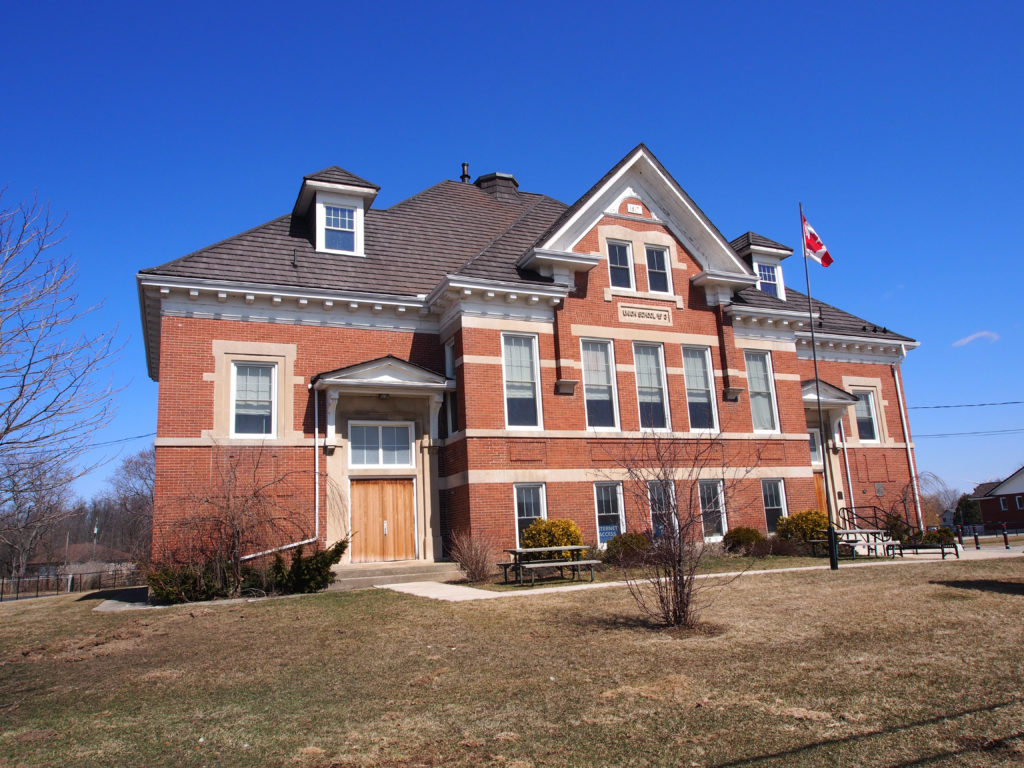
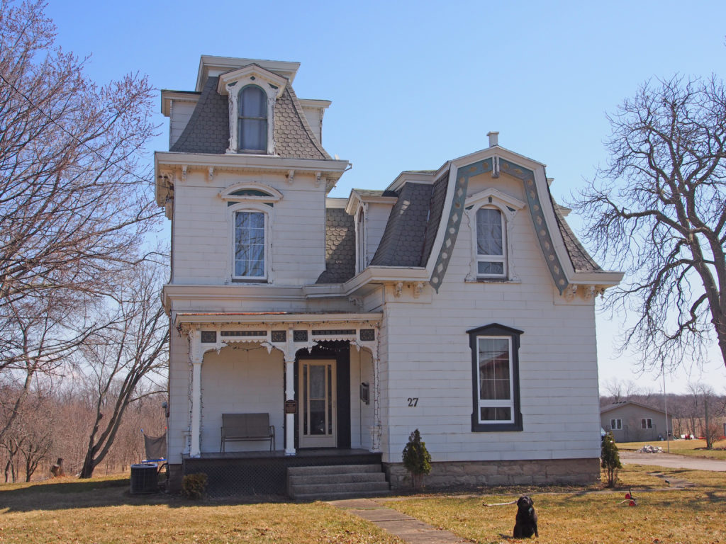
Ye Olde Fisherville Restaurant#4 – second floor balcony#9, Fisherville – Gothic#19, Fisherville – larger dormer, wraparound veranda#12 – Fisherville, Ontario#5 Fisherville, Ontario601 Haldimand Road 12, Fisherville – The Charles Reicheld House crafted by traditional German carpenter Valentine Hartwick in 1886 – farmhouse with cornice brackets, dichromatic brickwork, hipped roof95 Concession 4, Fisherville – The Hoover log house built in 1793 on the Lake Erie shore south of Selkirk for Daniel Hoover, son of Jacob Hoover from Pennsylvania. In 1997, the fire damaged remnants were brought by Mr. Bill Fletcher, reassembled and relocated on his farm.255 Kohler Road, Rainham Centre – former schoolNanticoke – Gothic Revival – verge board trim on gablesRainham Road – Methodist Church – 1874Wilson MacDonald Memorial School Museum, Cheapside – The original square framed school was opened on land owned by James Buckley and was replaced by this red brick one in 1872. It closed in 1965 and reopened in 1967 as a museum and memorial to Wilson MacDonald, a former student and renowned poet.S.S. No. 3 Union School, Selkirk – 1918 – the school closed in 1949. It reopened in 1967 as a library and Selkirk Centennial Community Centre.27 Erie Street South, Selkirk – James Cooper built this house in 1870. In 1878 he sold it to George Hoover. The frame house has irregular massing and is in the Second Empire style. It has an over-sized horseshoe dormer with barge board and finial, elaborate window molds with pediments. The three-story tower has four dormers in the mansard roof. The Fess family purchased it in 1947.15 Erie Street North, Selkirk – Italianate, hipped roof, cornice brackets, quoins, banding15 Erie Street North, Selkirk – Italianate, hipped roof, cornice brackets, quoins, banding