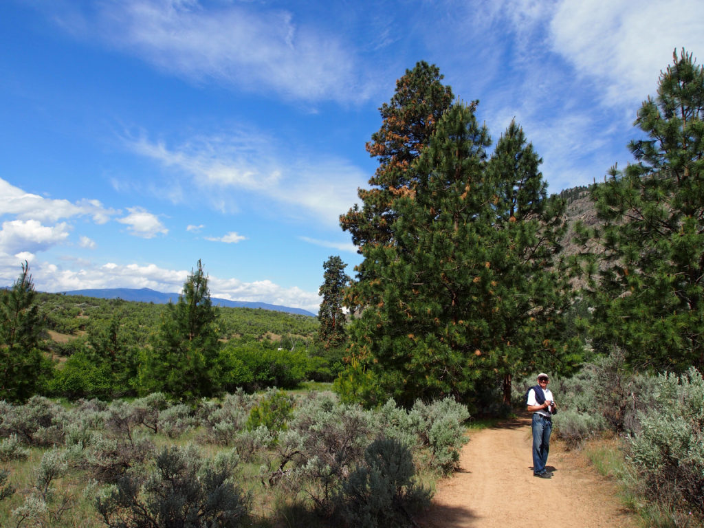
Vernon is a city in the Okanagan region of the southern interior of British Columbia. Named after Forbes George Vernon, a former Member of the Legislative Assemblyof British Columbia who helped found the famed Coldstream Ranch nearby.It is the oldest city in the Okanagan Valley and celebrates its history and heritage with the larger-than-life display of twenty-six murals painted on the walls of its downtown buildings.
The Okanagan people settled around the city’s two lakes, Okanagan Lake and Swan Lake, obtaining seasonal sources of food. Fur traders camped in Vernon as it started to develop in 1863, following a gold discovery at the Cherry Creek, Monashee Mountains, Mission Creek and east side of the Okanagan Lake. Vernon was home to many cattle ranches and fruit orchards.
Vernon expanded after the Canadian Pacific Railway was opened in the Okanagan and Shuswap regions in 1891. The stern-wheeler S.S. Aberdeen was launched by the Canadian Pacific Railway for use on Okanagan Lake in 1893 connecting Vernon to Penticton at the south end of Okanagan Lake, and points between.
Chase is located at the outlet of Little Shuswap Lake which is the source of the South Thompson River. Chase Creek, which drops over three small waterfalls before flowing through the town, enters the South Thompson just below the lake’s outlet. The main industries in Chase are forestry and tourism.
The town was named after a flamboyant character named Whitfield Chase, an American from New York State. After originally coming to Canada during the 1858 gold rush he settled in the area in 1865. He was the first non-native settler that farmed and raised a family, in what was then called, The Shuswap Prairie.
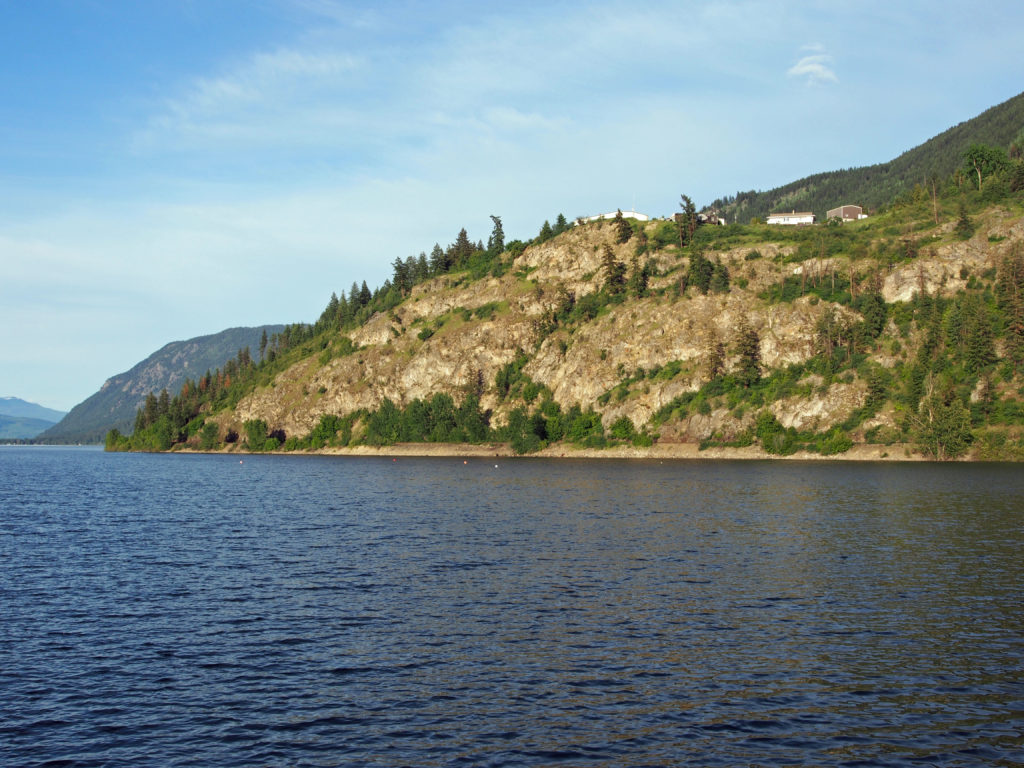
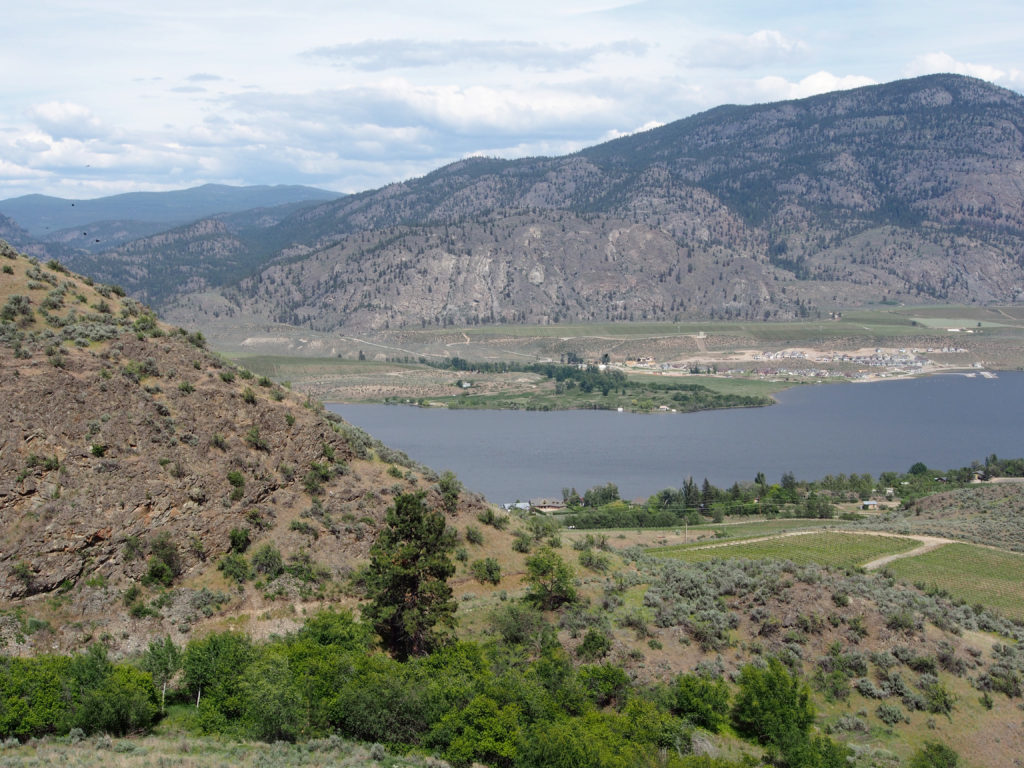
Sorrento is on the south shore of Shuswap Lake, 28 kilometers west of Salmon Arm and 80 kilometers east of Kamloops. You can fish in the lake, enjoy water sports and boating, and view scenic landscapes.
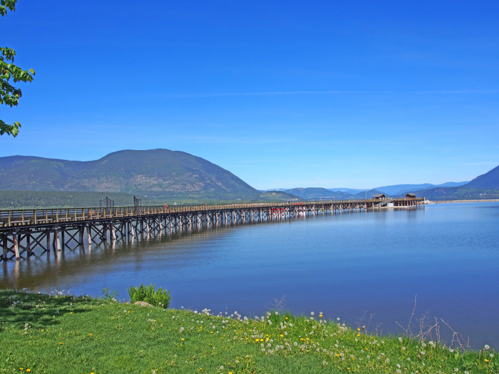
Salmon Arm is located on Shuswap Lake midway between Calgary and Vancouver on the Trans-Canada Highway. It has the longest curved wooden wharf in North America which draws tourists from around the World.
By 1904, Salmon Arm had acquired a reputation for having an excellent fruit harvest. The local businessmen grew fruit as a main export, sending it to the larger, more populated towns that surrounded it.
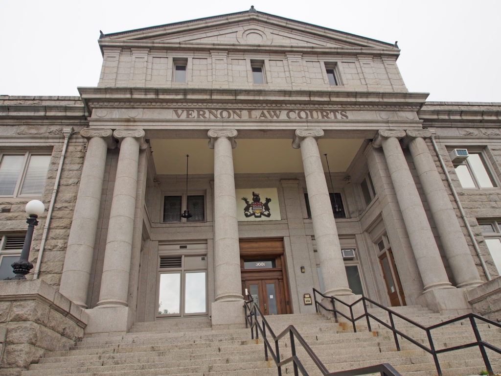
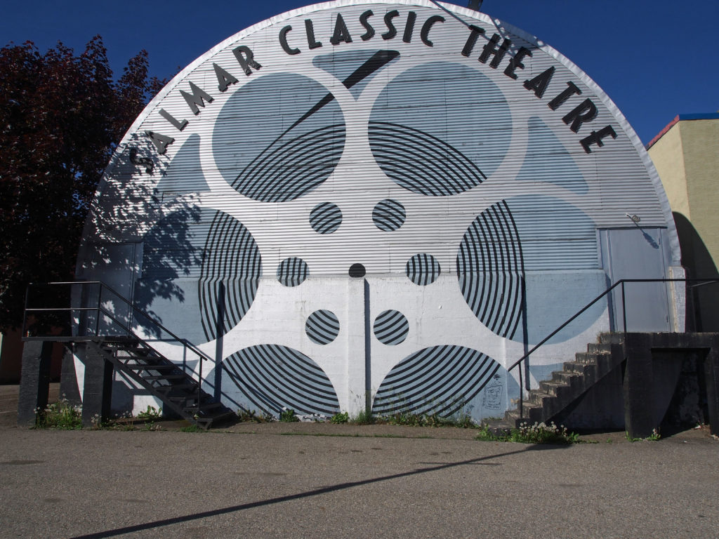
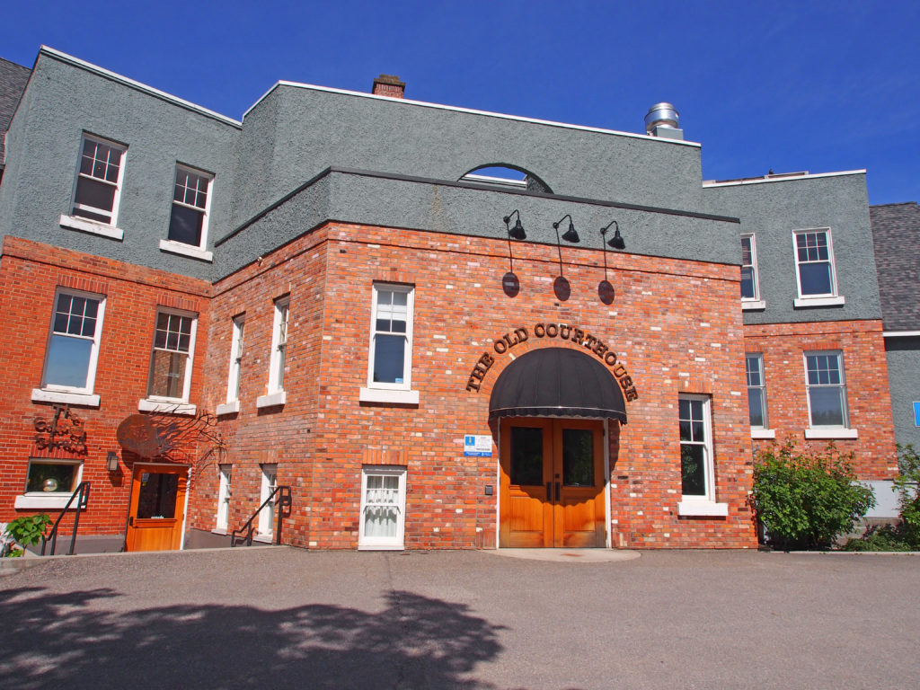
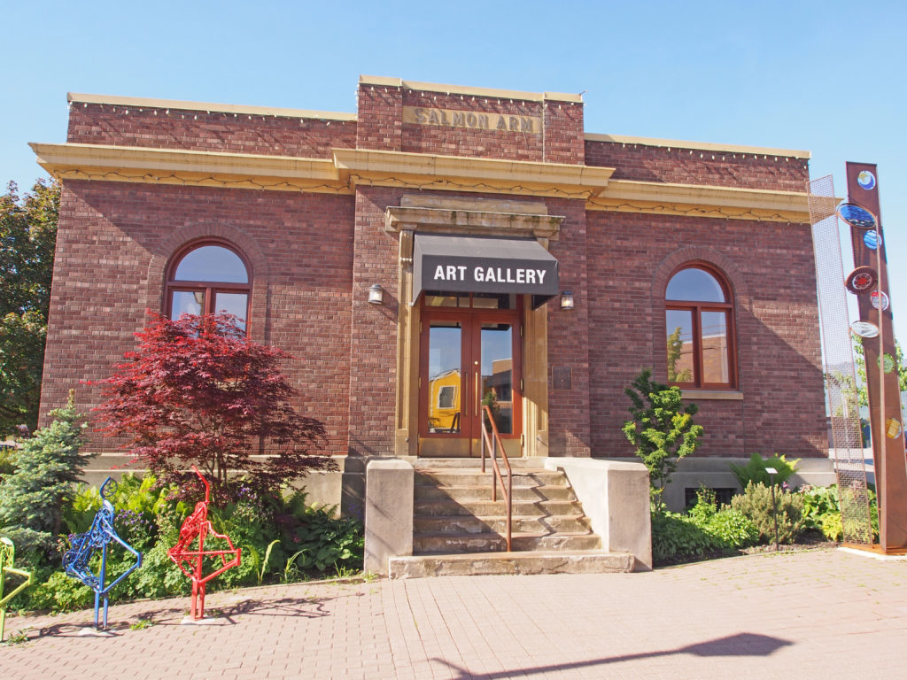
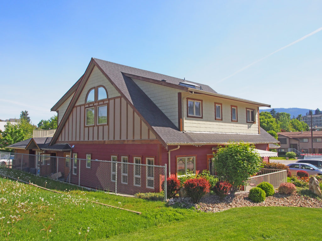
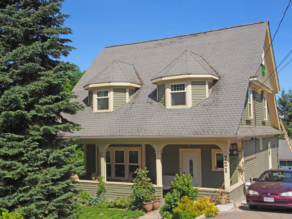
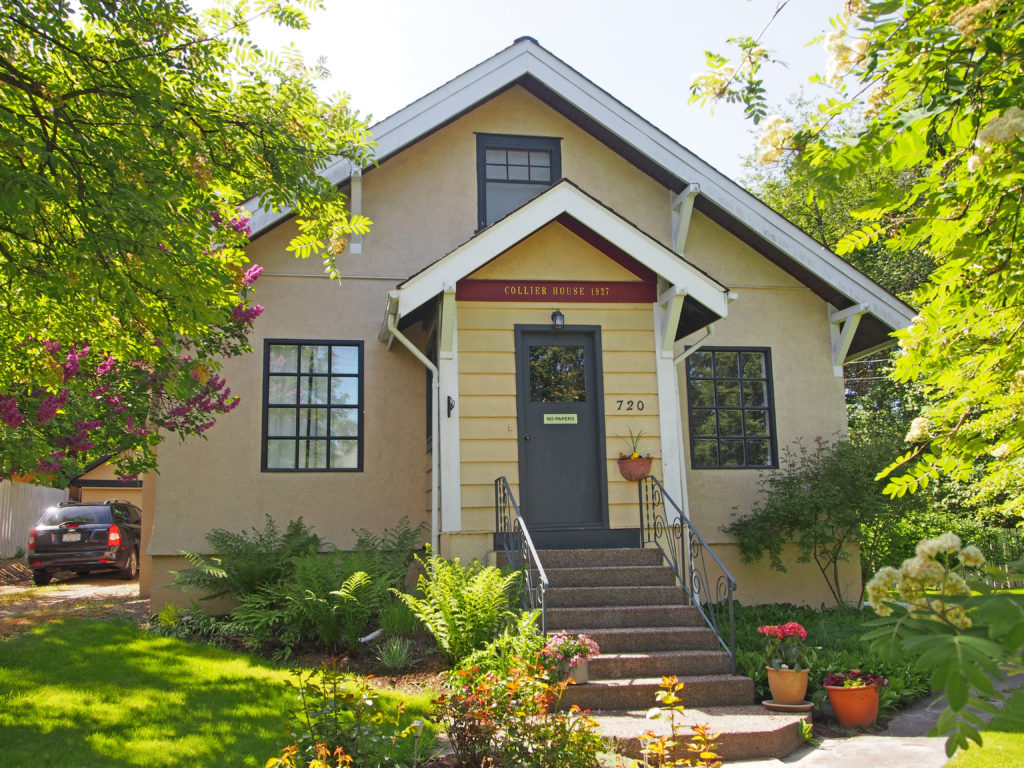
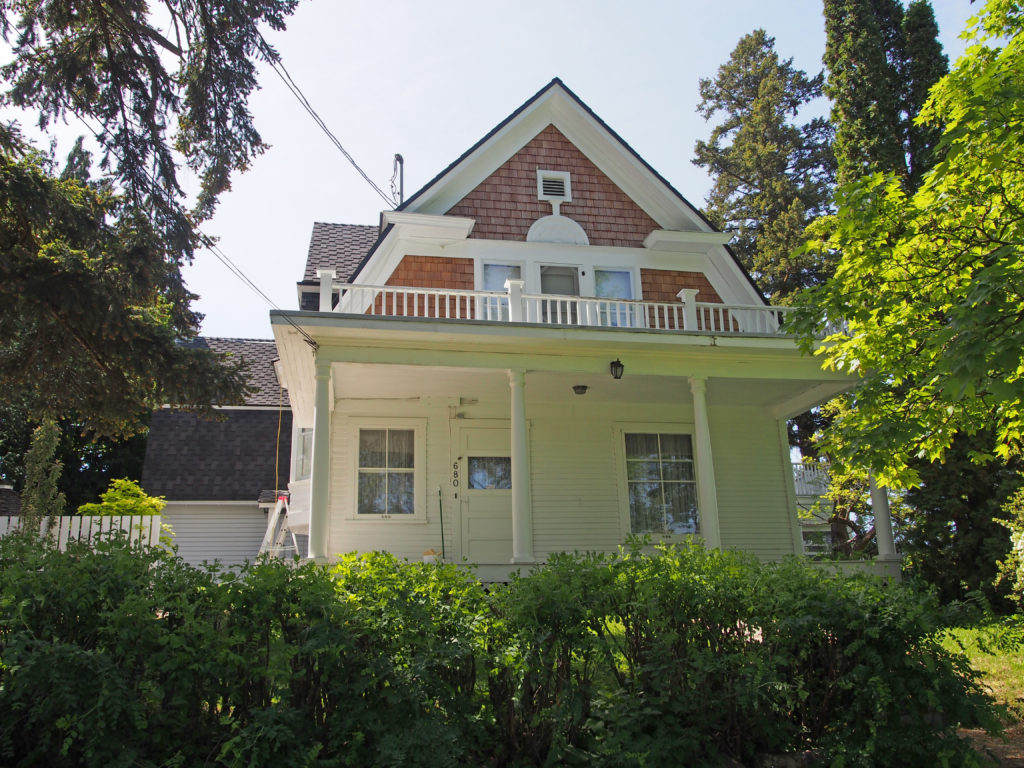
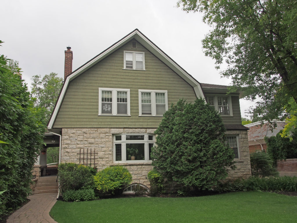
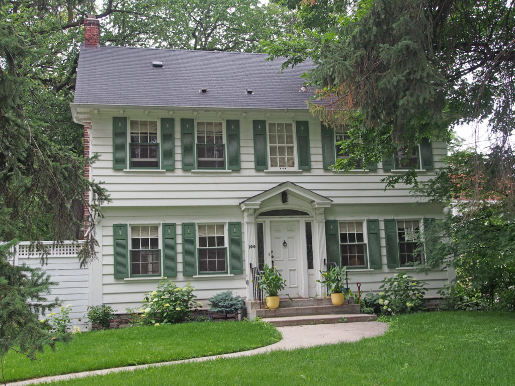
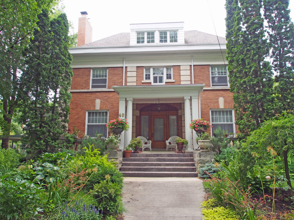
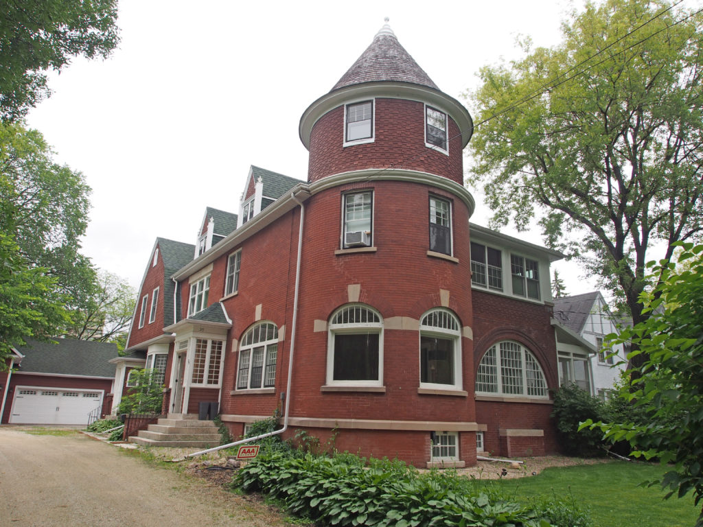
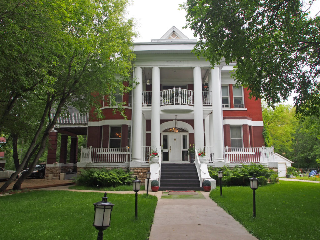
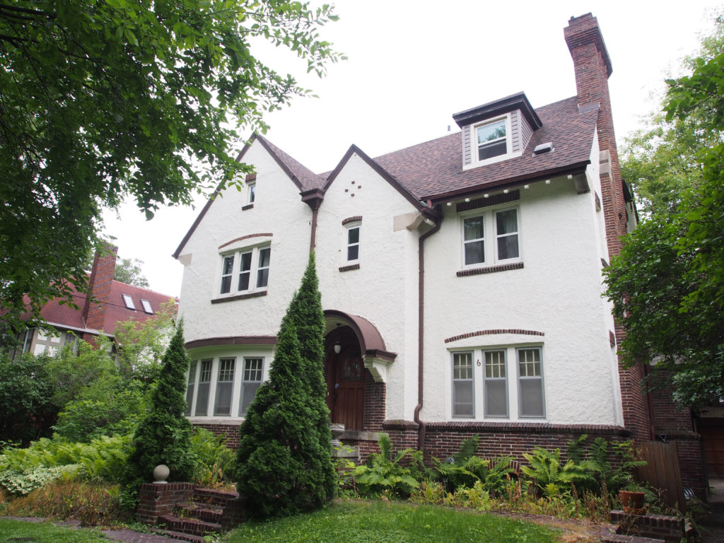
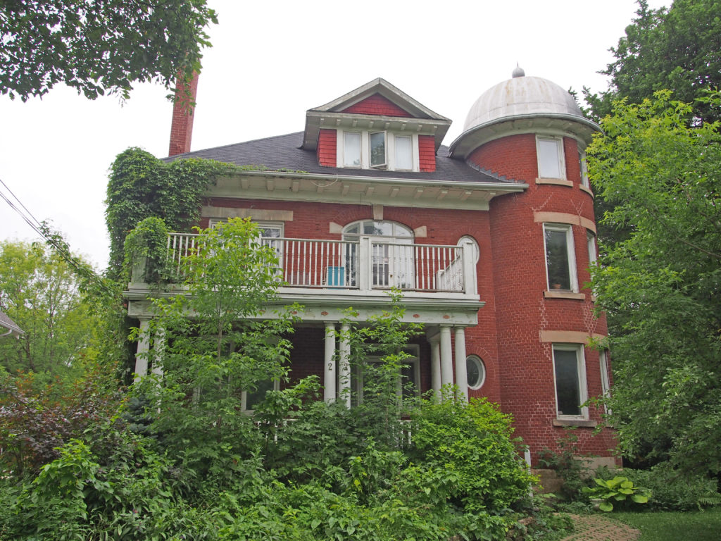
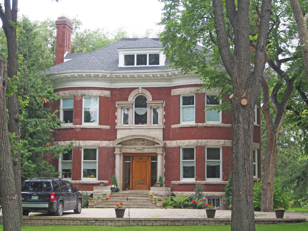
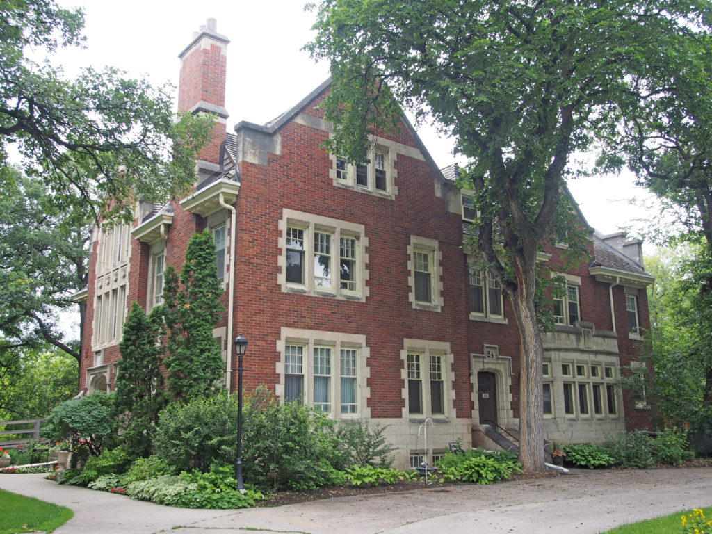
Vernon – 3302 27th Street – Beairsto Elementary School was known as Central School when it was built in Vernon in 1909. The brick building was three stories high with an auditorium on the third floor. A north wing in stucco was added in 1939 and a south wing was added in 1946. Harold K. Beairsto was principal from 1925 to 1961; when he retired the name of the school was changed to honor him. Beairsto Elementary School is still operating as a school and is the center for Vernon’s elementary French Immersion program. The main entrance is accentuated by a Georgian arch and the Mansard roof is topped by an octagonal cupola and framed by large chimneys.Vernon – 3001 27th Street – Vernon Law Courts – This second court house for Vernon was designed by T. Hooper and was started in 1910. It was built in the Classical Revival style of local granite from a quarry at Okanagan Landing. The first court case was heard in 1914.Vernon – 2203 30th Avenue – This impressive Queen Anne house features and octagonal tower, fish scale shingles, deep eaves and bay windows. The Campbells were long-established furniture dealers.Vernon – 2301 32nd Avenue – The steeply pitched Mansard roof of the Mohr House permits full use of the attic. It was built in 1893 for a wood-turner at Smith and Clerin’s Sawmill.Vernon – 2003 37th Avenue – C.B. Lefroy, rancher, later notary public and realtor had this home built in 1905. The hip-on-gable roof and highly decorated barge boards in the gable ends create a picturesque cottage-like effect. At one time the house was part of Miss Le Gallais’ School for Girls founded in 1913. Miss Topham-Brown, who came to Vernon in 1917, worked here as housekeeper, cook, games coach and drawing instructor prior to opening her own studio. She was an enthusiast supporter of the arts until her death in 1974.Chase – Shuswap LakeSorrento – Shuswap Lake taken from Caen Road Community ParkSalmon Arm – Salmar Classic Theatre was built in 1949 using a Quonset design which was developed during World War II. It is circular in shape and constructed of corrugated steel sheets bolted together into a half circle arch form.Salmon Arm – 20 Hudson Avenue NE – The old Courthouse, constructed in 1930, is a two-story brick and stucco building with gable dormers and half timbering. It has an arched entryway and portico, decorative eave brackets and carved barge boards.Salmon Arm – 20 Hudson Avenue NE – The Municipal Hall is a one-story brick building with a gable roof, gable dormers and a brick chimney.Salmon Arm – 70 Hudson Avenue NE – The Post Office, completed in 1937, is a one-story flat-roofed brick building with a raised stepped parapet in an Art Deco style including arched Palladian windows. The Post Office moved to a new location in 1974; the building was used as a library for nearly twenty years and now houses the Shuswap Art Gallery. Salmon Arm – 251 5th Street SE – Skeleton House was built in 1912. Bob Skelton was Manager of the Salmon Arm Cooperative Creamery and the city mayor. It has a large gabled roof with lower-sloped “skirts†at the eaves. There are two gable-roofed dormers (one front, one back) each with the same lower-sloped eave details as found on the main gable.Salmon Arm – 721 Harris Street – The M.M. Carroll House was built in 1909 and is an excellent example of pre-First-World-War bungalow design. Carroll was a plumber, tin-smith, undertaker and theater owner. It has a gable roof with dormer extensions at the top level; the windows are double hung and have upper lite multi-panes. The front verandah has bevel-sided half walls with cased posts, moldings and curved cased beams.Salmon Arm – 720 Harris Street – The Collier House is a 1½ story cross-gabled house in the low Craftsman bungalow style. There are knee braces supporting the gable end eaves.Salmon Arm – 680 Harris Street – The Lyman House was built about 1908 in the Dutch Colonial style.Salmon Arm – The wharf is one of the iconic features of Salmon Arm.
The South Okanagan Valley is located at the northernmost tip of the upper Sonoran Desert system which starts in Mexico and extends through North America as the Great Basin. Because of the low rainfall and a very sandy soil, desert plants grow in the region. Osoyoos is surrounded by hills blanketed in sage and pine forest. The valley sides and bottomlands have orchards that produce the earliest fruit in Canada as well as great wines. Early agricultural production in the Okanagan-Similkameen region was focused mainly on cattle ranching as the local environment was well suited to cattle grazing and provided beef to expanding communities.
Ranching in the Okanagan Valley got its start in the 1860s when Osoyoos customs officer Judge John Carmichael Haynes levied duties on the herds of cattle that were being driven from the United States to the Cariboo gold fields. Many of the cattle drovers could not afford to pay these duties, and thus paid Haynes with cattle. Haynes kept some of the cattle for himself, and sold some to other early settlers.
Until the construction of the Kettle Valley Railroad in 1915, the cattle had to be herded over the treacherous mountain trails in order to reach the markets. Once the K.V.R. was constructed, the cattle had only to be driven to Penticton, where they were loaded into boxcars and shipped to the meat processing plants in Vancouver. The ranching process was facilitated further in 1943, with the establishment of the first stockyard in Okanagan Falls.
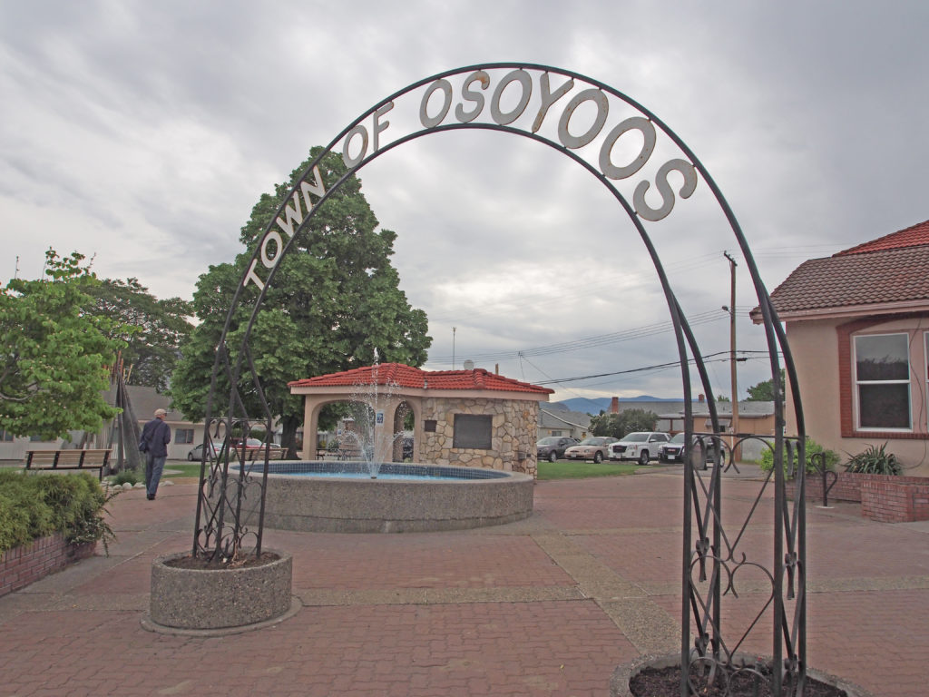
Osoyoos means “a place where two lakes come together.†In 1811 the first white men in their search for furs came here and established a fur trading post. Cattle ranching, mining and lumbering followed. In 1907 the first commercial fruit orchard was planted because it was the warmest place in Canada. The community nestles along Lake Osoyoos which is twelve miles long and at an elevation of only 912 feet above sea level.
With its orchard setting, lakes and mountains, the likeness to the county of Spain is apparent. This sparked the community to adopt a Spanish theme.
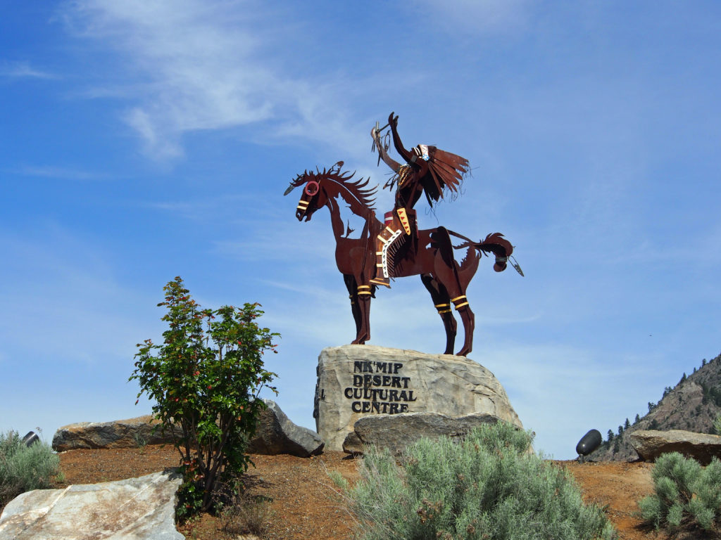
The Nk’Mip Desert Cultural Centre celebrates the precious cultural heritage of the Osoyoos Indian Band and explores their desert landscapes. The site is fifty acres of sage grasslands and ponderosa pine forest. The name NK’MIP (Inkameep) means “gateway or doorway to the bottom of the lake system.†The Inkameep lived off the land, lakes and rivers. They hunted, fished and grew crops and gave thanks to the ‘Great Spirit’ for the seasons and the bounty they shared. The Osoyoos Indian Band was a trading nation and developed trade with bands farther north in the Okanagan Valley and the Colville Band in Washington.
Nk’Mip Cellars became a reality under the leadership and vision of Chief Clarence Louie. His tenacity as an entrepreneur is upheld by his passion for his people and their place within the Canadian economy. Sam Baptiste, General Manager of Inkameep Vineyards is recognized as one of the best wine growers in this British Columbia region.
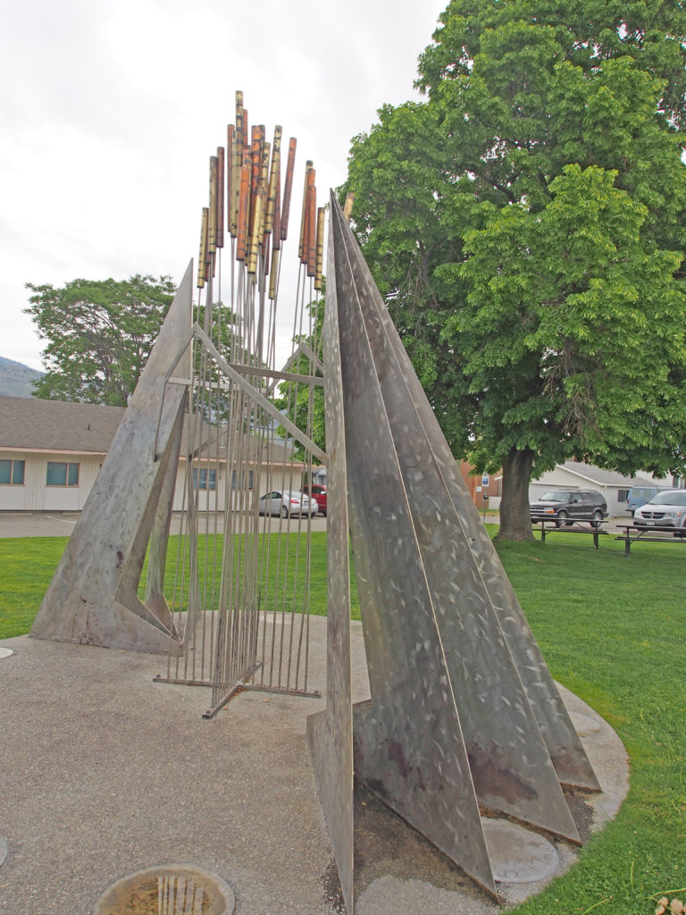
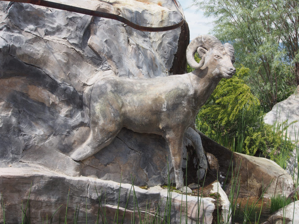
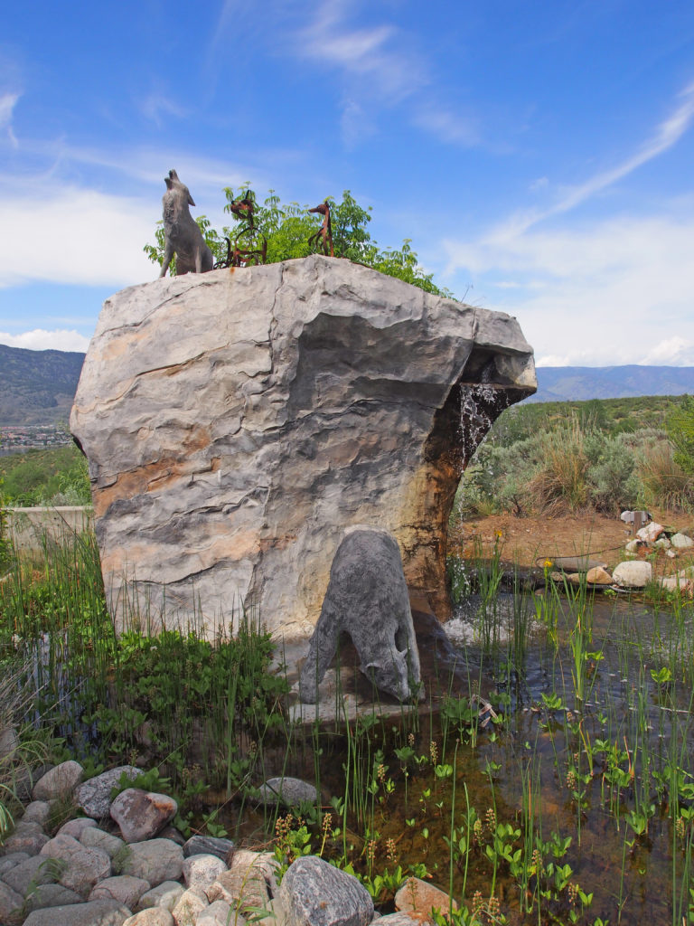
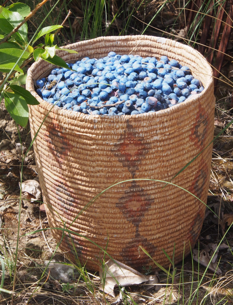
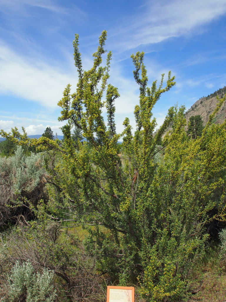
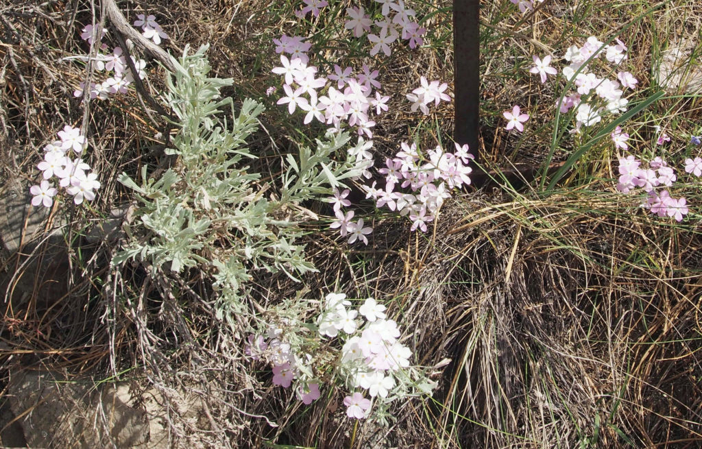
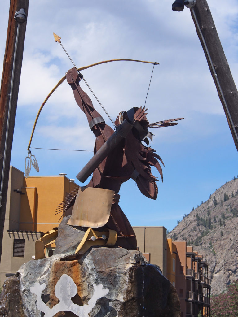
A kinetic sculpture pays homage to the Okanagan First Nation of the areaNk’Mip Desert Cultural CentreMountain SheepWolf howling, bear belowSoopalallie (also called soap berries) are berries gathered from May to July and whipped with water into “Indian ice creamâ€, a pinkish-white froth resembling beaten egg whites. Jinxed people drank a brew of soopalallie and wild raspberries to change their luck.Antelope Brush is a member of the rose family. The Okanagan People used this plant as a detoxifying cleanser. The branches were used to make hot fires during winter camping trips. The shrub is an important browse plant for deer and bighorn sheep. Chipmunks, ground squirrels and mice eat its seeds.Harry in front of the Ponderosa PineThe desert was in bloom for us – not too hot when we were there. Long Leaved Phlox – Growing among the sagebrush, phlox is the longest blooming native spring flower. The showy pink to white flowers appear in April and last through mid-June. The Okanagan People used this plant for treating anemia in children.Spotted Lake is located on Highway 3 and is sacred to the Okanagan First Nations People. The peculiar blue, green and yellow spots on the surface of the lake are formed from high concentrations of minerals and salt as the water level evaporates and drops.
Lockport is a small community in Manitoba located twenty-eight kilometers north of the city of Winnipeg. The community is a part of both the Rural Municipalities of St. Andrews (west of the river), and St. Clements (east of the river). Lockport is an ancient settlement, predating European history by thousands of years. It is one of the oldest known settlements in Canada. Flocks of the North American White Pelican are often seen.
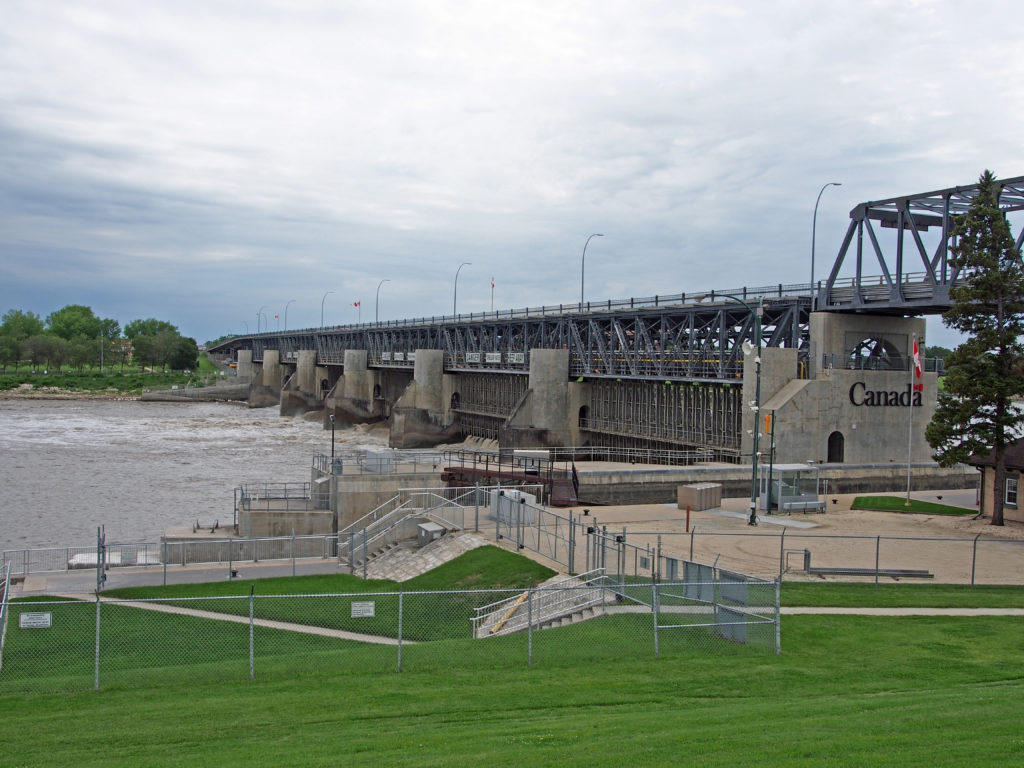
The Red River Floodway joins the Red River just north of the dam. The bridge and locks at Lockport (completed in 1910), submerged the St. Andrews Rapids (a natural obstruction to the south) in order to make the Red River navigable through to Lake Winnipeg.
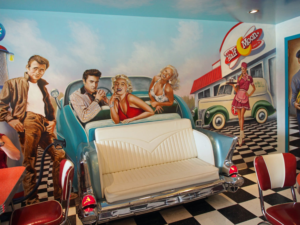
We enjoyed lunch at the Half Moon Restaurant.
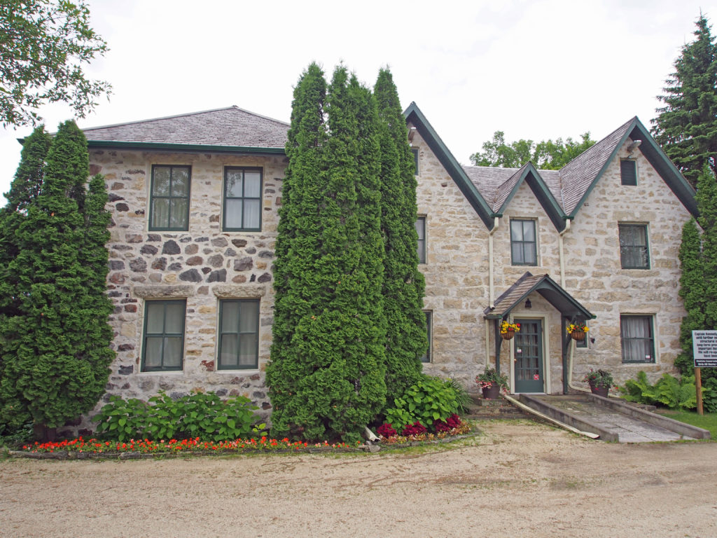
South along River Road is St Andrews Church and Rectory. The Church is the oldest operating church in Western Canada. Kennedy House, also located on River Road, was built by Captain William Kennedy in 1866.
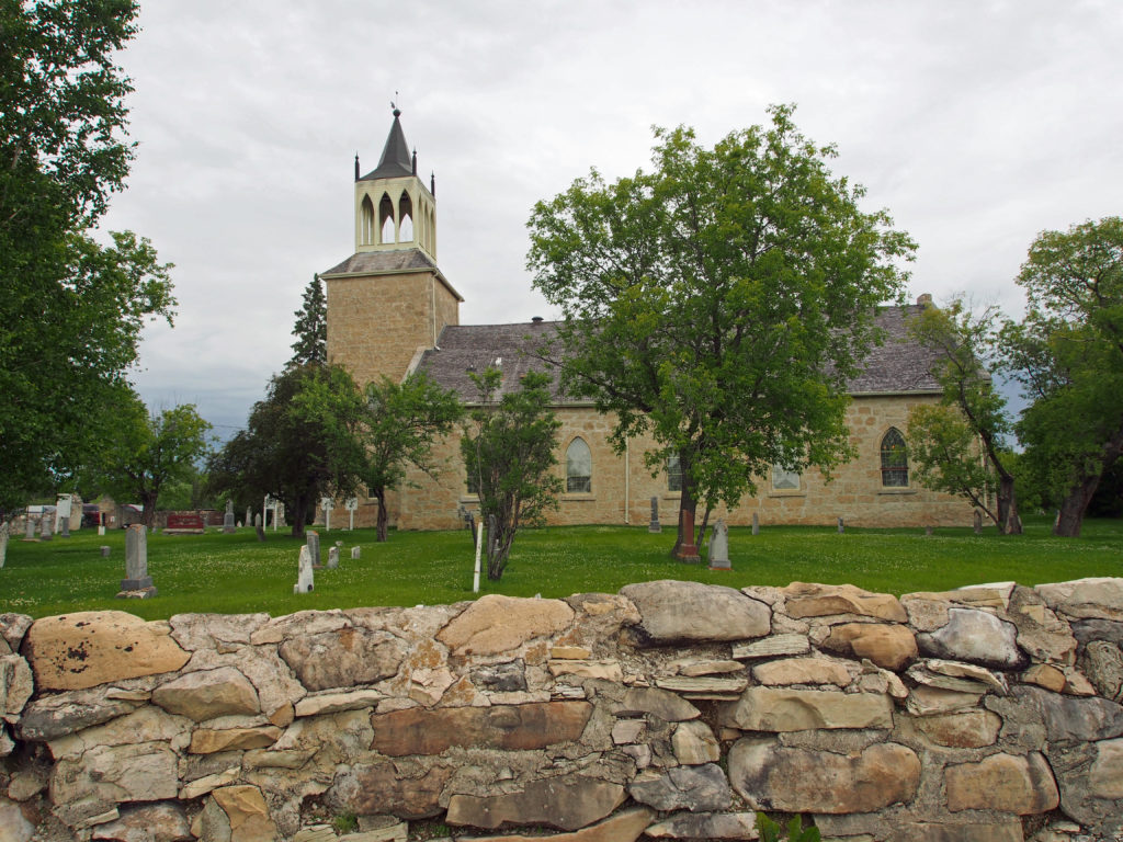
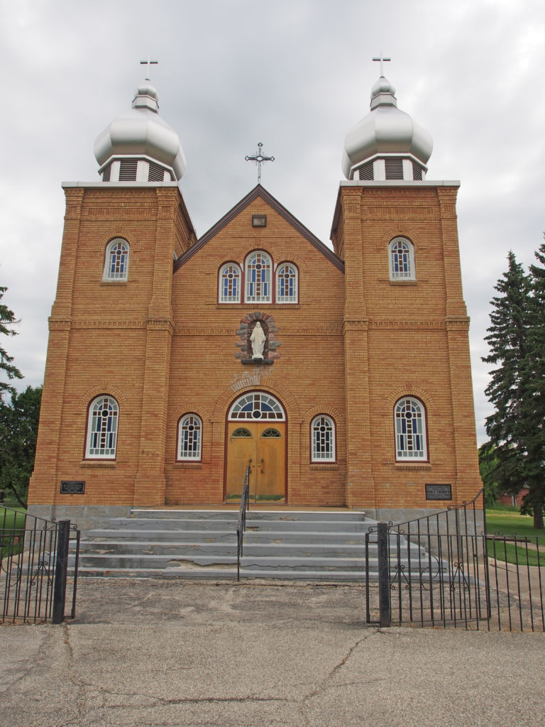
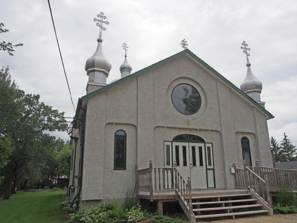
3 St. Andrews Road – Parish Church of St. Andrew – established 1828 – The church was built in 1844-49 in the Gothic Revival style. The walls were constructed from local limestone from the river bank. St. Andrew’s Church is the oldest church in continuous use in Western Canada.River Road – The Kennedy House – Eleanor called it “Maple Grove†– cobblestone house built in 1866 with large windows, French doors, and modified Gothic gables. Eleanor and William lived here with their children William and Mary. William farmed and kept a trading store on the adjacent north lot. The Kennedy House, in the Rural Municipality of St. Andrews, was built in 1866 for Captain William Kennedy using stones quarried from the Red River banks at nearby St. Andrews Rapids. The Gothic Revival style of the Kennedy House is architecturally distinctive, compared to the other old stone houses built in the Red River Settlement, which reflect Georgian influences. By contemporary Eastern Canadian or British standards Kennedy House was simple and unadorned. By Red River Settlement standards, however, it was very fashionable. William Kennedy (1814-1890) was an Arctic explorer, missionary, and a Hudson’s Bay Company employee. He was born at Cumberland House on the Saskatchewan River in April 1814, the son of Alexander Kennedy, a Hudson’s Bay Company Chief Factor, and an aboriginal woman, Agathas Margaret (Mary) Bear. When he was thirteen, he was sent to Orkney for his education. In 1836 he entered the employ of the Hudson’s Bay Company and was stationed on the Ungava Coast. He left the Company’s service in 1848 and went to Canada West where he engaged in his own business, and began to lobby for the expansion of Canada into the north-west. As a lad at Cumberland House he had met Sir John Franklin, and in 1850 he offered his services to Lady Franklin to help in the search for the Franklin expedition. He commanded two of the Franklin search expeditions and discovered the Arctic passage known as Bellot Strait. He was the first to use dogs and sleds from an exploring ship. In 1853, he presented a paper on these adventures to the Royal Geographical Society in London, England, and wrote a book entitled A Short Narrative of the Second Voyage of The Prince Albert in search of Sir John Franklin. In 1856, with George Brown’s support, he resumed his efforts to link the Red River Settlement and Canada West by a northern route. About 1860 he settled at Fairford, on Lake Manitoba, as an Anglican missionary and teacher to the Indians. In 1861 he settled at St. Andrew’s on the Red, where he was for a time employed by the Hudson’s Bay Company as a storekeeper at Lower Fort Garry. He was an early advocate of a railway to Hudson’s Bay. About 1859, he married Eleanor E. Cripps and they had two children. Crippled by rheumatism for most of his remaining years he lived a very retired life at St. Andrew’s. He died at his home on January 25, 1890.St. Andrews Lock and DamHalf Moon Restaurant MuralSt. Nicholas Ukrainian Orthodox Church at Gonor – The history of the St. Nicholas Parish begins in the year 1896-1897 when immigrants from Bukowina, Ukraine settled in the Gonor district. The Gonor district was already established by a Jesuit Missionary, called Father de Gonnor, who through his efforts, assisted la Verendrye, the explorer, and some years later, the Canadian Pacific Railway in 1877. As the Ukrainian settlers emigrated to Canada, one of the terminal depots was in East Selkirk, and from this point they traveled and walked to settle along the bank of the Red River in the Gonor district. Faith, physical strength, and hope, were their assets, and the church and religion were very important in the lives of these early pioneers. They desired a church building where they could open up their hearts to God. These early settlers made plans for the construction of the first church in 1904. The church and belfry were made of logs, which were brought in from the area. In April 1944, both the original church building and manse were destroyed by an accidental grass fire. The original belfry containing the bell from Bukowina was saved and is still in use today. The present church is about 1,100 square feet in area, is built of lumber and it is in the form of Byzantine architecture. Mr. Anton Prychun, a resident of Tyndall, Manitoba, was the master builder. All labor, with the exception of the head carpenter and painter, was provided free of charge. The church was painted and decorated in the following manner: The ceiling has sky-blue oil paint spangled with white stars. The dome has cherubim angels on and between clouds on a sky-blue background. The altar is painted in a similar manner. The walls are a cream color and a border is stenciled in a Ukrainian motif throughout the church. The Ikonastos consists of the picture of Jesus crucified at Golgotha, the Last Supper, and the twelve apostles and is painted and decorated in the Eastern Ukrainian Greek Orthodox style.6297 Henderson Highway – Ukrainian Parish of Catholic Holy Trinity, St. Clements – 1952 – Around 1890, a large influx of Ukrainian settlers was emigrating to Canada which led to the establishment of Ukrainian Catholic parishes. The first Holy Trinity Ukrainian Catholic Church was started in 1899, in the traditional Byzantine, rite style, in the form of a cross. The current church of brick and stucco structure, with its two radiant stainless-steel domes, which could be seen from miles around, was built 1952-1953.5635 Henderson Highway – St. Nicholas Orthodox Church in Narol was founded in 1911 by immigrants from the Brody area in Galicia. Like most Rusins/Western Ukrainians, these pioneers had been Greek Catholic in their homeland, which at that time belonged to the Austro-Hungarian Empire. Upon their arrival in Canada, the people reunited with the Orthodox Church of their forebears, becoming a part of the Russian Orthodox Mission.
The Forks Market offers a multitude of shops to browse for a wide variety of specialty items and souvenirs. Downstairs, The Market features a fresh food emporium with everything from gourmet cheeses to meats, organic baked goods and wine. Upstairs, in the Market Loft, shoppers will find items ranging from cigars and aromatherapy products to crafts and artworks from three hundred local and Canadian artisans. A constantly changing array of artisans and vendors also sell their wares at day tables inside The Forks Market and outside on The Plaza.
Across the courtyard from the Forks Market is the four-story Johnston Terminal building. Originally constructed in 1930, the terminal was a warehouse and freight-forwarding facility. After a substantial addition in 1930, the warehouse was at the time one of the largest in Winnipeg. It was occupied by National Storage and Cartage until 1961, and was leased to the Johnston National Cartage Company for the next fifteen years. Vacated in 1977, the building was unoccupied until the redevelopment of the site into The Forks.
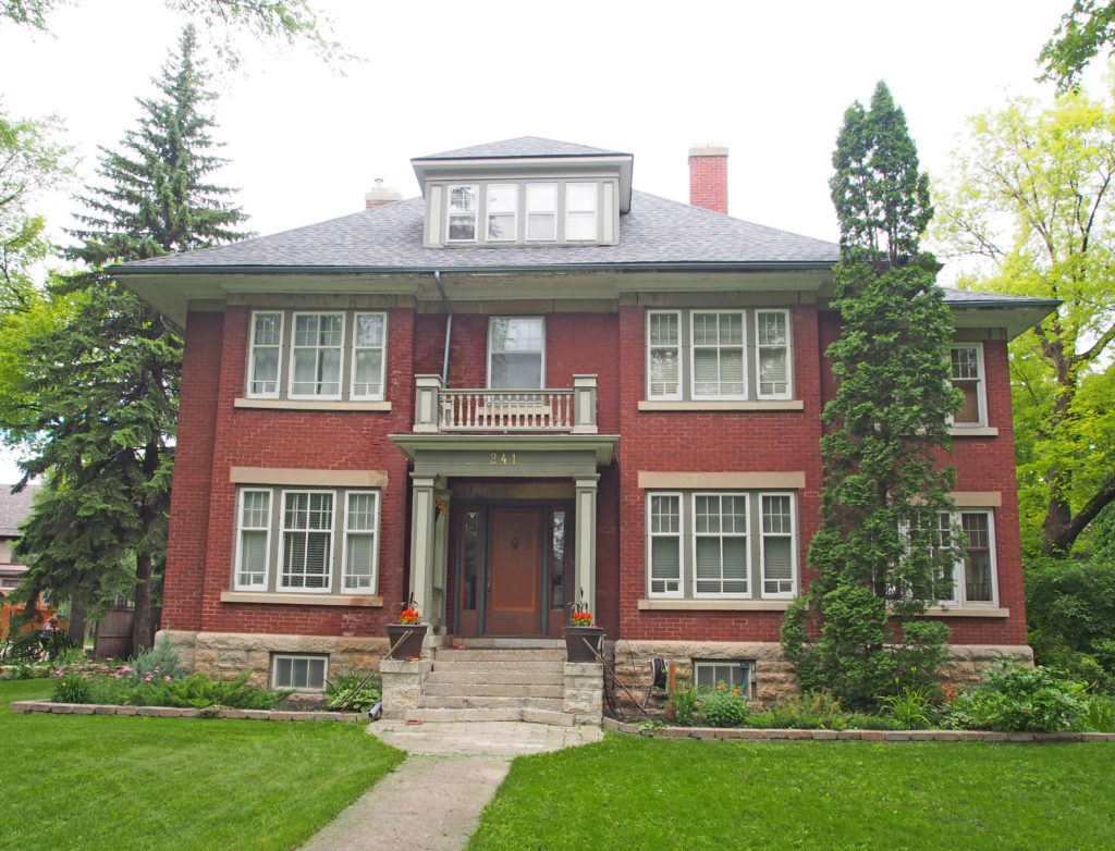
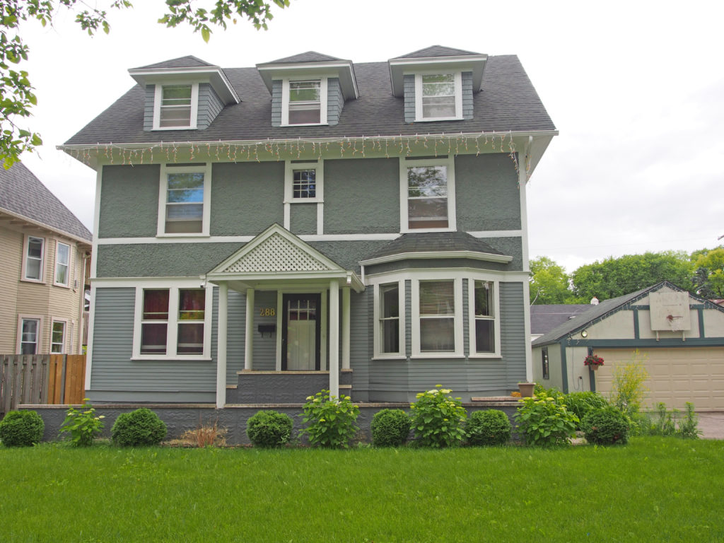
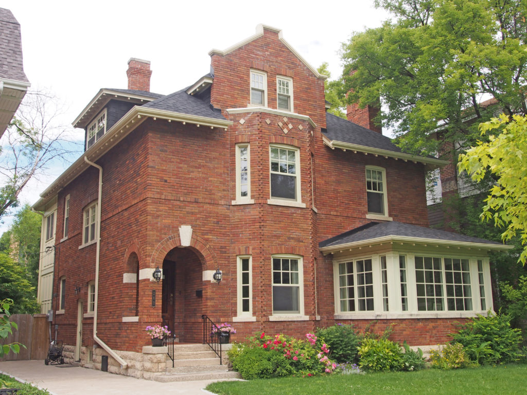
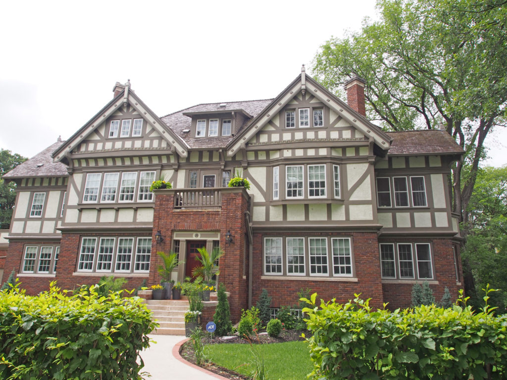
241 Yale Avenue288 Yale Avenue – dormers, pediment, bay window283 Yale Avenue – English Manor house – Jacobean gable37 Kingsway – Neo-colonial – gambrel roof29 Ruskin Row – The house, built for businessman Robert Ross Scott, is a grand brick and wood-frame structure built in 1914 in Crescentwood, one of Winnipeg’s early affluent neighborhoods. It is a fine interpretation of a Tudor Revival-style residence. Designed by John N. Semmens, the large dwelling is distinguished by several characteristics of the style, including a steeply pitched roof line with cross gables and dormers, massive chimneys, masonry and stuccoed walls with decorative half-timbering and multi-paned windows including sash, casement, oriel and bay windows in wood frames. The 2½-storey house has an off-center front entrance porch topped by a balcony. The load-bearing brick base is finished in red-brown brick with header detailing. Other details include barge boards and wood finials on the gable ends, stone lug sills, pilaster strips and detailed brickwork around the front entrance.2 Ruskin Row – corner quoins, pediment above doorPalk Road – balustrade
Near the convergence of the Red and Assiniboine Rivers is a natural shallow amphitheater known as the Oodena Celebration Circle. It pays homage to the 6,000 years of Aboriginal peoples in the area. Oodena, Ojibew for “heart of the communityâ€, features ethereal sculptures, a sundial, interpretive signage, a naked eye observatory and a ceremonial fire pit, making it a desirable venue for cultural celebrations or a place to simply sit and marvel at its beauty. Oodena was inspired by the myths and sacred places of the many people drawn to The Forks over its 7,000-year history. It is interpreted as an opportunity to restore contact with the cultural history of the site and the dynamic forces of earth, water and sky. Surrounding the bowl, cobblestone formations support sculptural sighting armatures that act as guideposts for celestial orientation.
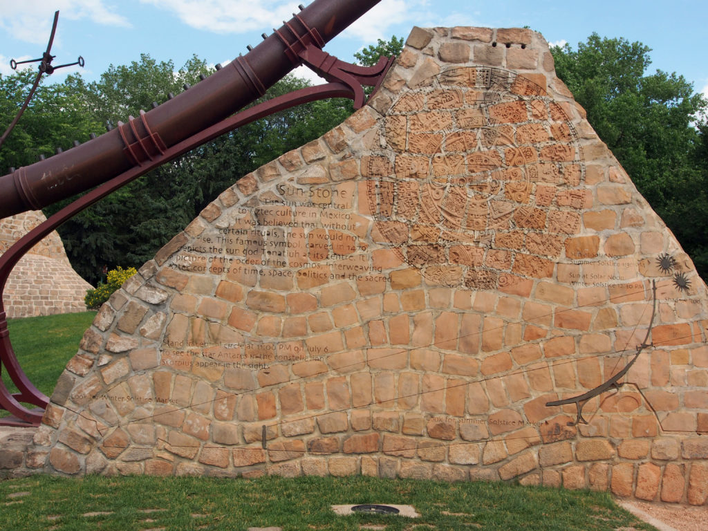
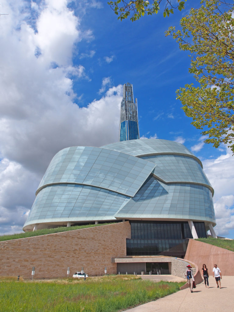
Sun Stone – The sun was central to Aztec culture in Mexico. The sun god is in the center with the order of the cosmos weaving Aztec concepts of time, space, politics and the sacred.The vision of Antoine Predock, an architect from Albuquerque, New Mexico for the Canadian Museum of Human Rights is a journey beginning with a descent into the earth where visitors enter the building through the “roots” of the museum, through the Great Hall, then a series of vast spaces and ramps, before culminating in the Tower of Hope, a tall spire protruding from the top that provides visitors with views of downtown Winnipeg. Its purpose is to promote respect for others.
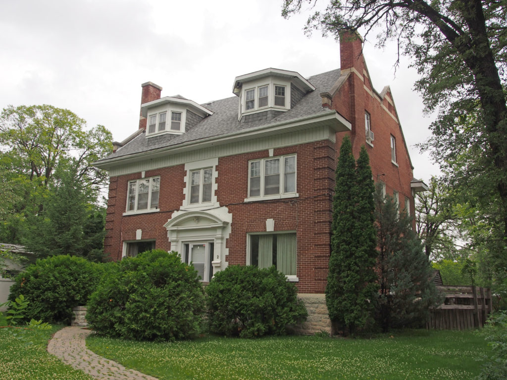
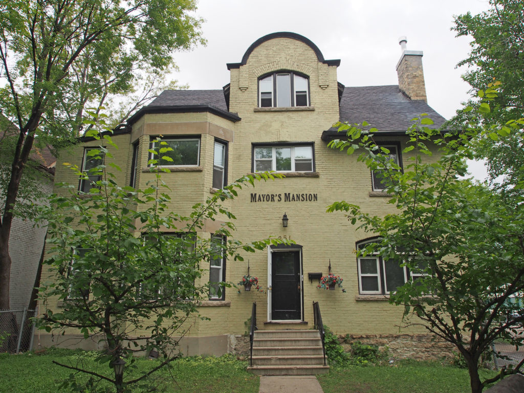
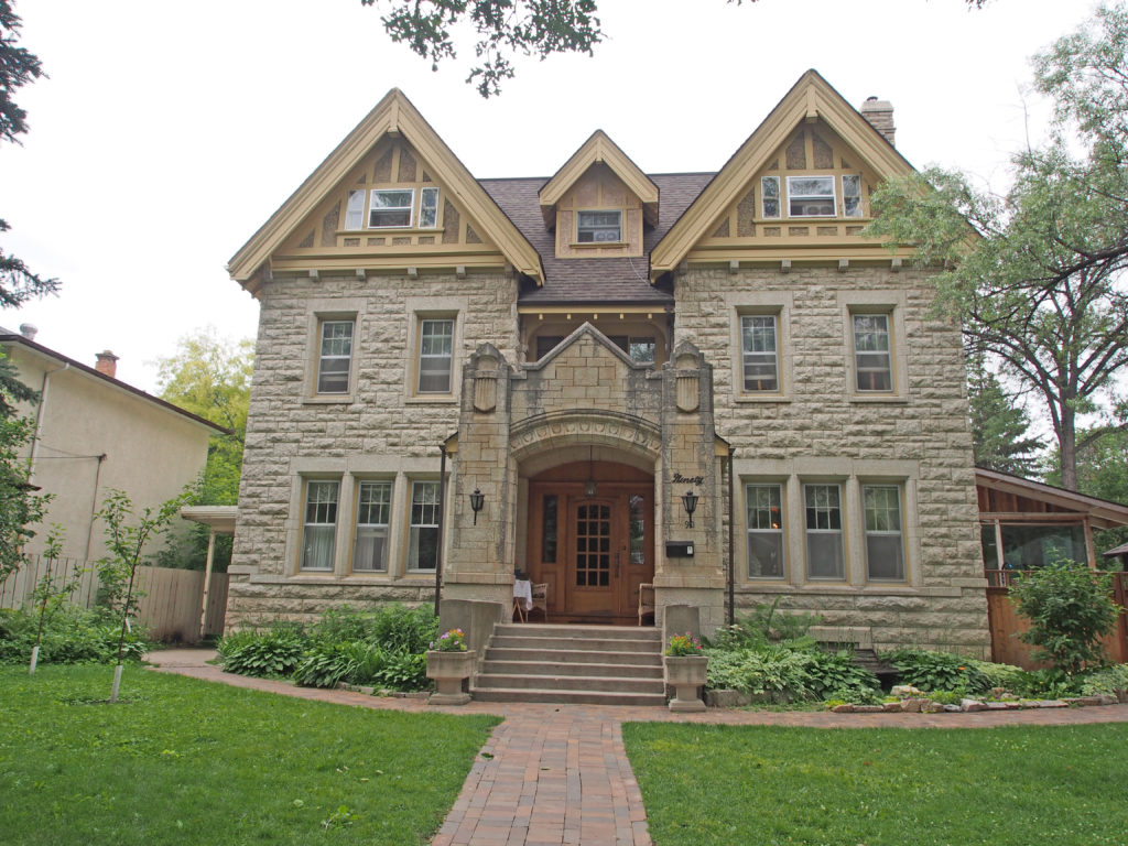
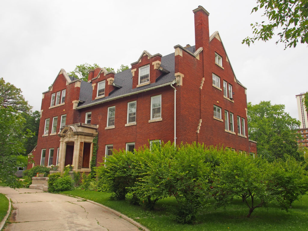
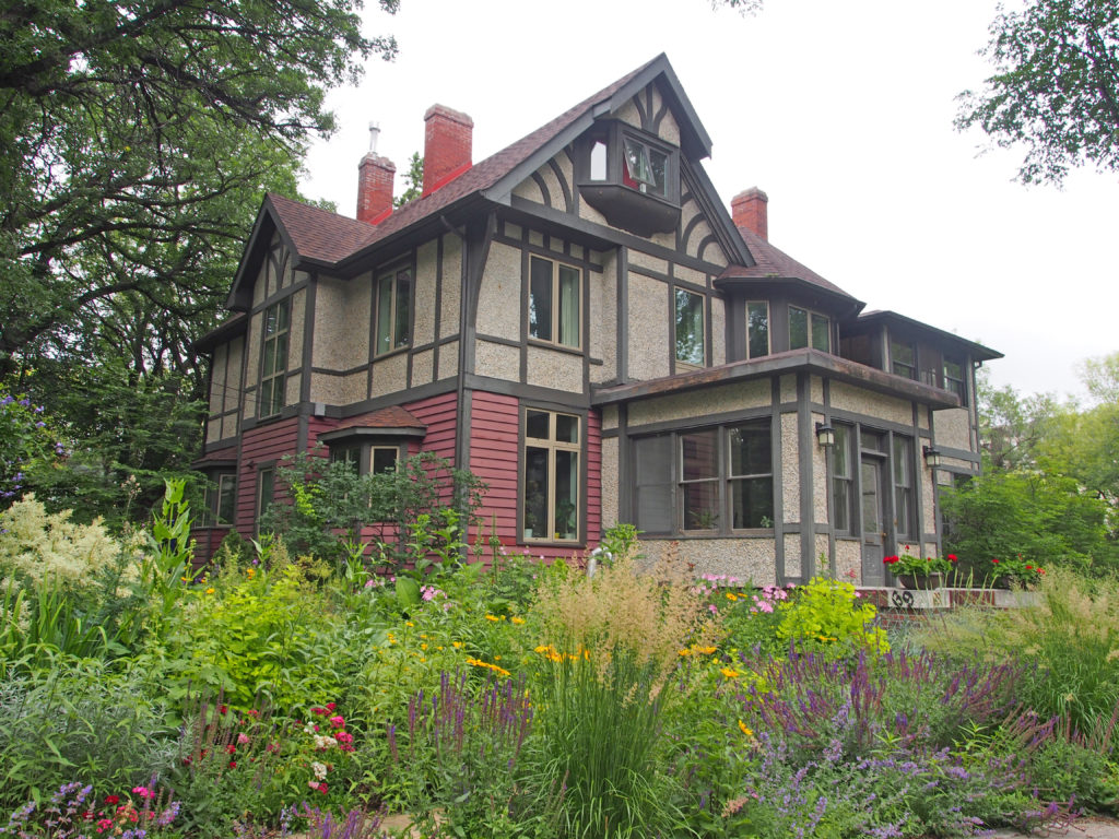
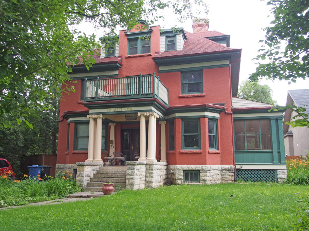
251 Furby Street – Mayor’s Mansion – two-story bay window147 East Gate was built in 1882 for Arthur F. Eden, land commissioner for the Manitoba and Northern Railway and later a partner of Stobart Wholesale Merchants. Some people are of the opinion that this house was originally the home of James Armstrong, though others believe that Armstrong resided on the point only as a squatter. The front door faces the River as the original drive circled to that side of the house. The Bird Cage Tennis Club occupied seven acres here between East Gate and Middle Gate. In 1891, the house was purchased by William Fisher of Happyland Amusement Park. Mr. Fisher called this house Elmsley. The fireplace in the living room is faced with blue Minton tiles telling the story of the Knights of the Round Table and the sword Excalibur. The house was owned by the Dr. Bruce Chown family. Fisher divided his property into three lots and sold them. The southern portion, the red brick house, became the Tupper property. W. J. Tupper lived there until he became Lieutenant Governor.100 East Gate – Georgian – engaged columns, open pediment, sidelights and transom90 East Gate – Gothic Revival with Tudor accents on gables, dormer, entrance with parapet above, sidelights – It was built in 1909 by R. T. Riley who lived here until he built 186 Westgate in 1920. The house then passed to C. S. Riley, his son. The walls are eighteen inches thick. One mantel has scenes from the Lord’s Prayer.89 East Gate –English Manor house – Jacobean gables, dormers with window hoods – built for George Crowe, a Winnipeg alderman in 1911. The home has ten fireplaces, nine bathrooms, a ballroom in the basement and a vault under the front entrance hall.69 East Gate – Tudor – built in 1896 by James Rawlinson Waghorn, the publisher of Waghorn’s Pocket Guide, a stockbroker and financial agent. He was secretary of the Birdcage Tennis Club (in Armstrong’s Point) and co-founder of the St. Charles Country Club. He called his home Maple Grove and it became a social center. The dining room seated fifty people in comfort. In 1905 the touring Shakespearean Company, the Ben Greet Players, performed “A Midsummer Night’s Dream†on the grassy knoll in the yard. Dame Sybil Thorndyke was a cast member, on her first tour. The second owner, Dan Bain, was a noted sportsman. Team Captain of the Winnipeg Victorias hockey team that twice won the Stanley Cup, he also placed second in the 1930 Canadian Figure Skating Championships in the waltz contest at the age of 56.51 East Gate – cobblestone, two-story frontispiece, hipped roof40 East Gate – hipped roof with dormer and tall chimney39 East Gate – Queen Anne style – three-story tower, dormers, voussoirs and keystones, gambrel roof at one end5 East Gate – Greek Revival – two-story pillars, two-story verandas – built in 1906 by Thomas Ryan, of Ryan’s Boots and Shoes. He was the mayor of Winnipeg while in his thirties.6 Middle Gate – Henry Linnell, architect, designed this home which was constructed at a cost of $24,000 for John T. Speirs, President of Speirs Parnell Baking Company, now part of Weston’s22 Middle Gate – three-story tower, dormer, second floor balcony with Doric pillars supporting it64 Middle Gate – Neo-colonial – dormers, voussoirs and keystones, sidelights123 Middle Gate – decorative gables, wraparound enclosed veranda – built in 1891 for Frederick William Stobart, wholesale dry goods merchant137 West Gate – Greek Revival – two-story pillars with Ionic capitals, dormer with Doric pillars, dentil molding – built in 1904 by William Wallace Blair – Blair called it ‘Kenilworth’134 West Gate – Queen Anne style – gables with fish scale patterning, tall chimneys, dormers, cornice brackets, second floor balcony with turned spindle balustrade, bay windows, pediment above porch – J. B. Monk, Manager of Bank of Ottawa, built it in 1898. It was Japanese Consulate until 1976.119 West Gate – Italianate – hipped roof with dormers and window hoods, tall chimney, balcony above Ionic pillars, bay window – owned at one time by Sidney T. Smith of Smith and Murphy, Grain Merchants112 West Gate – Dunedin – built in 1906 by William Harvey, trust company executive. It was designed by J.H.G. Russell. It was owned in the 1950s by Rupert Whitehead, well known for his accomplishments as a figure skater with the Winnipeg Ice Club.54 West Gate – The Ralph Connor House, a three-story brick Jacobethan Revival mansion built in 1913-14, sits on a well-groomed lot overlooking the Assiniboine River. It is noted for its complex roof structure, and warm red-brown brick facades contrasted by limestone dressings on a high stone foundation. Designed by architect G.W. Northwood, the mansion was first associated with Charles William Gordon, a minister at St. Stephen’s Presbyterian Church, a social reformer and best-selling author of international renown. As ‘Ralph Connor’, he penned 25 popular novels known for their moralistic, action-oriented plots of good versus evil and for their portrayals of early life in Ontario and the West. The most popular works were incorporated into Manitoba school reading programs in the 1940s, and three were made into silent movies. Gordon maintained a Winnipeg ministry, served as a military chaplain during World War I, was moderator of the Presbyterian Church in Canada during the formation of the United Church of Canada in 1925, and was involved in the League of Nations. The house has retained a high degree of physical integrity due to its successor occupant, the University Women’s Club of Winnipeg, a pioneering organization that has long promoted the advancement of women in the community and has diligently conserved the Ralph Connor House since 1939. The asymmetrical structure has a complex roof featuring steeply pitched cross-gable and hipped sections, wall dormers and one smaller gable and two shed dormers. The large rectangular windows have decorative limestone surrounds, lintels and mullions, some featuring six-pane top lights; there are also three dominant bay windows and a large stacked bank on the south elevation with rows of four windows separated by limestone medallions. The exquisite details and materials include stacked chimneys, cedar shingles, limestone coping and accents throughout, bracketed eaves, and label moldings.