Tillsonburg is a town in Oxford County located about fifty kilometers southeast of London on Highway 3 at the junction of Highway 19 which connects to Highway 401.
The area was settled in 1825 by George Tillson and other immigrants from
Massachusetts. A forge and sawmill were erected and roads built which led to the
establishment of a settlement on the Big Otter Creek originally called Dereham
Forge.
In 1836 the village was renamed Tillsonburg in honor of its founder. It
was also in this year that the main street, Broadway, was laid out to its full
100-foot (30 meter) width. Because the village was predominantly a logging and
wood product center, the street width was to accommodate the turning of
three-team logging wagons. This width has become a benefit toward handling the
pressures of modern-day traffic by providing angled parking. The extension of
Broadway north was called Plank Line and is now known as Highway 19.
The water system supplied pure water for domestic use, and provided
water power to such industries as a sawmill, planing mill, grist mill, spinning
mill, pottery and a tannery. Many of these new establishments were owned,
started, or financed by George Tillson.
In 1915, a Public Library was built with funds provided by the Carnegie
Foundation, and the town’s Memorial Hospital was constructed in 1925. In the 1920s,
major enterprises included milk production, manufacture of shoes, tractors,
textiles and tobacco.
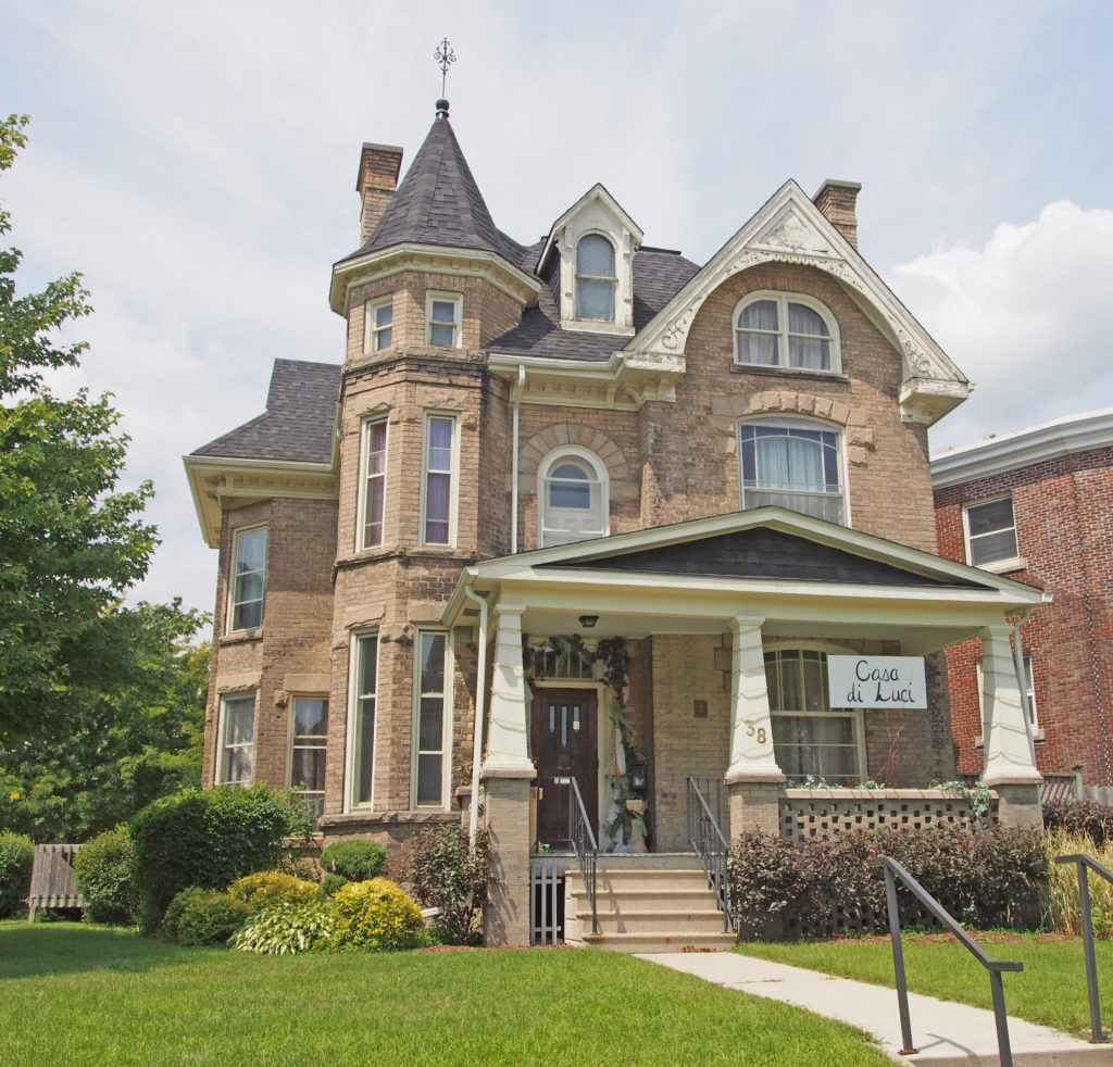
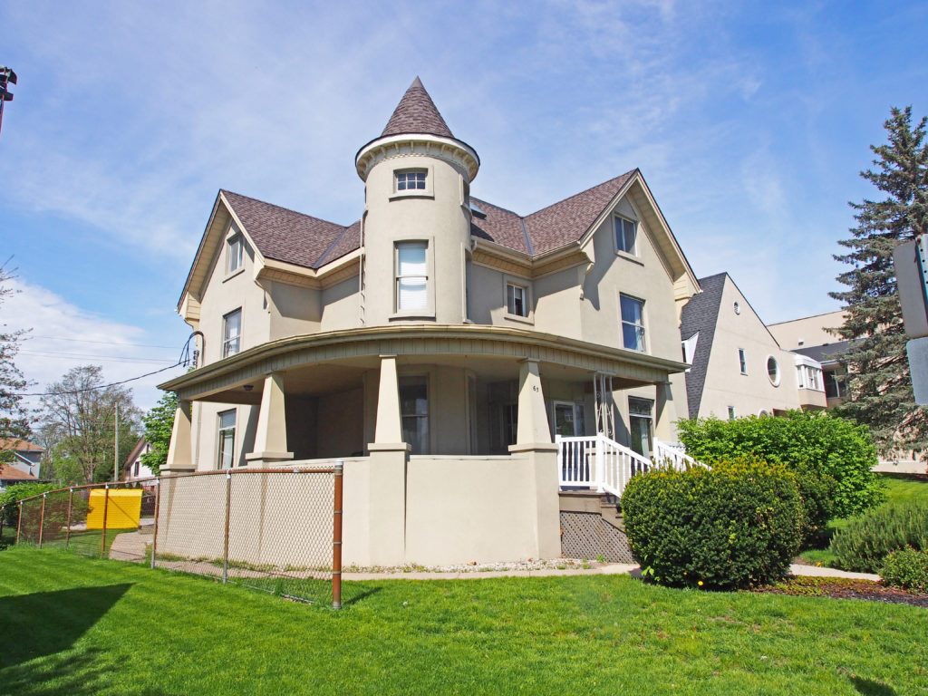
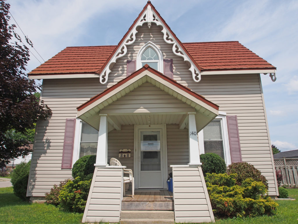
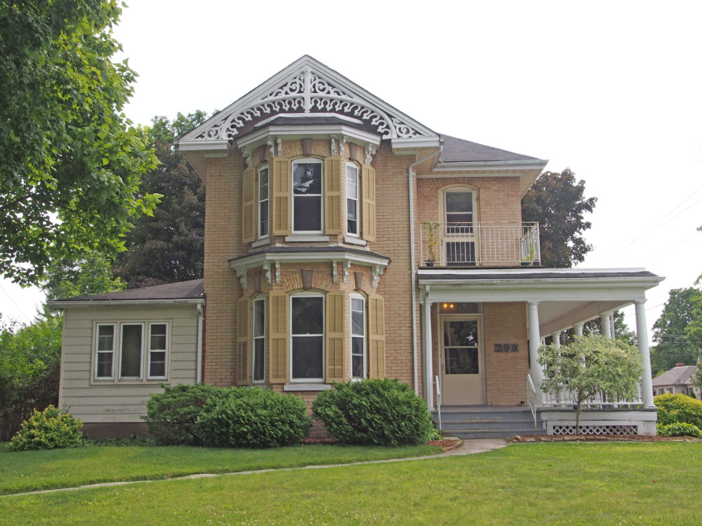
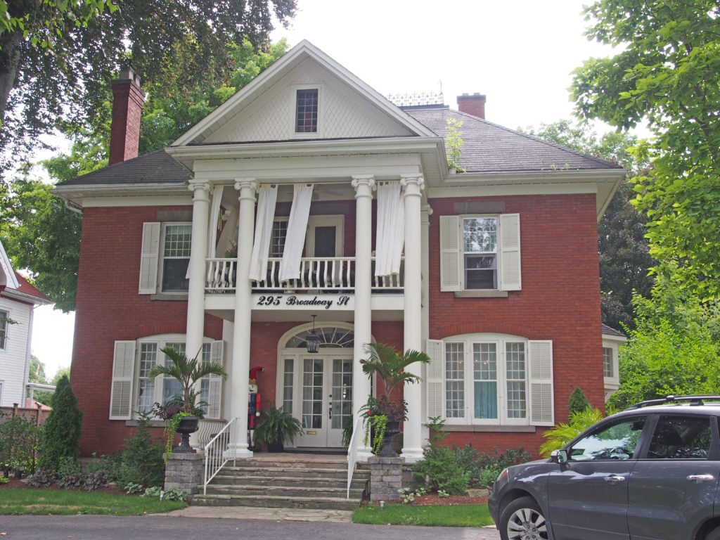
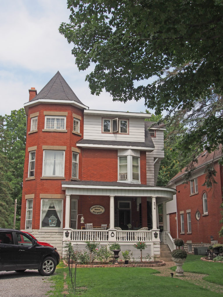
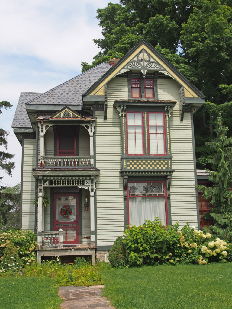
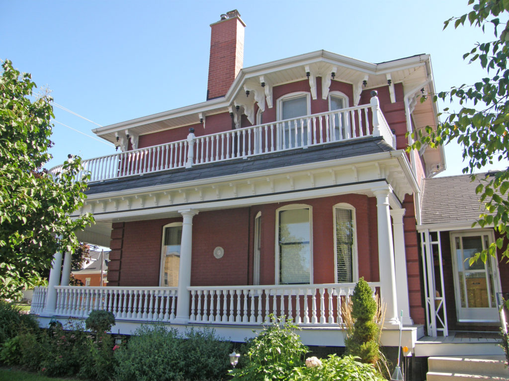
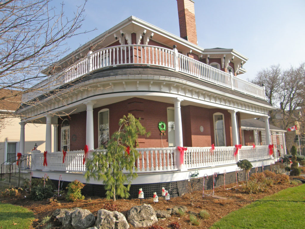
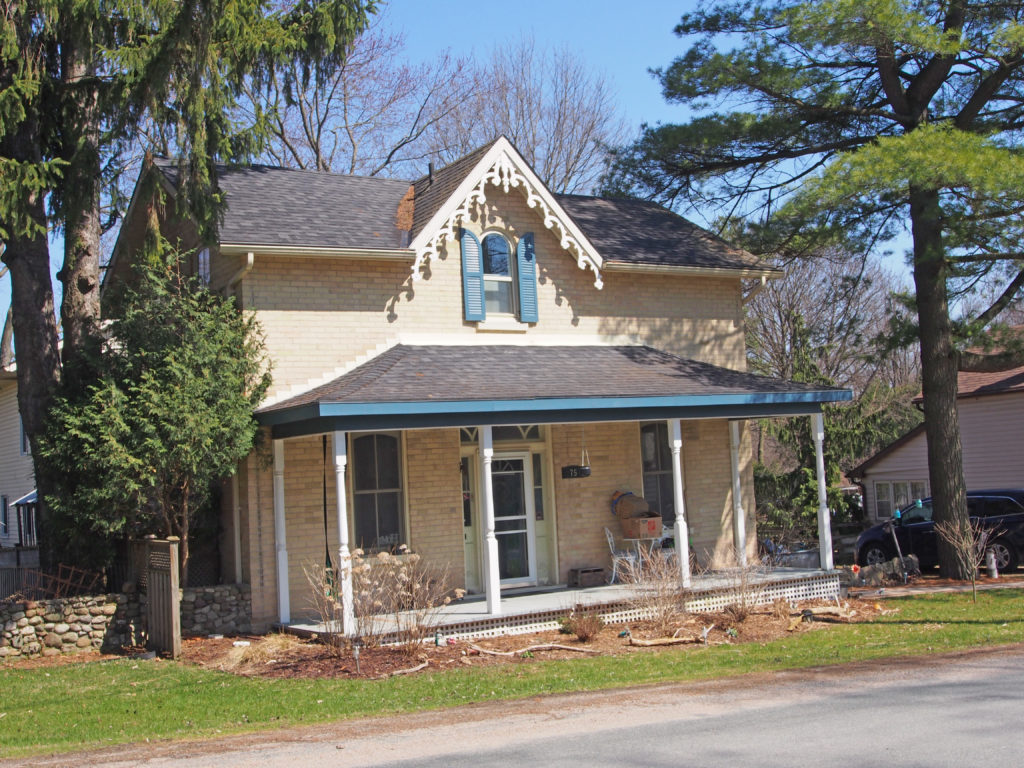
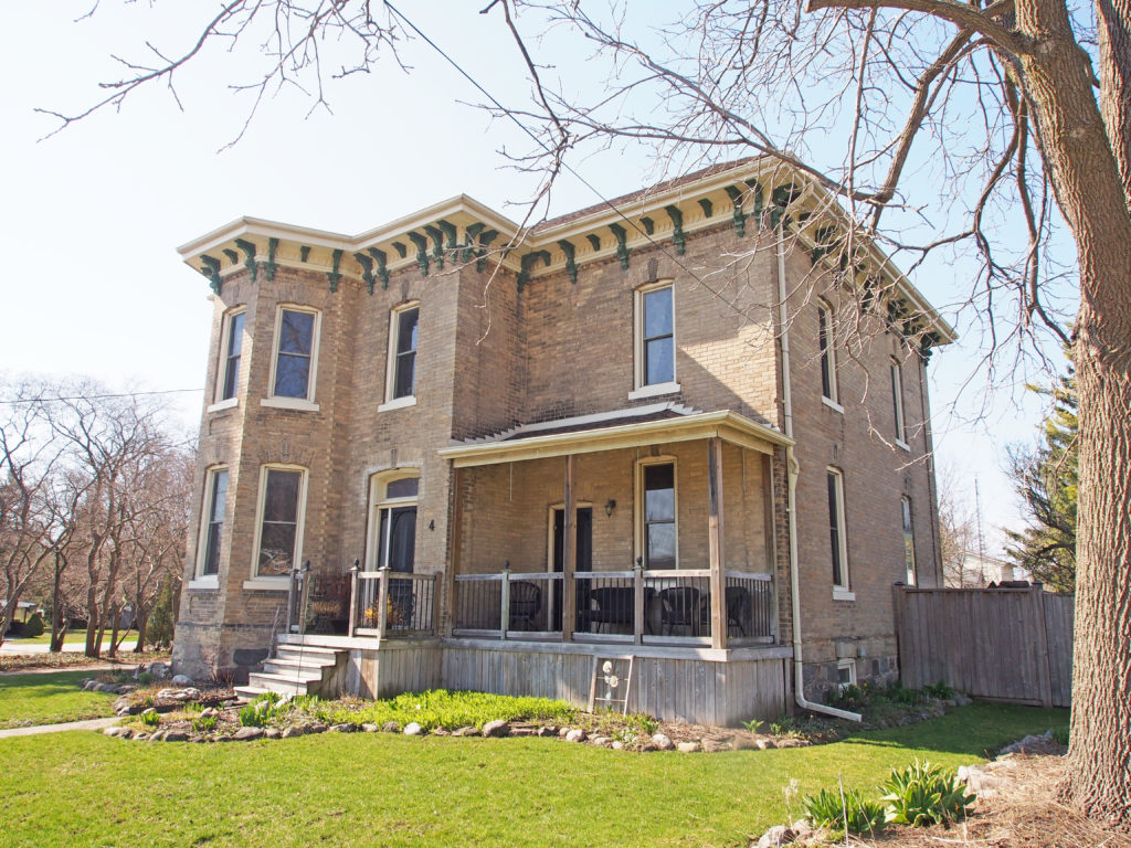
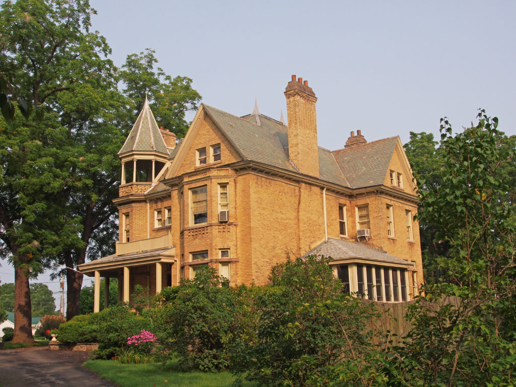
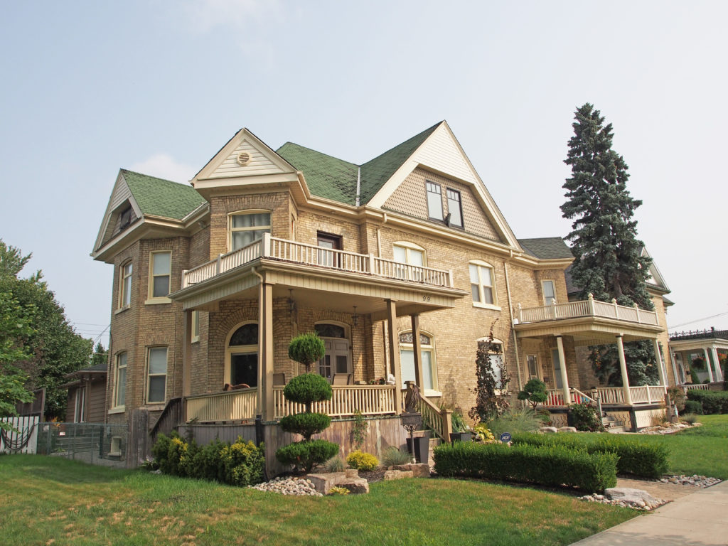
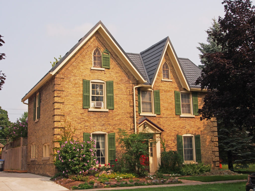
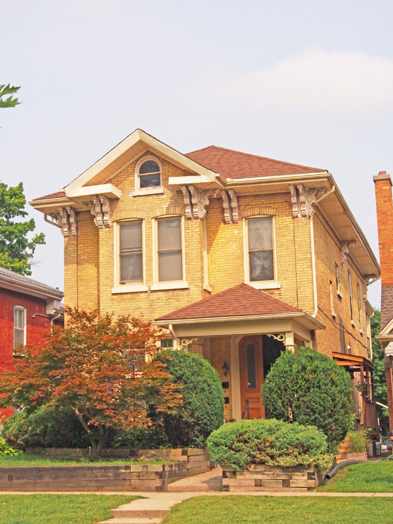
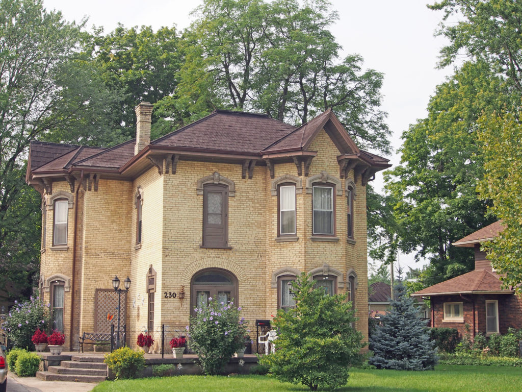
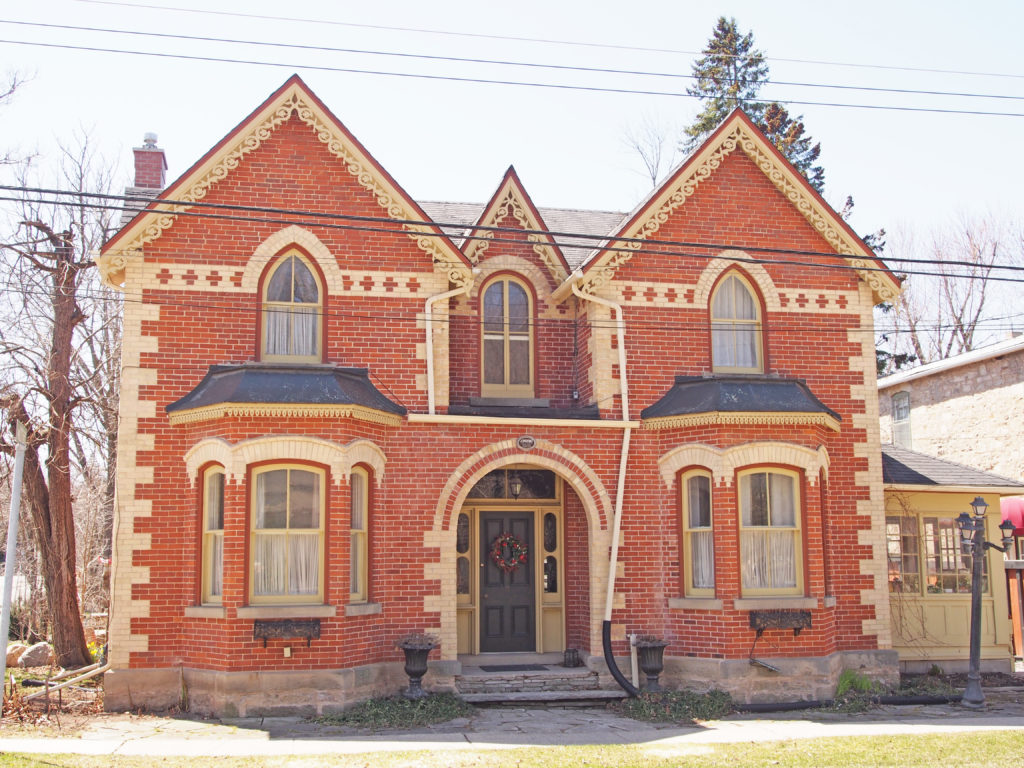
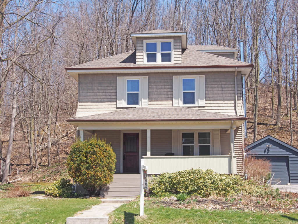
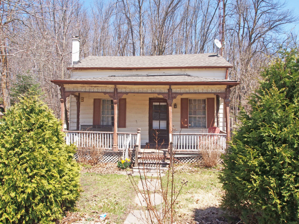
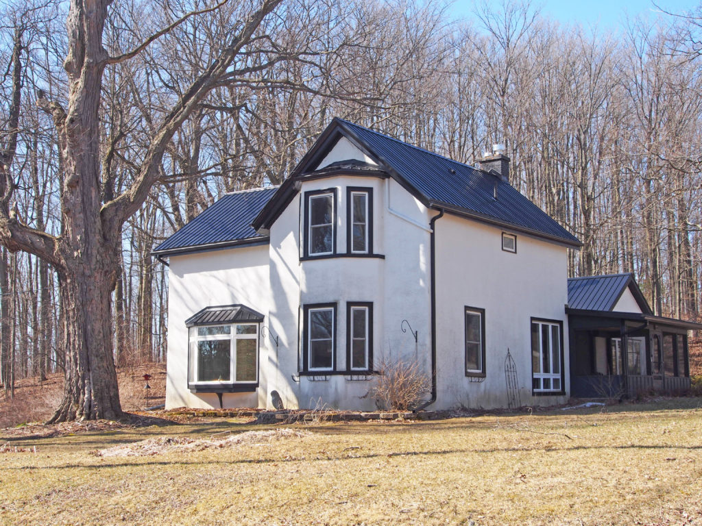
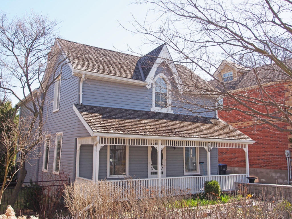
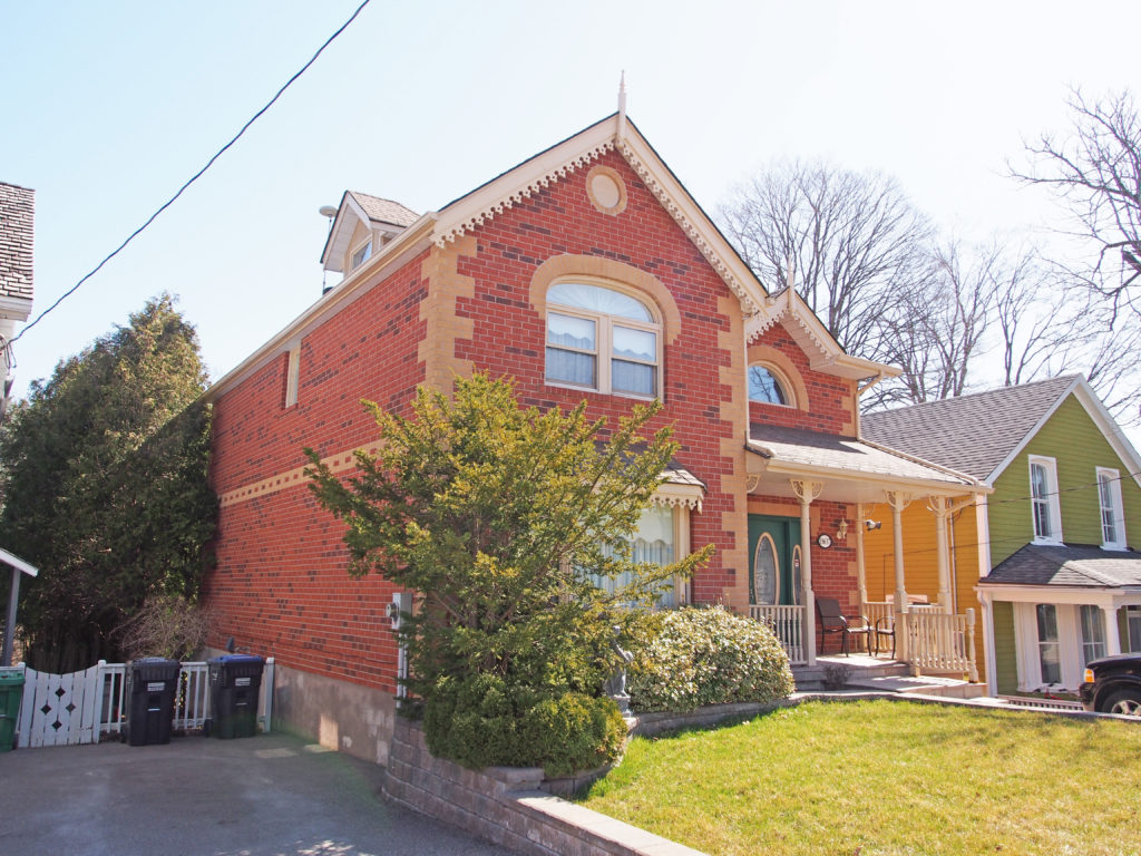
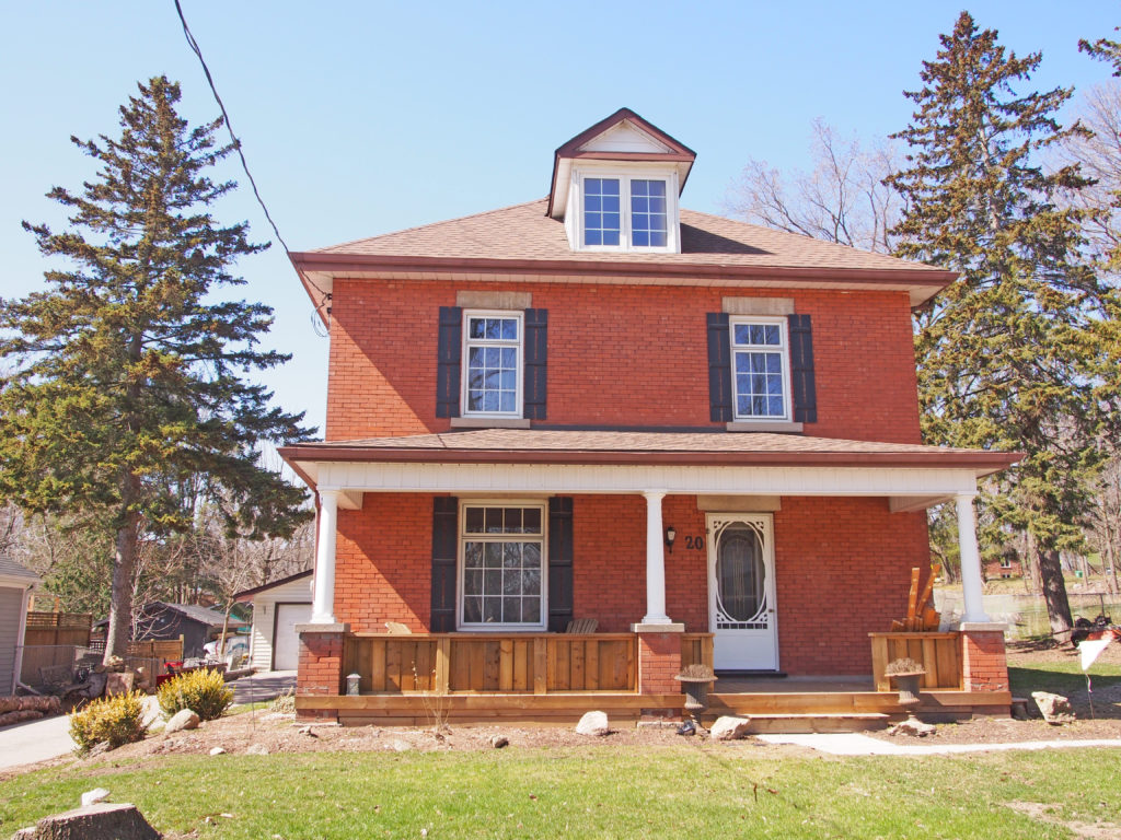
38 Ridout Street West – Casa di Luca Restaurant – Queen Anne style, verge board trim on gable, turret59 Ridout Street – Italianate – paired cornice brackets, bay window, voussoirs and keystones, transom window65 Bidwell Street – Queen Anne – turret, wraparound verandaBidwell Street – Edwardian, Palladian window140 Bidwell Street – Gothic Revival, verge board trim and finial299 Broadway Street – two-story bay windows, cornice brackets, verge board trim295 Broadway Street – two-story high Ionic pillars276 Broadway Street – Queen Anne, turret300 Broadway Street – verge board trim30 Tillson Avenue – Annandale National Historic Site – Constructed in seven years in the 1880s, this was the farm house for E.D. Tillson’s 600-acre Model Farm. The interior of the house exemplifies the Victorian style of design known as the “Aesthetic Art Movement†which was popularized by Oscar Wilde, and encouraged the use of color and decorative detailing. There are hand-painted ceilings, elaborate inlaid floors, ornate mantles, and stained glass throughout.64 Oxford Street – Seven Gables Bed & Breakfast – steeply pitched gables, Palladian windows, wraparound veranda60 Brock Street West – Neo-Colonial – gambrel roofs, wraparound veranda
Drumbo acquired its name in 1852; the community was named after Drumbo,
Ireland. It is located in Blandford-Blenheim Township, Oxford County at the
crossroads of County Road #3 (Wilmot Street) and County Road #29 (Oxford
Street); this is south of the 401 Highway and 24 kilometers northeast of
Woodstock.
Princeton is located in Oxford County on Country Road #3, twenty-two
kilometers east of Woodstock. Etonia, east of Princeton, and Gobles, west of
Princeton, are both located on County Road 2. Richwood is located on Blenheim Road and Township Road 5, north of
Etonia.
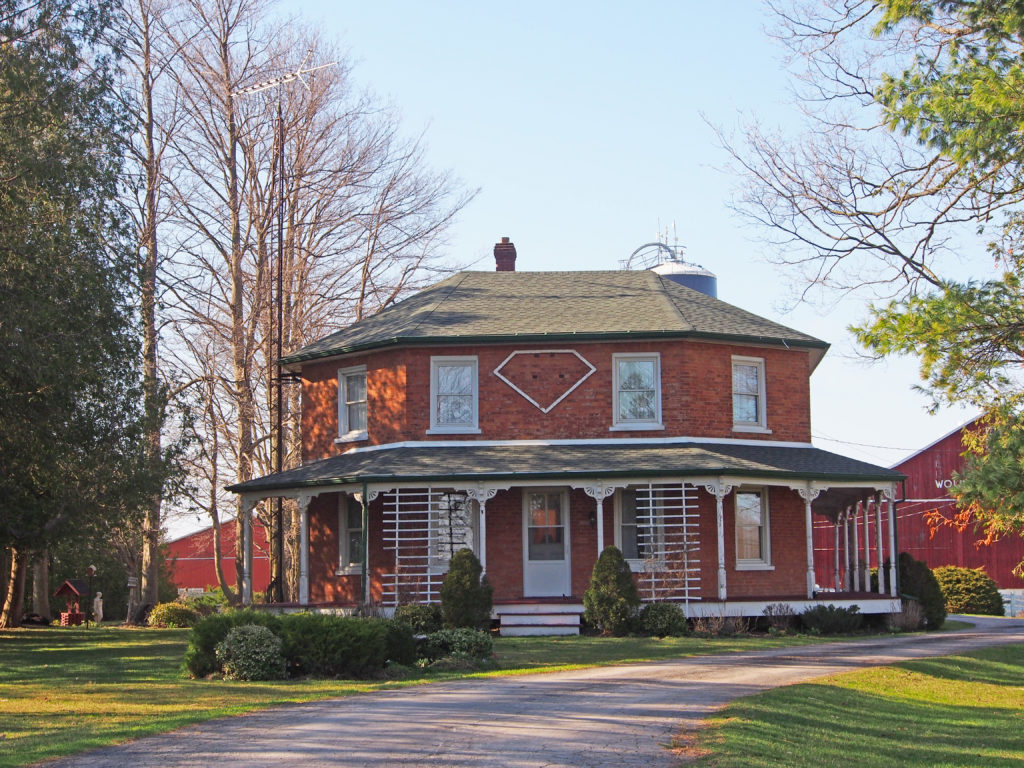
The village of Wolverton is named after its founder, Enos Wolverton (1810-1893), who built up a successful milling
enterprise on the Nith River. Enos came to Upper Canada with his parents from Cayuga County, New York state in 1826.
He married Harriet Towl in 1834
and had two daughters, Roseltha (Rose)
and Melissa (Lissa), and five
sons, Alfred, Daniel, Alonzo, Jasper and Newton. Enos’ brother, Asa Wolverton, became a successful
businessman in nearby Paris, Ontario. The Crimean War (1854-1856) brought on an agricultural boom in Upper
Canada and increased the Wolvertons’ fortunes.
Washington is on County Road 3 (Washington Road) and Regional Road 8,
east of Plattsville and north of Drumbo.
Plattsville is located on Township Road 13 & 42 (Albert Street) and
Regional Road 8. It is located north of Highway 401, and 32 kilometers
northeast of Woodstock. The community was named for its founder, Edward Platt,
who settled in 1811 and built a flour mill.
Bright is located where County Roads 22 and 8 cross. Windfall is
located on Oxford Road 29, north of Highway 401, west of Drumbo, south of
Bright.
Ratho is located on Blandford Road and Township Road 13, northwest of
Bright.
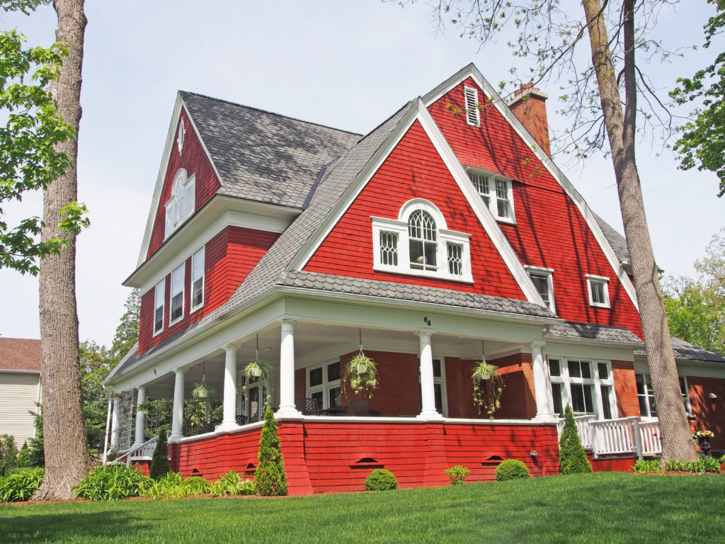
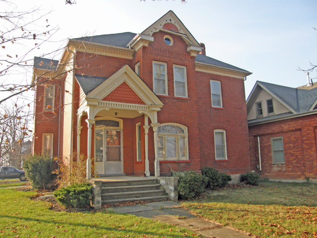
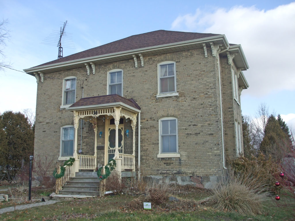
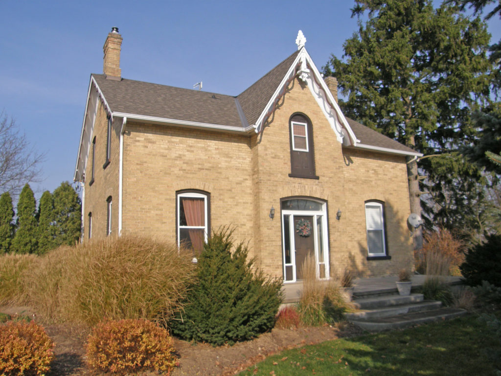
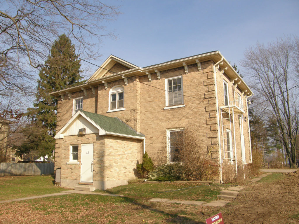
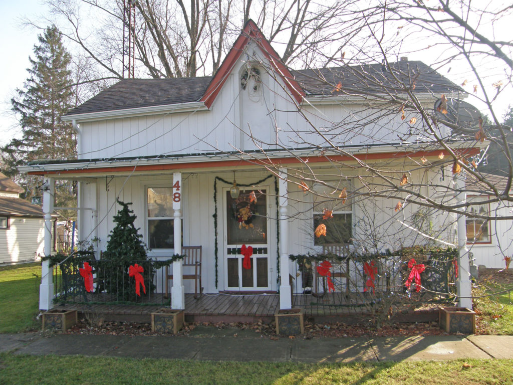
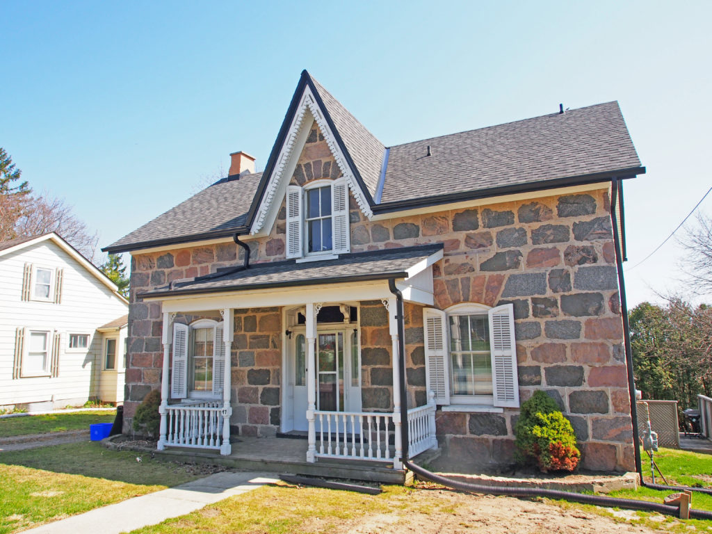
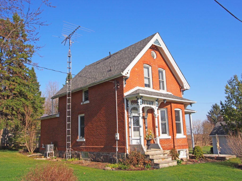
Drumbo – Yellow brick, Ionic pillars supporting an upper balcony, decorative trim on gable, dentil moldingDrumbo – Italianate – cornice brackets, two-storey verandaDrumbo – #15 – Italianate – verge board trim on gable, pedimentDrumbo – 23 Oxford Street – Prominent brackets on the cornice (roof overhang), triangular pediment above with a Palladian type triple window in the tympanum with the center window flanked by two lower windowsDrumbo – c. 1880 – wraparound two-story veranda, cornice bracketsPrinceton – Neo-Classical style – hip roof, cornice brackets, semi-circular balcony above front door with sidelights and transomPrinceton – #30 – Italianate – hip roof, paired cornice brackets, bric-a-brac on verandaPrinceton – Gothic Revival style with gingerbread verge board and finialPrinceton – #12 – Italianate, cornice brackets, corner quoinsPrinceton – #48 – Gothic Revival Regency CottageWolverton – Gothic, verge board trim on gableWolverton – About 1855, Enos Wolverton built an impressive new three storey family home with a cupola which came to be known as Wolverton Hall – Regency styleWashington – Gothic Revival stone cottagePlattsville – #32 – Gothic Revival – verge board trim on gable, second floor balconyPlattsville – #4 – Italianate, cornice brackets, two-story bay windowPlattsville – 66 Albert Street – 3-story, Second Empire style with dormersRatho – GothicRatho – wraparound veranda
Strathroy-Caradoc is located west of the City of London.
After the War of 1812, the British
government encouraged thousands of people from Britain to come to Southwestern
Ontario. There were three main reasons for this:
1. The British were afraid that Americans would invade through the Sydenham
River area again as they had at Baldoon. If there were settlements in the area,
the settlers could warn the British and fight against the Americans.
2. In England, the end of the war meant that many soldiers were out of work.
They were starving and homeless. In Ireland, landlords had mismanaged the
lands, which led to the Potato Famine. Since potatoes were the main source of
income and food, thousands of Irish were starving. In Scotland, landlords chose
to graze sheep in the Highlands, and they forced the Scottish Highlanders to
leave. In an effort to help these people, the British government began to give
away land in Upper Canada.
3. Soldiers of the War of 1812
and the war with France expected land rewards from the King of England; there
was no land left in Britain to give them. Land in Upper Canada was given away
instead.
Land
along the Sydenham River was sparsely settled, the land was fertile and flat
which made it easier to clear. The river gave settlers fresh water, and power
for their water mills. It could also be used as a highway to move goods to
Detroit, where they could be sold. A new road had been built between London and
Goderich, which made it easier to get to the Sydenham River by land.
When the government gave away land, there
were often conditions the new owner had to live up to, including building
roads, mills, and armies, but often, it meant inviting immigrants from Britain
to live on their land. For example, a settler might receive 20 000 acres of
land, but would be forced to give away 5,000 to other settlers. They would be
expected to organize how the immigrants would get to the new settlement, what
they would do when they arrived (such as raise sheep, beef or cotton), and help
them settle in by building churches and schools. This is how settlements and
villages were created along the Sydenham river.
In 1830 James Buchanan, the British Consul at New York City, acquired a
tract of 1,200 acres of unsettled land in Adelaide Township. His son, John
Stewart, settled there and built a sawmill and gristmill on the Sydenham River.
These pioneer industries formed the nucleus of a settlement which was named
Strathroy means “Red Valley†in Gaelic, and is named after James Buchanan’s birthplace in County Tyrone, Ireland. The
construction of a branch line of the Great Western Railway through Strathroy in
1856 stimulated the growth of the community. The line was eventually connected to
Michigan at Windsor, providing the farmers of Strathroy with an extra market
for their produce.
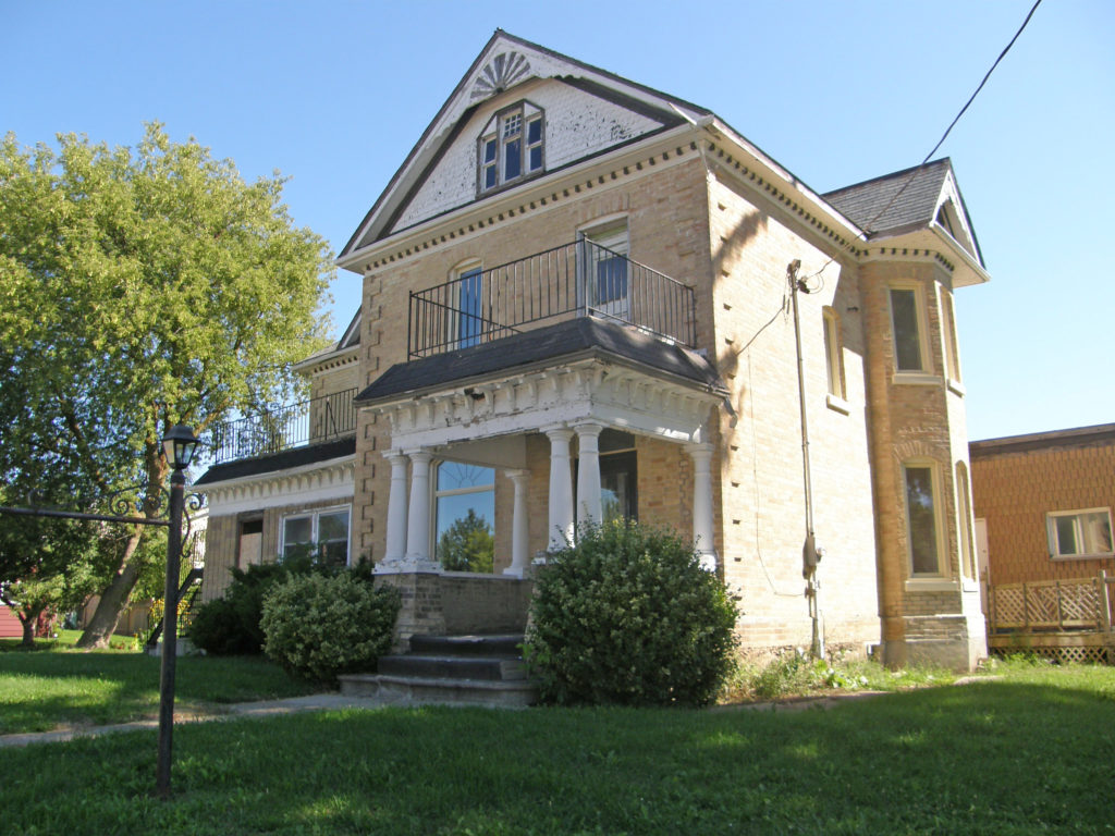
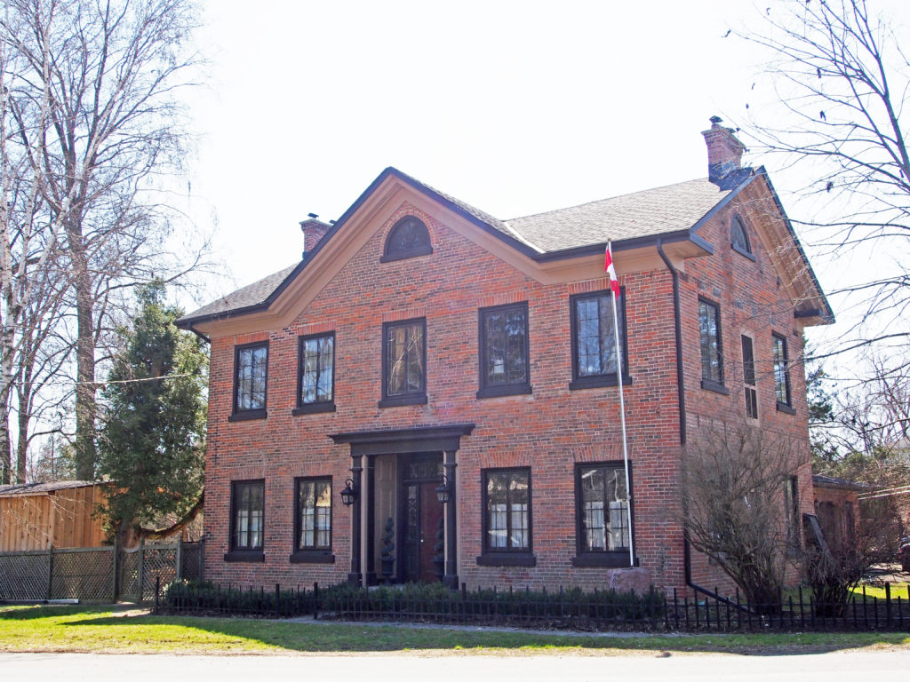
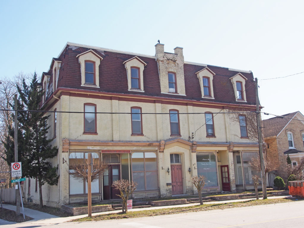
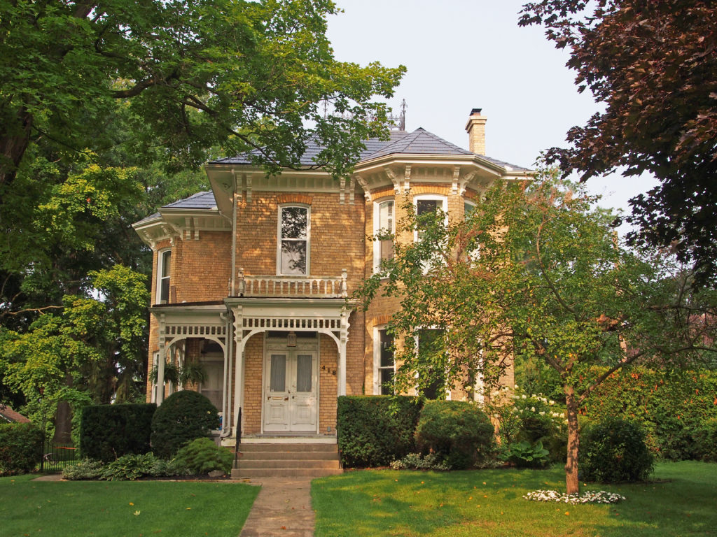
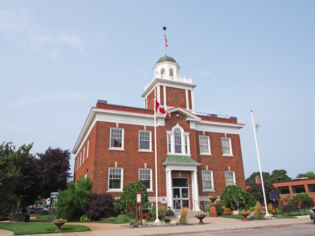
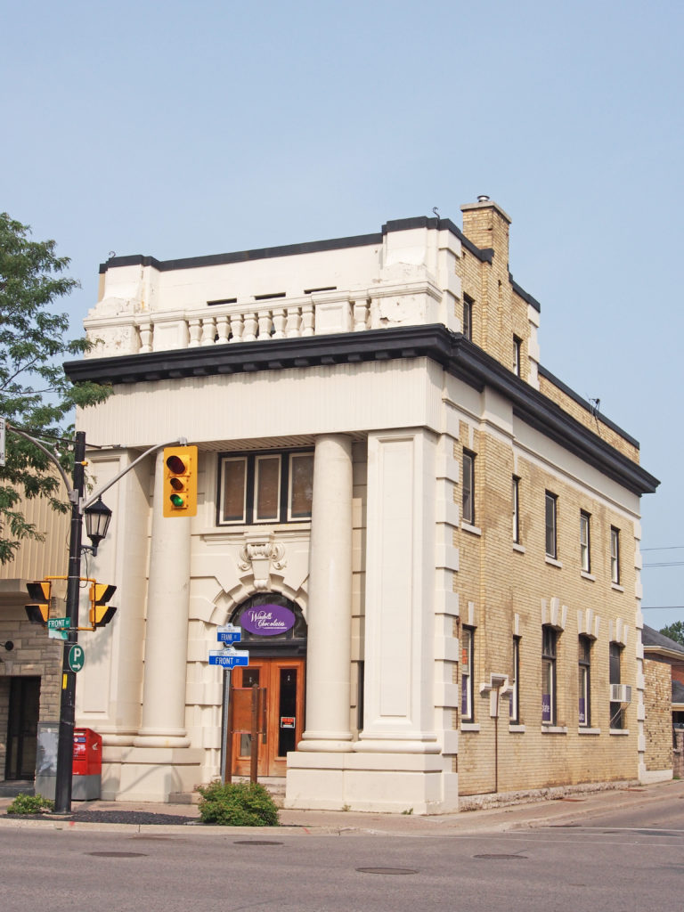
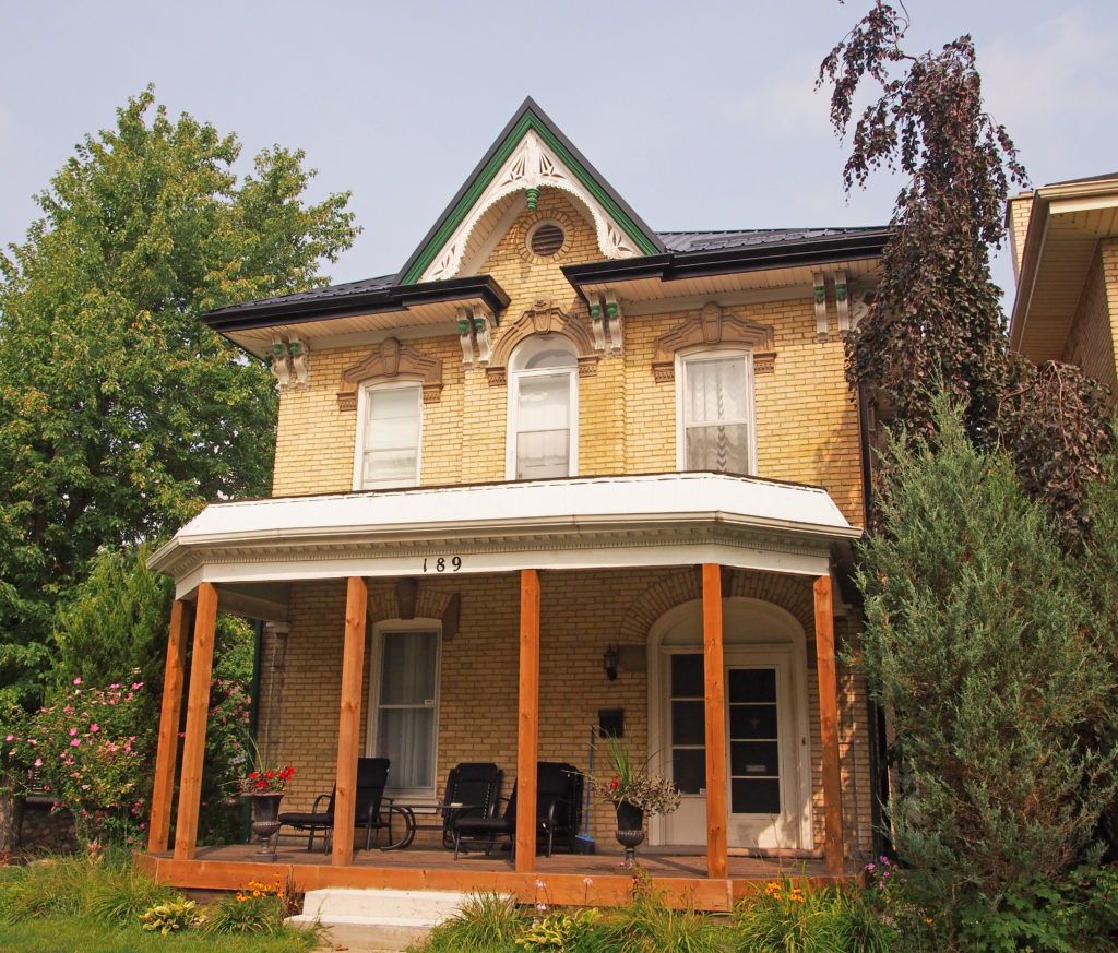
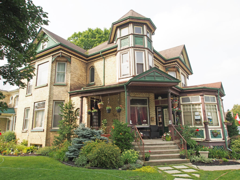
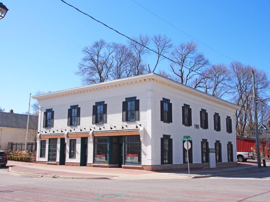
7 Kittridge Avenue West – Queen Anne – turret418 Victoria Street – Italianate – paired cornice brackets52 Frank Street – Town Hall – 1928 – reminiscent of a New England style of architecture combining beauty and utility51 Front Street West – Founded by William McMaster just before the Confederation of Canada in 1867, the Canadian Bank of Commerce quickly became the dominant financial institution in the country. In 1883, this building on the corner of Frank and Front Streets, was constructed. It features a Doric inspired front with vertical pillars in the Classical Greek style.97-99 Front Street – uneven roof line, second-floor balconies145 Front Street – Gothic – corner quoins, shutters153 Front Street – Italianate, 2½-story frontispiece, paired cornice brackets189 Front Street – decorative verge board on center gable, paired cornice brackets230 Albert Street – two-story tower-like bay windows, paired cornice brackets144 Albert Street – Queen Anne style – turret
Cheltenham – In 1816 Charles and Martha Haines and three children left
England for New York; the following year they arrived in York, Upper Canada,
where Charles, a millwright, built mills. In 1819, the Chinguacousy Township
survey was completed and Haines purchased 100 acres along the Credit River with
a mill site west of Creditview Road. The Haines family settled in what he named
‘Cheltenham’ after his birthplace. It is located north-west of Brampton.
In 1827 he built a grist mill, dammed the river and chiseled mill
stones. In 1842, Frederick Haines, the second son, built Cheltenham’s first
store. In 1845, the first tavern was built and run by C. Spence. In 1847, to
meet demand, Haines built a larger mill with three runs of stone, and he constructed
a saw mill on the south side of the river. In 1848, William Henry built an Inn.
In 1850,the first blacksmith shop was built. In 1852, Cheltenham post office
opened with William Allan as first postmaster. By 1853, Cheltenham had three
hotels.
In the 1860s, the commercial core expanded with the addition of four
shoe stores, a saddlery, and two cabinet makers. In 1874, the Hamilton &
Northwestern Railway arrived north of the village (later became CNR). In 1877,
the Credit Valley Railway arrived about one kilometer east of the village,
accessed by Station Road. In the 1870s, Kee’s steam tannery was started and two
distilleries produced ‘Cheltenham Wheat Whisky’. In 1887, fire destroyed a
major block of buildings; rebuilding began. In 1914, Interprovincial Brick
Company opened a plant just west of the village center.
In 1822, Joseph Kenny was awarded a Crown Grant in Chinguacousy
Township of 100 acres along the Credit River on which much of Terra Cotta now
sits. It is located south of Cheltenham. In 1857, Henry Tucker purchased 40
acres from Kenny to build grist and saw mills powered by a dam and mill race on
the Credit River. Simon Plewes bought the mills in 1859 and the hamlet became
known as Plewes Mills.
By the time a church, the Wesleyan Methodist Church, was built in 1862
the village had been renamed Salmonville for the annual spawning frenzy. A post
office opened in 1866 and by 1874 there were thirty-four surveyed lots in the
hamlet on the banks of the Credit River.
This early community spread westwards and straddled the boundary of
Chinguacousy and Esquesing townships. This divided the village schoolchildren,
their two schoolhouses being in opposite directions. By 1873 the village had
acquired telegraph facilities, two sawmills and a grist mill, and in 1877 the
Hamilton & Northwestern Railway arrived, stimulating local industry and
farm exports.
Industry began with brickworks exploiting the local red clay, and by
1891 the post office was renamed Terra Cotta. In the 1930s, the brickworks
became victims of the Depression and only a kiln chimney remains. Quarries east
of Terra Cotta were established in the 1840s and the arrival of the railway
broadened their market reach, allowing local sandstone to be used as far away
as Ottawa in the Parliament Buildings.
In the 1940s, community enterprise expanded into recreation. The
river’s abundant water resources were used to develop Clancy’s Ranch as a
weekend resort, expanded in 1949 into Terra Cotta Playground, and purchased in
1958 by Credit Valley Conservation.
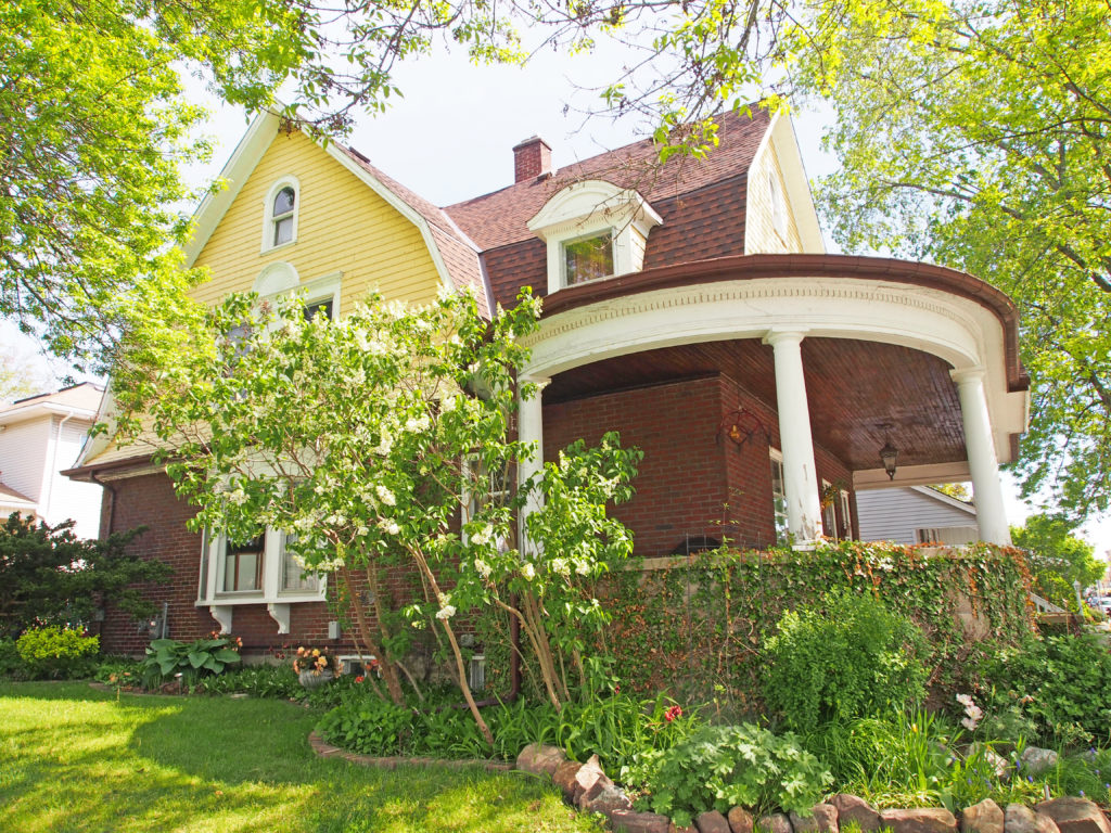
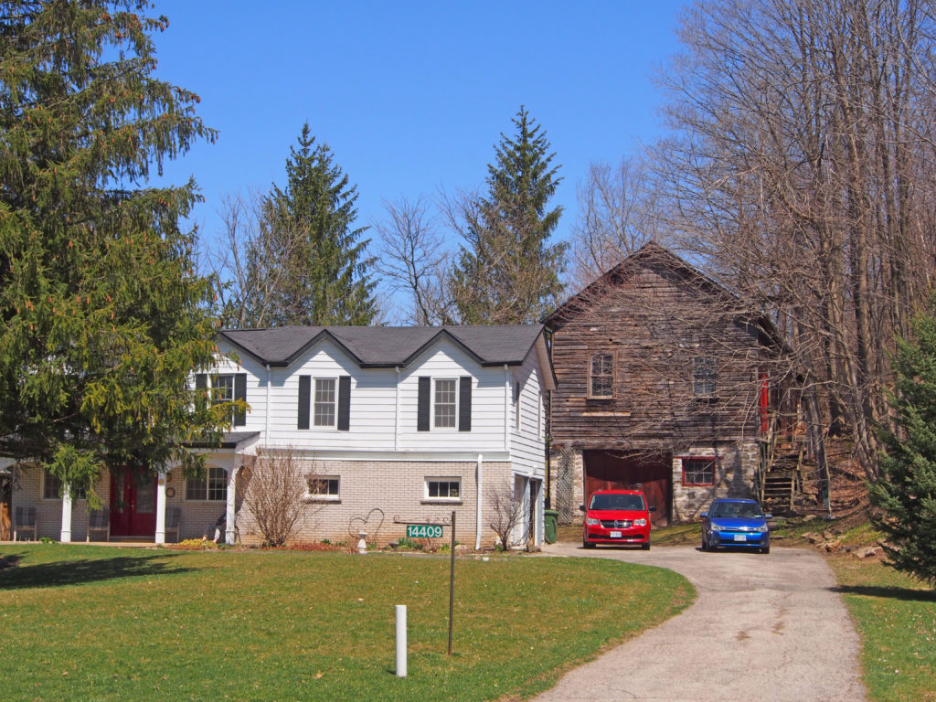
14376 Creditview Road, Cheltenham – Frederick Haines House – circa 1887 -After losing his first home to the 1887 fire, entrepreneur Frederick Haines, son of Cheltenham’s founder, built this red brick house with intricate yellow brick patterning. Later additions are compatible with the original three gable Victorian Gothic style. In the 1940s-1950s, it became a United Church rest and holiday home. It later housed an antique shop before being converted back to a private residence. It has a bell cast roof over each front bay, an arched entry and etched glass transom and sidelights of the central entrance.14411 Creditview Road, Cheltenham – King Store/Residence – circa 1870s -This Victorian Gothic general store/residence was built for Charles King, a Cheltenham merchant. In the 1880s, it became the Harris General Store with John and MaryAnn Harris living in the residence. Postmaster Albert Kee purchased it in 1928, removed the store portion and ran the post office here until 1931. His widow, Ada Louise Kee, took over as postmistress until she retired in 1958. There are cornice brackets on the eaves and there is a double Gothic window above the front bay window.14396 Creditview Road, Cheltenham – Henry’s Hotel – circa 1887 – William Henry’s pre-1859 Inn was destroyed in the 1887 fire. He rebuilt, replacing the Inn with this two-storey Georgian style frame building with hip roof and brick veneer. He named it ‘Henry’s Hotel’ operating it until his death in 1904. Thomas and Nathaniel Browne took it over as ‘Browne’s Hotel’. It was later a butcher shop with home above. In 1958 it was adapted to commercial/apartment use.14387 Creditview Road, Cheltenham – Claridge House – circa 1915 – This ‘four-square’ frame house is built in the Edwardian Classical style characterized by an asymmetrical floor plan, pyramidal hipped roof and large attic dormers. The partially enclosed verandah has a roof slope that matches that of house roof above. The original owner was a carpenter.14377 Creditview Road, Cheltenham – Neo-Classical Cottage – late 1850s -This 1½ storey frame cottage was likely built by John Lyons. It was sold soon after to Thomas Mercer who lived here for the next 20 years. The covered verandah with its hip roof has a banister running from both sides to the central entrance/steps along with a decorative frieze under the eaves.1499 Mill Street, Cheltenham – Horatio Haines Cottage – circa 1847-1851 -This 1½ storey, timber frame Georgian style cottage is unique with its identical front and rear facades, providing views to the grist and saw mills across the river and to the developing village core. Haines family members were its builders, carpenters, lumber suppliers and intended occupants, the first being Horatio Haines, miller and fifth son of Charles and Martha Haines. Horatio died in 1856, aged 32 and it was later sold to his brother Frederick.Mill Street, Cheltenham – Neo-Colonial – gambrel roof14409 Creditview Road, Cheltenham – Beaver Hall – circa 1884 – This 1½ storey timber frame building was built by store owner John Harris, who rented it out to the community for political meetings, concerts and dances until the mid-1930s. Built into the hillside, it has a substantial stone foundation with an 1884 date-stone in the front wall. The main floor is supported with large squared timber beams visible in the unfinished basement ceiling. About 1900, a cement tile business operated from the back of the hall.King Street, Terra Cotta – Gothic Ontario Cottage 396 King Street, Terra Cotta – The Grange – 400 m east of High Street – This building has evolved from John McComb’s 1840s squared timber cottage. In 1867 George Campbell and his brother William modified it into a two-family stone dwelling. It was inherited by George Campbell’s daughters in 1887 and later sold to Edward and Janet Little in whose hands it evolved into this elegant residence.49 Isabella Street, Terra Cotta – Stringer House – circa 1870s – This 1½ story Victorian Gothic house was originally a frame cottage later veneered in the red and yellow brick produced locally by Terra Cotta Pressed Brick. The projecting front bay has yellow brick detailing.Boston Mills Road – log cabin
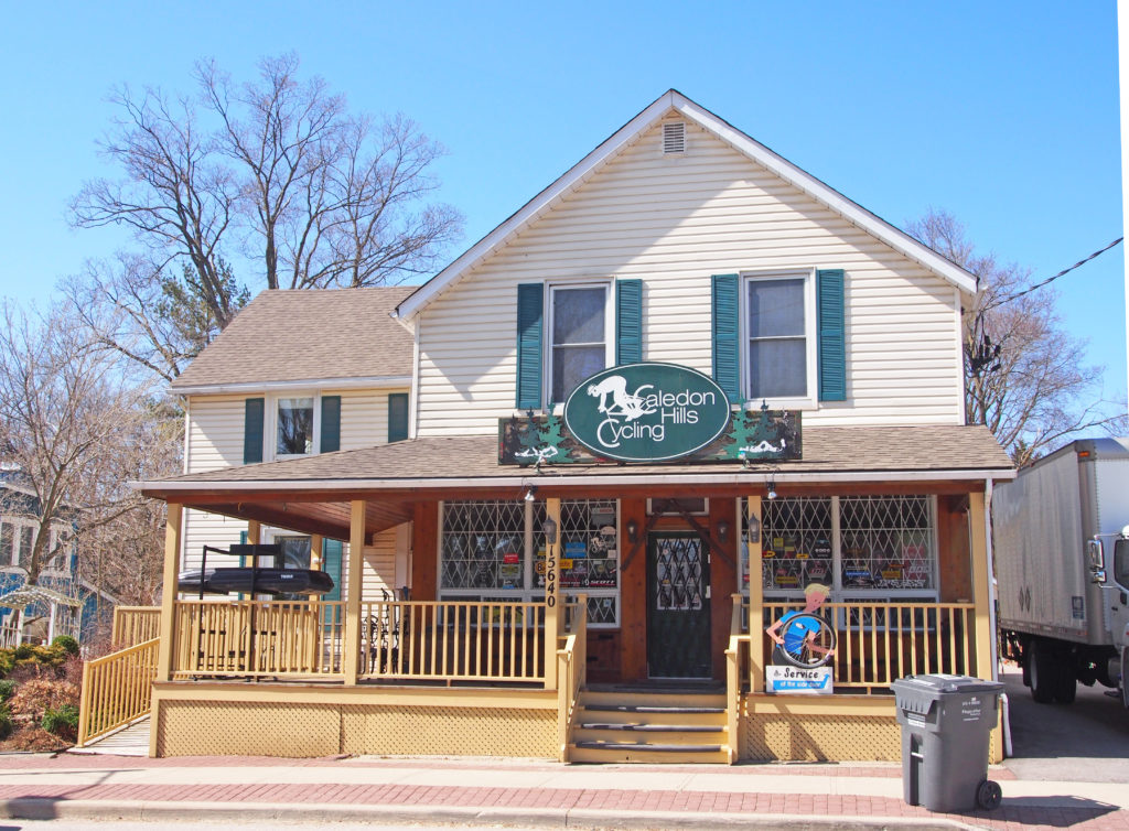
Caledon is a town in the Regional Municipality of Peel in the Greater Toronto Area. Caledon remains primarily rural. It consists of an amalgamation of a number of urban areas, villages, and hamlets; its major urban center is Bolton on its eastern side adjacent to York Region.
Caledon is
one of three municipalities of Peel Region. The town is just northwest of the
city of Brampton. In 1973 Caledon acquired more territory when Chinguacousy
dissolved with most sections north of Mayfield Road (excluding Snelgrove) transferred
to the township.
Some of
the smaller communities in the town include: Alton, Belfountain, Boston Mills, Caledon, Caledon Village, Campbell’s
Cross, Cheltenham, Inglewood, Mono Mills, Sandhill, Terra Cotta, and Victoria.
The region is very sparsely populated with farms.
By 1869,
Belfountain was a picturesque village in the Township of Caledon County Peel on the Forks of the Credit Road on the
Credit River. There were stagecoaches to Erin and Georgetown.
After the survey of Caledon Township was completed in 1819, pioneers
such as the Grahams, McColls, McCannells, Martins, Whites and McGregors
settled in the area around present day Inglewood. They cleared the land,
sharing common problems and interests.
In 1843, on the nearby Credit
River, Thomas Corbett built a dam and dug a mill race to provide water power to
run the Riverdale Woolen Mill. David Graham became a partner in the mill in
1860, and after a fire, reconstructed it in stone in 1871. By this time, Graham
was Corbett’s son-in-law. The mill attracted potential employees and their
families to the area. Early settlers discovered deposits of sandstone and
dolomite nearby on the Niagara Escarpment. Joachim Hagerman opened a quarry in
1875, the first of many.
The Hamilton & Northwestern
Railway arrived in 1877 and was crossed over by the Credit Valley Railway in
1878. The railways provided cheap and easily accessible transportation, for
both locally quarried stone and manufactured goods of the woolen mill. A
general store and railway hotel were soon built.
The village housing built in this
period, much of it by Graham, reflected the Ontario Cottage form popular in
that Victorian era. Most houses were
built using local lumber from the William Thompson Planing Mill, a more
affordable option than brick. These cottages usually featured a front verandah,
a center door symmetrically flanked by windows and a steep roof line with a
front center gable surrounding a Gothic or arched window, the basic elements of
the Victorian Gothic style. In Inglewood, most homes were left unadorned, a
style referred to locally as Rural or Carpenter’s Gothic.
The increase in population gave
rise to many small industries, and from the mid-1880s until 1910, Inglewood’s
commercial growth included several general stores, a blacksmith, a livery and
wagon maker’s shop, a butcher shop, a bakery, a general hardware and tinsmith
business, a barber shop, glove factory, post office, library, and a branch
office of the Northern Crown Bank.