Amherstburg is located near the mouth of the Detroit River in Essex County about twenty-five kilometers south of the United States city of Detroit, Michigan. The British military garrison, Fort Malden, was established here in 1796. The town was developed by Loyalists who were granted land by the Crown in Ontario after the British lost the American Revolutionary War. The Loyalists built many of their houses in the French style of a century before, giving the new town a historic character.
The local public high school in Amherstburg is General Amherst High School and is named after Jeffery Amherst, 1st Baron Amherst of Montreal, who served as an officer in the British Army and as Commander-in-Chief of the Forces. Amherst is best known as the architect of Britain’s successful campaign to conquer the territory of New France during the French and Indian War when he led the British attack on Louisbourg on Cape Breton Island in June 1758. Amherst led an army against French troops on Lake Champlain, where he captured Fort Ticonderoga in July 1759, while another army under Sir William Johnson took Niagara also in July 1759, and James Wolfe besieged and eventually captured Quebec with a third army in September 1759.
From July 1760, Amherst led an army down the St. Lawrence River from Fort Oswego, joined with Brigadier Murray from Quebec and Brigadier Haviland from Ill-aux-Noix in a three-way pincer, and captured Montreal, ending French rule in North America on September 8. In recognition of this victory, Amherst was appointed as the first British Governor General in the territories that eventually became Canada.
From his base at New York, Amherst oversaw the dispatch of troops under Monckton and Haviland to take part in British expeditions in the West Indies that led to the British capture of Dominica in 1761 and Martinique and Cuba in 1762.
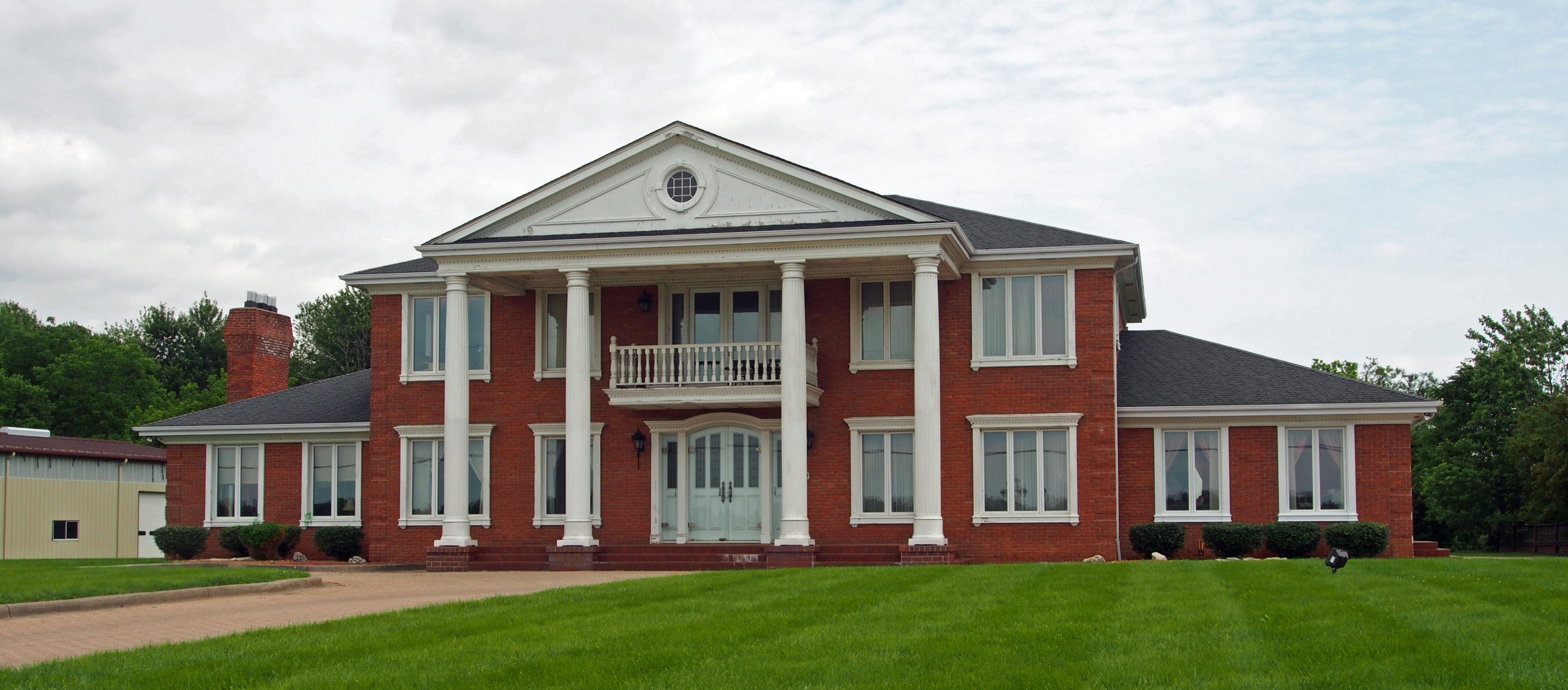
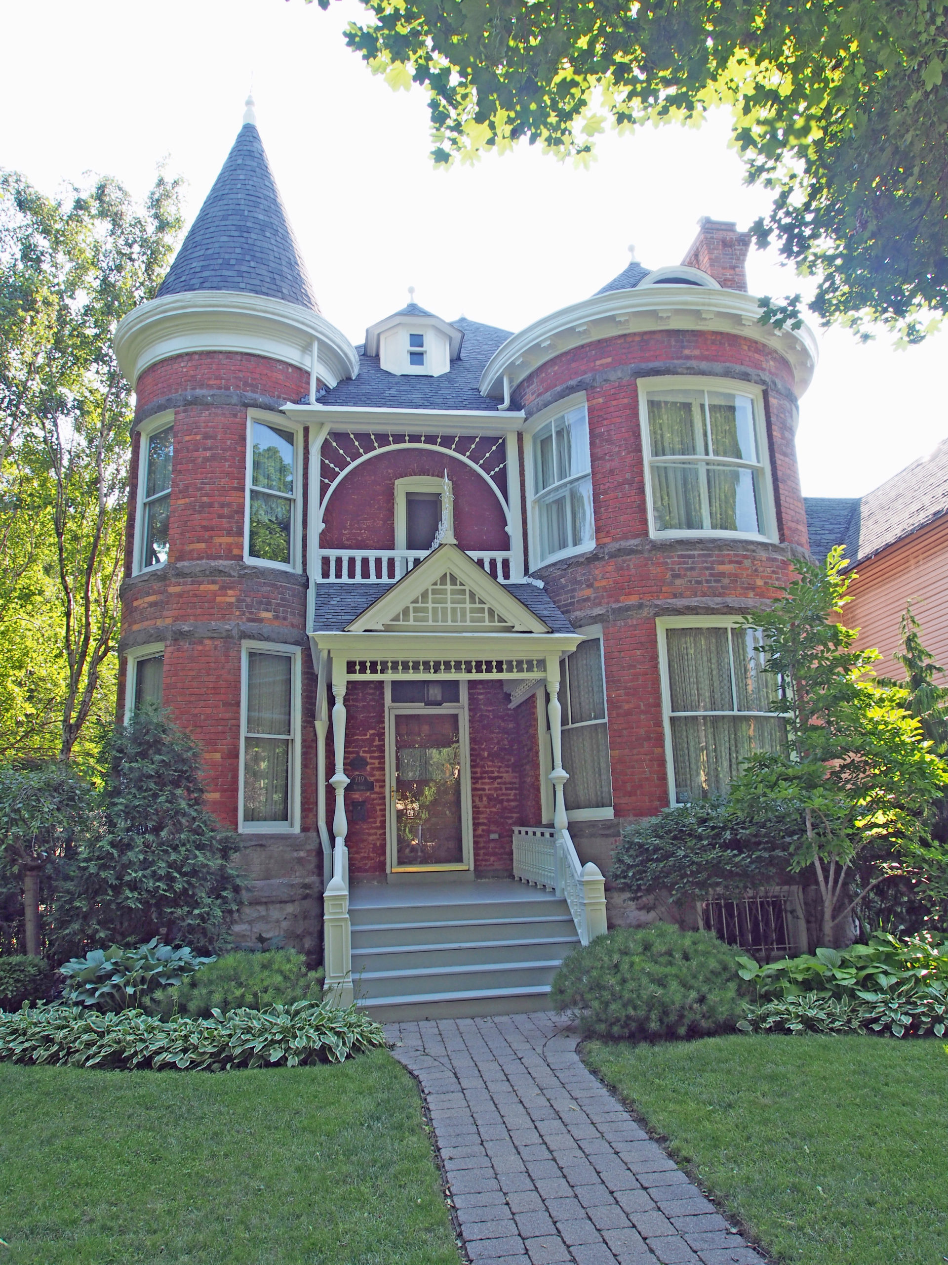
Dalhousie Street – Greek Revival, two-story Doric pillars, pediment, second floor balcony, side lights beside door – Amherstburg Book 1495 Dalhousie Street – Argyle Castle – 1894 -Arts and Crafts style, Palladian style window with window hood, turret – Book 1199 Dalhousie Street – Bondy House Bed and Breakfast – Century old Victorian Queen Anne home, turret called “Widow’s Walk†for a great view, trichromatic siding
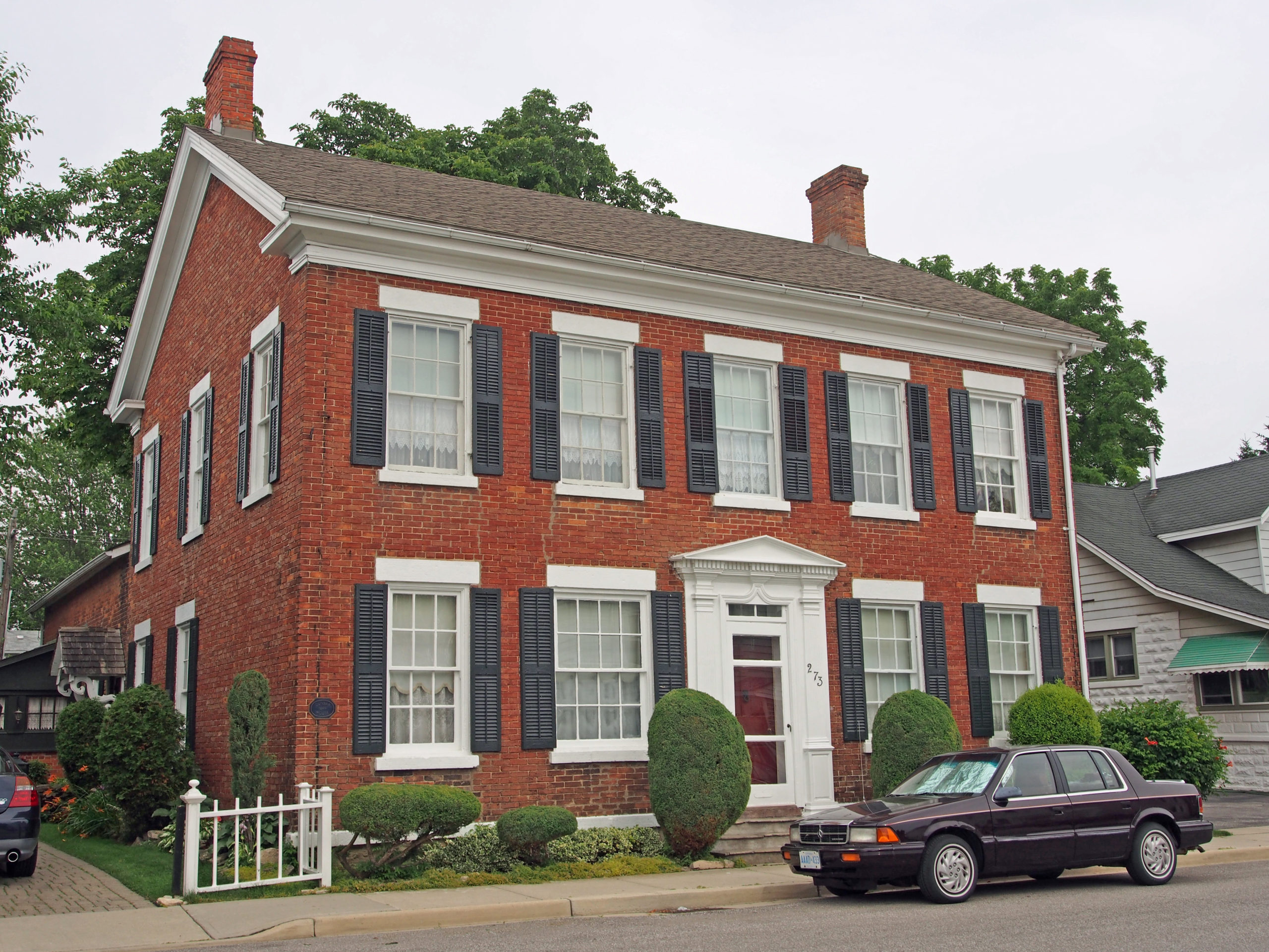
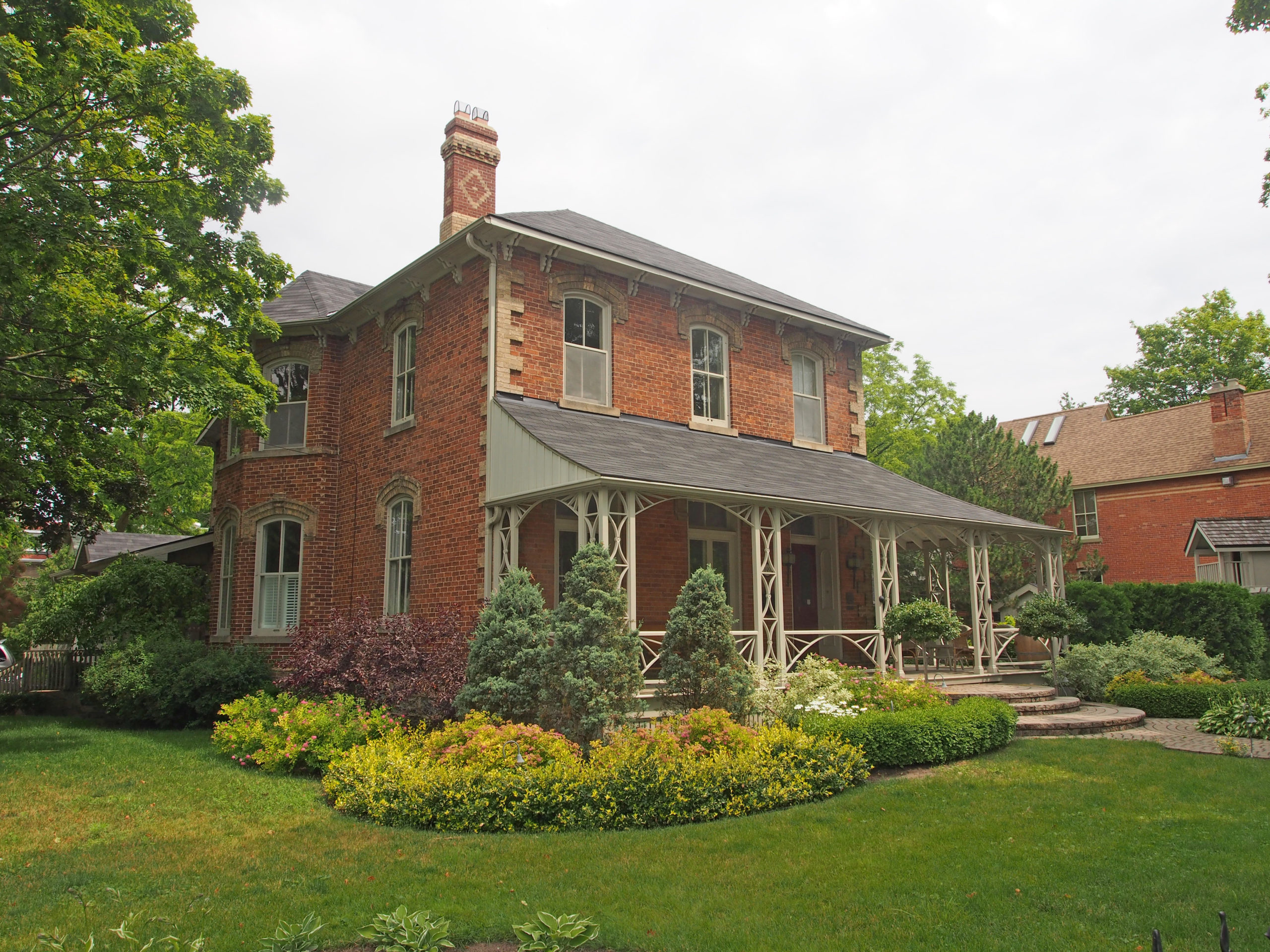
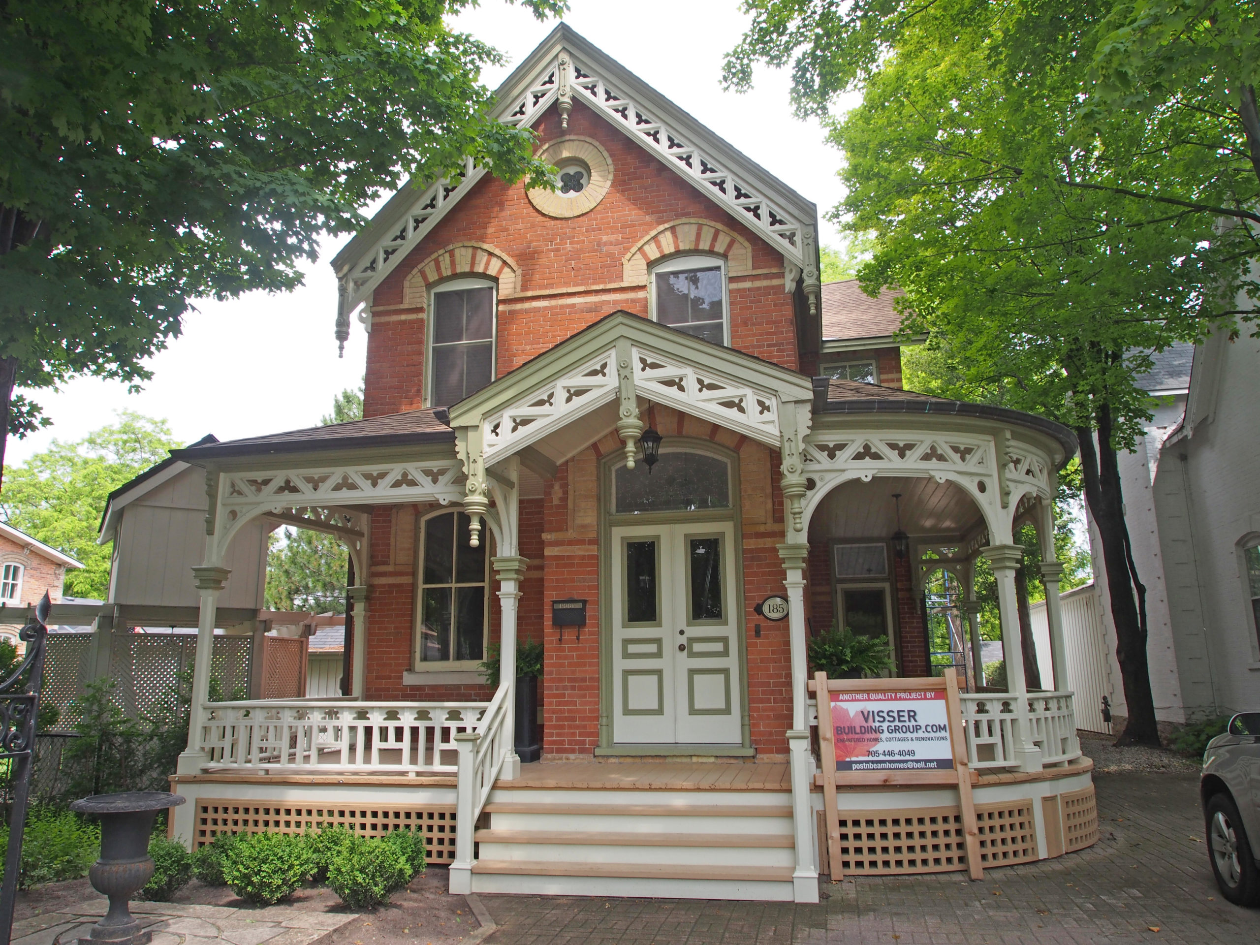
– Book 1214 Dalhousie Street – Pensioner’s cottage – the oldest house in Amherstburg (1796) – moved here from River Rouge, Detroit in 1798 by merchants Leith, Shepherd & Duff; purchased in 1838 by Thomas F. Park and owned by the Park Family (tinsmiths) until 1945 – moved to this site in 1972 and restored by the Rotary Club of Amherstburg as the Park House Museum – very early example of solid log, French frame construction; three dormers, Victorian style – Book 1232 Sandwich Street South – Amherstburg Carnegie Public Library – built in 1911 of limestone from the old Huron Indian Quarry in Anderdon Township – Book 136 Sandwich Street South – Gothic Revival, verge board trim on gable, iron cresting above windows, cornice brackets, dormer above one story section – Amherstburg Book 2140 Richmond Street – Michigan Central Railway Station – 1892 – dichromatic brickwork – Book 2273 Ramsay Street – Dunbar House – 1849 – Georgian – two-story brick, pediment above doorway with dentil molding below, transom window – Book 2207 Gore Street – James Caldwell House – This original one-story log house was built between 1835 and 1840 by James Caldwell. Caldwell served with the British Army during the Revolutionary War. At the end of this war, he was given a large tract of land in Amherstburg for his service. Georgian style – Book 29399 North Town Line Road – St. Joseph Church – 1910 – French-Canadian Church – a landmark at the center of the former community River Canard – entrance with Corinthian capitals on columns, voussoirs and keystones, decorative brickwork in gable – Book 2
Windsor is the southernmost city in Canada. The Detroit River is to the north of the city, which separates it from Detroit, Michigan. Windsor was settled by the French in 1749 as an agricultural settlement. In 1794, after the American Revolution, the settlement of “Sandwich” was founded. It was later renamed Windsor, after the town in Berkshire, England.
Sandwich, Ford City and Walkerville were separate towns until 1935 when they were annexed by Windsor. They remain as historic neighborhoods of Windsor. Walkerville was incorporated as a town in 1890.
The former Town of Walkerville was founded by Hiram Walker in 1858. The New England-born distiller bought two French farms on the south shore of the Detroit River, and the growth of his industry and the town it supported continued for seven decade under his family’s guidance.
Railroads played an important part in Walkerville’s history. First, the Great Western’s extension to Windsor in 1854 opened up opportunities for commercial expansion. Then Walker built his own line in 1885 with government financing, the Lake Erie Essex & Detroit River Railroad, which connected Walkerville with lake shore towns and farms, and extended as far as St. Thomas. The availability of rail transportation attracted other industrial enterprises to the area, and brought great prosperity to the Walker family and their town.
The Walkerville Land & Building Company was incorporated in 1890 with Hiram’s oldest son, Edward Chandler, as president. The Town passed a by-law in 1894 to provide temporary tax exemptions to attract new industries, and to encourage individuals wishing to build homes in Walkerville. Rental properties for the distillery’s employees were built. All of the community’s amenities were provided by Walker – a fire brigade and police, streetlights, sewers, paved roads and sidewalks, parks, a music hall, a school, library and church.
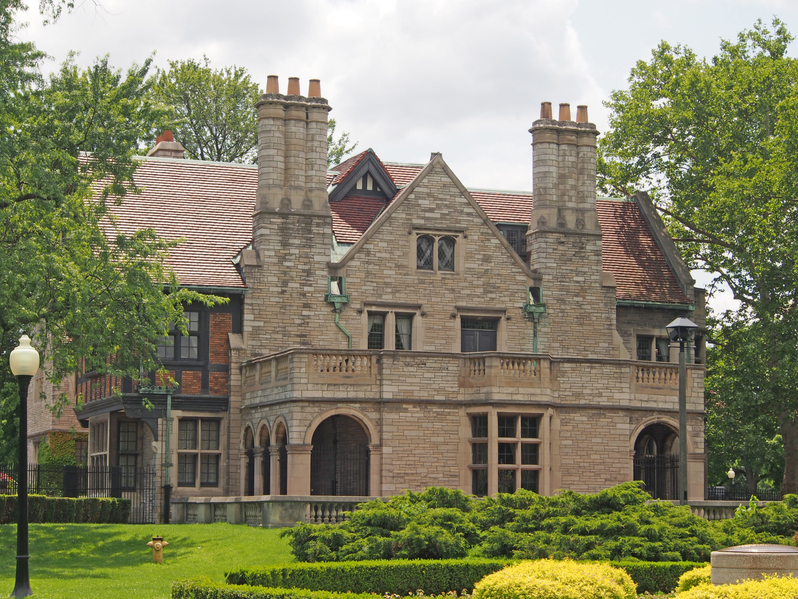
Walker Road’s east side was devoted to industrial manufacturing facilities. Its western edge had modest, brick, semidetached houses; Monmouth Road’s semis and terraces replaced rows of cottages, and employees were originally required to rent from the distillery. Argyle Road had a mix of terraces and vernacular houses for a higher rank of employee. Devonshire Road became the main street, with Romanesque Revival semis for management and the clergy. Later, distinctive houses of various architectural styles, popular in the protracted Edwardian Period (1900 to the 1930s), rose on the street, and spilled over onto Kildare Road. The concept was fully realized with the landscaped “island†developed as the site of St. Mary’s Anglican Church – the sons’ memorial to their parents, and the erection of Willistead Manor on the former Country Club and park lands.
The Arts and Crafts Movement, a philosophy of design founded in England about 1850, emphasized handmade architecture in an age when factory mass-production was taking hold. Every home Albert Kahn designed shows Arts and Crafts influence. Kahn believed that historic period styles were best suited to homes and public institutions, while factories should be utilitarian, brightly illuminated and devoid of ornament.
Hiram Walker was born in East Douglas, Massachusetts, and moved to Detroit in 1838. In 1847 at the age of 30, he married Mary Abigail Williams and they had 7 children, two daughters, Julia Elizabeth and Jennie Melissa, and five sons, Willis Ephraim, Edward Chandler, Franklin Hiram, Alfred (infant), and James Harrington. Edward Chandler, his second son, commissioned the development of Willistead Manor.
He was an American entrepreneur and he purchased 460 acres of land across the Detroit River in the town of Sandwich, near Windsor, Ontario, Canada. In 1858 the flour mill and distillery were completed. The flour produced in his mill benefited the County of Essex’s farming community with farmers from all around using the mill.
Mid-summer in 1858 marked the opening of Hiram Walker’s whisky operation. The same process which he had used in Detroit was now used in Windsor to distill his alcohol. Spirits were leached through charcoal, a process widely used at the time. Walker began selling his whisky as Hiram Walker’s Club Whisky and it became very popular. His Canadian industries quickly took precedent over that of his grain business still located in Detroit. As a result, Hiram Walker traveled by ferry to Canada from his home in Detroit on a daily basis. The trip was a lengthy process as the ferry that brought him to Canada dropped him off in Windsor, which left a long ride by horse and buggy to his flour mill and distillery. Throughout his life, Hiram Walker remained an American citizen but in March 1859 Hiram Walker moved to Canada in order to save time traveling to and from his Canadian businesses.
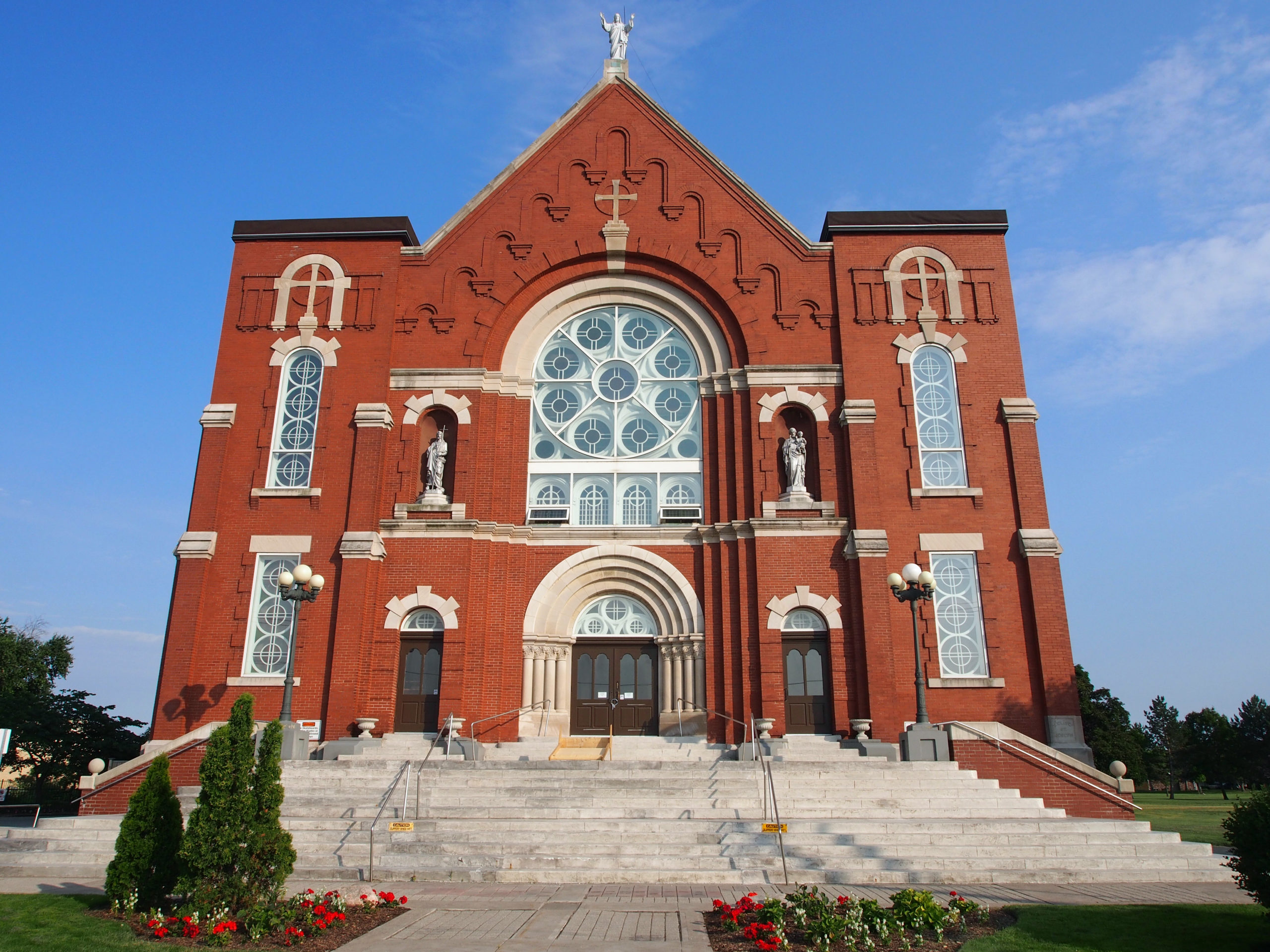
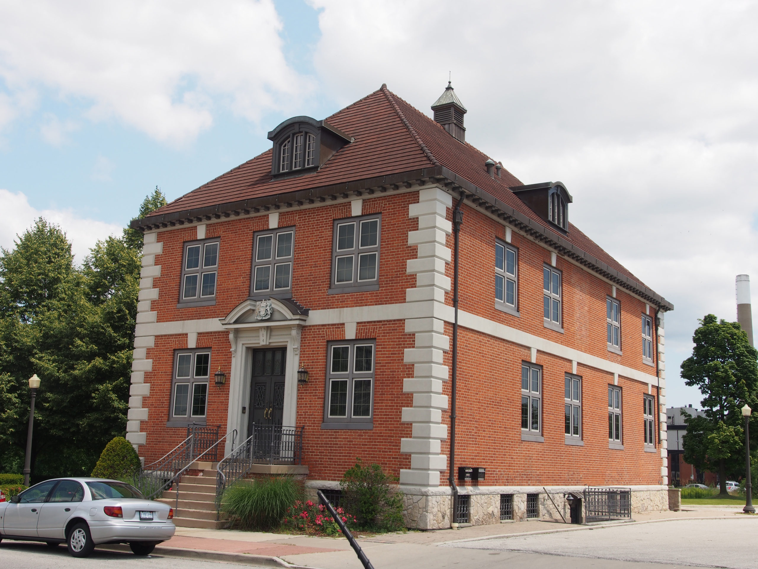
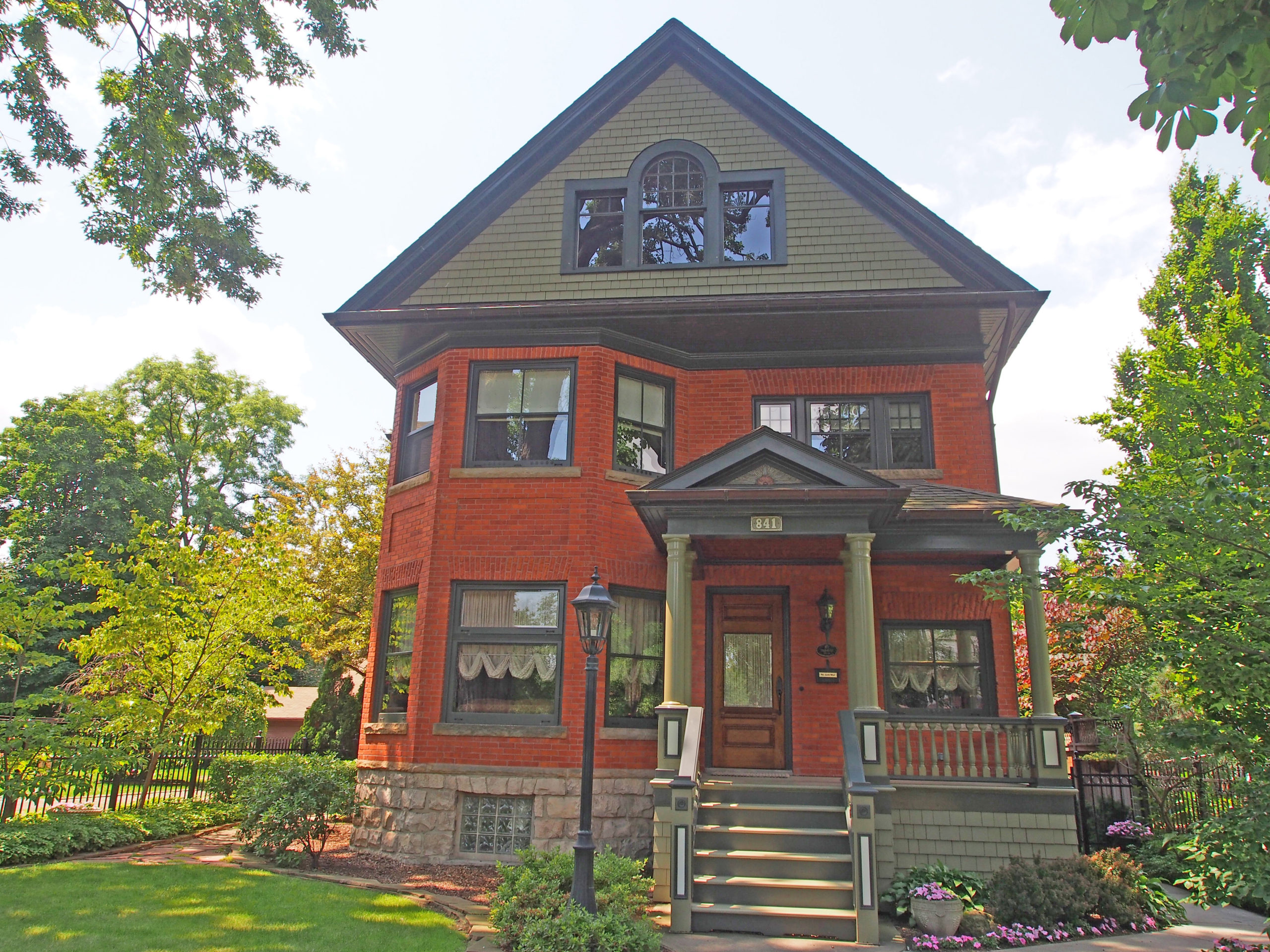
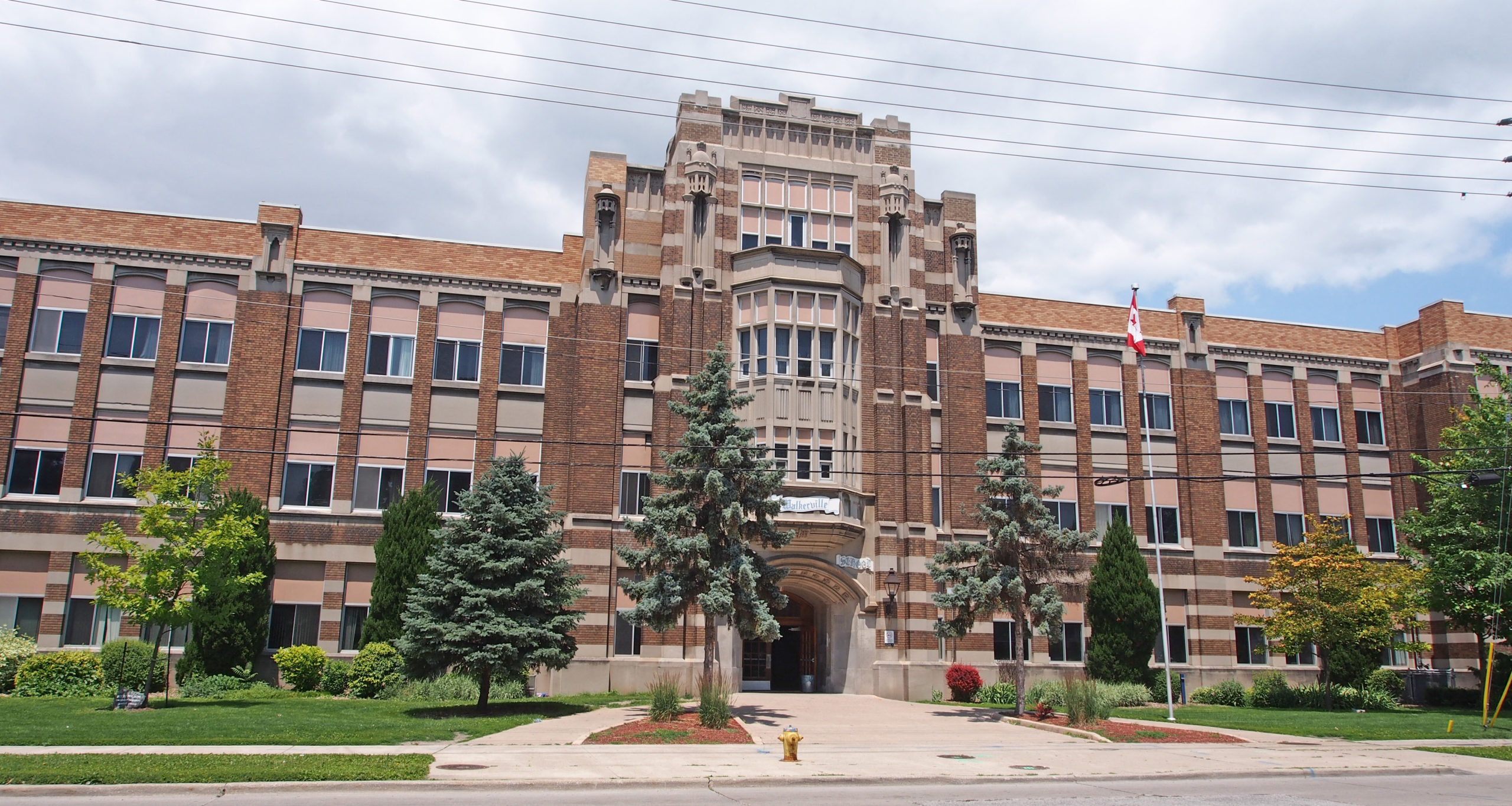
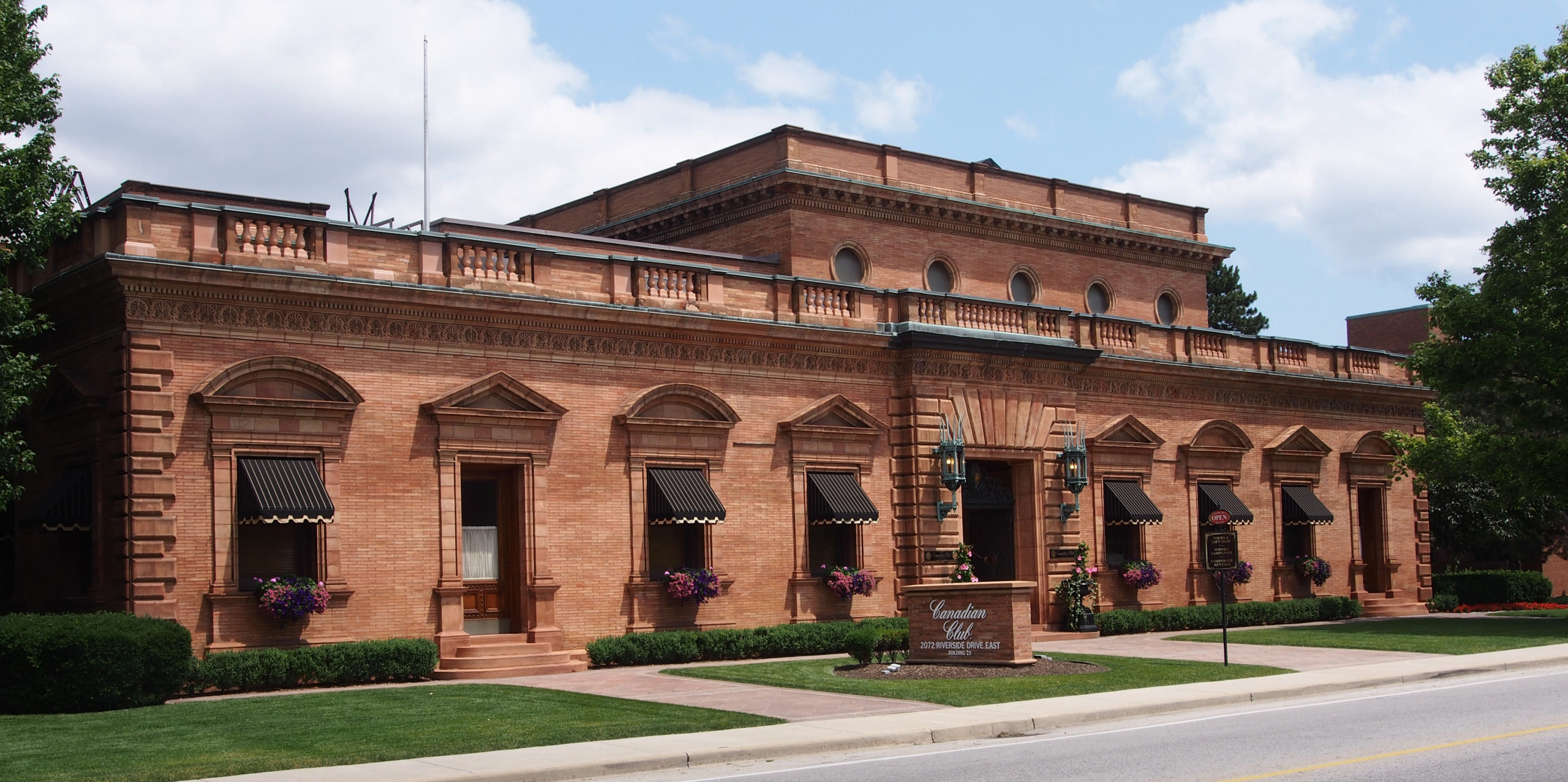
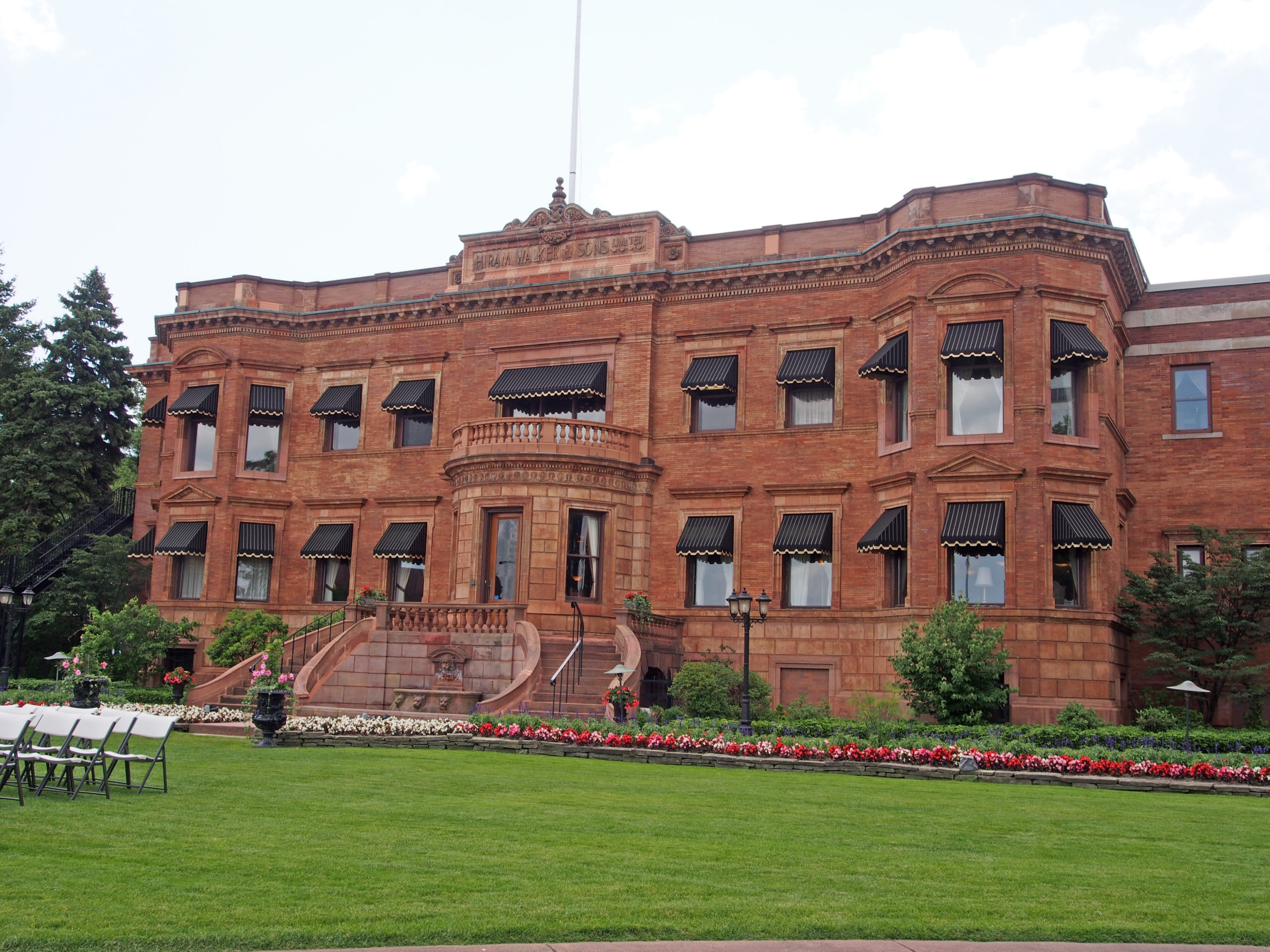
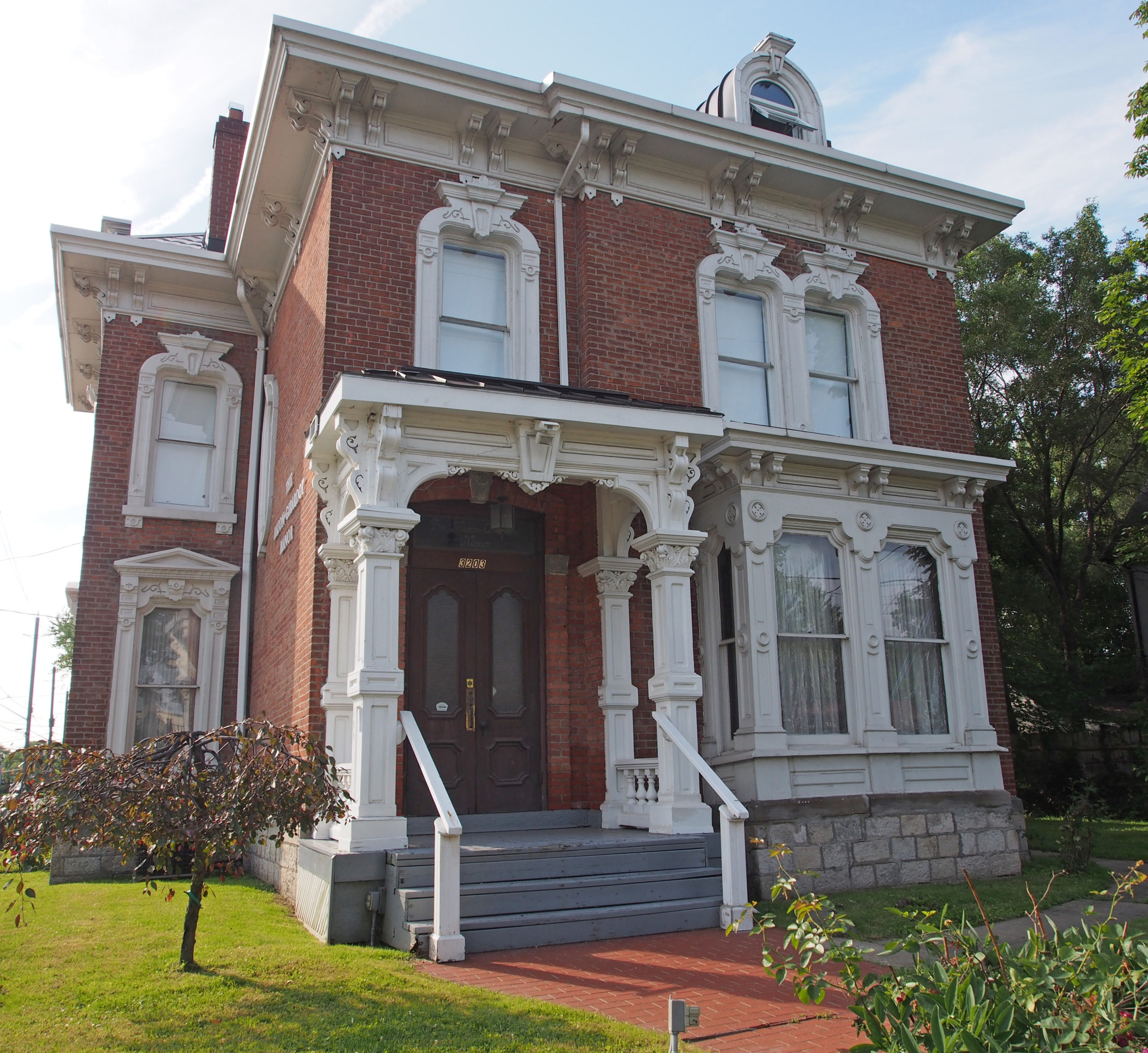
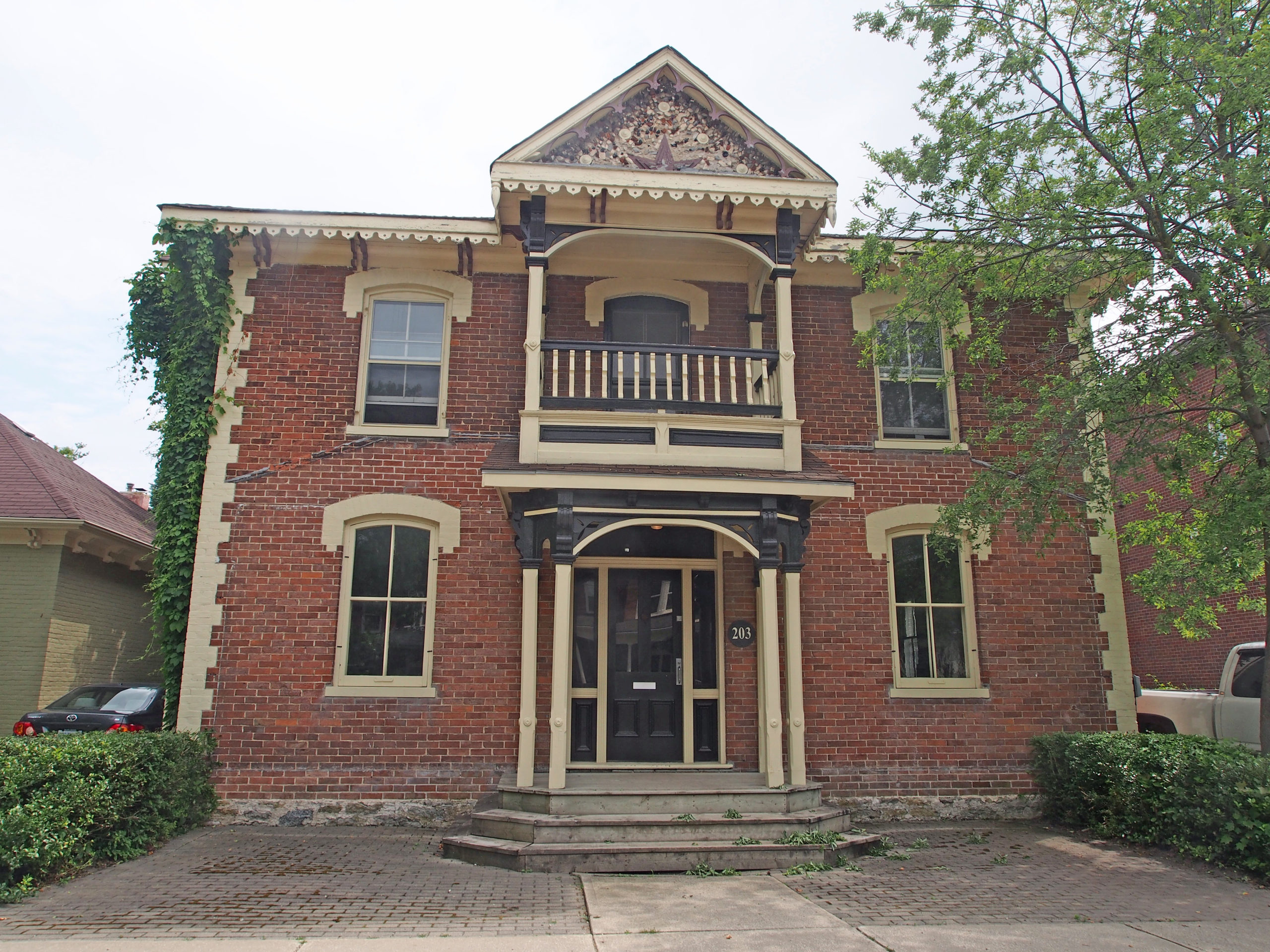
350 Devonshire Road – Walkerville Town Hall – 1904 – Classical Revival – symmetrical, belt courses (a continuous row of stones set in the wall), angled quoins, burst pediment above door with coat of arms, dormers, cupola – Windsor Book 1546-548 Devonshire Road built 1890 – Bed & Breakfast – 1889 – Romanesque style arched entrances – Book 1841 Kildare Road – Miers-Fraser House built in 1904 – Edwardian, Palladian window, two-story bay, Ionic columns supporting a pediment – Book 11899 Niagara Street – Willistead Manor – 1906 – 16th-century Tudor-Jacobean style of an English manor house was commissioned by Edward Chandler Walker, the second son of Hiram Walker. It has 36-rooms but contained only one bedroom. Edward and his wife never had any children, and the coach houses provided ample room for guests. The exterior of gray limestone, quarried in Amherstburg, was hand-cut at the Willistead work site by Scottish stonemasons specifically imported for the project. Tudoresque half-timbering – Book 12100 Richmond Street – Walkerville Collegiate – 1922 – Classical Revival style – Book 1706 Victoria Avenue – Neo-Classical style, symmetrical facade with a prominent columned entry porch sheltering the fanlight and sidelights of the paneled door; dentiled eaves, dormers in attic – Windsor Book 2719 Victoria Avenue – Treble-Large House – 1895 – Queen Anne Revival style – Book 2942 Victoria Avenue – Georgian with eyebrow window in roof, pillared entrance with rounded pediment2072 Riverside Drive East – Hiram Walker main office building 1894 – Florentine Renaissance – Windsor Book 32072 Riverside Drive East from rear2879 Riverside Drive East – Our Lady of the Rosary Church – built 1907-1913 – Romanesque-style brick and stone building could hold about 1,000 people, features two domed bell towers – Book 33203 Peter Street – dormer – Book 33277 Sandwich Street – Mackenzie Hall – District Court House and Gaol – when–the British withdrew from Detroit in 1796 they transferred the courts of the Western District to Sandwich (Windsor) – this building constructed in 1856 in Renaissance Revival style; a facade broken with pilasters which give strong vertical lines; the main entrance has side lights and a fanlight; it is constructed of Anderdon limestone and Ohio sandstone. The carving above the main doorway represents the seal of the Western District of Upper Canada. – Book 3
Waterford is located on Pleasant Ridge Road, or old Highway 24 in Norfolk County, south of Brantford, north of Simcoe and southwest of Ohsweken. Waterford was established in 1794 with saw and grist mills on Nanticoke Creek. An early major industry was the agricultural implement factory built by James Green, a local merchant. The area surrounding the town is primarily agricultural land with tomatoes, tobacco and corn among the main crops. With the decline of the tobacco industry, area farmers have suffered, but ginseng is being grown on some farms. In 1979 a freak tornado swept through the town, knocked down trees, and damaged houses and public property.
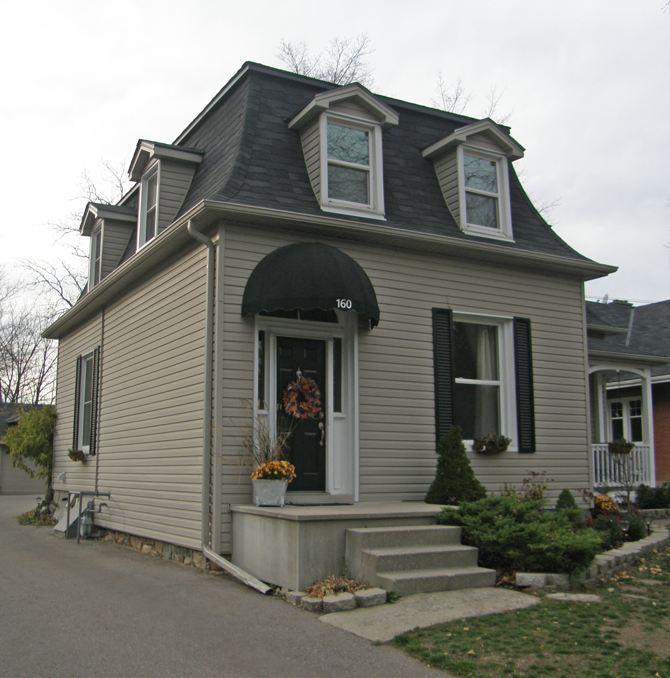
Italianate, hipped roof, dormer, second floor balcony92 Main Street – Italianate, belvedere on roof, paired cornice brackets, verge board and finial on gables, second floor balcony, Doric columns163 Main Street – Vernacular – three story tower173 Main Street – two-story tower-like bay capped with barge board trim on gableItalianate – Doric pillars160 Main Street – Second Empire style, mansard roof, dormersQueen Anne – 3½ story towerGeorgian – six-over-six windows, Doric pillars, widow’s walk on rooftop, sidelights and transom window around door
Collingwood is situated on Nottawasaga Bay at the southern point of Georgian Bay. Collingwood offers a combination of old time charm and history with recreation opportunities for skiing on Blue Mountain, and golfing.
Collingwood was incorporated as a town in 1858, nine years before Confederation and was named after Admiral Lord Cuthbert Collingwood, Lord Nelson’s second in command at the Battle of Trafalgar, who assumed command of the British fleet after Nelson’s death.
The land in the area was originally inhabited by the Iroquoian Petun nation, which built a string of villages in the vicinity of the nearby Niagara Escarpment. They were driven from the region by the Iroquois in 1650. European settlers and freed black slaves arrived in the area in the 1840s, bringing with them their religion and culture.
In 1855, the Ontario, Simcoe & Huron (later called The Northern) railway came into Collingwood, and the harbor became the place for shipment of goods destined for the upper Great Lakes ports of Chicago and Port Arthur-Ft. William (now Thunder Bay). Shipping produced a need for ship repairs, so it was not long before an organized ship building business was created. On May 24, 1883, the Collingwood Shipyards, formerly known as Collingwood Dry Dock Shipbuilding and Foundry Company Limited, opened with a special ceremony. On September 12, 1901, the Huronic was launched in Collingwood, the first steel-hulled ship launched in Canada. The shipyards produced Lakers and during World War II contributed to the production of Corvettes for the Royal Canadian Navy. Shipbuilding was one of the principal industries in the town, employing as much as 10% of the total labor force. Overseas competition and overcapacity in shipbuilding in Canada led to the demise of shipbuilding in Collingwood in September 1986.
242 Pine Street – Italianate with Gothic style frontispiece, verge board and finial, dichromatic brickwork
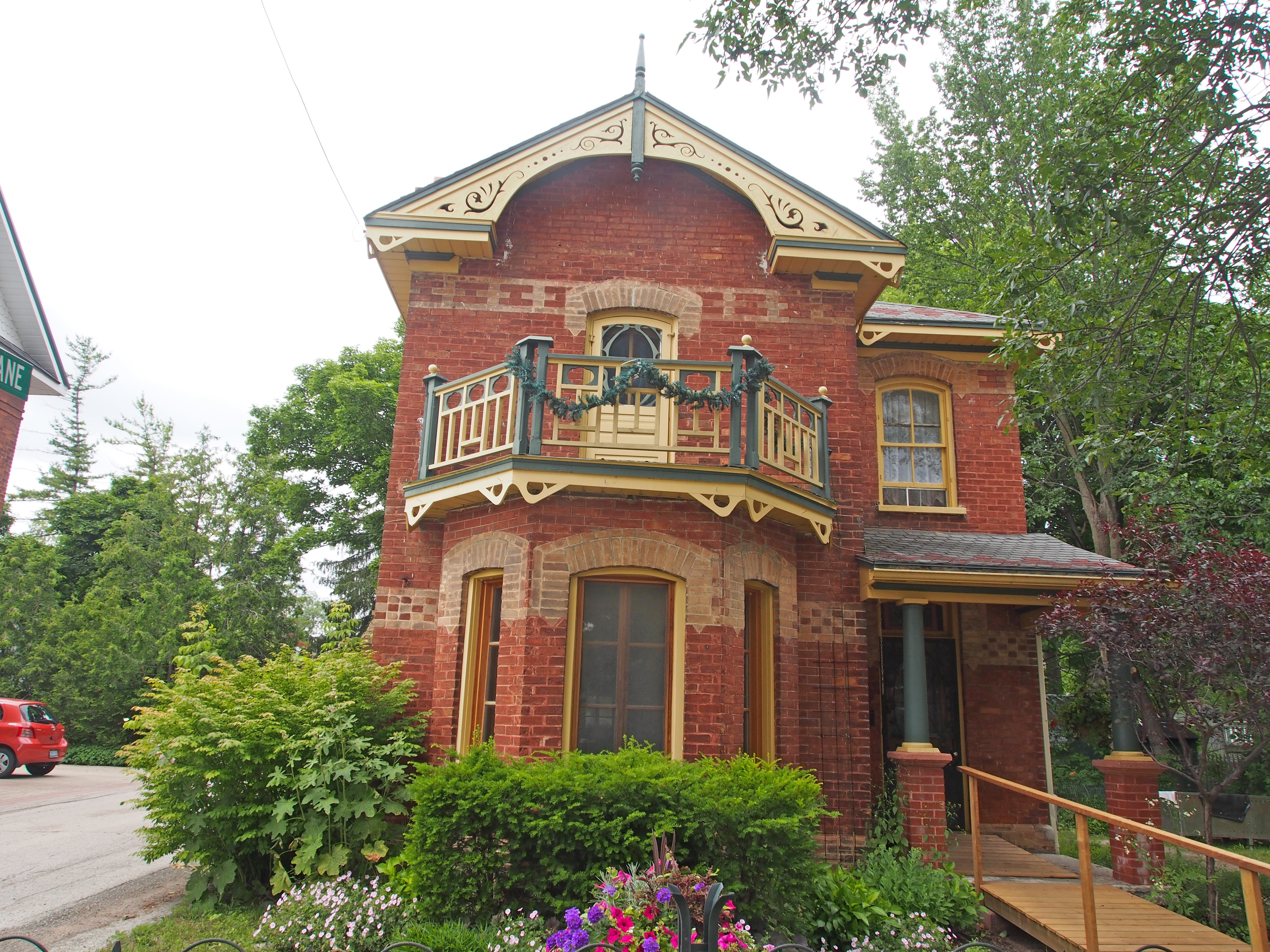
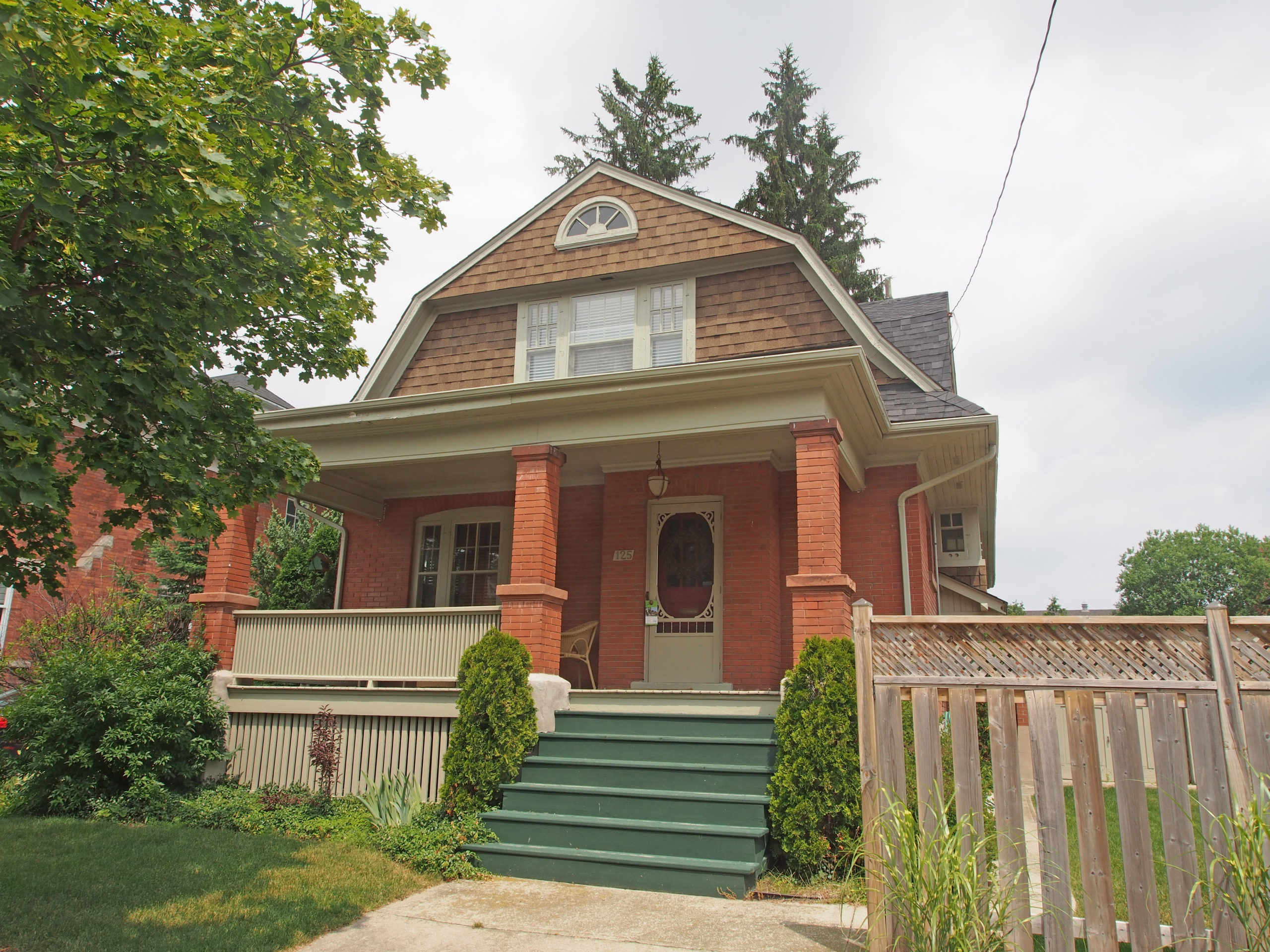
296 Pine Street – Italianate style – red brick with buff colored accentsOne story wing with fiddler on the roof – The first date Harry and I went on was to see “Fiddler on the Roofâ€200 Oak Street – This 10,380 square foot Victorian home, the largest and tallest in Collingwood, at the corner of Oak and Third Streets was originally owned by Frank F. Telfer, a leading businessman and ex-mayor of Collingwood. He purchased the property in 1891, and by 1893 the local firm Bryan Brothers Manufacturing Company completed the construction of the Telfer home. In 1925 the Telfer family sold the house, and the “Gowans Home for Missionaries’ Children†was established by the Interior Sudan Mission. This home displays a variety of architectural features. The three story structure is of double brick construction laid in a stretcher bond fashion and rests on a cut stone foundation. The three main exterior walls are accented by a repeating Greek style pattern running the full width of the walls below the eaves. The northeast corner of the building is formed by a large round turret with a conical roof. There are eighty windows of various shapes set above limestone sills; they include round, oriel, semicircular, and oval as well as stained glass.242 Third Street – This 2½ story brick home was built for Charles Pitt, owner of the Bertram Lumber Company. John Wilson was the local Collingwood architect. The house was built in 1908 and is a Georgian influenced Neo-Classical home. A large pediment and column portico adorns the front facade. A balcony protrudes from the second floor within the pediment which has an elliptical window. Brick alternating radiating voussoirs adorn the window and door surround heads on the facade.199 Third Street – Built in the Italianate tradition for the Toner family, early coal and lumber merchants, this home has retained its elegance with minor alterations since 1882. The interior of the home features a circular staircase, marble fireplaces, plaster medallions and a built in buffet. The exterior brick work laid in the common bond tradition is highlighted by protruding quoins and plinth in lighter contrasting brick. Decorative brick work adorns the original chimney as well as highlighting the window openings. Brick arch work and keystones decorate the window surrounds in a unique three-tiered stepped arch design. The main front facade contains unique, French doors with recessed mullion and molded panels. The home has a heavily bracketed low hip roof with an east side gable featuring a combination of corniced boxed brackets.185 Third Street – elaborate verge board trim – Gothic Revival style – dichromatic brick work banding and window voussoirs#125 – Neo-Colonial style – gambrel roof203 Pine Street – Italianate style – triangular pediment with decorated tympanum, lighter colored window hoods, double cornice brackets, frontispiece supported by pillars
Toronto, the largest city in Canada, the provincial capital of Ontario, is located in Southern Ontario on the northwestern shore of Lake Ontario. During the American Revolutionary War, United Empire Loyalists fled from the United States to live on lands north of Lake Ontario. In 1787, the British Crown purchased more than a quarter million acres of land from the Mississaugas of the New Credit, and established a settlement called the Town of York. Lieutenant Governor John Graves Simcoe designated York as the capital of Upper Canada. Fort York was constructed at the entrance of the town’s natural harbor where it was sheltered by a long sand-bar peninsula. The town was captured and ransacked by American soldiers in the Battle of York during the War of 1812, and the parliament buildings were set on fire.
In 1834, York became a city and the name was changed to Toronto. In the 19th century, long-distance railway lines were constructed, including a route linking with the Upper Great Lakes. The Grand Trunk Railway and the Northern Railway of Canada joined in the building of the first Union Station. The railway brought more immigrants, and commerce and industry increased. Horse-drawn streetcars were replaced by electric ones in 1891. The great fire of 1904 destroyed a large section of downtown Toronto but the city was soon rebuilt with more stringent fire safety laws and the expansion of the fire department.
In 1954, the City of Toronto and twelve surrounding municipalities joined together into a regional government known as Metropolitan Toronto. The postwar boom resulted in rapid suburban development, and the metropolitan government began to manage services that crossed municipal boundaries, including highways, police services, water and public transit. In that year, disaster struck the city when Hurricane Hazel brought high winds and flash flooding causing the deaths of 81 people in the Toronto area, and leaving about 1,900 families homeless.
Toronto covers an area of 630 square kilometers stretching 21 kilometers (13 miles) from north to south and 43 kilometers (27 miles) east to west. The waterfront shoreline is 46 kilometers (29 miles) long. The Toronto Islands and Port Lands extend out into the lake. The city’s borders are formed by Lake Ontario to the south, Etobicoke Creek and Highway 427 to the west, Steeles Avenue to the north and the Rouge River and the Scarborough-Pickering Townline to the east. Today the city has a population of 2.6 million people.
The city is intersected by three rivers and many tributaries: the Humber River in the west end and the Don River east of downtown, and the Rouge River at the city’s eastern limits. The many creeks and rivers created large tracts of densely forested ravines, and provided sites for parks and recreational trails.
Toronto is a city of high-rises with 1,800 buildings over 30 meters (98 feet), most of them are residential having been built in the 1950s, while the central business district contains commercial office towers.
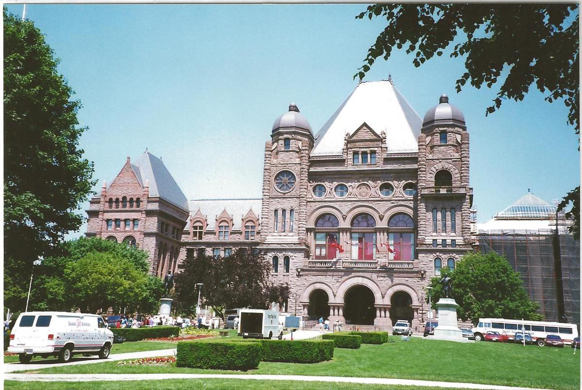
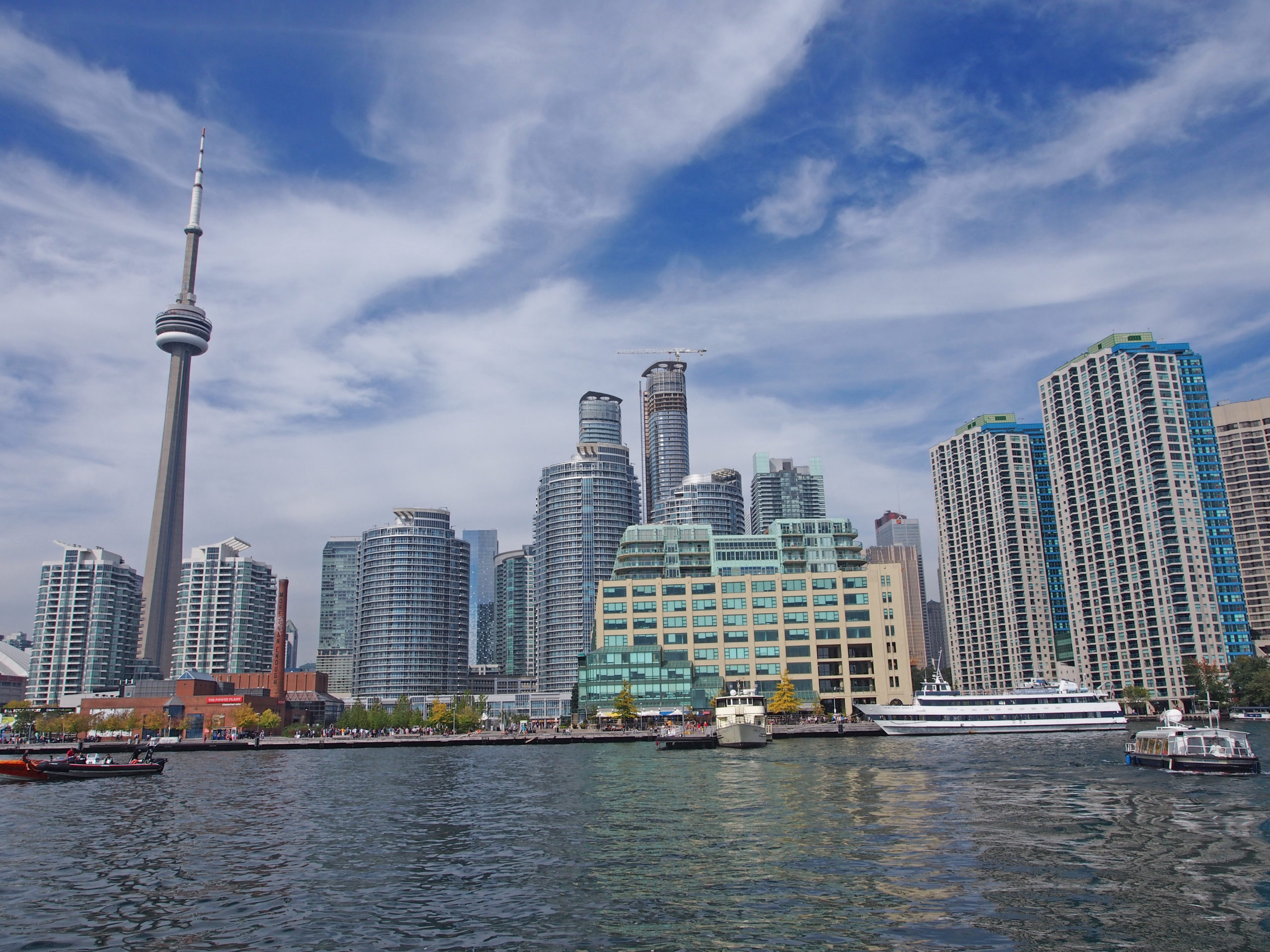
Queen’s Park – In 1859 the city leased land from King’s College and in 1860 a park named after Queen Victoria was opened by the Prince of Wales. The main block of the massive Romanesque Revival Parliament Buildings with its towering legislative block was completed in 1892.King’s College, the first university in this province was chartered in 1827 but it wasn’t until 1843 that classes began in the former Parliament Buildings on Front Street. Construction was completed in 1845. King’s College offered instruction in the arts, science, law, theology and medicine. In 1850 it became the new University of Toronto.Reflections49 Wellington Street East, The Gooderham or Flatiron Building – Romanesque Revival and French Gothic architecture styles – opened in 1892ArmouriesCN Tower and SkyscrapersView from the water