January, 2017:

Brantford, Ontario – My Top 5 Picks

Brantford is located on the Grand River in Southern Ontario. Brantford is connected to Woodstock in the west and Hamilton in the east by Highway 403 and to Cambridge to the north and Simcoe to the south by Highway 24. Brantford is known by the nickname The Telephone City as former city resident Alexander Graham Bell conducted the first distant telephone call from the community to Paris, Ontario in 1876. It is also the birthplace of hockey player Wayne Gretzky.

In 1784, Captain Joseph Brant and the Six Nations Indians of the Iroquois Confederacy left New York State for Canada. As a reward for their loyalty to the British Crown, they were given a large land grant on the Grand River. The original Mohawk settlement was on the south edge of the present-day city at a location favorable for landing canoes. Brant’s crossing of the river gave the original name to the area: Brant’s ford. By 1847, European settlers began to settle further up the river at a ford in the Grand River and named their village Brantford. It was incorporated as a city in 1877.

Architectural Photos, Brantford, Ontario
Laurier Brantford – Ionic capitals on pillars, pediment
Architectural Photos, Brantford, Ontario
SC Johnson Building – corner Dalhousie & Market Streets, mansard roof with dormers with triangular window hoods, Ionic capitals
Architectural Photos, Brantford, Ontario
26 Lorne Crescent – Italianate – 1875 – dichromatic brickwork, paired cornice brackets, bay window on side
Architectural Photos, Brantford, Ontario
#30 – 1896 – Queen Anne style – round turret
Architectural Photos, Brantford, Ontario
#102 – Italianate, hipped roof, paired cornice brackets, corner quoins

Ancaster – My Top 6 Picks

Ancaster, Ontario – My Top 6 Picks

The earliest European settlers to arrive and clear land in the mid-18th century in what would eventually become Ancaster were made up of American farmers traveling north searching for arable land, French-speaking fur traders, and British immigrants.  Also arriving into this area around 1787 with the incentive of inexpensive land grants were the United Empire Loyalists loyal to the British crown who were fleeing from the United States after the 1776 American War of Independence.  Britain’s promise of free land brought many people who did not exhibit the same loyalty to the crown as the Loyalists. This eventually led to a series of defections, accusations and treasonous acts during the War of 1812 that precipitated the largest mass hangings in Canadian history, the so-called Bloody Assizes whose trial took place in Ancaster in 1814.

Architectural Photos, Ancaster, Ontario
#535 – Gothic Revival style with center gable
Architectural Photos, Ancaster, Ontario
Wilson Street – limestone building, gingerbread trim, second floor verandah
Architectural Photos, Ancaster, Ontario
375 Wilson Street East – Rousseau House – built in 1838 by George Brock Rousseau, postmaster of Ancaster for ten years
Architectural Photos, Ancaster, Ontario
311 Wilson Street East – Italianate, belvedere, paired cornice brackets, sidelights surrounding door
Architectural Photos, Ancaster, Ontario
117 Wilson Street West – c. 1855 – Gothic Revival, two-story red brick house, verge board trim and finials on gables, corner quoins, bay windows
Architectural Photos, Ancaster, Ontario
Wilson Street West – two-story red brick, second floor balcony under gable which has stenciling on the verge board trim, dormer, bric-a-brac on lower porch

Mount Forest, Ontario – My Top 5 Picks

Each photo I take that precedes a demolition, each photo I click before a natural disaster such as a tornado or a fire, is meeting this aim of mine of Saving Our History One Photo at a Time. Enjoy the beautiful architecture of the town in the comfort of your living room. Dream about what it was like to live in a mansion like one of these. Where would you like to travel to next?

Mount Forest is located at the junction of Highways 6 and 89 on a height of land near the headwaters of the Saugeen River.  In 1871, eighteen years after the town was surveyed, it had ten hotels, eight churches and eighteen stores; the first train came into Mount Forest later that year.

Prior to European settlement, present day Mount Forest was prime hunting ground for the Saugeen Ojibway peoples due to its location on the Saugeen River.


Architectural Photos, Mount Forest, Ontario
Gothic Revival, 2-story bay windows, dormer between gables
Architectural Photos, Mount Forest, Ontario
230 Queen Street East – St. Mary’s Catholic Church – established 1863 – buttresses, lancet windows, dichromatic
Architectural Photos, Mount Forest, Ontario
170 Wellington Street West – Mount Forest Post Office – built in 1912. The timepiece for the clock tower was made in Birmingham, England.
Architectural Photos, Mount Forest, Ontario
Dichromatic brickwork, beveled dentil molding, pilasters
Architectural Photos, Mount Forest, Ontario
Tudor accents

Owen Sound, Ontario – My Top 6 Picks

Owen Sound, Ontario – My Top 6 Picks

Saving Our History One Photo at a Time – each photo I take that precedes a demolition, each photo I click before a natural disaster such as a tornado or a fire, is meeting this aim of mine. Enjoy the beautiful architecture of the town in the comfort of your living room. Dream about what it was like in those by-gone days. Dream about what it was like to live in a mansion like one of these. Where would you like to travel to next?

Owen Sound is located on the southern shores of Georgian Bay in a valley below the sheer rock cliffs of the Niagara Escarpment. The city is located at the mouths of the Pottawatomi and Sydenham Rivers. It has tree-lined streets, many parks, and tree-covered hillsides and ravines. There are two photo books on Owen Sound if you want to see more.

John Harrison, born in Staffordshire England, emigrated to Canada at the age of six with his widowed father, three sisters and three brothers. In 1848, John and two brothers, William and Robert, arrived in the Village of Sydenham (now Owen Sound). They acquired the mill dam site on the Sydenham River and operated waterpower grist, woollen and saw mills. In 1861 John married Emma Hart and they raised their family of six children in a house beside his mills. In 1875-76 they purchased the land now known as Harrison Park. When the mills were slack in depressed times, John sent the men to work and exercise the teams on this land. They built roads, bridges, paths and buildings, gradually bringing his vision for the parkland to life. John and his family and employees transformed this land and created Harrison Pleasure Grounds where everyone was welcome. Between 1909 and 1911 while John’s eldest son Frederick served as Mayor of Owen Sound, the parkland was transferred to the town for half the value of the land – as long as it remained a public park forever.

The park today has picnic facilities, basketball courts, heated twin swimming pools, canoe and paddle boat rentals for use on the river, a bird sanctuary, a mini-putt golf course, playground, campsites, cycling and walking trails, and the black history cairn and Freedom Trail.

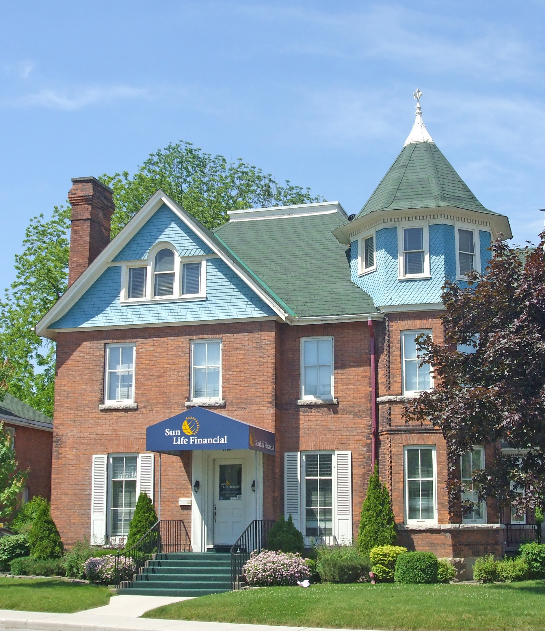
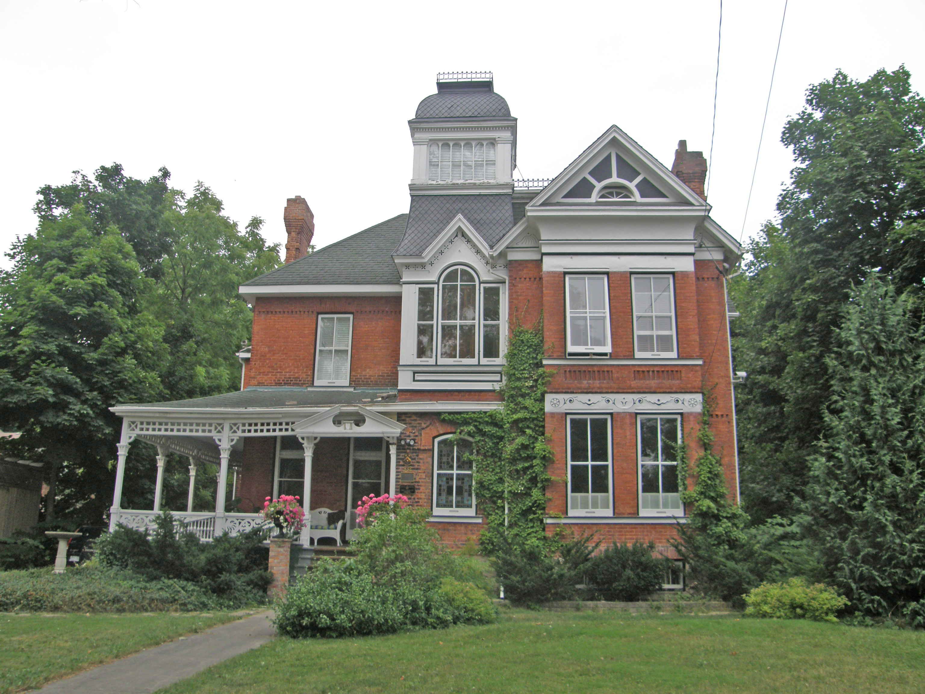
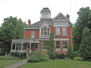
1000 First Avenue West – Queen Anne Revival style, built in 1893-94 – turret, Palladian window – in Book 1 on Owen Sound

Edwardian style – in Book 1 on Owen Sound

#629 – Gothic Revival, corner quoins – in Book 1 on Owen Sound

932 3rd Avenue West – Former U.S. Consulate – 1890 – Vernacular example with Italianate influence, tower – in Book 1 on Owen Sound

Tudor Revival – in Book 2 on Owen Sound

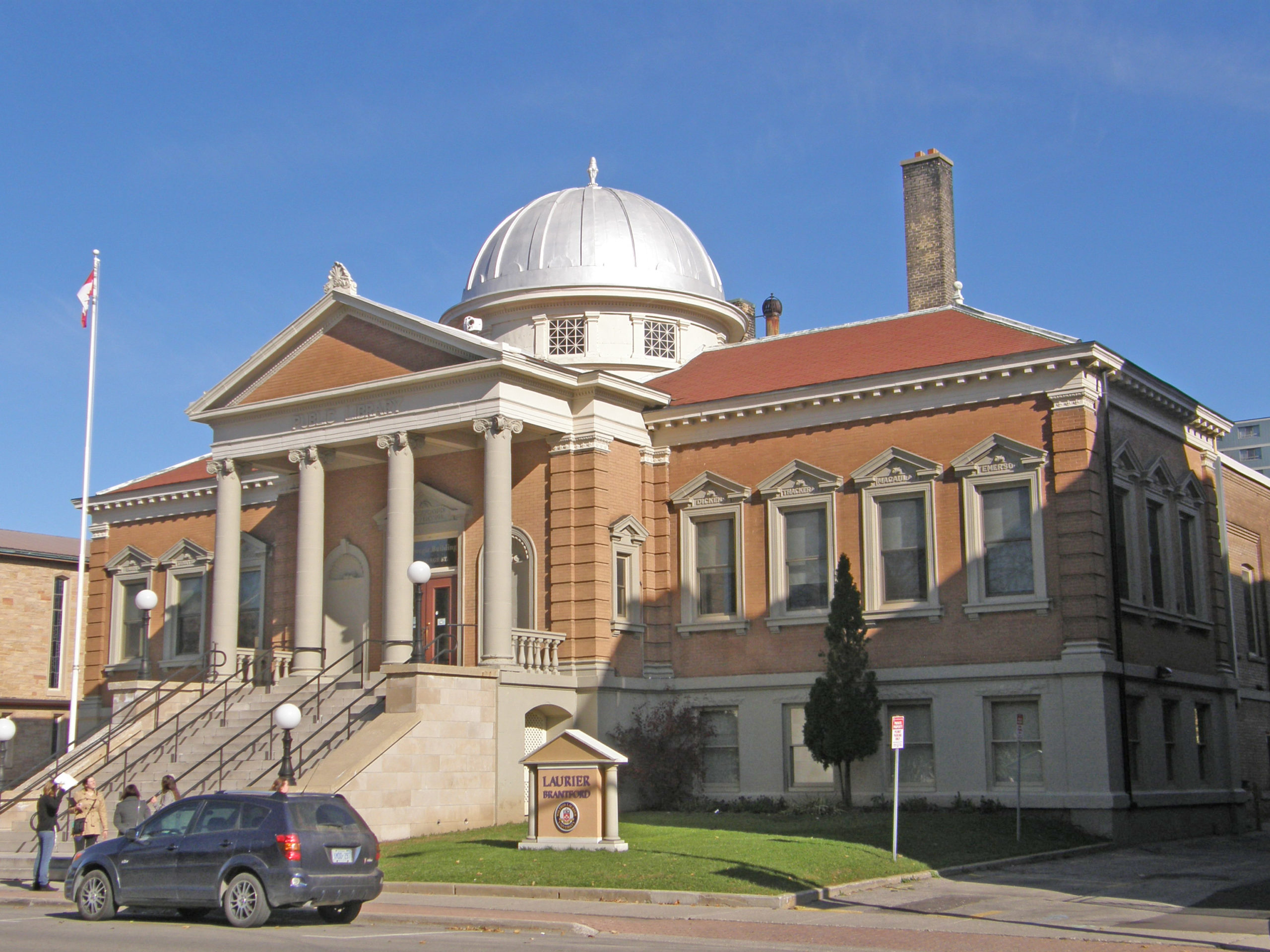
Old Post Office – 1907 – Beaux Arts style featuring harmony and balance; positioning of windows, Ionic columns, pediments project vertical and horizontal symmetry; shapes and materials echo across all three floors in pleasing proportions; varied texture of stone graduates from rough and solid rock face limestone to slightly inset and smoother stone above, providing a lighter feel the higher the building climbs; window sills are continuous cut stone, walls are lined with brick; a brick vault was constructed on each of the first and second floors; mansard roof with dormers; voussoirs and keystones over windows and doors on first floor – in Book 2 on Owen Sound

Waterford, Ontario – My Top 6 Picks

Waterford, Ontario – My Top 6 Picks

Enjoy the beautiful architecture of the towns in the comfort of your living room. Dream about what it was like in those by-gone days. Dream about what it was like to live in a mansion like one of these. There are more than 100 towns already photographed which you can visit without moving from your comfortable chair. Where would you like to travel to next?

Waterford is located on Pleasant Ridge Road, or old Highway 24 in Norfolk County, south of Brantford, north of Simcoe and southwest of Ohsweken. Waterford was established in 1794 with saw and grist mills on Nanticoke Creek. An early major industry was the agricultural implement factory built by James Green, a local merchant. The area surrounding the town is primarily agricultural land with tomatoes, tobacco and corn among the main crops. With the decline of the tobacco industry, area farmers have suffered, but ginseng is being grown on some farms. In 1979 a freak tornado swept through the town, knocked down trees, and damaged houses and public property.

92 Main Street – Italianate, belvedere on roof, paired cornice brackets, verge board and finial on gables, second floor balcony, Doric columns

Neo-colonial style of architecture with a gambrel

163 Main Street – Vernacular – three storey tower, intricate spindle woodwork on porch, pediments, unusual shaped turret or tower

Italianate – paired cornice brackets, bay window on the side of the house

138 Main Street – Italianate, paired cornice brackets, wraparound verandah

Georgian – six-over-six windows, Doric pillars, widow’s walk on top of hipped roof, two tall chimneys, sidelights and transom window around door