March, 2019:

Why I Plan

In December 2016, I had my first introduction to planning a novel. Jennifer Blanchard reviewed Story Engineering by Larry Brooks over the course of four weeks. Then I read Story Fix by the same author, and Scene and Structure by Jack Bickham.

When I wrote my first book, Coins of Gold, I felt driven to write a story about my Mom and the life she lived. It was a celebration of her life, a woman who knew how to enjoy the simple things of life. I knew nothing about how a story should be structured or that there was even such a thing as story structure.

“Show don’t tell” were just words with no meaning. Character arc I may have heard of, but I certainly did not know how to apply it in my writing. I always admired Daniel Boone when I was growing up. I loved to watch the stories of his adventures as seen on television. For my second book, I decided to write a fictional story about Daniel Boone and I called it Arrows, Indians and Love. Each day I waited for inspiration, did research of course, and slowly the story came about.

One of my fans suggested I write about a Canadian hero. I chose Laura Secord as my next character and built a story around my family in central Ontario intertwined with the Secord family and the service Laura did for Canada during the War of 1812. I compiled a Cromwell family history tracing my ancestors back to the 1100s and wrote some books of interest to me (Olympics, Wonders of the World, Wars, Inventions, etc.).

My next inspiration was a novel about Joe and Kate starting with a dream of going to Montana. It became a series that I wrote as inspiration arrived. I didn’t understand about stakes in a story and why they are needed. I didn’t understand about inner demons and antagonists. I didn’t understand the need for a resolution to a problem. I just tried to have a good ending to the life story.

I realized I needed better covers so I approached Andrew Rudd www.detailfordesign.com and he produced five lovely covers for my Montana Series.

What was the plot of my books? Was my main character wanting something and going on a journey to achieve it? I didn’t have a clue about this aspect of a story either. What opposition was there in my stories? There were some inner struggles, but exterior struggles were really absent. The idea that people wanted to be transported into the lives of the characters was a nice thought, but I didn’t know about the need to overcome opposition, defeat it and be the victor. These ideas were completely foreign to me.

Then I had the opportunity to join a group of authors with Jennifer Blanchard jennifer@jenniferblanchard.net to take the Write Your Damn Novel (WYDN) course. Jennifer walked us through the stages of planning our stories from the premise and concept, through the journey that needs to occur to make a story work. I learned about a hook – a medallion is my hook for my next novel. I learned about First and Second Plot Points, First and Second Pinch Points and a Midpoint. They were all new terms for me to get my head around.

I started with a couple of thoughts for a novel. I didn’t have much of a premise or concept, but I pushed ahead to stay on track with the course, learning to apply some of the things as I went along. I managed to plan about three quarters of the book, knowing how it would turn out, before I started writing.

There are those who think that planning a novel takes away the creativity. Nothing could be further from the truth. Just because I had the title for the scenes and knew sort of how the story was going to progress, inspiration had its part along the way and many twists and turns came in as the words mounted up. There were daily blog posts, videos, and additional courses and books along the way to help me get my novel finished.

Once I had the novel finished as much as I could do, then there was the scary part of actually sending my manuscript to a content editor. Jennifer Blanchard agreed to perform this service for me. A little over a month later, I had several pages of written notes, and an hour long conversation on where the novel was not working and lots of suggestions of how to fix it.

I had a well-developed main character, I had a journey he was on, and I had some interesting scenes. I managed to break many of the biggest story mistakes writers make but this was all a learning process. I had random things in the story which did not connect to the main story. Jennifer was very encouraging on what was working and gave me lots of suggestions of how to make it work better.

I went back to the drawing board, so to speak. I was determined to make changes and create an even better story for my readers to enjoy. I worked on it daily over the next couple of months until I was satisfied that I had done everything I could to improve the story structure. It went back to my content editor and by year’s end I had more ideas of what to fix.

I did what I could and then put the book aside to work on book 2 of the series. Once I had it as complete as I could get it at that time, I set it aside and once more switched back to Rite of Passage. I worked through the “course” on Description and Setting by Robert Rozelle and have learned a lot about adding description and setting, geography and time, and using the senses in my writing. I am now on my final read through of the novel. Then I have two months set aside to work on Rite of Marriage. My goal is to publish both books by June 30, 2019.

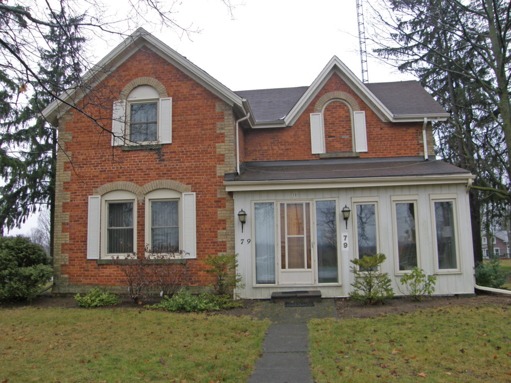
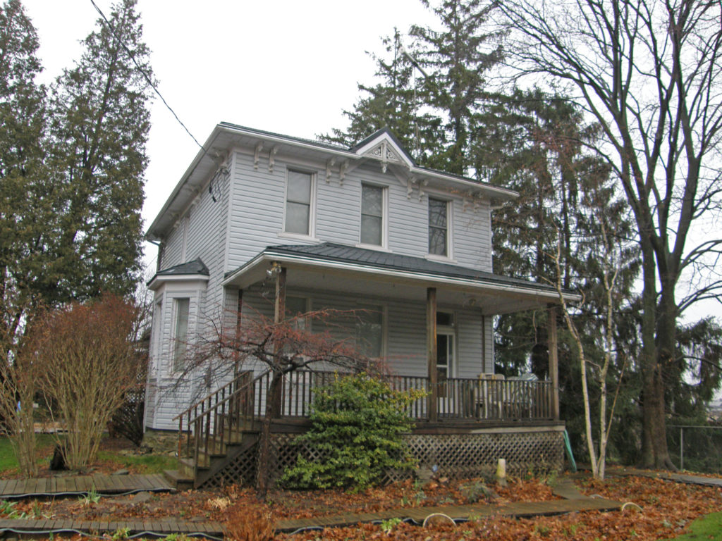
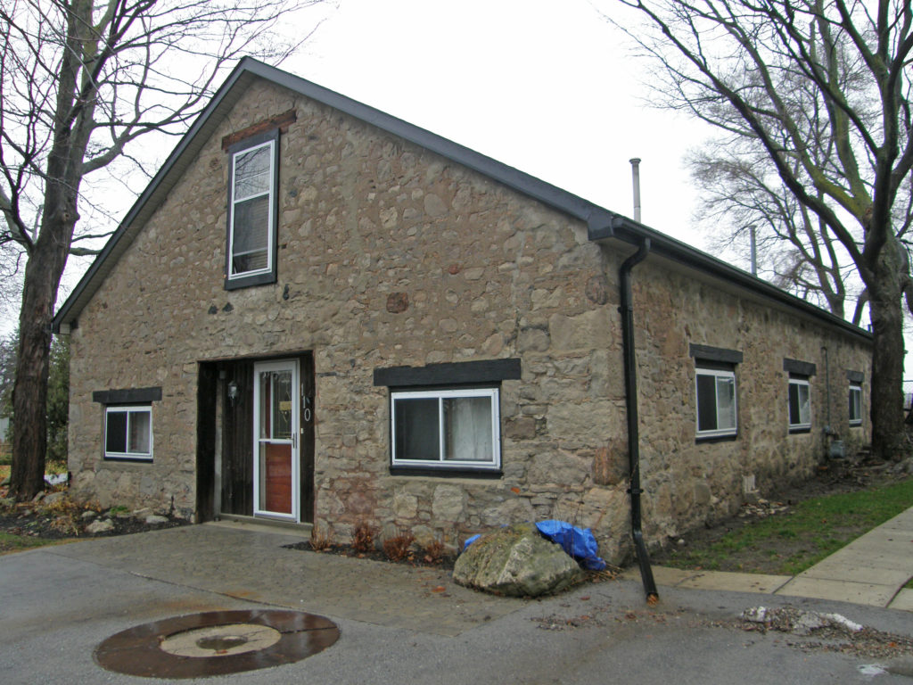
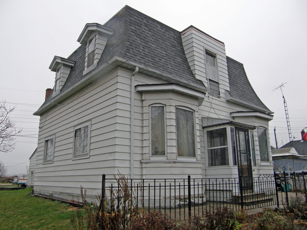
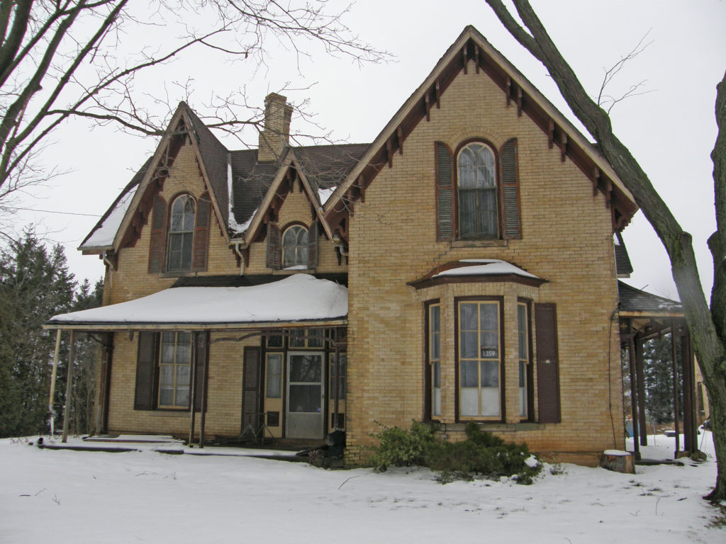
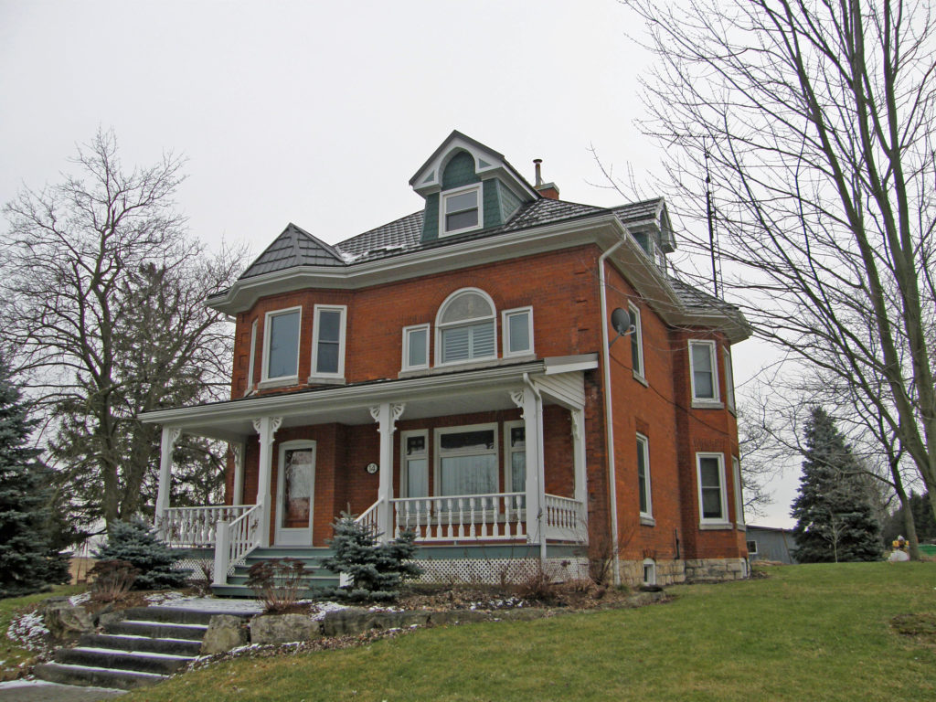
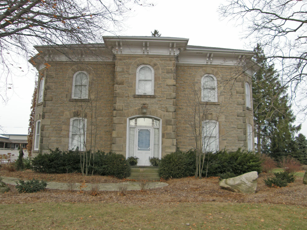
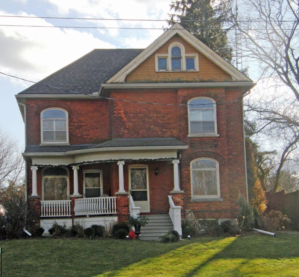
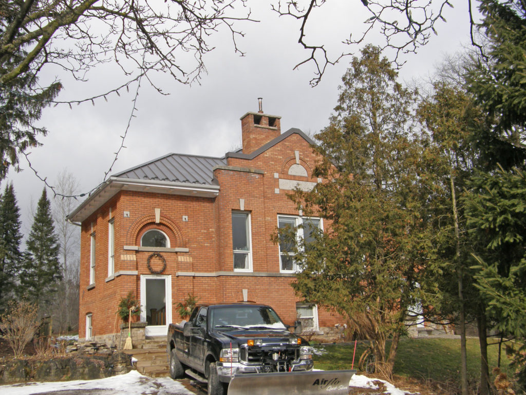
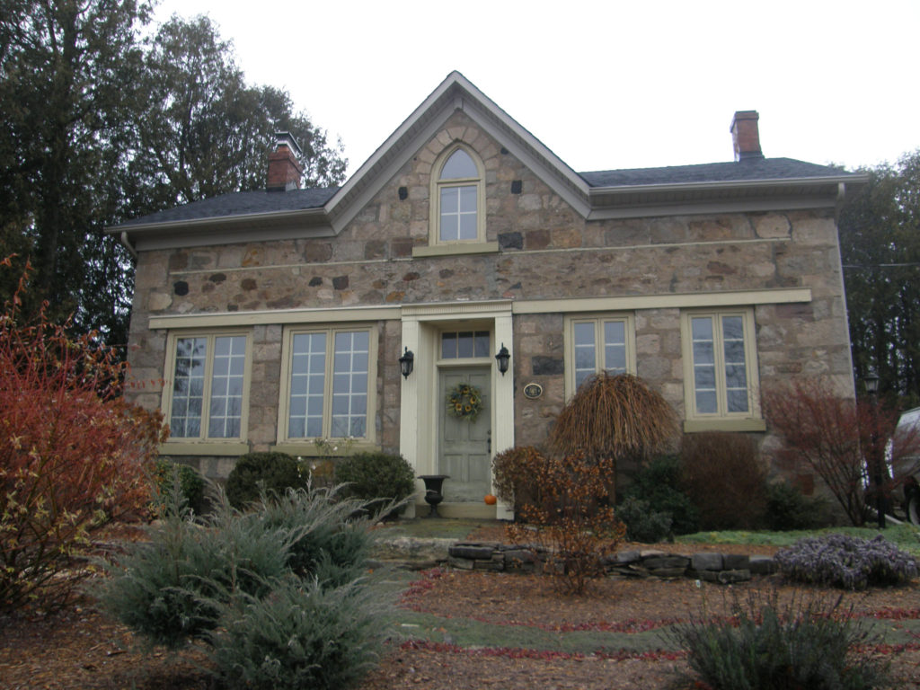
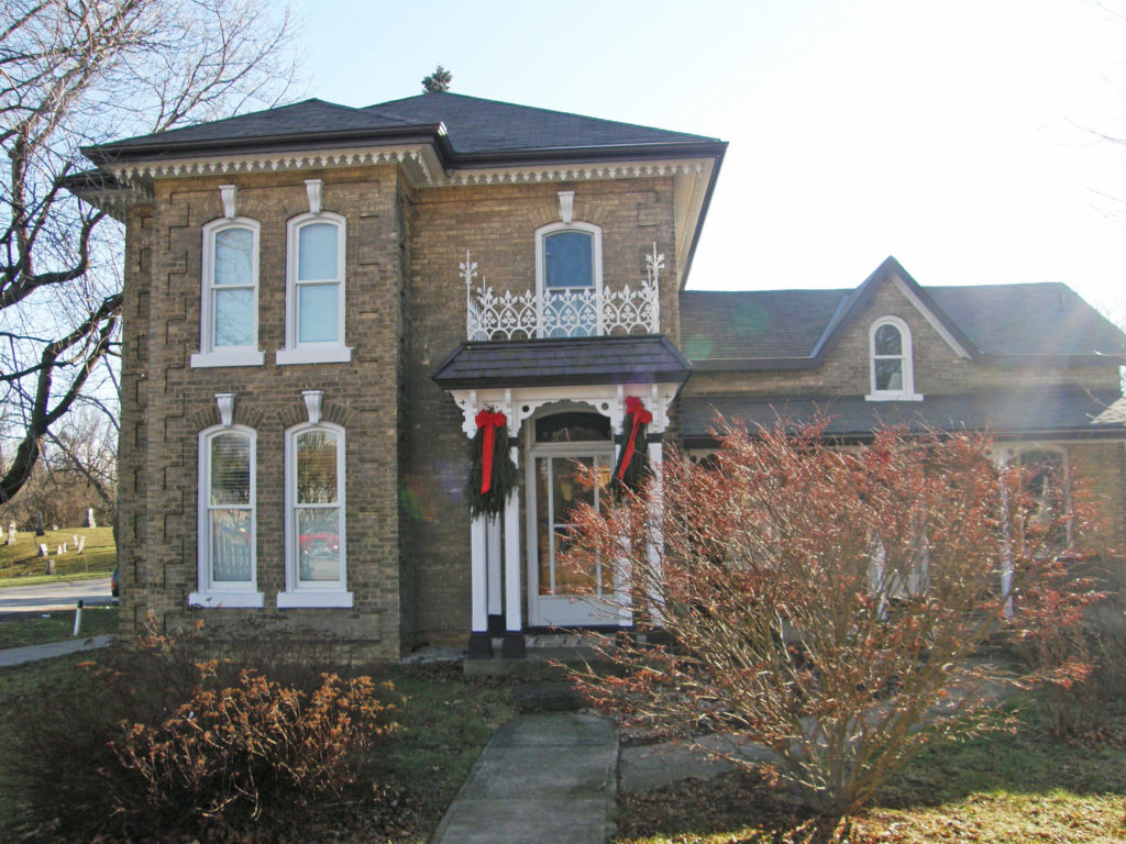
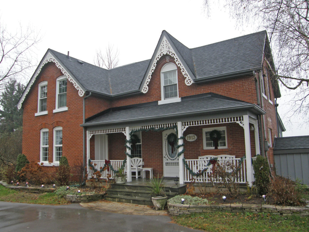
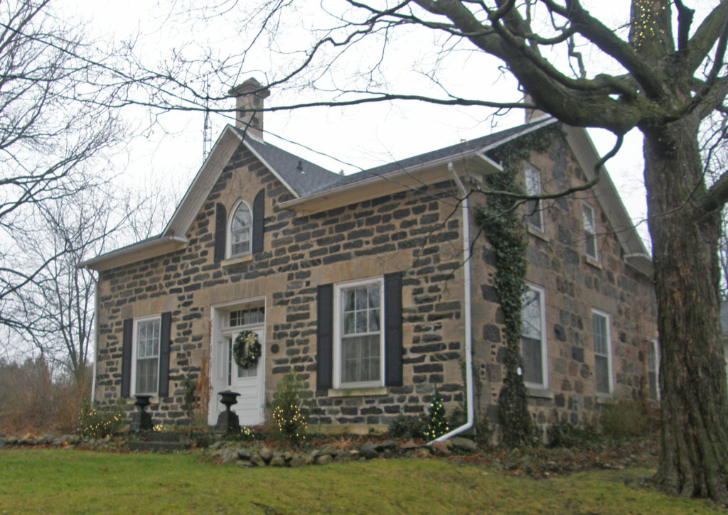
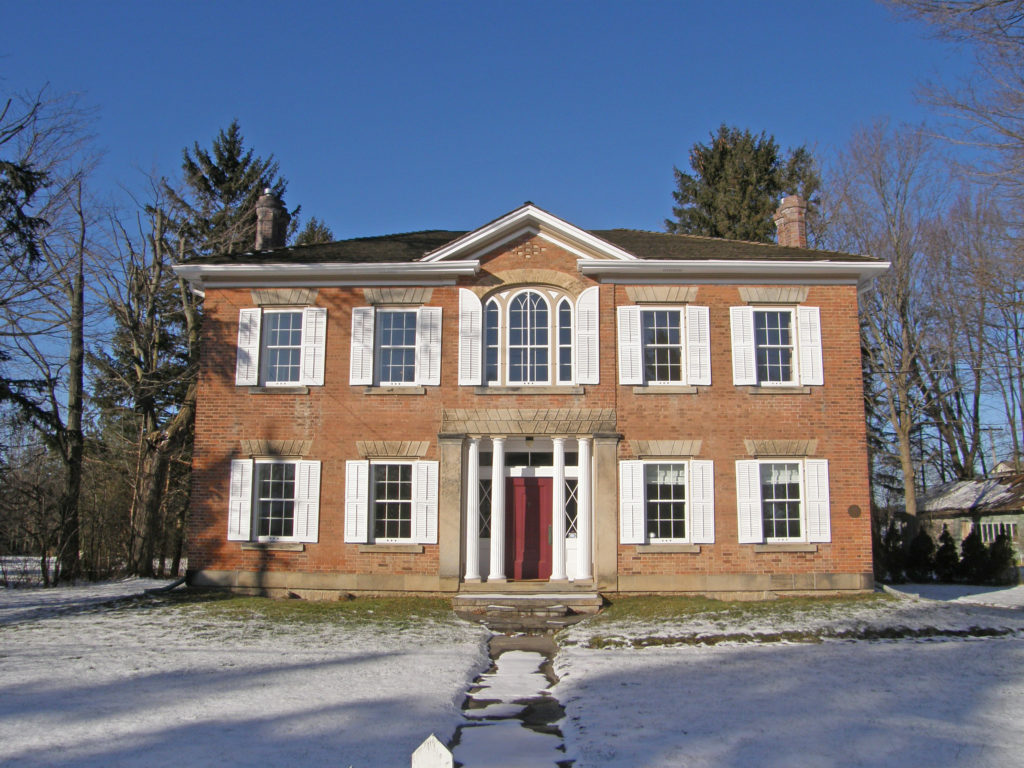
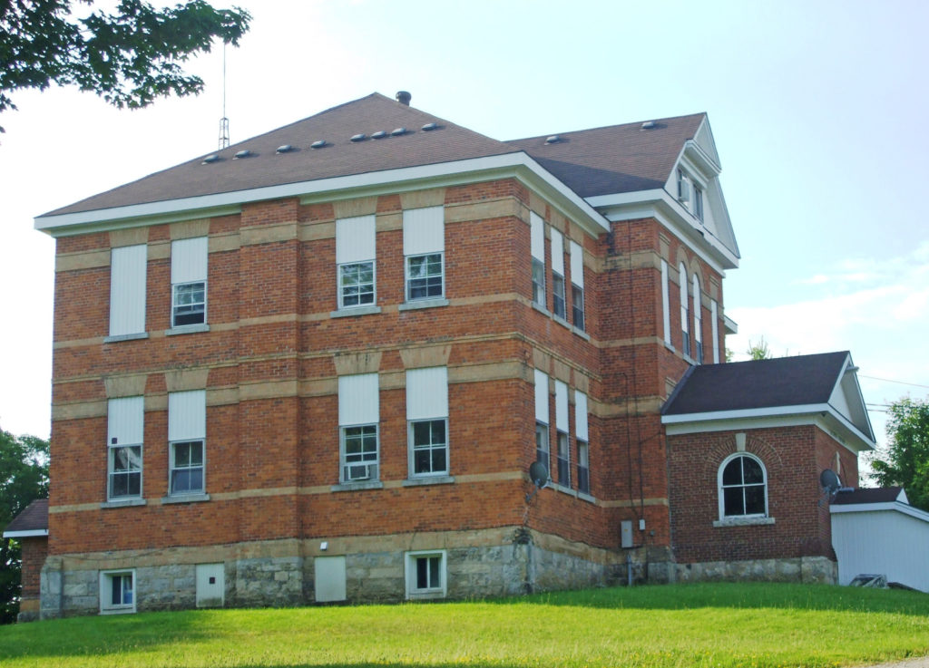
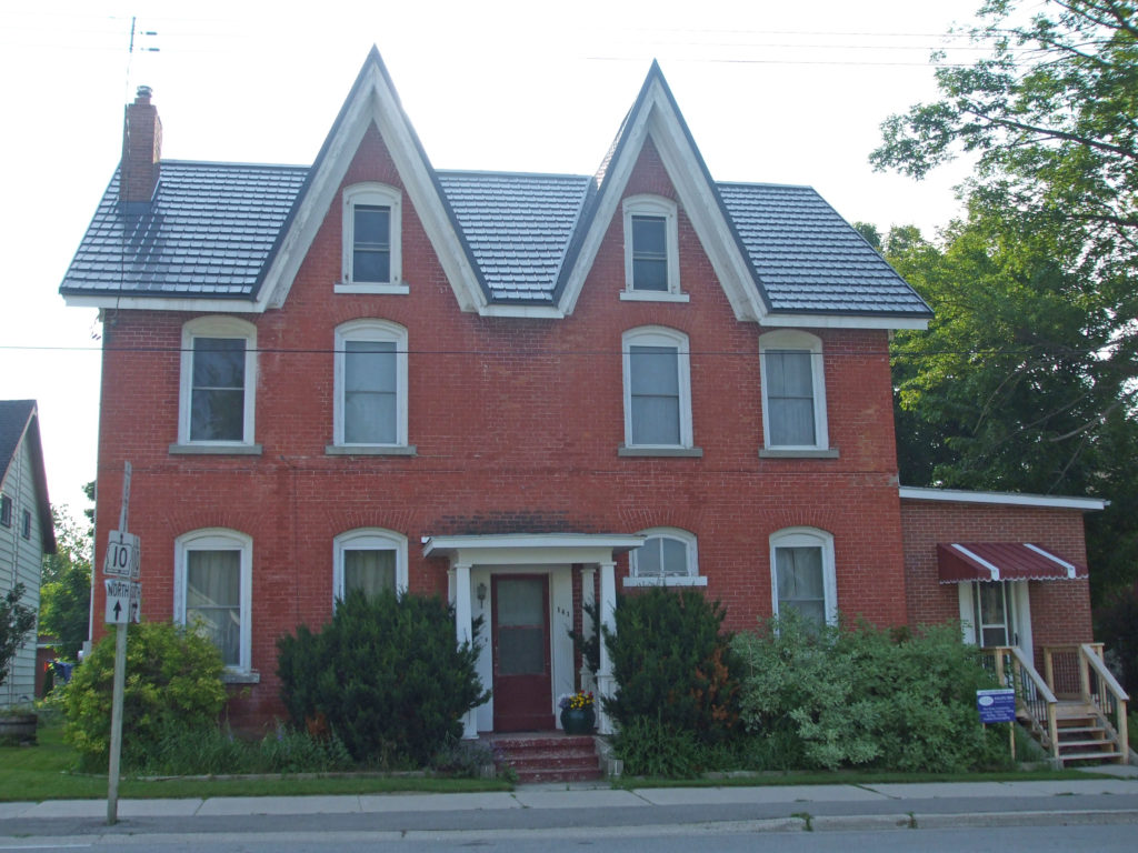
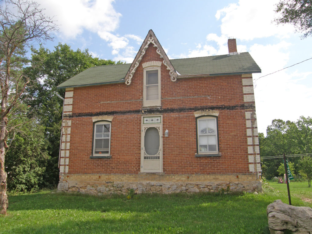
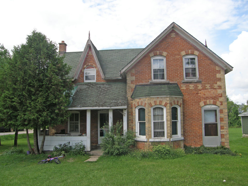
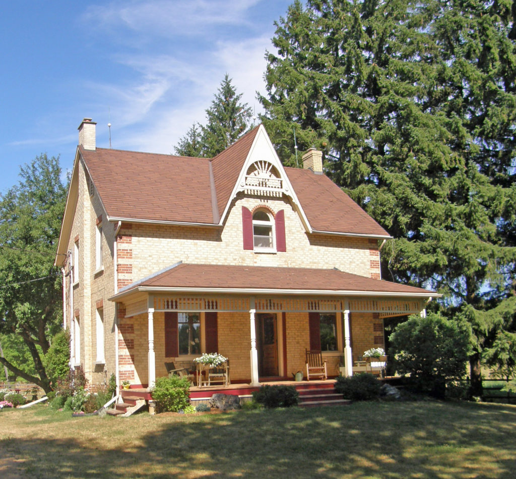
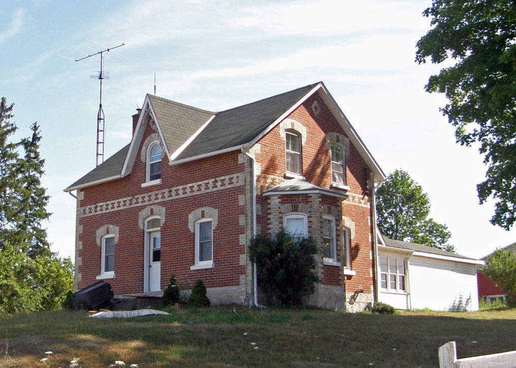
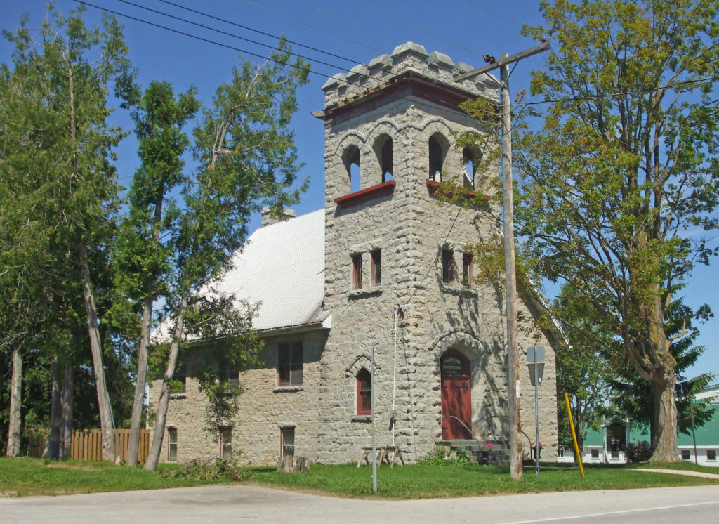
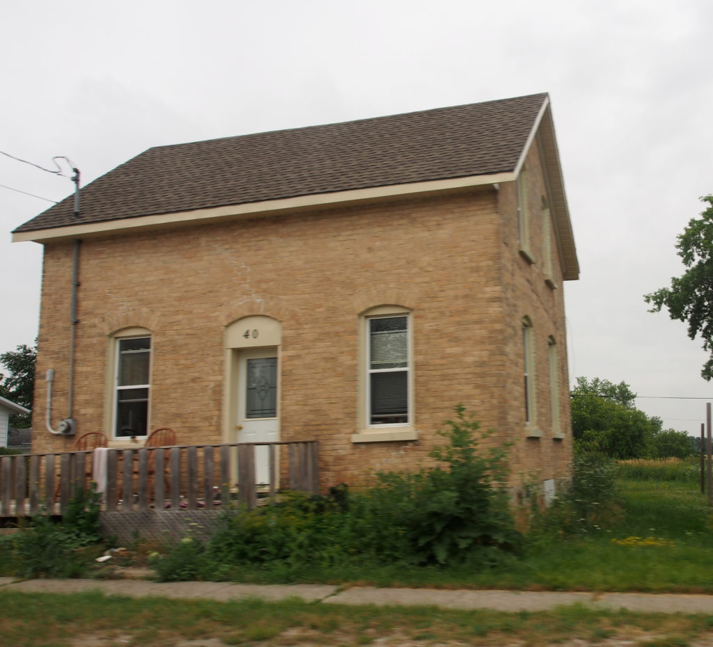
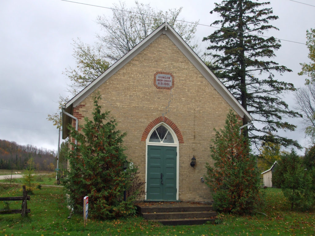
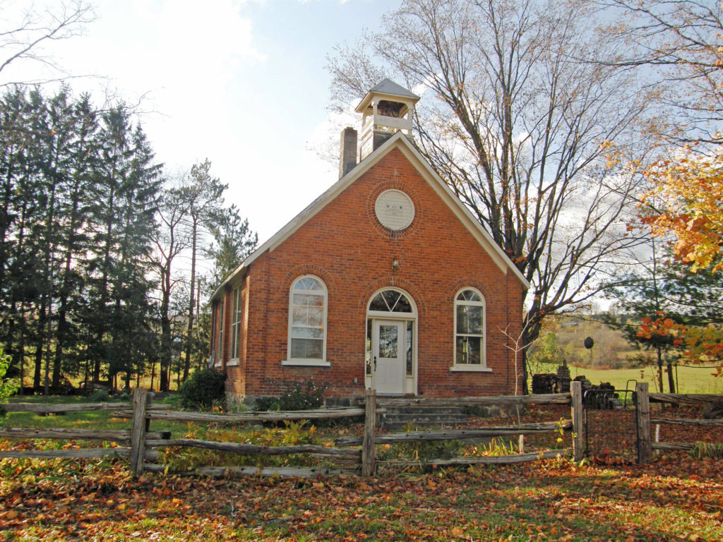
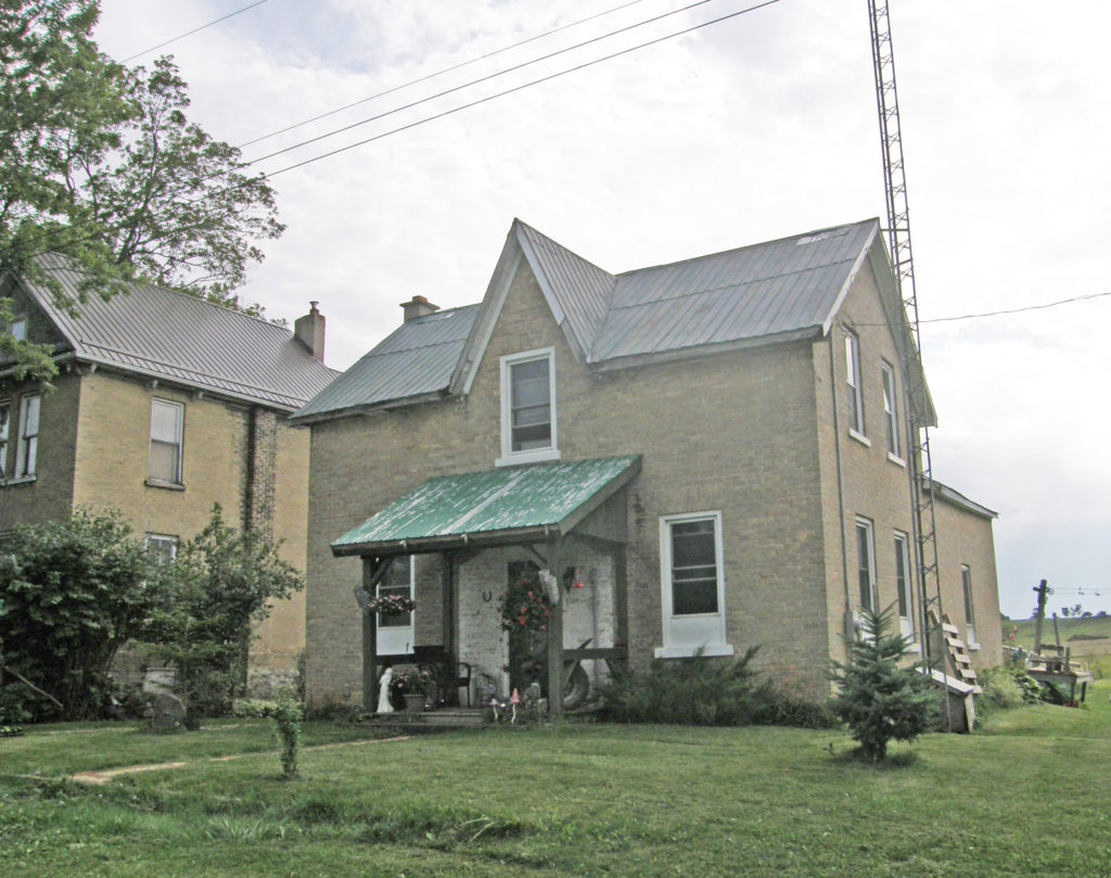
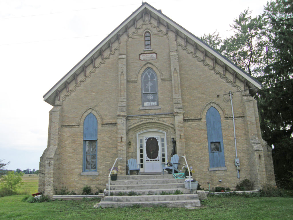
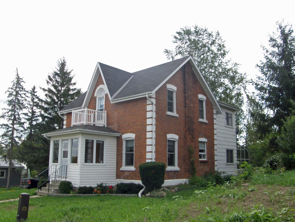
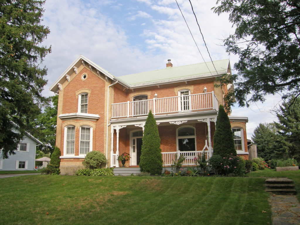
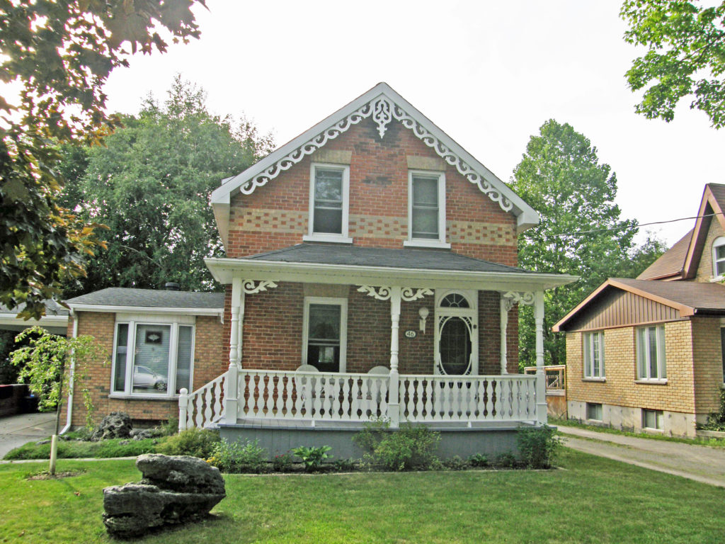
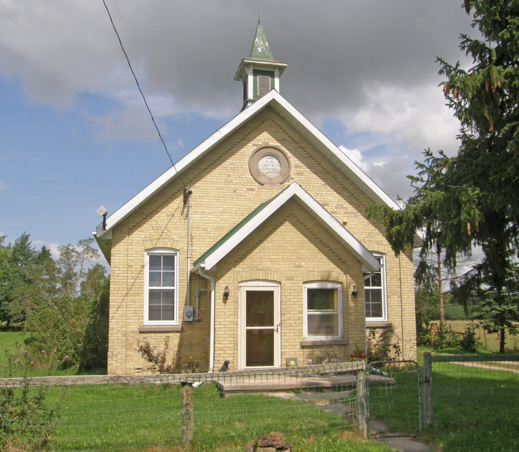
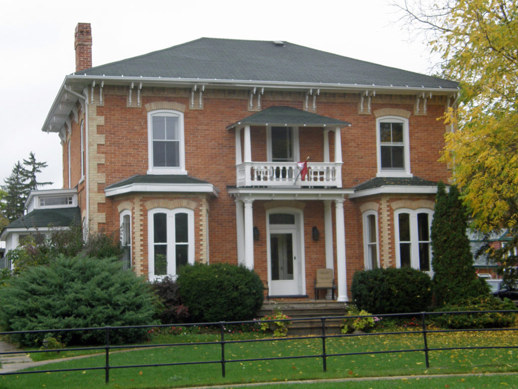
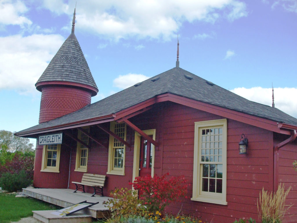
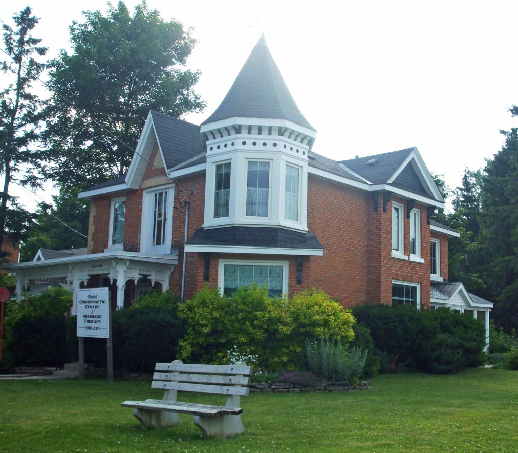
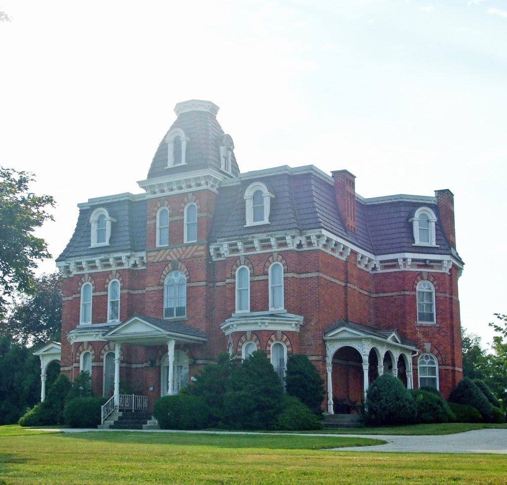
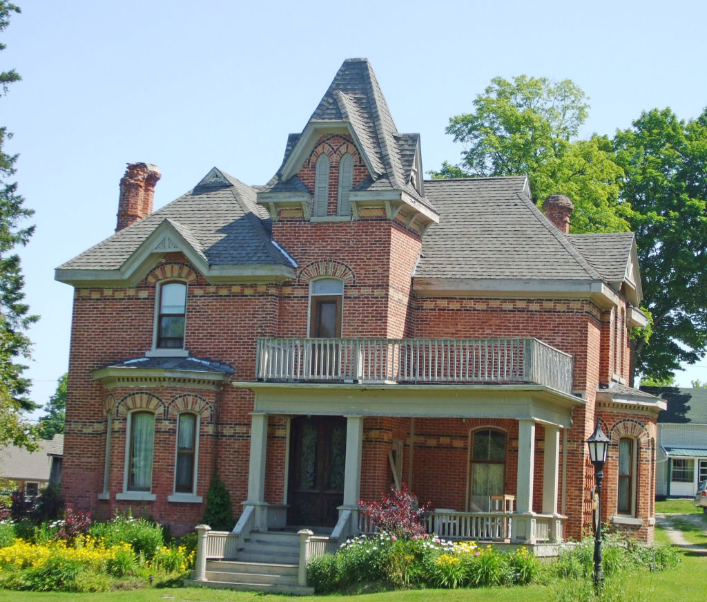
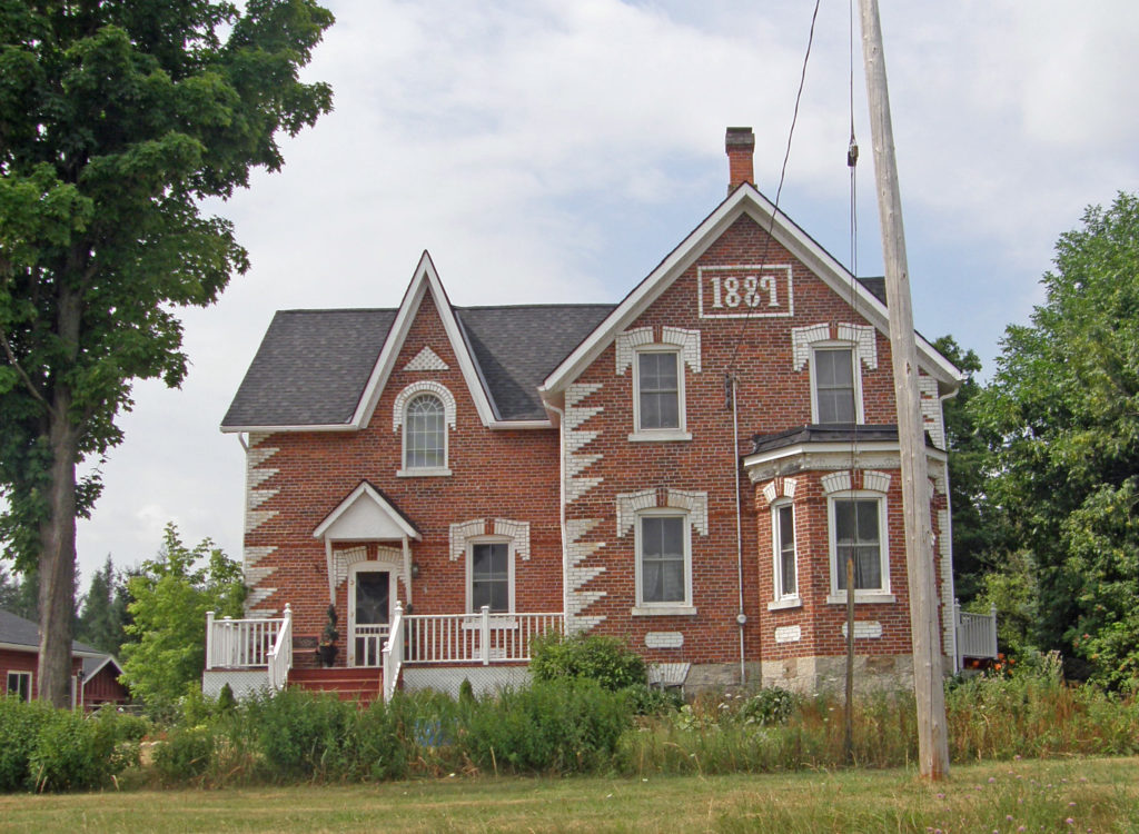
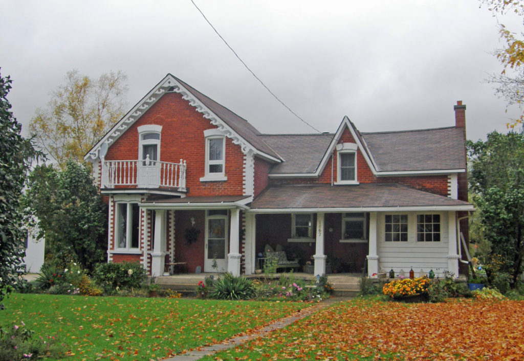
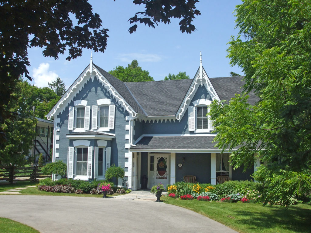
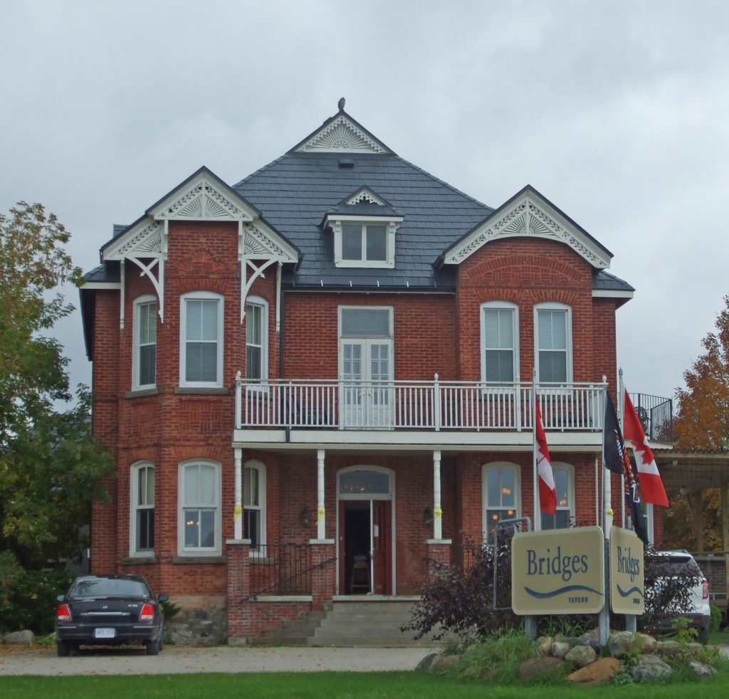
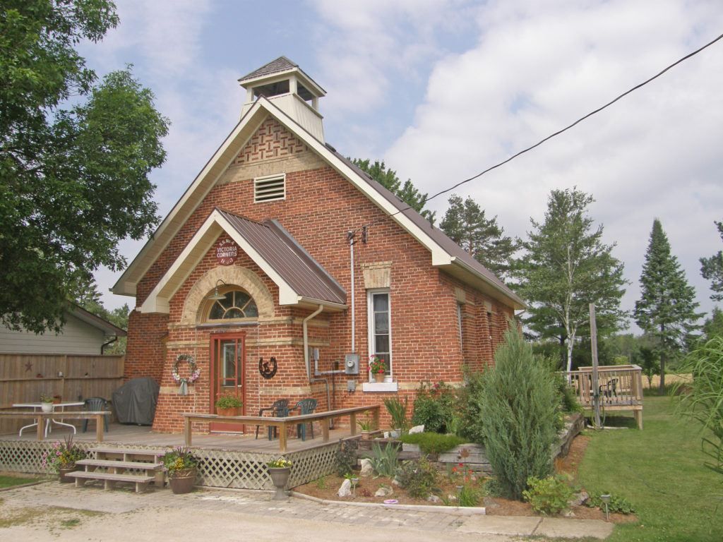
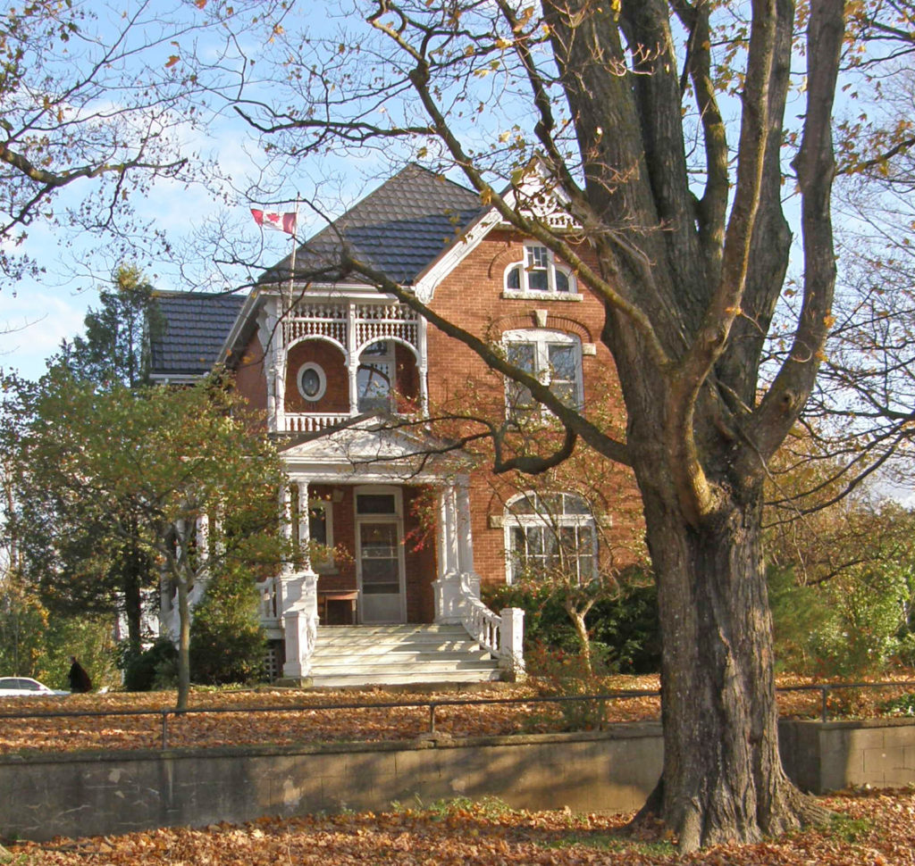
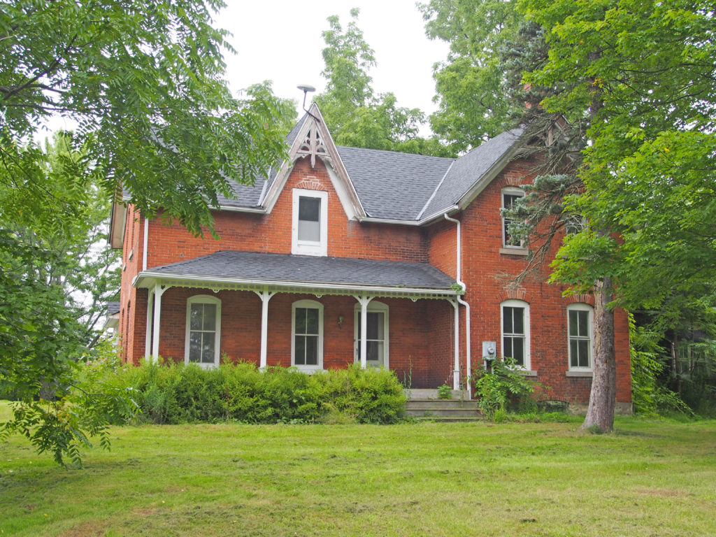
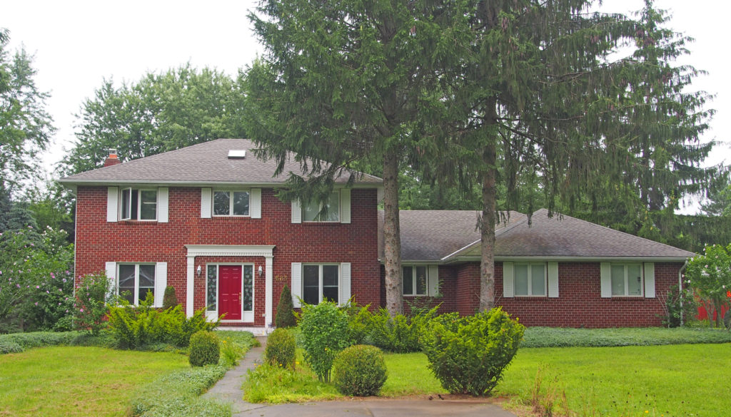
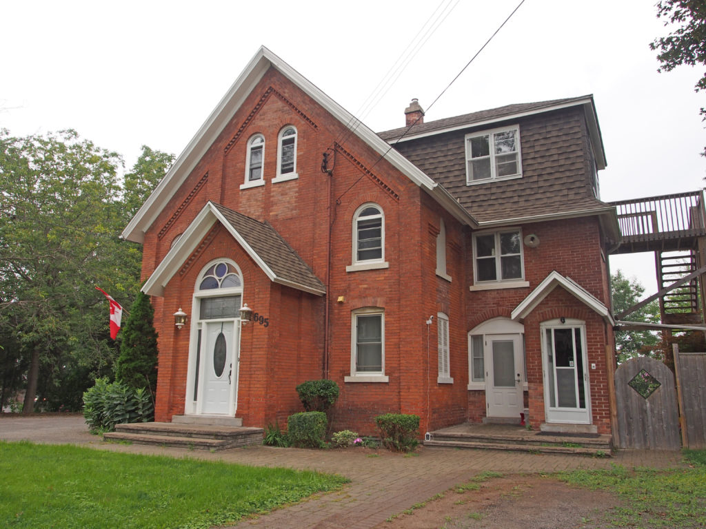
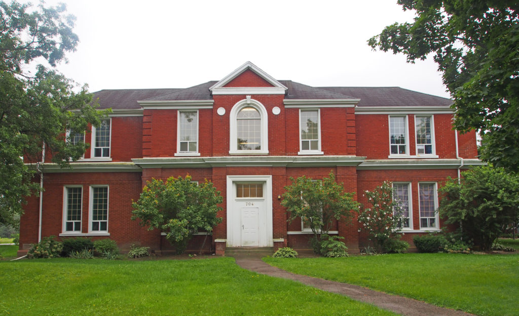
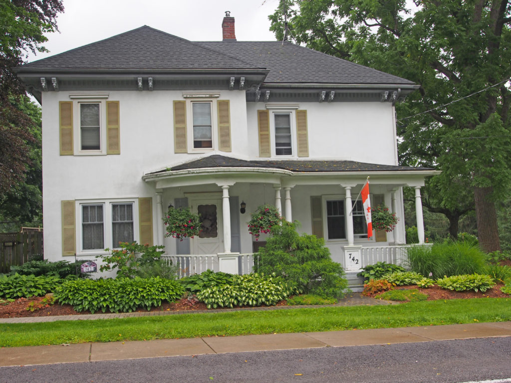
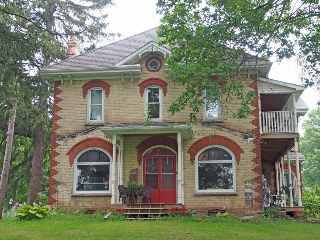
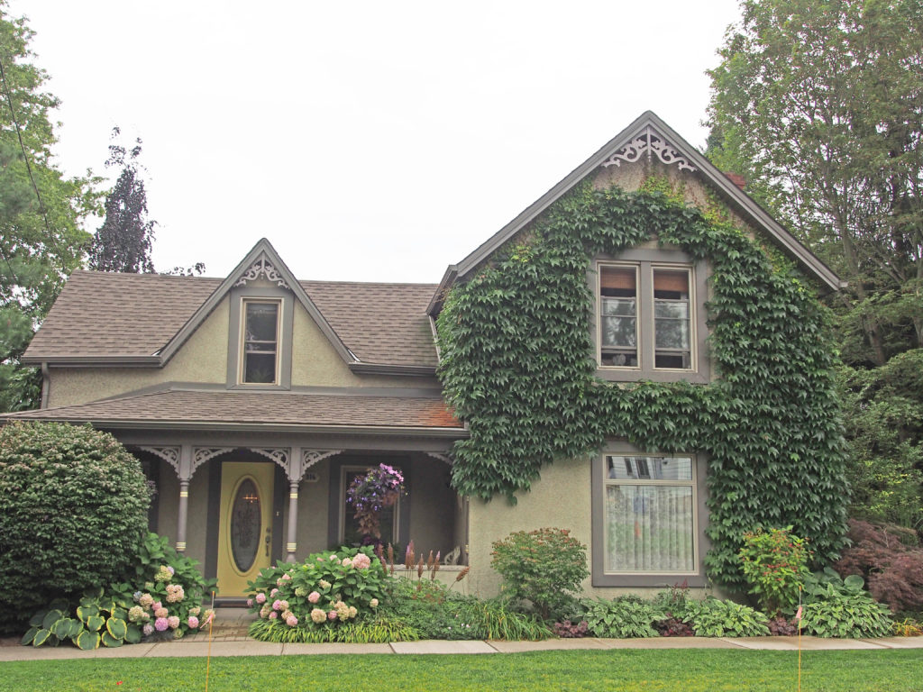
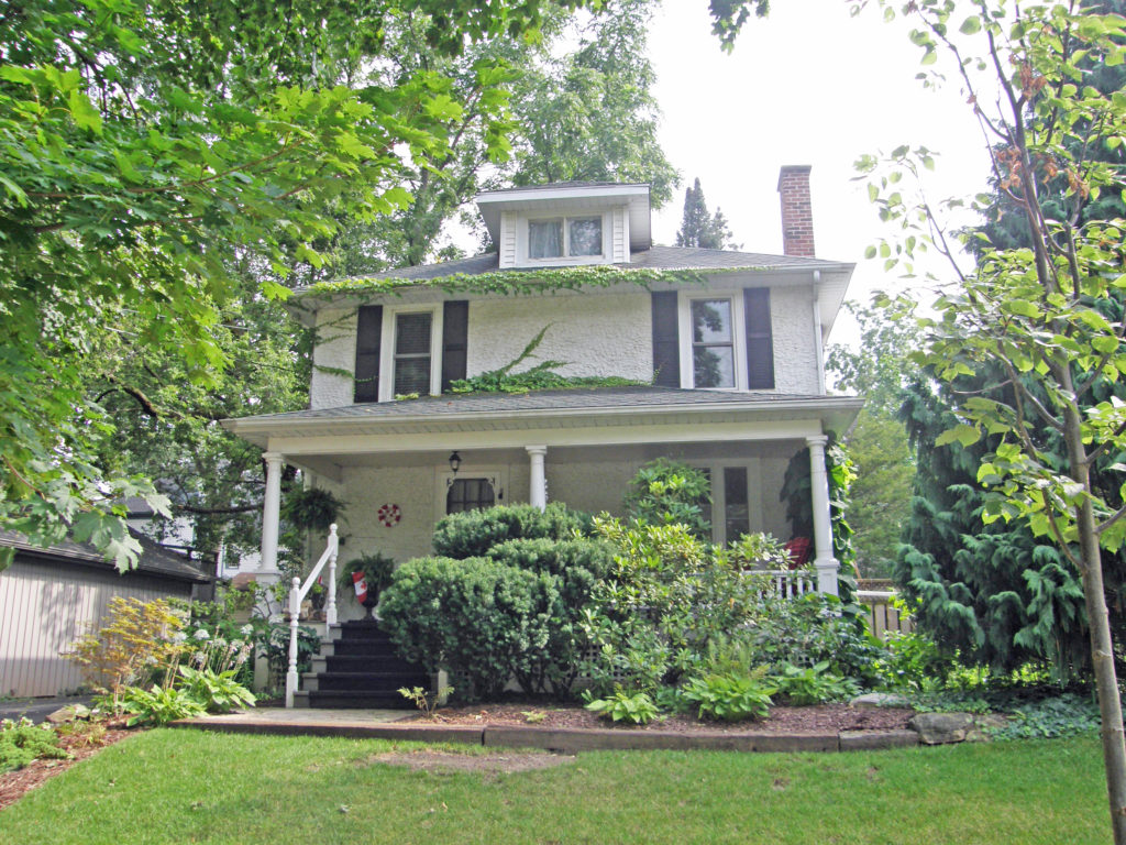
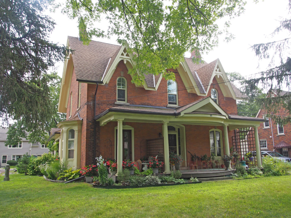
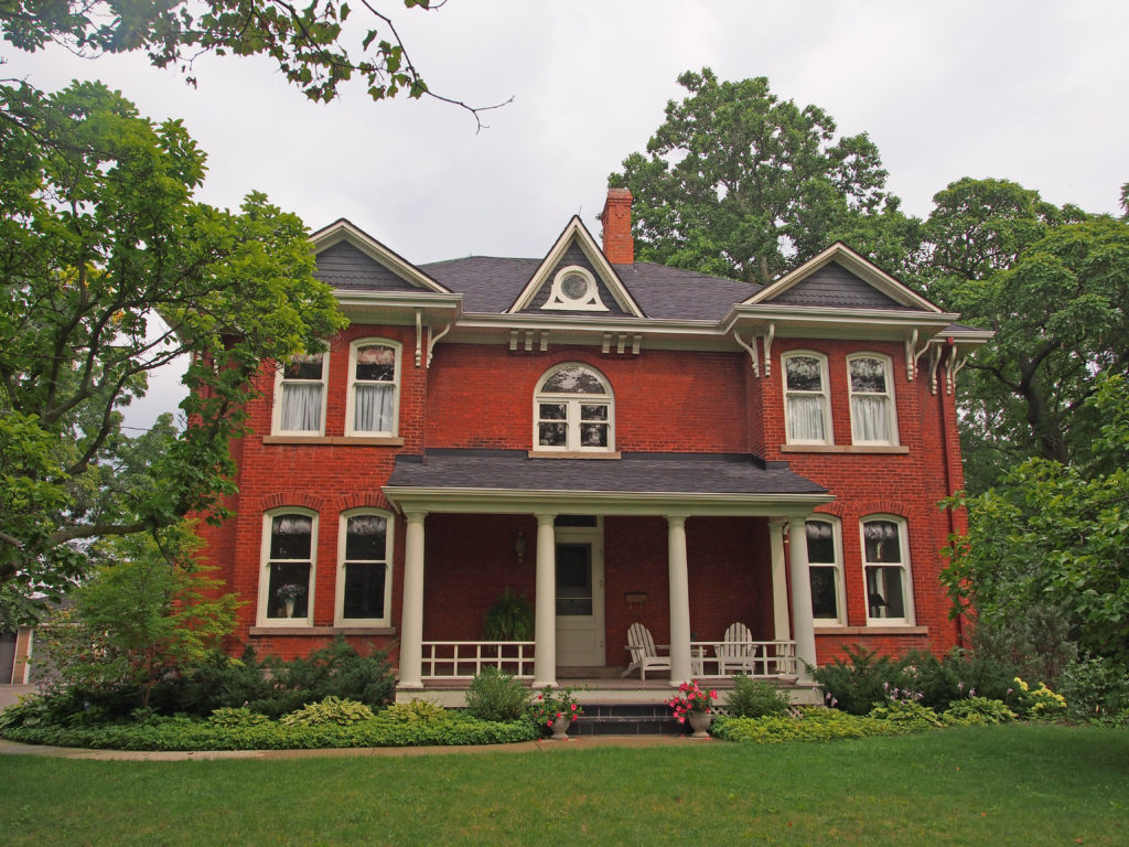
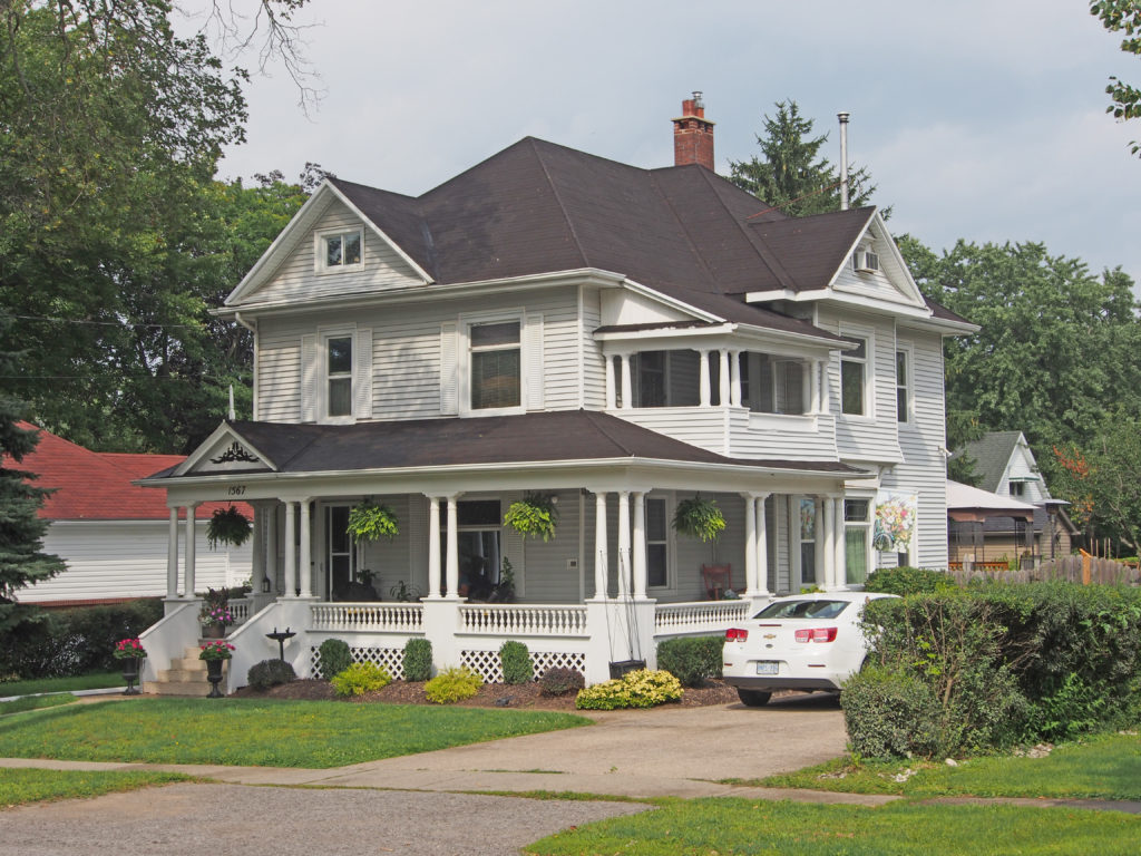
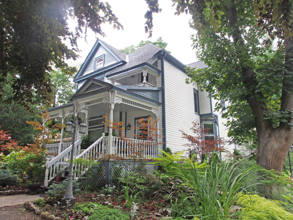
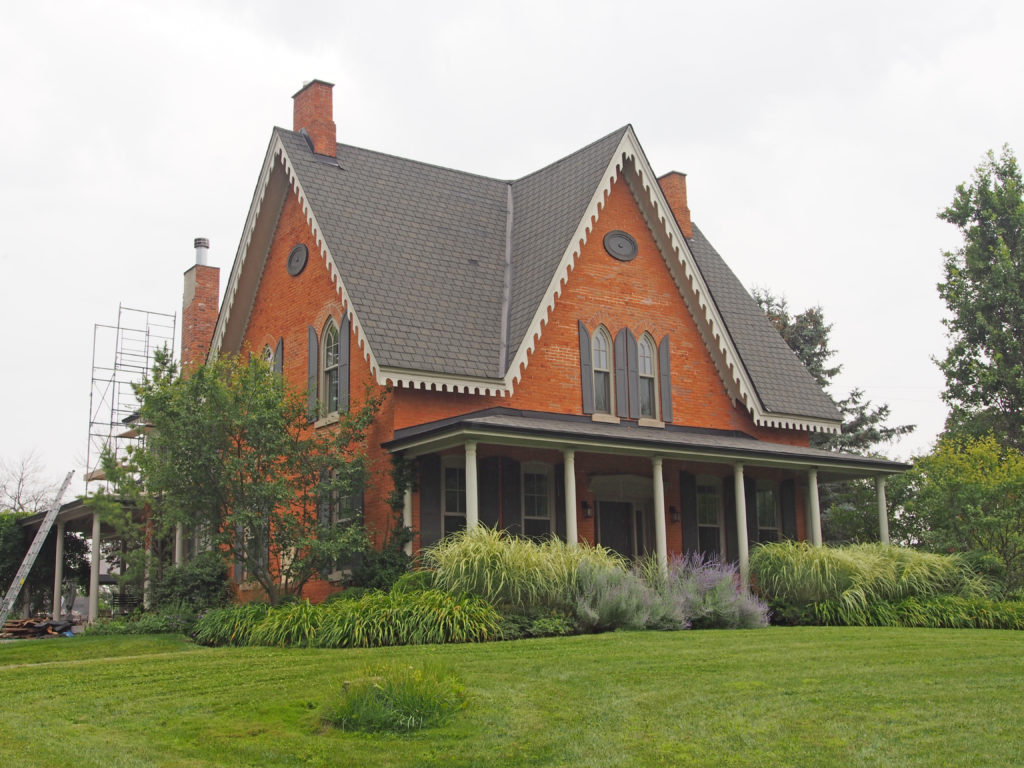
Being a multi-passionate person, my photography hobby expanded into another whole line of work. I love the old architecture in towns and started taking pictures. The first town I photographed was London, Ontario. When I look back at the first book I created, I chuckle to myself. I had the basic concepts, but I have grown into the project as the years have gone by. I do research ahead of time so that I have a better idea of where to start a project. Most towns I can complete in a day, but usually that will be a long day. I never seem to have enough time to finish as I would like to. There are always more pictures I could take. I took several photography courses to help me in setting up pictures for the best effect.

Then comes the time I get to play around with the pictures and put them into books. I say “play” because it doesn’t seem like work. I love to compile the histories in photos, Saving Our History One Photo at a Time.

When we traveled to Winnipeg, Manitoba in 2016 to visit my brother James and his wife Mary Ann, I thought it would be “nice” to photograph some of the buildings in the city. James knows the city very well, and he took us on our first photograph session. Wow! What a city to photograph! Day after day, James took us to another area with lovely architecture. We came home in the late afternoon every day with three or four hundred pictures on the camera.

After returning home, I had a huge project to put together. There were many articles on the architecture of Winnipeg available for me to add to the knowledge included in my pictorial history of the city where I was born. It took nine books to include all of the choice pictures I had taken. There are always pictures which get discarded. That’s the plus of digital photography – I can take as many pictures as I like, from as many angles as I like, and then choose the best ones.

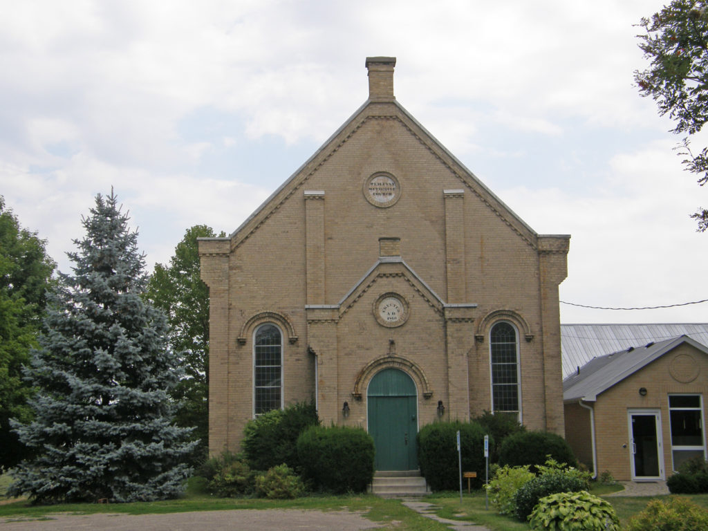
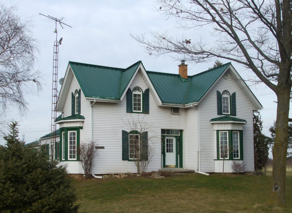
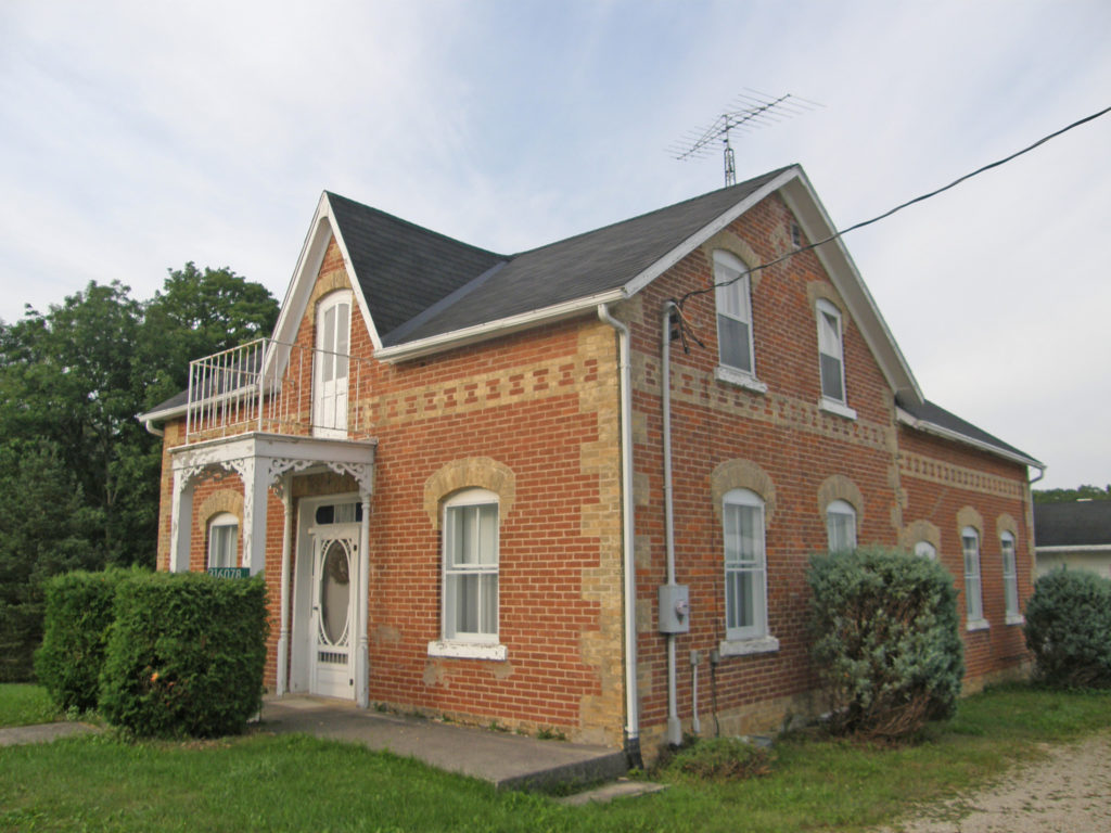
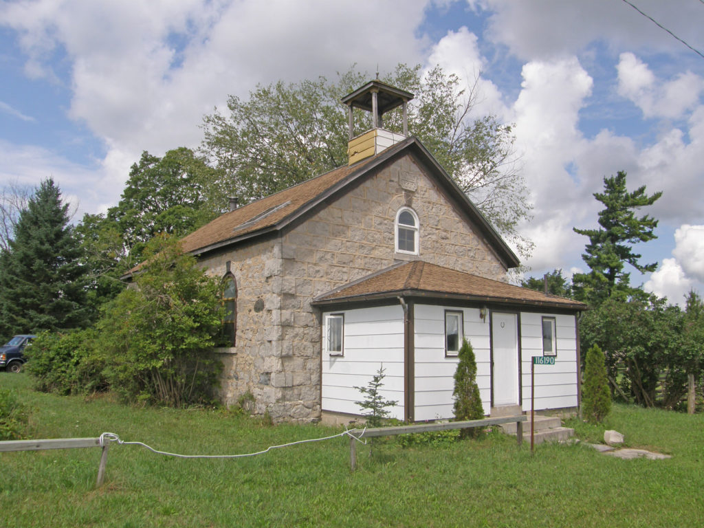
I have my next photo projects planned and research done of the cities and towns. We get to see a whole different picture of the places we visit. We often don’t get into the museums and places of interest, although sometimes we do. Depending on the town, I may get a lot of walking in; in other towns, buildings are more scattered and Harry drives me from place to place. What I love to do is to be left on my own for an hour or two and explore and see what I find. I never limit myself to what I am told are the heritage buildings – I want to record more than those. Some architecture is unique, some is rather plain. I have learned about different architectural styles as I have progressed through the years. I have also learned terms that are used.

I have been connected to the 100 Day Challenge since 2007 and I am encouraged to plan. I have accomplished much more in the last ten years that I would have if I had not planned what I was going to do and given myself deadlines for accomplishing the goals I set. Sometimes it takes me longer than I originally planned to complete items, but then I give myself a new time frame to work towards.

And my journey carries on. To see some of the things I have accomplished, check out my website at http://barbararaue.ca.

What are your plans for this week, month, and the year 2019? If you plan, set yourself deadlines, and put in the work, you will be amazed what you can accomplish.

West Flamborough, Ontario and Area in Colour Photos – My Top 19 Picks

West Flamborough, Ontario and Area

Flamborough is a former municipality in the city of Hamilton. For most of its existence before amalgamation with Hamilton in 2001, Flamborough comprised the former townships of East Flamborough, West Flamborough, and Beverly, as well as the village of Waterdown. Other Flamborough communities include Carlisle, Christie’s Corners, Clappison’s Corners, Copetown, Freelton, Greensville, Lynden, Kirkwall, Millgrove, Mountsberg, Orkney, Peter’s Corners, Rockton, Troy, Sheffield, Valens, and Westover.

After the American Revolution in 1783 and the creation of Upper Canada, land at the western end of Lake Ontario was surveyed and organized into townships, which included East Flamborough, West Flamborough and Beverly. Governor’s Road (also known as Queen’s Highway 99) was built on the border with neighboring Ancaster Township linking York (later Toronto) and London.

In 2001, the provincial government amalgamated Flamborough with Ancaster, Dundas, Glanbrook, Stoney Creek and Hamilton into the City of Hamilton.

Copetown is a rural neighborhood located east of Brantford. William Cope, a United Empire Loyalist from the state of New York settled here in 1794.

Jerseyville was initially settled by United Empire Loyalists from New Jersey in the late 1770s. The Brantford to Hamilton rail trail passes through Jerseyville in place of the old train tracks. The original Jerseyville train station building can be found at Westfield Heritage Village in Rockton.

There used to be a train station in Lynden that went to Hamilton. Currently Lynden has many farmers, small business entrepreneurs and commuters to Hamilton, Cambridge, Dundas, Brantford and Toronto.

Architectural Photos, Freelton, Ontario
Freelton – #79 – Gothic – corner quoins
Architectural Photos, Freelton, Ontario
Freelton – Bay window on the side
Architectural Photos, Freelton, Ontario
Freelton – #110 – stone building
Architectural Photos, Freelton, Ontario
Freelton – #100 – Mansard roof with dormers, bay windows
Architectural Photos, Concession 2, Ontario
Concession 2 – Verge board trim on gable, paired cornice brackets
Architectural Photos, Concession 2, Ontario
Concession 2 – Cornice brackets, corner quoins
Architectural Photos, Concession 2, Ontario
Concession 2 – Georgian
Architectural Photos, Howell Road, Ontario
14 Howell Road – dormers, oriel window on left side, two-storey bay window on right side, Palladian-type window above veranda
Architectural Photos, Howell Road, Ontario
235 Howell Road – Orchard Home Farm – two-storey frontispiece with corner quoins, paired cornice brackets
Architectural Photos, Copetown, Ontario
Copetown
Architectural Photos, Copetown, Ontario
S.S. No. 3 School – West Flamborough and Ancaster – 1916 – voussoirs and keystones
Architectural Photos, Crieff, Ontario
Crieff – Stone Gothic heritage home – transom window
Architectural Photos, Jerseyville, Ontario
Jerseyville – Wesleyan Methodist Church erected A.D. 1860
Architectural Photos, Lynden, Ontario
Lynden – Gothic
Architectural Photos, Lynden, Ontario
Lynden – Decorative cornice, voussoirs and keystones, iron cresting above porch, corner quoins
Architectural Photos, Mountsberg, Ontario
Mountsberg – #1913 – Gothic – verge board trim on gables
Architectural Photos, Puslinch, Ontario
Puslinch
Architectural Photos, Strabane, Ontario
Strabane – #1322 – Gothic – verge board trim and bric-a-brac on veranda
Architectural Photos, West Flamborough, Ontario
West Flamborough – 252 Highway 8 – McKinlay-McGinty House c. 1848 – Classical Revival architectural style – The front entrance is screened by four Tuscan wooden columns. The main door is flanked by pilasters of ashlar limestone set on a plinth and surmounted by a limestone lintel carved to simulate a rusticated voussoir. The door frame is flanked by sidelights with a four-light transom above. Above the entrance there is a Palladian-inspired window, set within an elliptical arch, with a central semi-circular headed window with Gothic glazing bars, flanked by a pair of lancet windows showing the growing influence of the Picturesque and early Gothic Revival movement. Above this window is a recessed yellow brick lozenge pattern detail below a low gable with return eaves. The front windows have shutters and rusticated voussoirs.

Chatsworth and Grey Bruce Ontario in Colour Photos – My Top 21 Picks

Chatsworth and Grey Bruce Ontario

Chatsworth is a township in south-western Ontario in Grey County located at the headwaters of the Styx, Saugeen, Sauble, Bighead, Spey, and the old Sydenham Rivers. The current township was formed on January 1, 2001 with the amalgamation of Holland Township, Sullivan Township, and the village of Chatsworth. The first white settlers arrived in this area in the early nineteenth century.

Canadian suffragette and activist Nellie McClung was born in the town of Chatsworth. The Sullivan Township area has a large Amish population.

The township includes the town of Chatsworth, Arnott, Berkeley, Desboro, Dornoch, Glascott, Grimston, Harkaway, Hemstock Mill, Holford, Holland Centre, Keady, Keward, Kinghurst, Lily Oak, Lueck Mill, Marmion, Massie, Mooresburg, Mount Pleasant, Peabody, Scone, Strathaven, Walters Falls, Williams Lake, and Williamsford.

Chatsworth is located south of Owen Sound and north of Durham where Highways 6 and 10 merge. The village neighbors Williamsford, Dornoch, and Desboro. The name of the town comes from Chatsworth House in Derbyshire, England near the home town of the postmaster. Chatsworth was founded in 1848 at the northern terminus of the Toronto-Sydenham Colonization Road. Modern Highway 10 follows most of the original road’s route.

The first building in the village of Desboro in 1856 was a log school house. The area was originally called Brown’s Corners. At some point its name was changed to Donnybrook and then to Desborough after a village in central England. The first house and store were built in 1866 by George Smith. The Desboro hotel was built in 1869 and was one of the only rural taverns still operating in the township before it closed in 2011. The town hall was built in 1875 and enlarged to a two-storey building in 1950. Desboro is about 13 kilometers west of Chatsworth and Williamsford.

Keady is a small farming village, located at the intersection of Grey Roads 3 and 16. Keady saw its first settlers in the 1850s. The original general store was built in the late 1860s and operated for almost 100 years before being converted into a residence. It has a Community Centre, licensed mechanic, livestock market, machine shop and a United Church, and is home to about 200 people.

Keady is well known in the area for the weekly summer farmer’s market and numerous functions held at the Keady Community Centre.

The village of Dornoch was settled by Bartholomew Griffin in 1841 when he encountered a crossroads that appealed to him. The area was originally called “Griffin’s Corners” after Griffin started the first general store. In the late 1850s the village was served by a stage coach that was running between Durham and Chatsworth. Around the turn of the century, the name was changed to Dornoch after the village in northern Scotland. The community center was built in 1952 and still serves Dornoch. Dornoch is situated between Williamsford and Durham on Highway 6 and is 33 kilometers south of Owen Sound.

Williamsford is a village on the North Saugeen River. It has a general store, post office, a bookstore and restaurant housed in a historic grain mill. A small dam controls the river. It has several churches, and a community cemetery. It is located on Highway 6 between Durham and Owen Sound. The village of Williamsford was first surveyed in 1858 comprising 400 acres in preparation for a railway which was to run from Toronto to Owen Sound. The post office was built in 1847 and the general store was built in the late 1800s. At the south end of the village sit the community centre grounds with a playground, a baseball diamond and a curling rink. The curling rink was completed in 2010 and has a lounge and two rinks.

West Grey is a township in western Ontario in Grey County spanning across the River Styx, the Rocky Saugeen River, the Beatty Saugeen River, and the South Saugeen River. Unlike most rural communities, West Grey maintains its own police force, the West Grey Police Service. The municipality was formed on January 1, 2001, when the former Townships of Bentinck, Glenelg, and Normanby, the Village of Neustadt, and the Town of Durham were amalgamated in a county-wide reorganization. Elmwood is one of the communities in this township.

Elmwood is a village in Grey County on the county line between Bruce and Grey, about six miles (10 kilometers) north of Hanover. It was a location in which Mennonites were to be found from before 1870, when ministers from Waterloo County were sent to Brant Township every eight weeks to conduct services which alternated in the homes of Mennonite families living there. In 1875, when the Mennonite Brethren in Christ (MBC) were organized in Ontario, Elmwood was one of their earliest places of worship. It was the village into which the retired farmers moved when they left the farms in that community.

Duncan is located south of Thornbury.

Euphrasia is a former township in Grey County. Since 2001 it is a part of the municipality of Grey Highlands. Euphrasia is located east of Beaverdale, north of Wodehouse and southwest of Beaver Valley. Euphrasia has an elevation of 433 meters.

Markdale is a community in Grey County. Markdale was first settled in 1846. In 2001, Markdale was amalgamated with the townships of Artemesia, Euphrasia and Osprey to form Grey Highlands. On August 20, 2009, an F2 tornado originating in Durham touched down in Markdale and caused some local damage.

Arkwright was an important community in the early days of Bruce County’s history. First settled in the 1850s, it gained prominence as both a supply centre and busy stopping place along the stage route. At its height Arkwright boasted two hotels, two stores, a wagon shop, two blacksmiths and a physician. A sawmill was located close by. There was also a school and two Methodist churches that later merged. A post office operated from 1857 to 1915 in one of the general stores. Arkwright served as the seat of township government for many years. Lack of a railway prevented Arkwright from attracting any major industries.

Tara is located in the municipality of Arran-Elderslie in Bruce County and is located on the Sauble River. Tara was named after a town in County Meath, Ireland which served as the seat of Irish royalty. Soon after the survey of the township was completed in 1851, John Hamilton and Richard Berford, early settlers in the area, located here along the river. The opening of the Owen Sound Post road stimulated the growth of a small community. Situated in a rich agricultural region with abundant water power, the settlement developed quickly. By 1861 Tara had saw and grist mills, a foundry producing agricultural implements, wagon works and a tannery. Hamilton opened a hotel to serve the incoming settlers of the surrounding townships. A post-office opened in 1862. In 1880, the local newspaper, The Tara Leader was first published. Tara became a thriving commercial and manufacturing center and, in anticipation of the arrival of the Stratford and Huron Railway, it was incorporated as a village on January 1, 1881.

Williscroft was a farming hamlet, located in Bruce County, first settled around 1850. By 1856 it had a post office, followed by a school in 1858. The village quickly grew to include a blacksmith shop, a store, two coopers, a door and sash building business, and saw and grist mills. A Baptist church was added in 1875. Later industries in Williscroft included a cheese factory and woodworking and carriage shops. Farm based organizations, which took hold during the 1880s, led to the construction of a large Grange Hall, also used as a community and social center, and later as an Orange Lodge.

Architectural Photos, Chatsworth, Ontario
777346 Ontario 10 – Holland-Chatsworth Central School – banding, voussoirs
Architectural Photos, Chatsworth, Ontario
Chatsworth – #141 – Gothic
Architectural Photos, Desboro, Ontario
Desboro – verge board trim on gable
Architectural Photos, Desboro, Ontario
Desboro – Gothic Revival – dichromatic brickwork, bay window, corner quoins
Architectural Photos, Desboro, Ontario
481 Grey Road 40 – Desboro Tavern – dichromatic brickwork, banding, corner quoins
Architectural Photos, Dornoch, Ontario
Dornoch – Stone building
Architectural Photos Ontario
Grey Road 40 and Grey Road 3 – Gothic – spindle work in the gable
Architectural Photos Ontario
Grey Road 40 and Grey Road 3 – Gothic, red brick, dichromatic brickwork, banding, quoins, bay window, voussoirs and keystones
Architectural Photos, Williamsford, Ontario
Williamsford – Gothic – dichromatic brickwork, corner quoins, second floor balcony, voussoirs
Architectural Photos, Marmion, Ontario
Marmion – S.S. No. 6 School – 1877
Architectural Photos, Keady, Ontario
Chalmers United Church, Keady – battlement on top of three-storey tower
Architectural Photos, Elmwood, Ontario
Elmwood – #40
Architectural Photos, Duncan, Ontario
Duncan Union Church – 1901
Architectural Photos, Euphrasia, Ontario
No. 21 Euphrasia – 1900
Architectural Photos, Markdale, Ontario
Markdale – verge board trim on gable, banding, voussoirs
Architectural Photos, Arkwright, Ontario
Arkwright
Architectural Photos, Arkwright, Ontario
Arkwright United Church – lancet windows, buttresses, dentil molding
Architectural Photos, Dobbinton, Ontario
Dobbinton – Gothic – corner quoins
Architectural Photos, Tara, Ontario
Tara – Bay window
Architectural Photos, Tara, Ontario
Tara – verge board trim and finial on gable, dichromatic banding
Architectural Photos, Williscroft, Ontario
Williscroft – S.S. No. 8 Elderslie school – 1907

Beaver Valley, Ontario in Colour Photos – My Top 13 Picks

Beaver Valley Ontario in Colour Photos

The Beaver Valley is located in southern Ontario at the southern tip of Georgian Bay. The Beaver River flows north through the valley emptying into Georgian Bay in the town of Thornbury. It is a productive agricultural area producing 25% of Ontario’s apple crop on 7,500 acres of apple orchards. The main towns in the valley from Flesherton at the south end are Kimberley and Thornbury. Grey Road 13 follows the meandering Beaver River along the valley floor. It rises briefly before crossing the river again at Heathcote.

Clarksburg, the hidden gateway between the picturesque backroads of the Beaver Valley, the slopes of the Blue Mountains, and the shores of Georgian Bay, is located just south of Thornbury on Grey Road 13. The Beaver River cascades through a series of picturesque rapids from Clendenan Dam through the village and north to Georgian Bay. In 1858 William Jabez Marsh travelled from Holland Landing to purchase 500 acres of Crown land adjacent to the village of Thornbury. After choosing a location for his own farm, he donated 2.5 acres for the building of a church and rectory. The first church was a frame building erected in 1863 and named St. George’s and was located in the newly established village of Clarksburg immediately adjacent to the border with Thornbury in order to serve both municipalities. The original church served until 1899 when it was replaced by the present brick structure erected on the same site. Once the brick church was completed, the original frame building was dismantled and transported in mid-winter by horse-drawn sleighs to Beaverdale where it was reassembled and continued to serve the congregation there for another 50 years. The brick rectory next to the church was built in 1867 and has been well maintained.

Markdale is located on Highway 10 north of Flesherton. Settlement began in 1849, and it was incorporated as a village in 1888 with a thriving business center, three churches, a bank, a school, a wagon shop and a drug store. The beautiful Beaver Valley lies just a few miles to the east of Markdale.

Craigleith is located east of Thornbury on Georgian Bay. The name is Gaelic meaning rocky bay and the town was given the name by Andrew Craig Fleming, one of the community’s earliest settlers. Craigleith was the home of Sir Sandford Fleming who contributed to the establishment of standard time earning him the title of “The Father of Standard Time.” Fleming also designed the first Canadian postage stamp; issued in 1851, it cost three pennies and depicted the beaver, now the national animal of Canada. The Sanford family began operating a quarry and lumber mill in Craigleith which provided essential building materials to their new settlement.

On November 24, 1872 the steamer “Mary Ward” ran aground two kilometers offshore as she was traveling from Sarnia to Collingwood. A group of local fishermen rescued those remaining on board; however, the last of three rescue boats capsized and eight passengers drowned.

One of the last remaining wooden CNR stations is located here.

Flesherton is located at the junction of Highway 10 and Grey County Road 4. In 1850, 25-year-old William Kingston Flesher surveyed a portion of the Township of Artemesia. The north-south Toronto-Sydenham Road and east-west Durham Road which both ran through the township, were built shortly after the survey was finished, thereby opening the area to settlement. The intersection of the two roads which lay in a small valley was named Artemesia Corners.

As was usual for the time, Flesher was paid for his work in property within the survey area. He chose the valley containing Artemesia Corners and laid out a portion in village lots. Aaron Munshaw arrived as the first settler and built a tavern on the southeast corner of the intersection of the two roads. In 1864 as the village grew, Munshaw built a larger inn and stagecoach stop that incorporated some parts of the original hotel. This building, operated as a hotel by the Munshaw family until the 1960s, is now known as Munshaw House and still stands on the original spot.

Throughout the 1850s many Scottish immigrants arrived to claim lots and began to clear the land. Mr. Flesher continued to develop the valley economy building a sawmill and a grist mill on the Boyne River that flowed through the bottom of the valley. He encouraged other businesses to settle in the area. In his honor, the name of the settlement was changed to Flesherton.

The red brick Methodist Church was built in 1877. In 1879 Chalmers Presbyterian Church was built where the Toronto-Sydenham Road crossed the Boyne River. In 1926 the Methodist Church joined with Chalmers Presbyterian to form St. John’s United Church. The combined congregation chose to retain the highly visible Methodist building and sold the much smaller Presbyterian building.

Leith, located on the south shore of Georgian Bay, is nine kilometers northeast of the city of Owen Sound. It is the boyhood home of the renowned Canadian landscape artist Tom Thomson who is buried in the pioneer cemetery behind Leith United Church.

Heathcote is located in Grey County on the Beaver Road and Concession Road 13 south of Thornbury. William Fleming settled here in the 1840s and for a time the place was called Williamstown after him. That name was already in use elsewhere in Ontario, so when the post office opened in 1859, this community was called Heathcote, possibly after a place of that name in Derbyshire, England.

Meaford is located on the southern shore of Georgian Bay, on Highway 26 between Thornbury and Owen Sound. In 1837 inhabitants of St. Vincent Township petitioned the government requesting that land at the mouth of the Bighead River be reserved as a landing place. In 1841 there was a saw mill, a grist mill, several roads had been constructed to the landing place, and a post office was established. The town plot of Meaford was laid out in 1845.

Meaford Town Hall was built in 1908-09 with Palladian lines and stately Doric columns after the original building built in 1864 had become dilapidated and was destroyed by fire on October 5, 1907. Local contractor James Sparling recycled as much of the original town hall’s brick as possible in the construction of the new building. Like many public buildings across small-town Ontario, Meaford Hall was made to be more than a town hall. The building housed the council chambers and town offices. The chambers also served as a court room and there were two tiny jail cells in the basement.

At the other end of the building was the Meaford Public Library. Farmers used the basement on market day, and the space has been used for a ballroom, meeting area, and Boy Scouts hall. It has housed the Women’s Institute, the Meaford Quilters, a Senior Citizens’ Club, and the Senior Men’s Euchre club. The second floor Opera House was the cultural heart of the community. Local plays, high school graduations, concerts and famous speakers have all made use of the theatre. In 1967, the library moved to a bigger space in the old post office. The Meaford Police Department left the hall in 1996. The town vacated the old offices in 2002.

In 2003, Meaford secured a grant to restore and renovate the building. Thousands of volunteer hours later, the Meaford Hall Arts and Cultural Centre opened for business in the spring of 2006. The building housing the current museum was built in 1895 as the towns Pumping Station. The Public Utilities Department was later relocated to the Pump House and the building was called the “Power House.” During the 1940s, the chimney was removed. Cyrus Sing, a local citizen, donated his collection of memorabilia to the Town, and the building which had been vacant for a while was converted to a museum and opened to the public on July 1, 1961. Due to a continually expanding collection, several renovations and additions have been made to the building over the years.

Born in Nova Scotia, Margaret Marshall Saunders (1861-1947) was a novelist whose second book “Beautiful Joe” achieved international recognition. Inspired by a visit to Meaford in 1892, it is based on the story of a dog rescued from a brutal master by a local miller, William Moore. In 1994 the Beautiful Joe Heritage Society was formed to honor the life and story of Beautiful Joe and the literary and humane achievements of Margaret Saunders. Beautiful Joe Park is located in Meaford.

Victoria Corners is located on 21st Sideroad near Loree Forest and north of the hamlet of Banks.

Thornbury is located on Georgian Bay between Meaford and Collingwood. The Township of Thornbury was incorporated in 1833. In 1855 the town’s first business, a milling operation, was set up, followed by a general store, blacksmith, cooper and fanning mill shops, grist and saw mills, and a post office. In 1887, feeling they were unfairly burdened with high taxes, the businessmen of Thornbury petitioned for independence from the Town of Collingwood. After much negotiating, they received it and the Township of Thornbury became the Town of Thornbury. The apple packing industry took root in Thornbury in 1885. At the Thornbury Village Cider House, they produce Premium Apple Cider from apples grown in the area, cider that is light, crisp and refreshing.

On January 1, 2001, the Town of Thornbury and the small settlements in the Township of Collingwood were amalgamated. Thornbury is the primary population center. The town’s territory includes the communities of Banks, Camperdown, Castle Glen Estates, Christie Beach, Clarksburg, Craigleith, Duncan, Gibraltar, Heathcote, Kolapore, Little Germany, Lora Bay, Loree, Ravenna, Red Wing, Slabtown and Victoria Corners.

Walter’s Falls is located south of Owen Sound on Grey County Road 29. It was the site of a saw mill and woolen mill. The saw mill burned down but the woolen mill remains. Water from Walter’s Creek flows to form Walter’s Falls.

Architectural Photos, Beaver Valley
Clarksburg – Hipped roof, paired cornice brackets, bay windows with corner quoins, second floor balcony
Architectural Photos, Beaver Valley
Craigleith – In 1872 Andrew Grieg Fleming, father of Sir Sanford Fleming, sold a parcel of land to the Northern Railway Company for the purpose of building a train station to serve his newly founded community. The station building was constructed from local timber between 1878 and 1881 and included a rounded turret. By 1881 there were six trains a day at the Craigleith station. In 1882, the Northern Railway was purchased by the Grand Trunk Railway. In 1923 the Grand Trunk became part of the Canadian National Railway. The convenience of the railway allowed businesses to be created and to prosper. In the 1940s the ski industry in Ontario began to grow with weekend ski trains from Toronto. Passenger service to the Craigleith station ended in 1960. In 1966 the station and lilac grove were saved from destruction by Kenn and Suyrea Knapman who re-opened the station as a restaurant and museum. In 2001 the Craigleith Depo was purchased by The Blue Mountains.
Architectural Photos, Beaver Valley
#41, Markdale – red brick Gothic style house with white accents, checkerboard band
Architectural Photos, Beaver Valley
65 Main Street West, Markdale – turret on the Gothic style home
Architectural Photos, Beaver Valley
A gorgeous Second Empire style mansion in Markdale
Architectural Photos, Beaver Valley
Flersherton – 2½-storey tower-like frontispiece, polychromatic brickwork and banding, bay windows, second floor balcony
Architectural Photos, Beaver Valley
Verge board trim on gable, pediment with decorative tympanum
Architectural Photos, Beaver Valley
Flesherton – Gothic – 1889 – dichromatic brickwork, bay window
Architectural Photos, Beaver Valley
Heathcote – Gothic – verge board trim on large gable, second floor balcony
Architectural Photos, Beaver Valley
#60, Meaford – Gothic Revival – verge board trim and finials on gables, corner quoins
Architectural Photos, Beaver Valley
27 Bridge Street, Thornbury – Bridges Tavern – two tower-like bays with verge board trim on gables and fretwork, second floor balcony, dormer in roof
Architectural Photos, Beaver Valley
S.S. No. 4 Victoria Corners School – 1880
Architectural Photos, Beaver Valley
Walter’s Falls

Town of Pelham, Ontario in Colour Photos – My Top 14 Picks

Town of Pelham, Ontario

Fenwick is a community in the in the town of Pelham located in the Niagara Region. Welland is the closest city center. The community was named in 1853. The name probably comes from Fenwick, East Ayrshire in Scotland, which was the birthplace of Dr. John Fraser, who was reeve of Pelham Township at the time.

Ridgeville is a community within the town of Pelham. It borders the western limit of Fonthill. It derives its name from its location on the south western ridge of the Fonthill Kame. It has a post office, a rural mail route named Ridgeville, a small number of shops found along Canboro Road, including a bakery, chocolate shop and specialty home and bath shops, the local high school, Gwennol Organic Blueberry Farm and the Berry Patch Tea Room.

Fonthill is a community in the town of Pelham. It has a few small industries, but is primarily a residential suburb known for its fruit orchards, nature trails, and neighborly attitude.

Fonthill shares its name with the Fonthill Kame, on which it is located, formed by glacial deposits. Effingham Creek, a cold-water stream, originates in the glacial silts and sands of Short Hills area of the moraine, northwest of Fonthill. Effingham Creek is a tributary to Twelve-Mile Creek, which empties into Lake Ontario.

The Fonthill Kame is a geological feature in the form of a large, isolated hill composed of sand and gravel deposited by the retreating glaciers of the last ice age. The Fonthill Kame rises about 75 meters (246 feet) above the surrounding land and is the highest elevation in the region. The kame is 6 kilometers (4 miles) east to west and 3 kilometers (2 miles) north to south. It slopes gradually on the west side, more steeply on the south and east and merges with the Short Hills Provincial Park area of the Niagara Escarpment on the north. The Fonthill Kame influences the climate of Pelham by sheltering it from the winds from the southwest. This provides good growing conditions for fruit crops, including the grape vines that supply the local wine industry. It is also mined for sand and gravel.

Letters written by Henry Giles, a settler who came to the area in 1840, suggest that he chose the name Fonthill because the area looked similar to the area around Fonthill Abbey in England. The village’s first post office was established in 1856. On June 10, 2006, Fonthill celebrated its 150th anniversary. The celebration was marked by the opening of the band stand (a replica of the original bandstand that existed in the early 1900s), historical displays and a variety of musical and artistic presentations.

On a clear day, the tall buildings of Niagara Falls to the East and the Toronto skyline to the North are clearly visible from a vantage point near Effingham Street and south Tice Road just west of Fonthill. This also allows views of Lake Ontario, Lake Erie, and the skyline of Buffalo.

In 1970, the Town of Pelham unified five historical communities: Fonthill, Ridgeville, Effingham, North Pelham and Fenwick into a single town covering more than one hundred and twenty-six thousand square kilometers. This integration brought together a mix of farming (agriculture) and commercialism.

The Town of Pelham is located in the center of Niagara Region. The town’s southern boundary is formed by the Welland River, a meandering waterway that flows into the Niagara River. To the west is the township of West Lincoln, to the east the city of Welland, and to the north the city of St. Catharines. Pelham Township was part of Welland County since the late 1780s. The Town of Pelham derived its name from Pelham Township which was named by John Graves Simcoe in the 1790s. Simcoe gave names to the Townships of Niagara that were created to provide land for Loyalist refugees, disbanded troops former rangers and others after the British defeat in the Revolutionary War (which ended in 1783). The policy of Simcoe was to adopt township names from England.

Architectural Photos, Town of Pelham
655 Canboro Road – Gothic, verge board trim on gable
Architectural Photos, Town of Pelham
683 Canboro Road, Fenwick – hipped roof, sidelights
Architectural Photos, Town of Pelham
695 Canboro Road
Architectural Photos, Town of Pelham
704 Canboro Road – former Pelham High School – 1926 – now Canboro Gardens
Architectural Photos, Town of Pelham
742 Canboro Road, Fenwick – hipped roof, paired cornice brackets
Architectural Photos, Town of Pelham
Canboro Road, Fenwick – hipped roof, corner quoins, voussoirs
Architectural Photos, Town of Pelham
840 Canboro Road – hipped roof, cornice brackets, porches decorated with bric-a-brac
Architectural Photos, Town of Pelham
Canboro Road, Ridgeville – Gothic – verge board trim on gables
Architectural Photos, Town of Pelham
Elm Avenue, Fonthill – dormer
Architectural Photos, Town of Pelham
90 Canboro Road, Fonthill – The Wilson-Hansler-Stirtzinger House was built by John Wilson in 1876 of triple brick in the Gothic style. The walls are two feet thick and the floors are made of a mixture of cherry and maple woods. There is verge board trim on the gables, and a pediment above the door with sidelights and transom windows. The house passed onto the family of Dr. John Hansler, and then to his nephew John Loyal Stirtzinger in 1926. The house still remains on the property owned by descendants of Stirtzinger. Outside the house, the original Hansler carriage step and one of the hitching posts still stands.
Architectural Photos, Town of Pelham
Chestnut Street, Fonthill – Italianate, two-storey tower-like bays each topped with a pediment, cornice brackets
Architectural Photos, Town of Pelham
1567 Pelham Street, Fonthill
Architectural Photos, Town of Pelham
Pelham Street, Fonthill
Architectural Photos, Town of Pelham
711 Tice Road – The Rice Moore House has been designated a heritage site for its architectural value. There is barge board trim around roof line, and steeply pitched gables.