July, 2017:

Elmira, Ontario – My Top 7 Picks

Elmira, Ontario – My Top 7 Picks

Elmira is the largest community within the Township of Woolwich in the Regional Municipality of Waterloo and is located 15 kilometers (9 miles) to the north of the city of Waterloo.

The land comprising Woolwich Township originally belonged to the Huron and then the Mohawk Indians.  The first settlers arrived in Woolwich Township in the late eighteenth century. In 1798, William Wallace, one of the first settlers in the area, was deeded 86,078 acres of land on the Grand River for a cost of $16,364.

In 1806, Wallace sold the major portion of his tract to Mennonites. Benjamin Eby, the secretary of the Germany Company came to the area with his friend Henry Brubacher. The young men liked Wallace’s Woolwich.  Eby returned to Pennsylvania where he formed a land company. The following year, he returned with a barrel of silver dollars, and the Musselmans, Martins, Hoffmans, and Gingerichs to settle in the area. Wallace sold the Germany Company 45,185 acres of land at $1.00 an acre.

In 1834, Edward Bristow became one of Elmira’s first settlers when he purchased 53 acres of land here for 50 cents per acre. A community by the name of Bristow’s Corners was in existence in 1839 when a post office was assigned there.  In 1853 the community was renamed Elmira.  In the 1850s, German settlers moved into the community, including Oswald, Esche, Steffen and Tresinger. Like most of the township, the primary settlers in the Elmira area were Mennonites who still form a significant proportion of the population today. The town still retains much of its traditional Pennsylvania Dutch character.
Architectural Photos, Elmira, Ontario
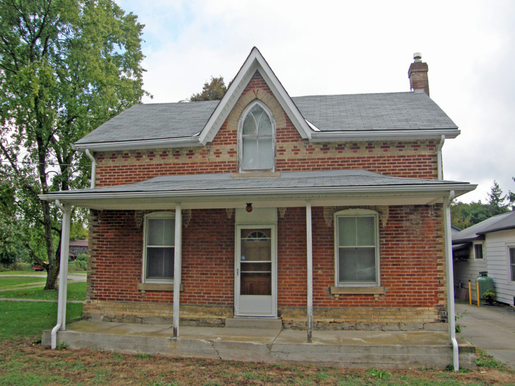
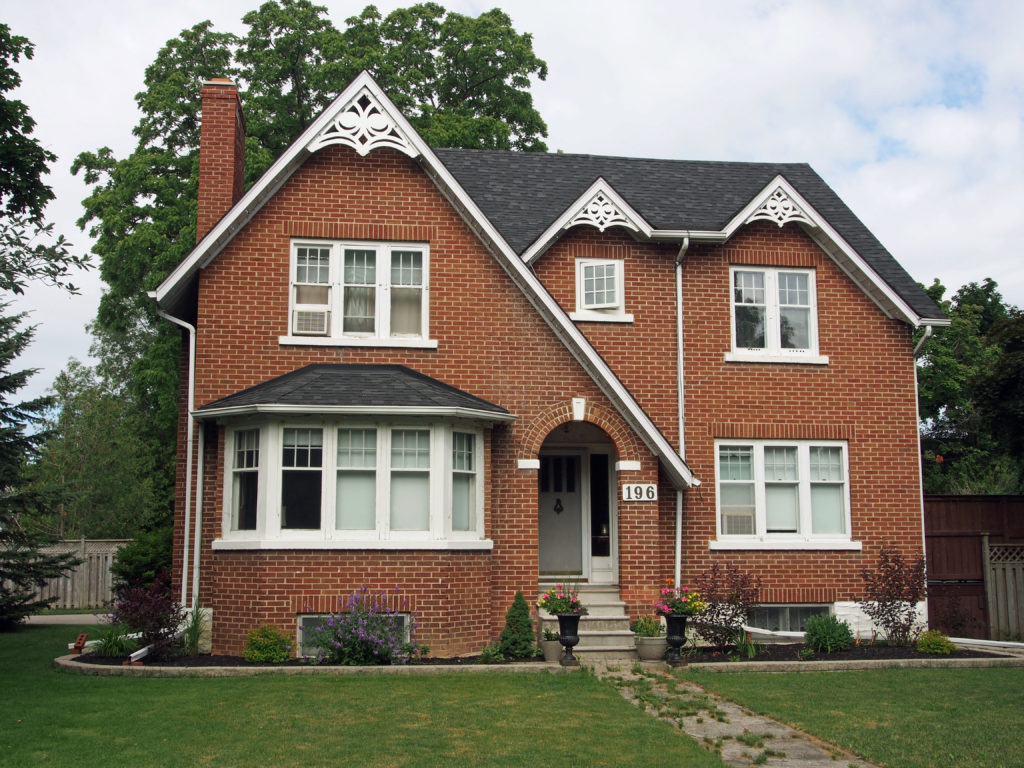
196 Arthur Street South – Gothic Revival, verge board trim – Elmira Book 1
Architectural Photos, Elmira, Ontario
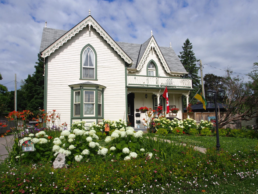
80 Arthur Street South – Gothic Revival, verge board trim – Elmira Book 1
Architectural Photos, Elmira, Ontario
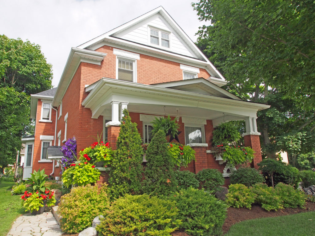
24 Queen Street – Edwardian – cornice return on gable, pediment – Elmira Book 1
Architectural Photos, Elmira, Ontario
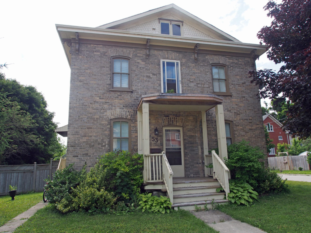
53 Memorial Avenue – Italianate – dormer, single cornice brackets – Elmira Book 1
Architectural Photos, Elmira, Ontario
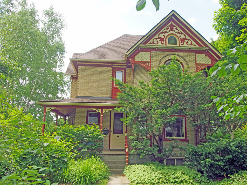
5 Park Avenue – decorative gable, Romanesque style arch on second floor window – Elmira Book 2
Architectural Photos, Elmira, Ontario
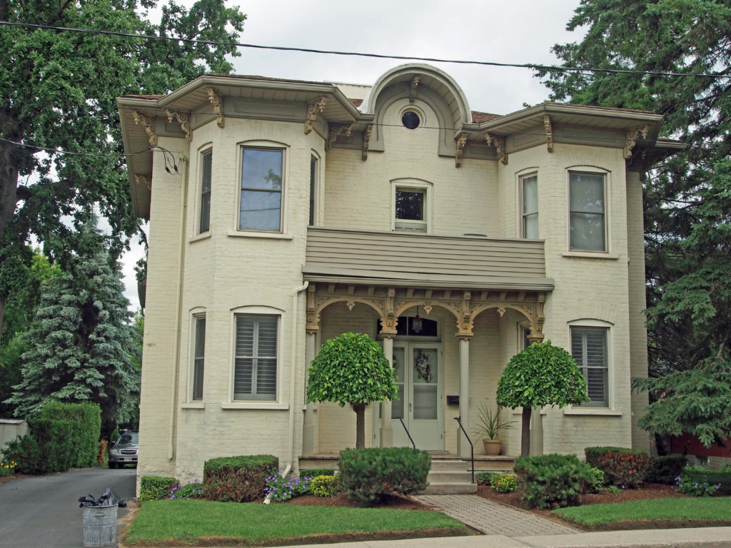
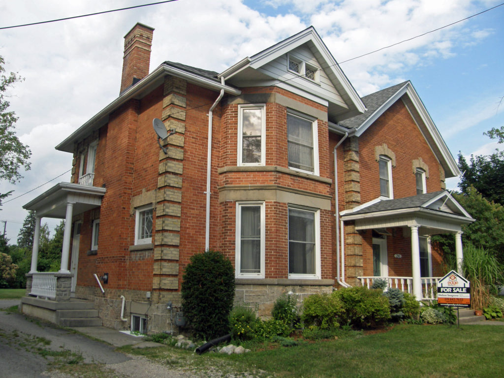
42 Church Street West – Italianate – cornice brackets, two-story bay windows – Elmira Book 2
Architectural Photos, Elmira, Ontario
Martins Line – Italianate with two-and-a-half story tower-like bays, cornice brackets – Elmira Book 2

Elora, Ontario – My Top 5 Picks

Elora, Ontario – My Top 5 Picks

Elora is located in Wellington County on the Grand River and is about twenty kilometers north of Guelph, and twenty kilometers northeast of Kitchener-Waterloo.

Elora was founded in 1832 by Captain William Gilkison, a British officer recently returned from India. Gilkison named the community after his brother’s ship, which was itself inspired by the Elora Caves near Aurangabad, Maharashtra, India.

The Elora Gorge, located at the western edge of the village, is one of the most scenic areas in Southern Ontario with its limestone cliffs descending 80 feet into the Grand and Irvine rivers where small caves, rapids, falls and quiet waters beckon visitors.

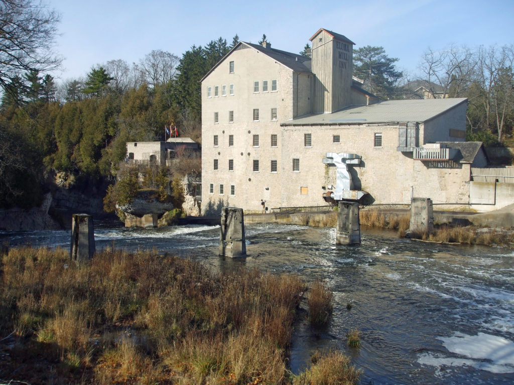
At the foot of Mill Street stands the Elora Mill, one of the few early Ontario five-story grist mills still in existence.

David Boyle, born in Scotland in 1842, came to Canada in 1856 and settled in this area.  As a local school teacher, he began an extensive collection of native artifacts and became an archaeological authority.  In 1886, Boyle was appointed the first curator of the Provincial Archaeological Museum in Toronto.  He was dedicated to the study and retention of artifacts and he initiated an active program of excavation and acquisition.  Through his work on Ontario prehistory, Boyle gained international recognition as a leading Canadian archaeologist and anthropologist.

When Elora first established itself as an agricultural supply center in the mid-nineteenth century, farmers coming from the north were greeted by a wagon and carriage factory, a lumber yard, blacksmith shops, and a farm implement enterprise.

Architectural Photos, Elora, Ontario
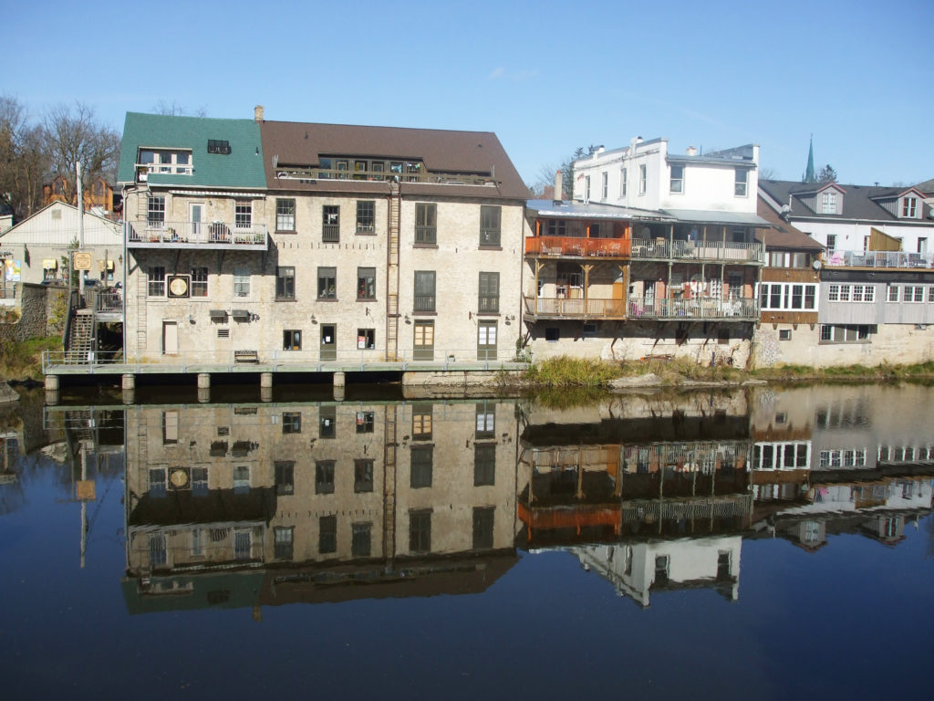
Reflections
Architectural Photos, Elora, Ontario
Elora Mill Inn – Towering 100 feet above the thundering falls of the Grand River, the Mill at Elora has stood for over 150 years as a symbol of what the combined energies of man and nature can achieve. The Mill was rebuilt mostly of stone after a fire in 1870.
Architectural Photos, Elora, Ontario
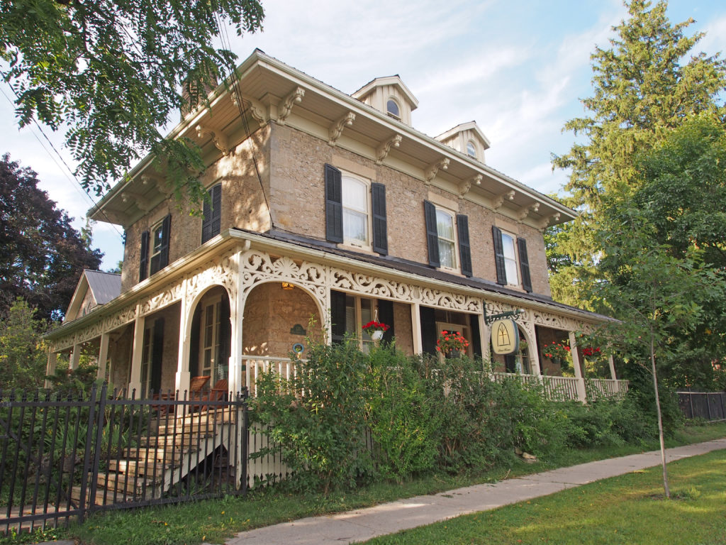
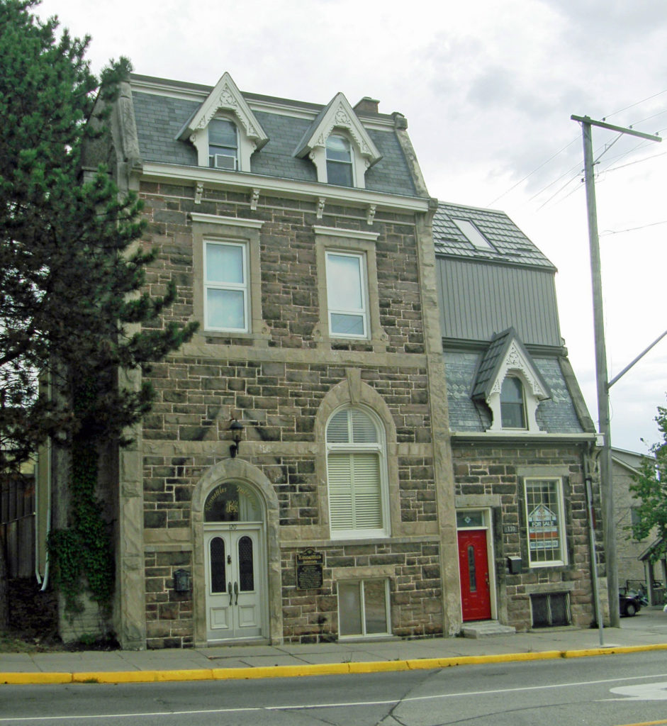
120 Mill Street East – Drew House – Italianate style – dormers in attic, single cornice brackets, wraparound verandah with bric-a-brac
Architectural Photos, Elora, Ontario
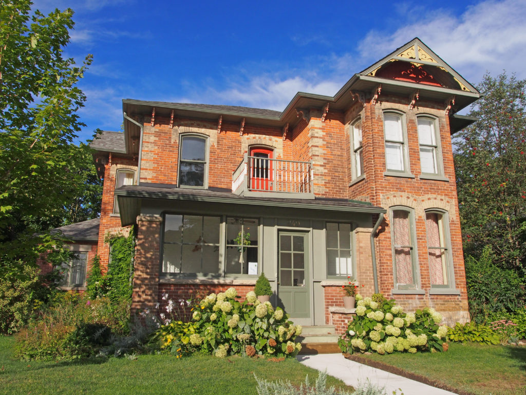
Geddes Street – Italianate – hipped roof, two-story tower-like bay topped with pediment with verge board trim, corner quoins, cornice brackets, voussoirs, dichromatic brickwork
Architectural Photos, Elora, Ontario
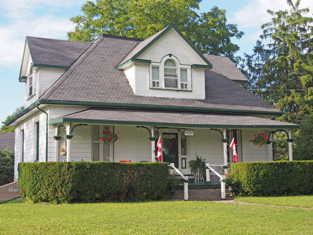
Church Street – Walter P. Newman, Banker c. 1854 – dormers in steeply pitched hip roof, Palladian window in dormer

Fergus, Ontario – My Top 6 Picks

Fergus, Ontario – My Top 6 Picks

Fergus is the largest community in Centre Wellington, a township within Wellington County.  It lies on the Grand River about 25 kilometers north of Guelph.

The first settlers to this area were freed slaves who formed what was known as the Pierpoint Settlement, named after their leader, Richard Pierpoint. Along with half a dozen other men, Pierpoint was granted land in Garafraxa Township in what is now Fergus.

Adam Fergusson visited Canada in 1831 to investigate emigration for the Highland Society of Scotland.  In 1833 in partnership with a fellow Scot, James Webster, they purchased over 7,000 acres of uncleared land in Nichol Township.  Attracted by the abundant water power, they laid out the town of Fergus.  Webster took up residence there and supervised the settlement’s early development.  The first house was built in 1833, then a hotel, a saw mill, grist mill, church and school.

They established a vibrant economy using the waterfalls on the Grand River as power for local industry. The Scots built solid stone houses, factories and other buildings which have characterized Fergus to this day. Many of the houses and factories built by these early settlers are still in use today.

Originally Fergus was known as Little Falls, because of the scenic waterfalls downtown between the Public Library and the Fergus Market.

St Andrew Street runs parallel to the Grand River on the north side and is the heart of downtown. On the south side of the river is Queen Street where the newly renovated Fergus Market is located.

Architectural Photos, Fergus, Ontario
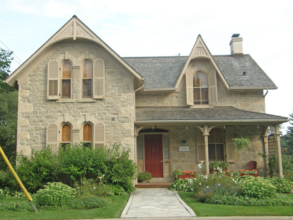
296 St. Andrew Street – Thomas Cumming, Carriage Maker – c. 1891 – Gothic Revival, verge board trim on gables, semi-circular window voussoirs with keystones, corner quoining
Architectural Photos, Fergus, Ontario
St. David Street
Architectural Photos, Fergus, Ontario
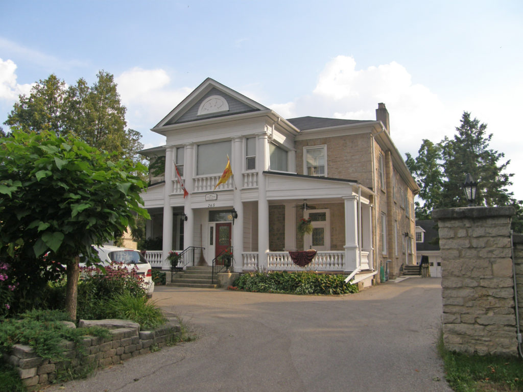
265 St. David Street North – James Argo Merchant c. 1867 – Neo-Colonial style – hipped roof, two-story-tall Doric porch pillars topped with pediment with decorated tympanum
Architectural Photos, Fergus, Ontario
250 St. David Street – Edwardian/Gothic – corner quoins, arched window voussoirs with keystones, pediment
Architectural Photos, Fergus, Ontario
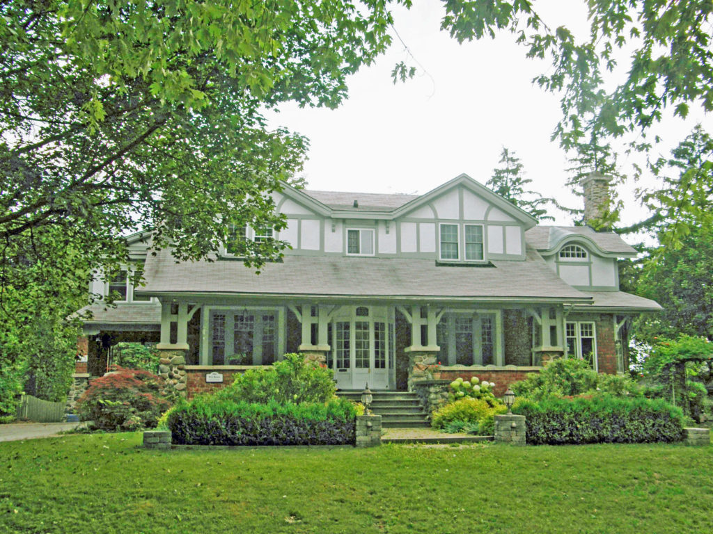
St. David Street – W. G. Beatty, Foundry Owner – c. 1912 – Tudor style
Architectural Photos, Fergus, Ontario
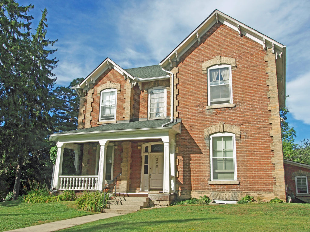
220 St. David Street – Gothic Revival, corner quoins, single cornice brackets

Eden Mills, Eramosa and Everton, Ontario – My Top 7 Picks

Eden Mills, Eramosa and Everton, Ontario – My Top 7 Picks

Eden Mills was established in 1842 with the construction of the first of three mills and called Kribbs Mill.  The mills used water power generated  by the Eramosa River, which splits into two branches at the village then flows on to join the Speed River in Guelph, and finally to the Grand, the great Canadian Heritage River.  When Adam Argo bought the mill he changed the name to Eden Mills, the name for the post office in 1851 with Mr. Argo as the postmaster. In the early days Eden Mills had a hotel, a flour mill, a wagon maker, blacksmith, general store, shoe store, cooper shop and a daily stage. The first church was of the Congregation Faith.  During the nineteenth and early part of the twentieth century Eden Mills grew into an important center of commerce. In addition to its three mills, it boasted an imposing three-story general store, a hotel (both still standing), post office, smithy, electric railway station, gas station and coffee shop.

Eramosa is located at the crossroads of Highway 124 and Wellington Road 29 east of Guelph.

Guelph/Eramosa is a township in Wellington County in mid-western Ontario. It partly encircles the city of Guelph from northeast to south southwest of the city.

Rockwood is the main community in the township. Rockwood is located on Highway 7 between Acton and Guelph. The Eramosa River runs through the center of the village and the river was the source of power for several mills that were built for the original settlement. Limestone was also extracted from the area. The Rockwood Conservation Area is used for swimming, hiking, canoeing, picnicking and camping.

The township also includes the smaller communities of Ariss, Armstrong Mills, Birge Mills, Blue Springs, Brucedale, Centre Inn, Eden Mills, Eramosa, Everton, Marden, Colbertville, Mosborough, Oakvale, Redwood Hills, and Rockcut.


Architectural Photos, Eden Mills, Ontario
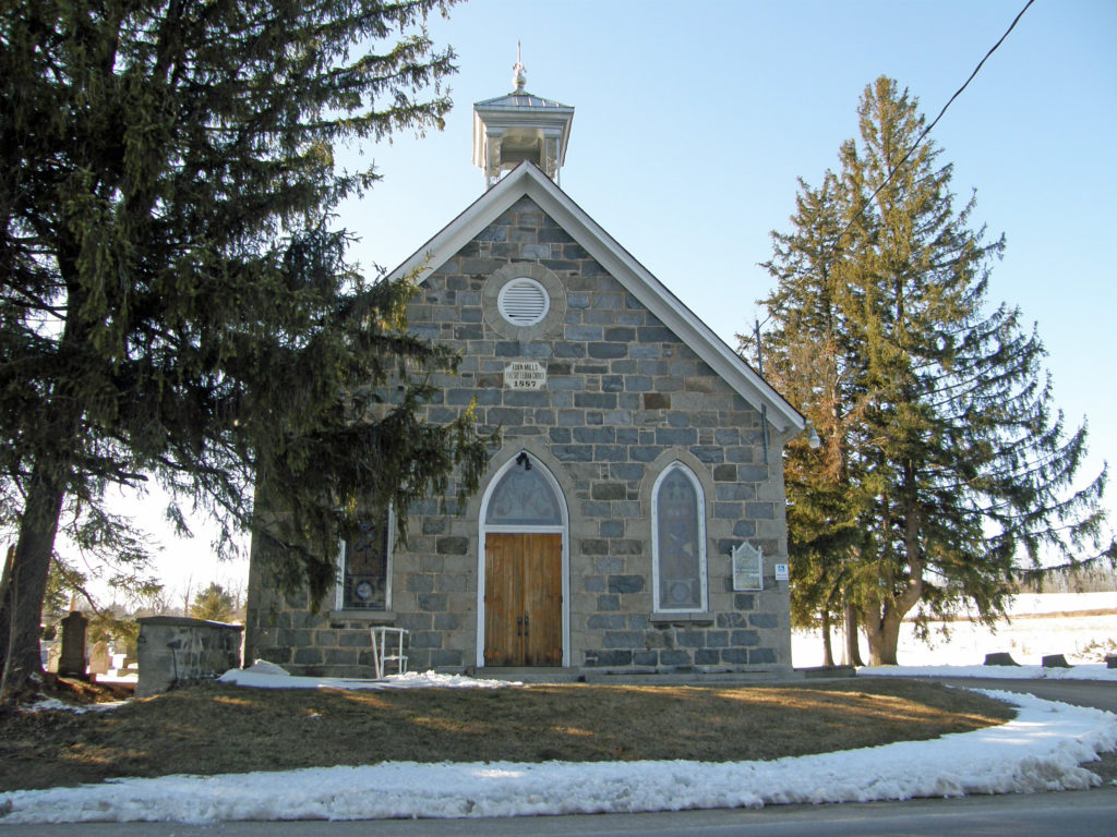
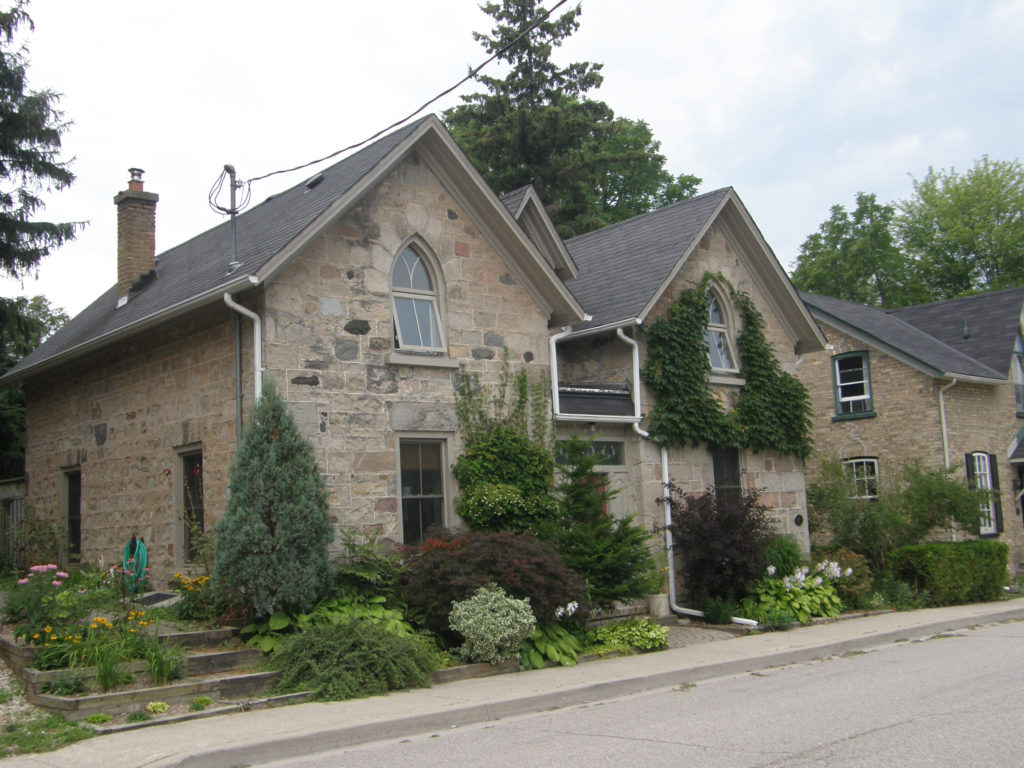
Stone building – Gothic Revival – Eden Mills
Architectural Photos, Eden Mills, Ontario
Eden Mills Presbyterian Church – 1887 – Gothic Revival – Eden Mills
Architectural Photos, Eramosa, Ontario
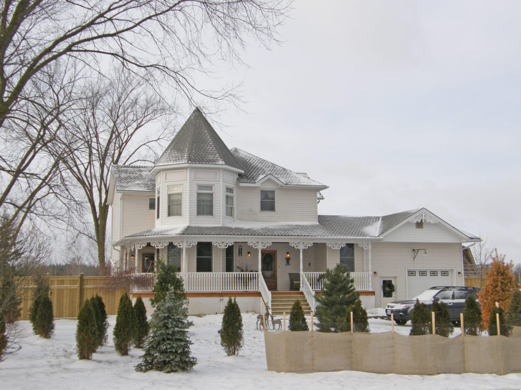
Queen Anne style – turret
Architectural Photos, Eramosa, Ontario
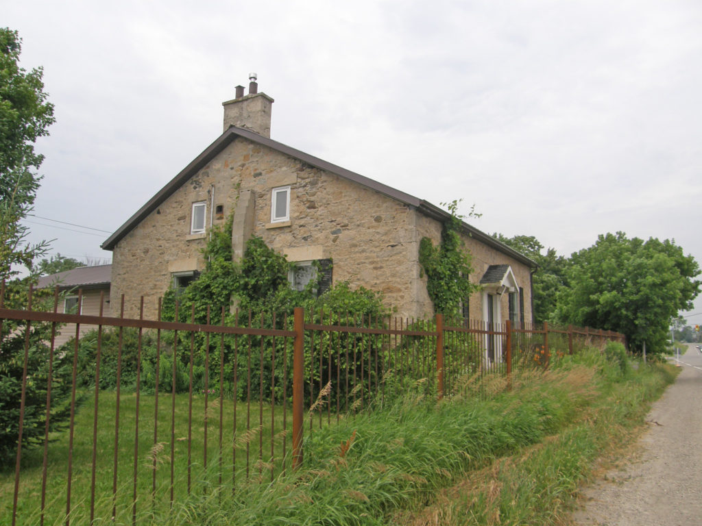
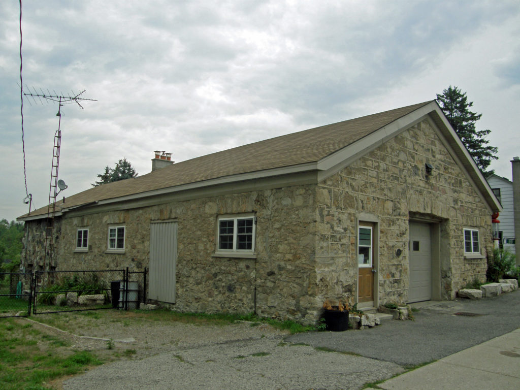
Stone – Gothic Revival
Architectural Photos, Eramosa, Ontario
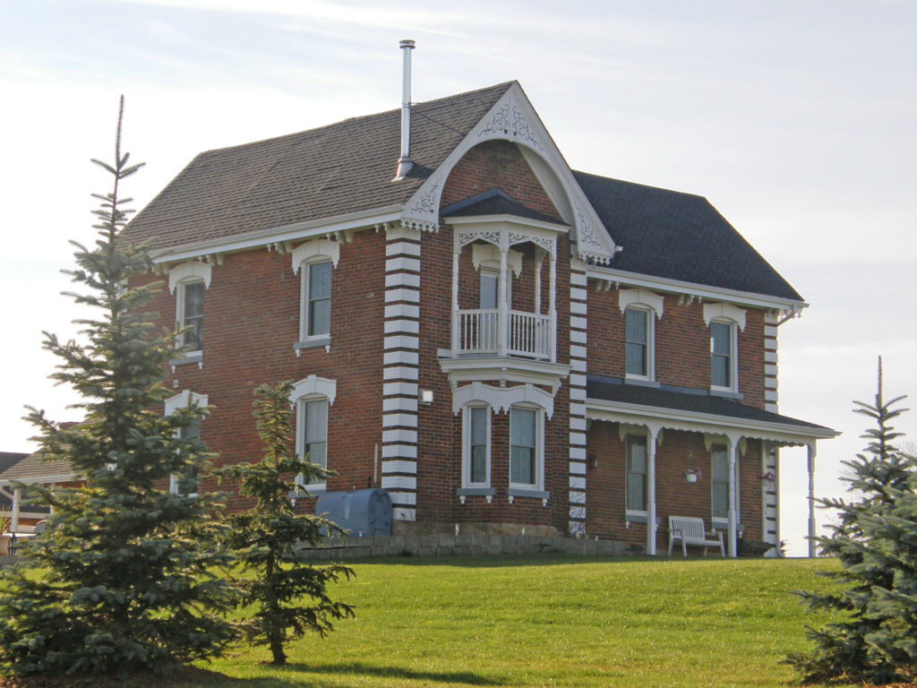
Gothic Revival – corner quoins, bay windows, balconies
Architectural Photos, Everton, Ontario
Gothic Revival – dichromatic brickwork
Architectural Photos, Everton, Ontario
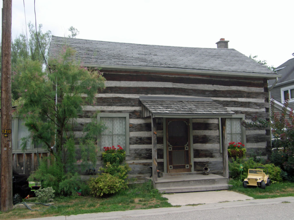
Log Cabin

Aberfoyle and Morriston, Ontario – My Top 6 Picks

Aberfoyle and Morriston, Ontario – My Top 6 Picks

Puslinch is a township in south-central Ontario in Wellington County south of Guelph. The area is rich in natural gas resources. About half of the township is forested, and a conservation area lies to the southwest. Near the western edge of the township, just outside of Cambridge, Ontario is Puslinch Lake, the largest kettle lake in North America.  A kettle lake is a shallow, sediment-filled body of water formed by retreating glaciers or draining floodwaters.

The township includes the communities of Aberfoyle, Aikensville, Arkell, Badenoch, Barbers Beach, Corwhin, Crieff, Killean, Little Lake, Morriston and Puslinch.

Aberfoyle is the administrative center for Puslinch Township and the municipality’s administrative offices and fire station are located here. Aberrfoyle is located at the headwaters of Mill Creek, about ten kilometers south of Guelph. Aberfoyle was first settled in the 1840s and is named for Aberfoyle, Scotland. It is famous for its spring water.

Morriston is located in Puslinch Township at Highway 6 and County Road 36, one kilometer south of Highway 401, and sixteen kilometers southeast of Guelph.  In 1847 Mr. R. B. Morriston opened a store in one end of his blacksmith shop and two years later built a store on the east side of the road.

Architectural Photos, Aberfoyle, Ontario
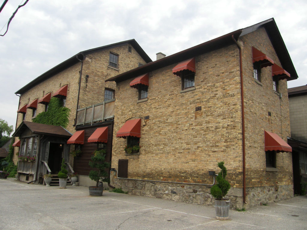
Aberfoyle Mill
Architectural Photos, Aberfoyle, Ontario
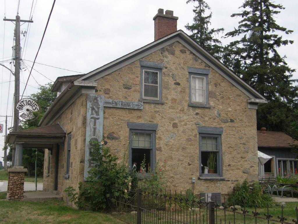
Gothic Revival – stone – cornice return on end gable – Aberfoyle
Architectural Photos, Morriston, Ontario
Gothic Revival – stone architecture – Morriston
Architectural Photos, Morriston, Ontario
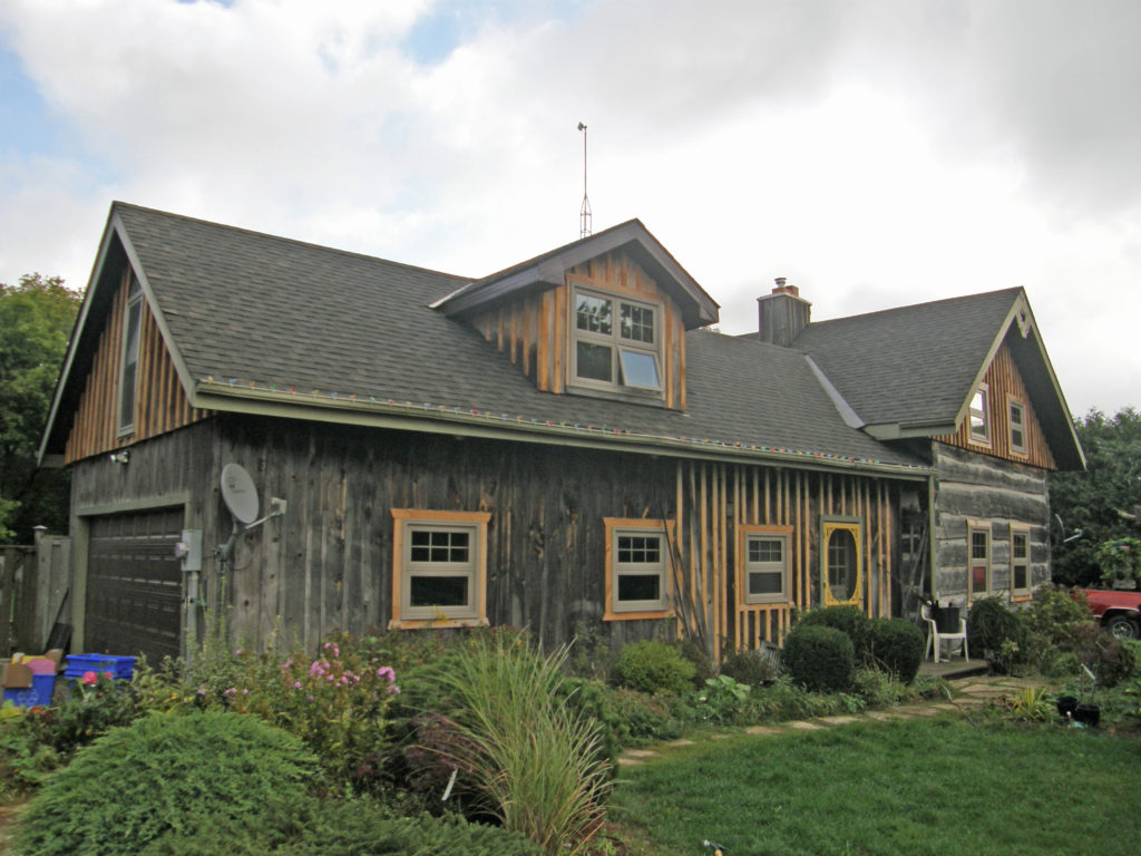
Log cabin – Morriston
Architectural Photos, Morriston, Ontario
Puslinch Heritage Building – Gothic – stone
Architectural Photos, Morriston, Ontario
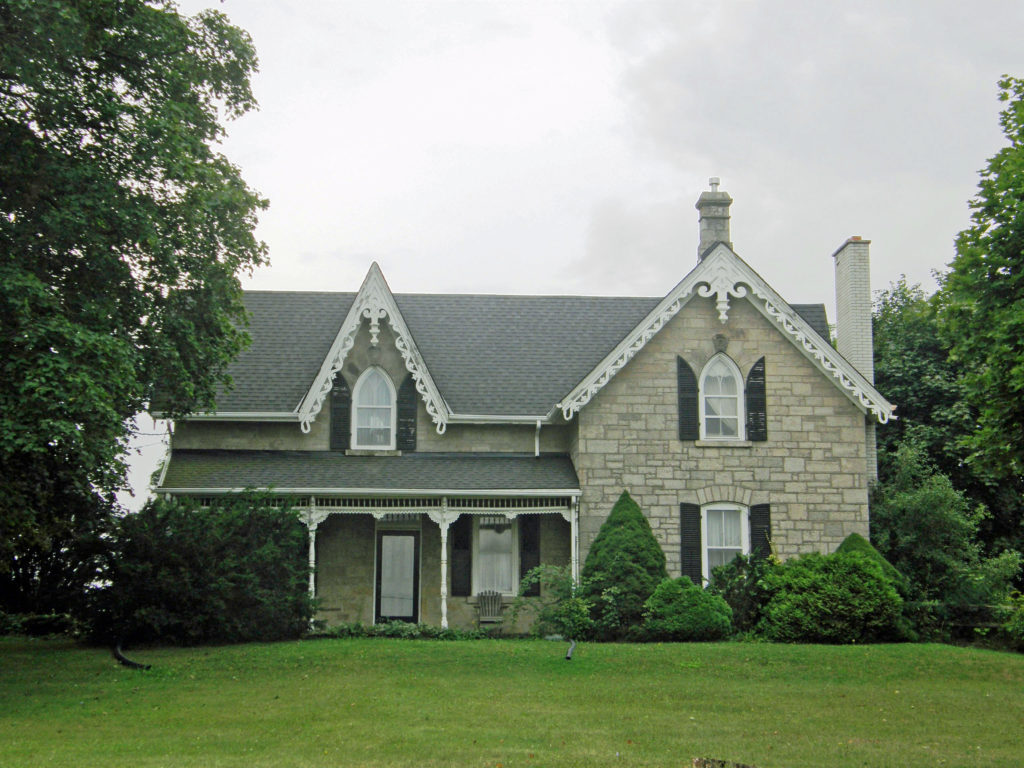
Gothic Revival – verge board trim on gables with finials