Vancouver British Columbia Book 3 in Colour Photos
Vancouver, the largest city in British Columbia and the third largest city in Canada, is a sea port in British Columbia’s southwest corner sitting at the foot of the Coast Mountain range. Much of Vancouver is built on a peninsula surrounded by water.
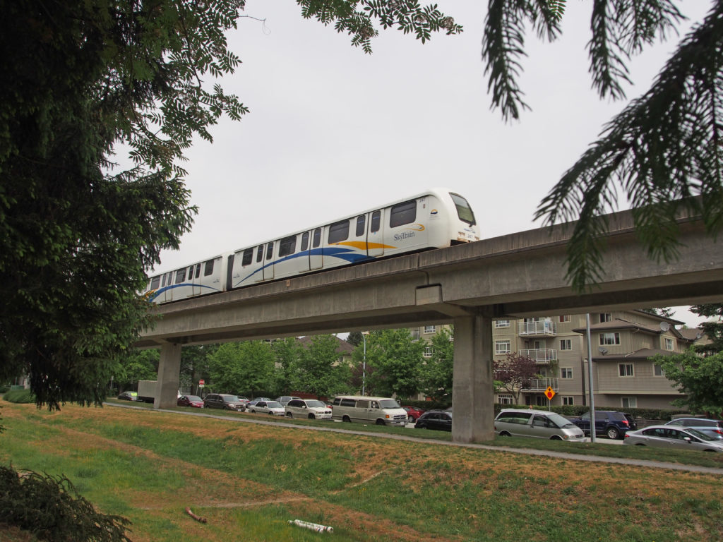
Expo 86 was the biggest event B.C. had ever seen in 1986. The World’s Fair drew twenty-two million visitors to the north side of False Creek over six months. The infrastructure contributions from Expo 86 include the SkyTrain Expo Line, Science World, BC Place Stadium, Canada Place and the Plaza of Nations.
North Vancouver is directly across the harbor from the downtown area. North Vancouver is a thriving deep sea port and richly scenic holiday area. Here you can ride a gondola car up Grouse Mountain, or drive nearly to the peak of Seymour, but offering spectacular viewing and skiing sites. You can hike forest trails and enjoy a thrilling walk across a suspension bridge in Capilano or Lynn Canyon Park. Park and Tilford Gardens is a beauty. Seaside fun is available at the beaches.
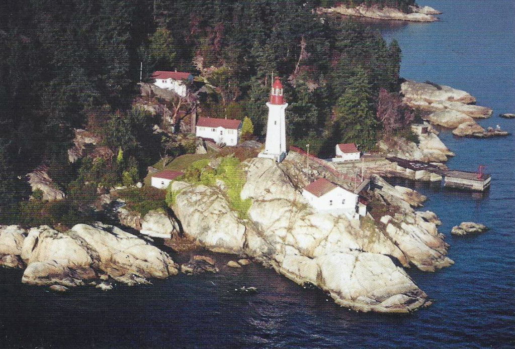
West Vancouver is also clustered along the base of the towering Rocky Mountains. At Lighthouse Park you can see some of the largest trees on the west coast of Canada. Horseshoe Bay is a famous salmon fishing center. Here is the terminal of the B.C. ferries.
Richmond is located on two major islands at the mouth of the Fraser and is connected with Vancouver by a network of highways and bridges. The flat, fertile delta lands yield rich crops of vegetables and berries. Richmond includes the fishing village of Steveston, the home of much of B.C.’s commercial fishing fleet in the early 1900s. Richmond is also the site of Vancouver’s international airport.
New Westminster is called the Royal City because Queen Victoria selected its name. New Westminster overlooks the Fraser River just east of Burnaby. Irving House is a Victorian residence with an adjoining museum. Adjacent to the City Hall is the Garden of Friendship, a beautiful Park dedicated to its sister city of Moriguchi, Japan.
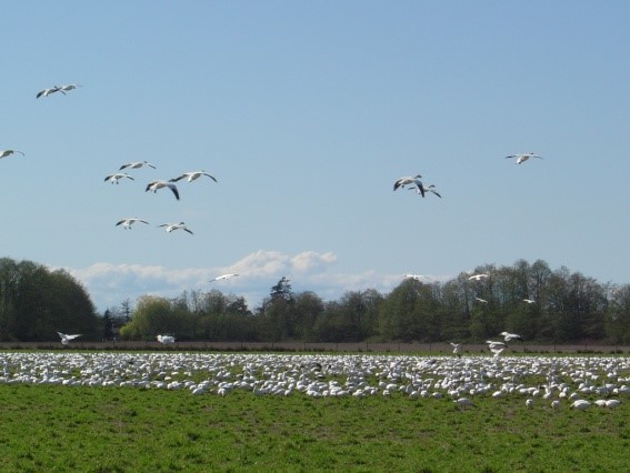
On Westham Island, to the south of Vancouver, is the George C. Reifel Waterfowl Refuge. White Rock is a town on a beautiful beach and is named for a huge rock landmark on the sands of Semiamhoo Bay. My Great Uncle Dick Todd lived in White Rock and we visited them there.
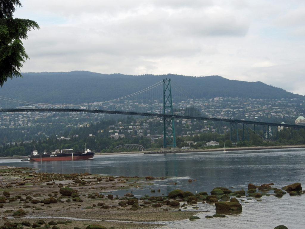
The towering North Shore Mountains which form a backdrop to the bustling city of Vancouver have beckoned outdoor recreationists for many years. Until the opening of the Lions Gate Bridge in 1939, a fleet of ferries transported hikers and skiers across Burrard Inlet on the first leg of their journey to Hollyburn Ridge, which is now part of Cypress Provincial Park. The park was established on October 9, 1975 and is 3,012 hectares in size. Bounded on the west by Howe Sound, on the north and east by the ridgetops of Mount Strachan and Hollyburn Mountain and to the south by West Vancouver, Cypress sits like a ship’s crows nest high above Vancouver.
On a clear day to the southeast snow-clad Mount Baker in the Cascade Mountain chain can be seen. To the west and southwest lie the Gulf Islands and Vancouver Island with Georgia Strait in the foreground. The diversity of natural features, old-growth trees and outdoor recreation opportunities both summer and winter, is due partly to the climate of coastal British Columbia. The average annual temperature of around 9-10 degrees Celsius (49-50° F) results in many warm days for hikers and sightseers. Cypress Mountain, was the official freestyle skiing & snowboard venue for the Vancouver 2010 Olympic winter games.
Harry and I drove north to Britannia Mines for a tour of a closed copper mine. We had lunch at Kahlina Restaurant opposite Shannon Falls on Highway 99, just south of Squamish, where The Royal Hudson is the last remaining steam locomotive in scheduled service in North America. Between May and September, the Royal Hudson steams along the breath-taking beauty of Howe Sound between North Vancouver and Squamish. Whistler is located 120 kilometers (75 miles) north of Vancouver. We enjoyed the scenic two-hour drive which winds around Howe Sound and close to the Coast Mountain range. Whistler, in the heart of the mountains, is very scenic.
On the return trip, we stopped at Brandywine Falls with a 211-foot drop, with 600 cubic feet of water per minute falling over the falls at the heaviest season in early summer. It got its name from the time when brandy and wine were bartered for guessing the height of the falls.