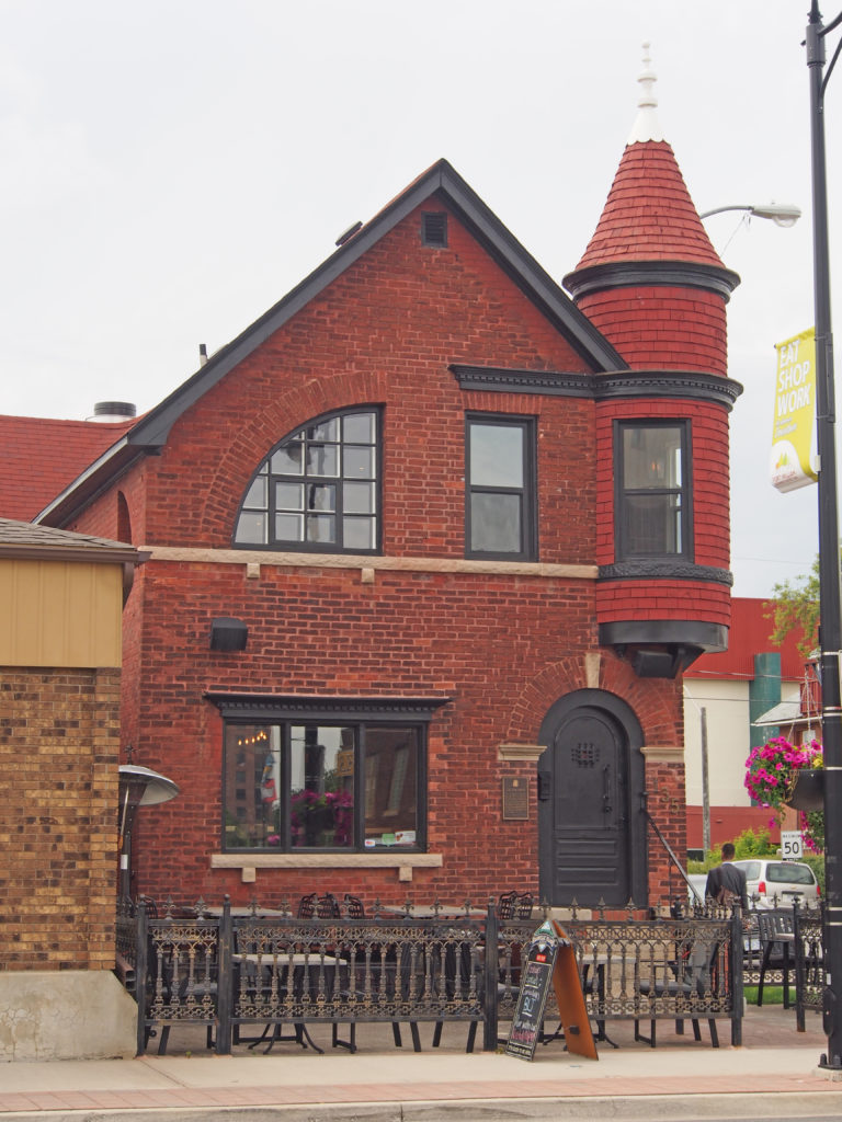
St. George, Ontario – Book 2 in Colour Photos – My Top 15 Picks
The County of Brant is located at the mid-point of the Grand River as it flows south from Luther Marsh to Lake Erie.
In 1852 the City of Brantford, the Village of Paris, and the Townships of Brantford, Oakland, Onondaga, South Dumfries, and Burford became Brant County.
Two hundred years ago, Obed Wilson ventured forth seeking an area in Upper Canada in which to settle. He discovered a place with fertile land, sparkling water and natural beauty which enticed him to stay and build a log cabin. Eventually the vision grew into the Village of St. George.
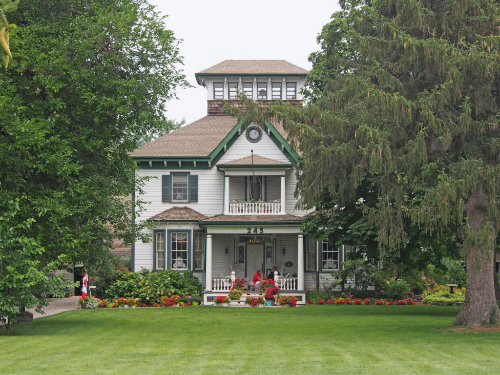
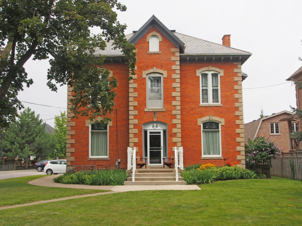
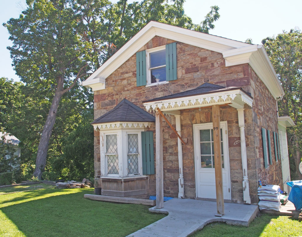
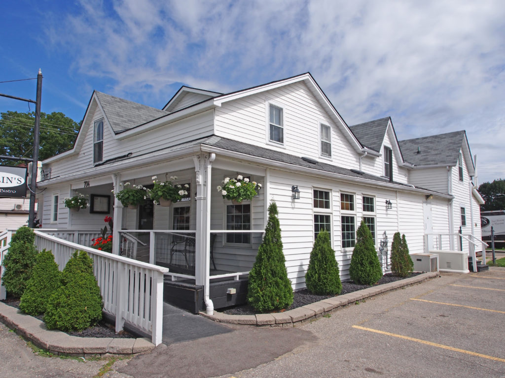
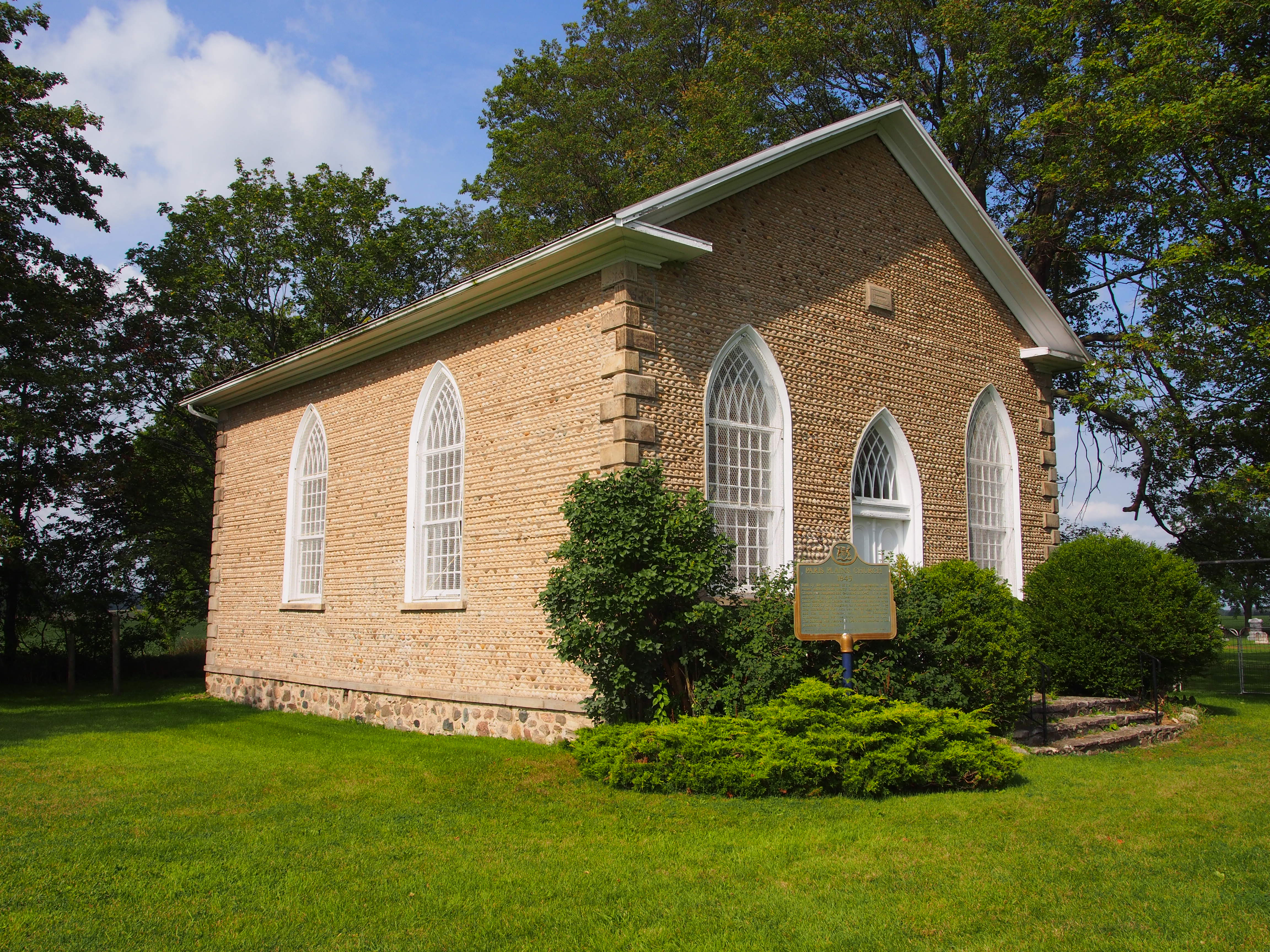
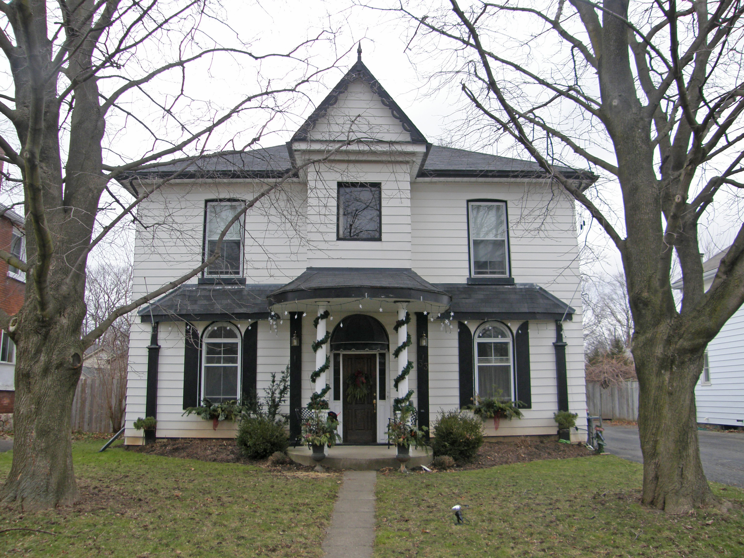
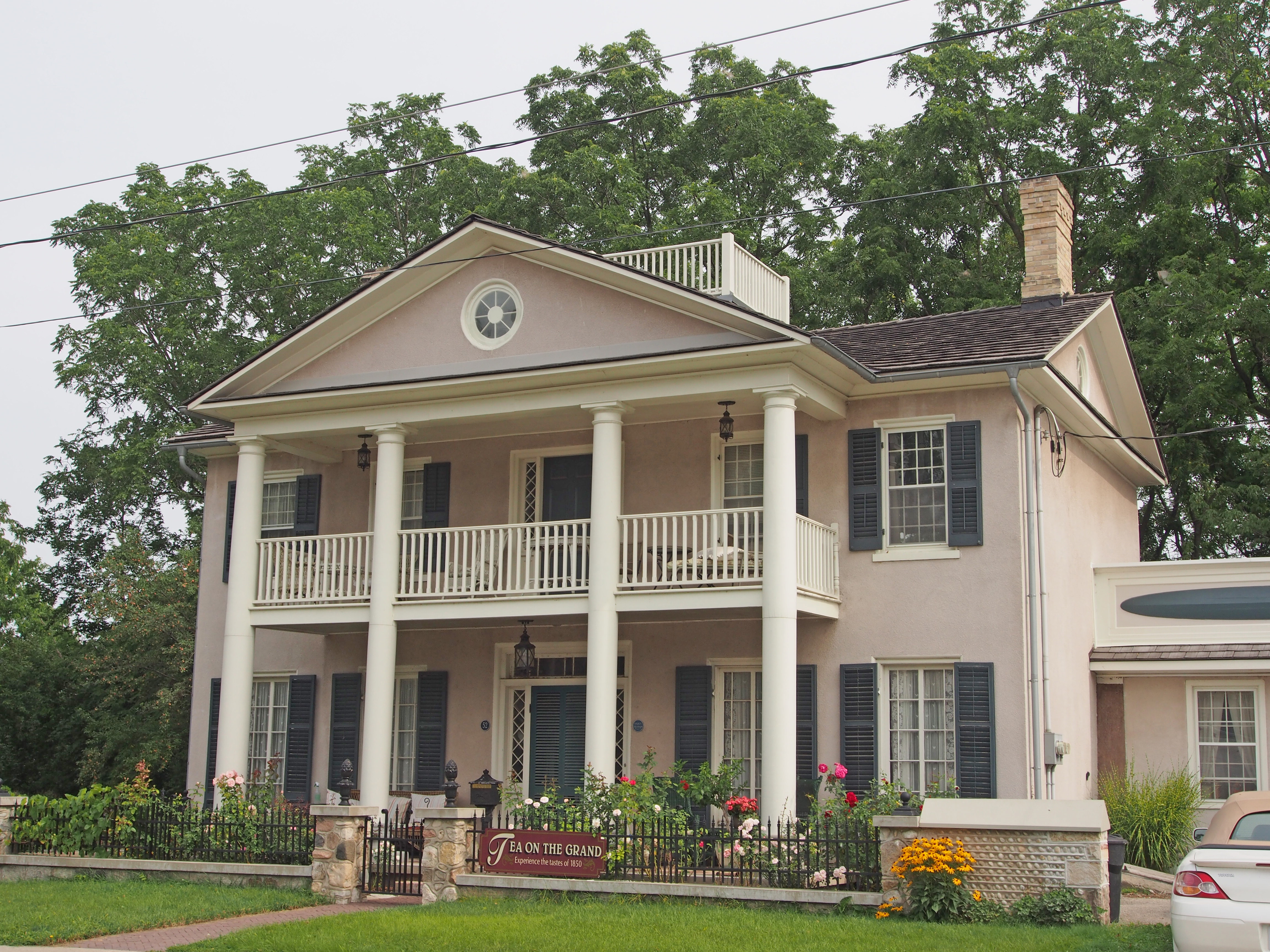
St. George, located to the north of the City of Brantford, is in the Township of South Dumfries. It was founded in 1814. John and Peter Bauslaugh were early settlers in St. George, and the early name of the village was “Bauslaugh Mills†in honor of John Bauslaugh who owned a sawmill near Highway 99. Main Street began to develop in the 1820s when Henry Moe began selling fish and dry goods from the first log building. By 1832, the village had three churches and several businesses. Today Main Street continues to thrive with many of the original buildings from the 1800s attracting people to the antique shops, cafes and restaurants.
The community around Bethel Road with Rest Acres Road to the east and Bishopsgate Road to the west was settled in the 1830s. The major industry in this area was farming. Some of its first settlers were the Gurneys, McAllisters (wagon maker), Aulsebrooks, Lovetts and Major Arnold Burrowes whose 1,000 acre estate was known as Strathmore. On his estate Major Burrowes constructed a mill dam, stock pens, hop mill, a distillery, a grist mill and a plaster mill.
The Township of Oakland includes the towns of Scotland and Oakland. It has a rich history.
Scotland is located on the Burford/Oakland township line. The village was surveyed and laid out by Eliakim Malcolm. The first hotel opened in 1830, the first story in 1837 and the first post office in 1855. Malcolm’s Creek had enough waterpower to sustain several industries such as a woolen mill, gristmill, tannery and foundry. Other early industries were a cooperage, a wagon and carriage works, carriage and buggy works and a starch factory. Two doctors and a lawyer practiced in Scotland in the mid-1800s.
The Village of Oakland is located three kilometers east of Scotland on the Oakland Road. Oakland was named for a ridge of oak trees that ran through it. In 1850, the first municipal office was at the Oakland Post Office. A town hall was built in 1854 and Council met there until the early 1900s. Oakland had a grist mill in 1806, saw mill in 1807, a cheese factory, cider mill, three general stores, a shoemaker, harness maker, and a hotel.
Oakland is the site of the Battle of Malcolm Mills which was the last land battle of the War of 1812 on Canadian soil against an official foreign power. The battle took place at the stream that runs through Lion’s Park. In October 1814, an invading American force of about seven hundred men under Brigadier-General Duncan McArthur advanced rapidly up the Thames Valley. He intended to devastate the Grand River settlements and the region around the head of Lake Ontario, which supplied British forces on the Niagara Frontier. McArthur reached the Grand, and after an unsuccessful attempt to force a crossing, attacked a body of about one hundred and fifty militia at Malcom’s Mills (Oakland) on November 6th. Canadian forces put up a spirited resistance but were overwhelmed.
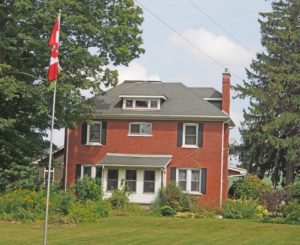
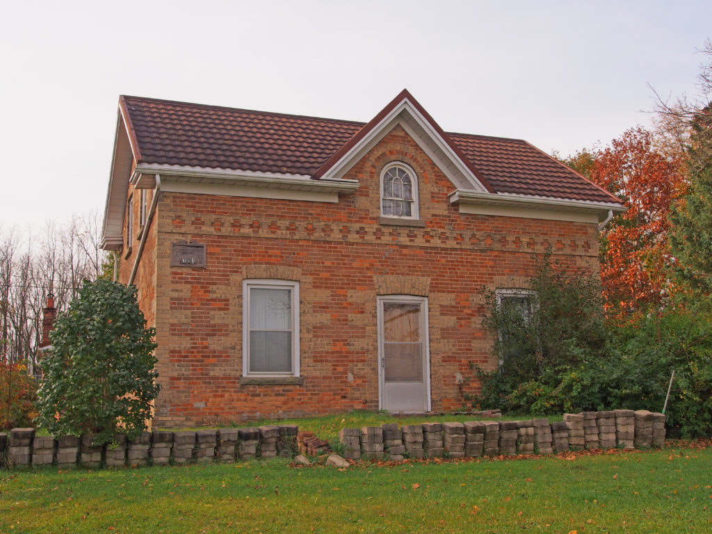
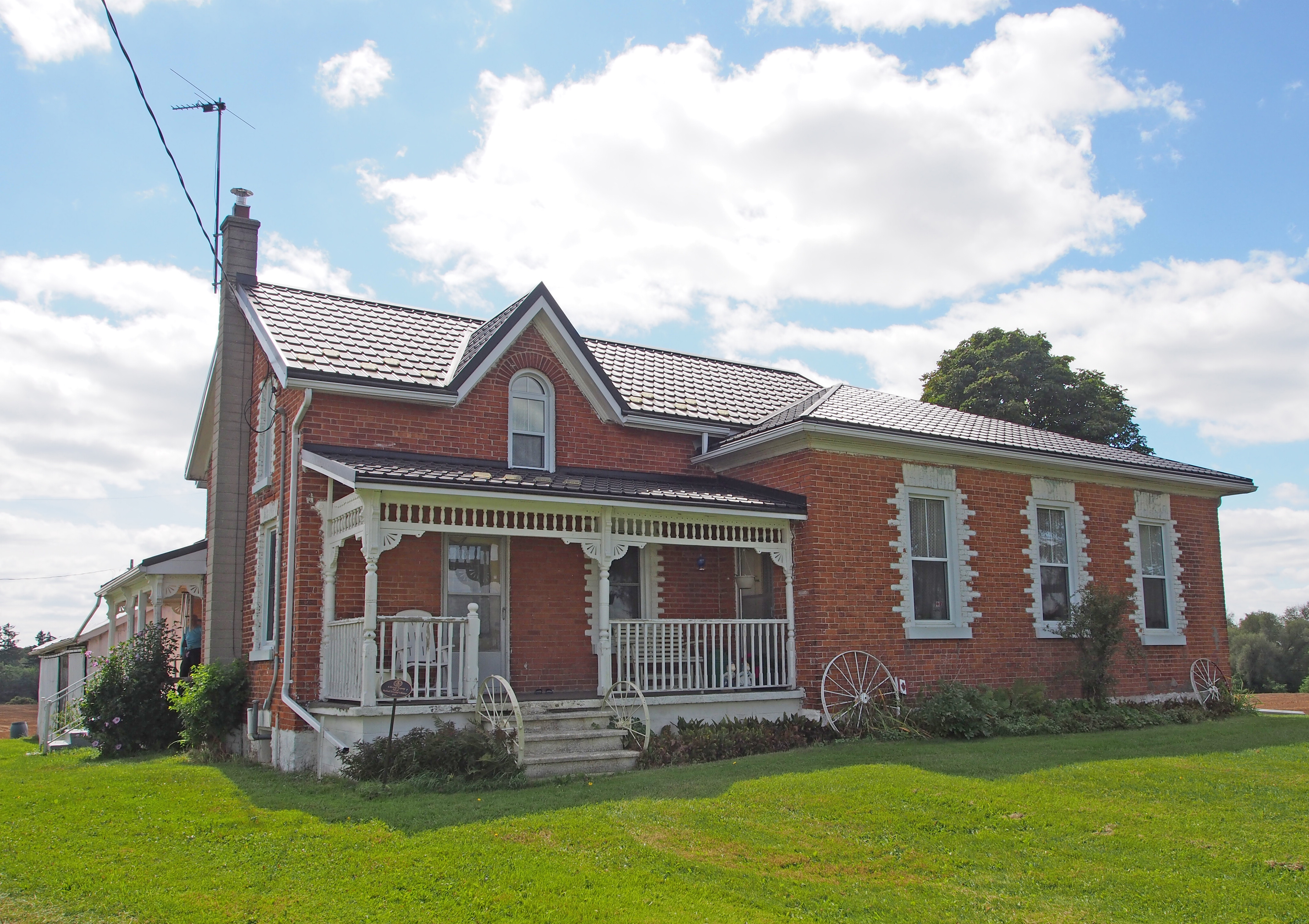
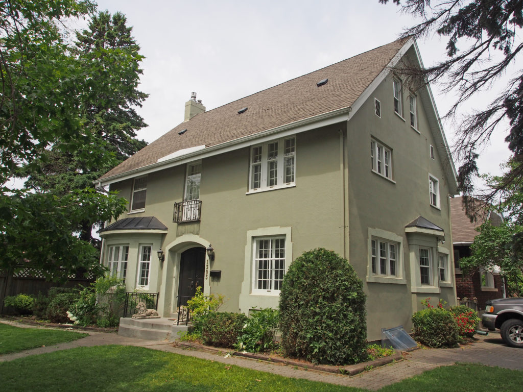
356 St. George Road – hipped roof with dormers
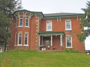
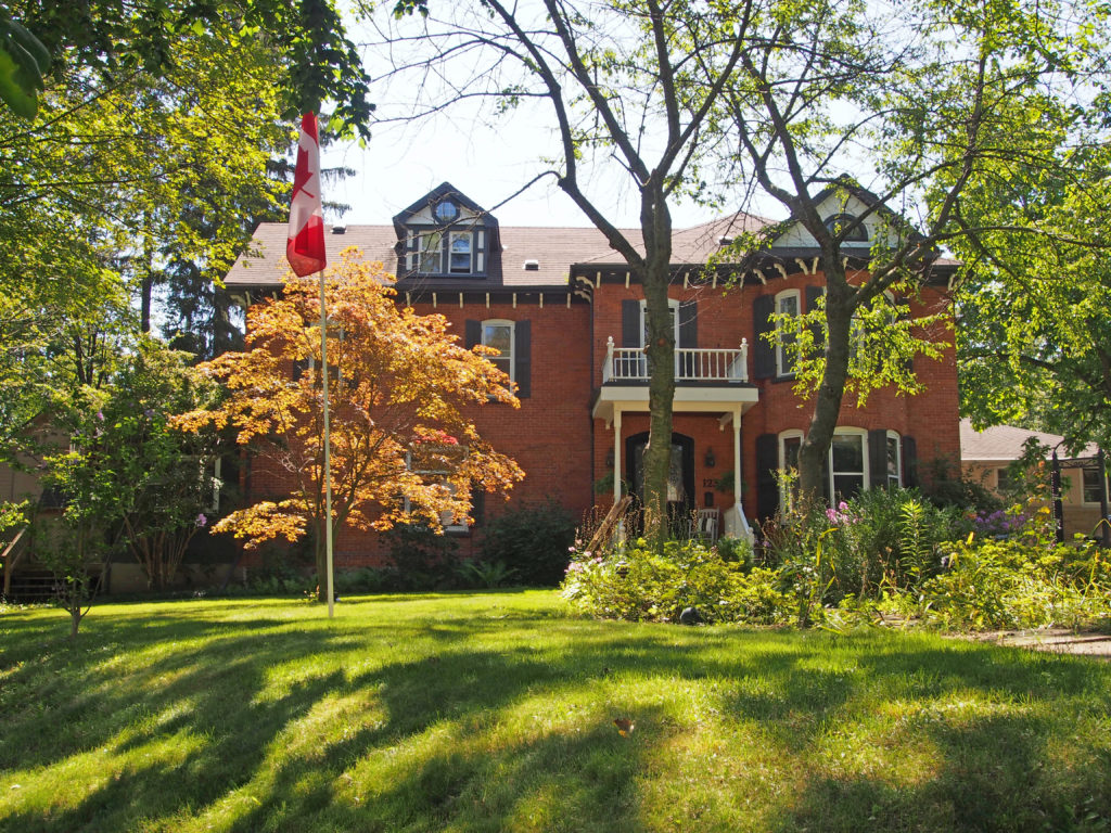
125 McLean School Road – Italianate, cornice brackets, two-storey bay window, corner quoins
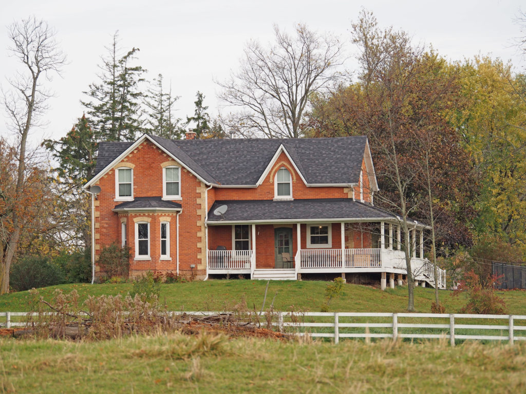
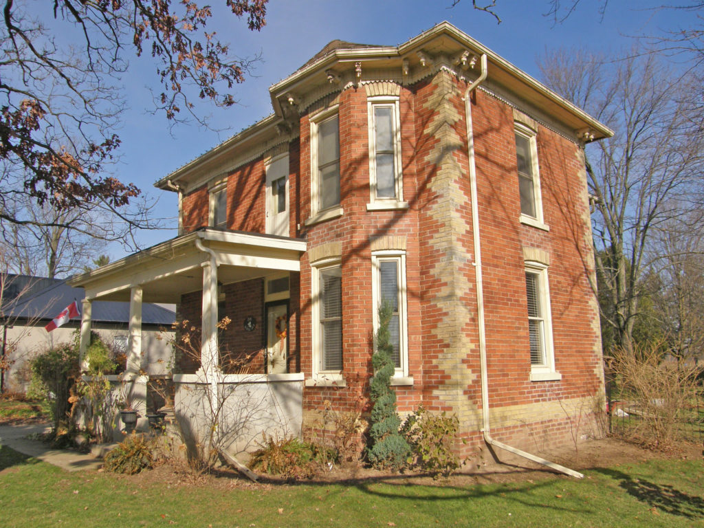
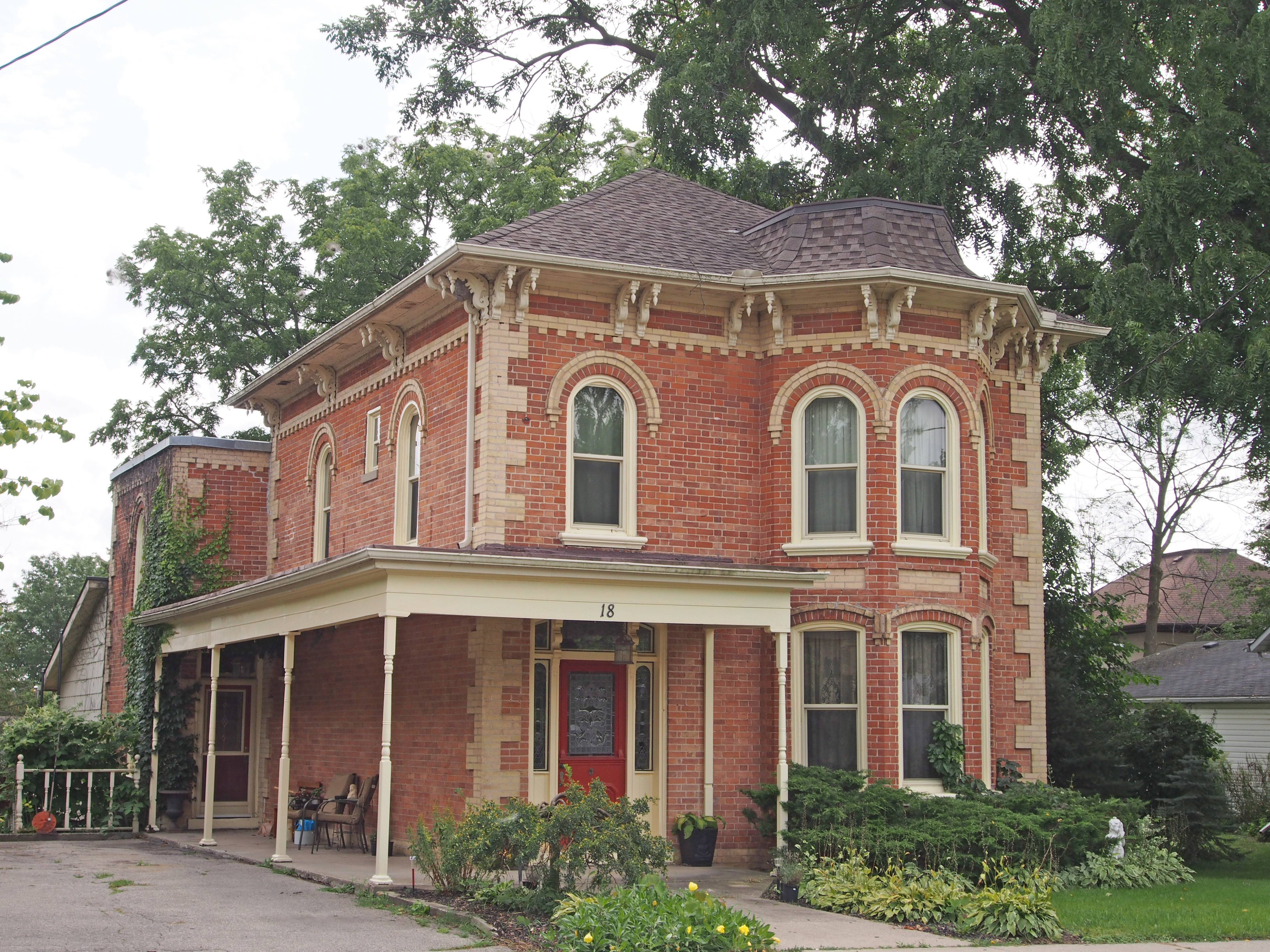
86 McLean School Road – Smith I. Wait House – circa 1875 – High Victorian and Italianate – three layers of brick for the main part of the house and a two-feet thick stone foundation – cornice brackets, corner quoins, bay window
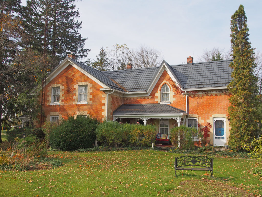
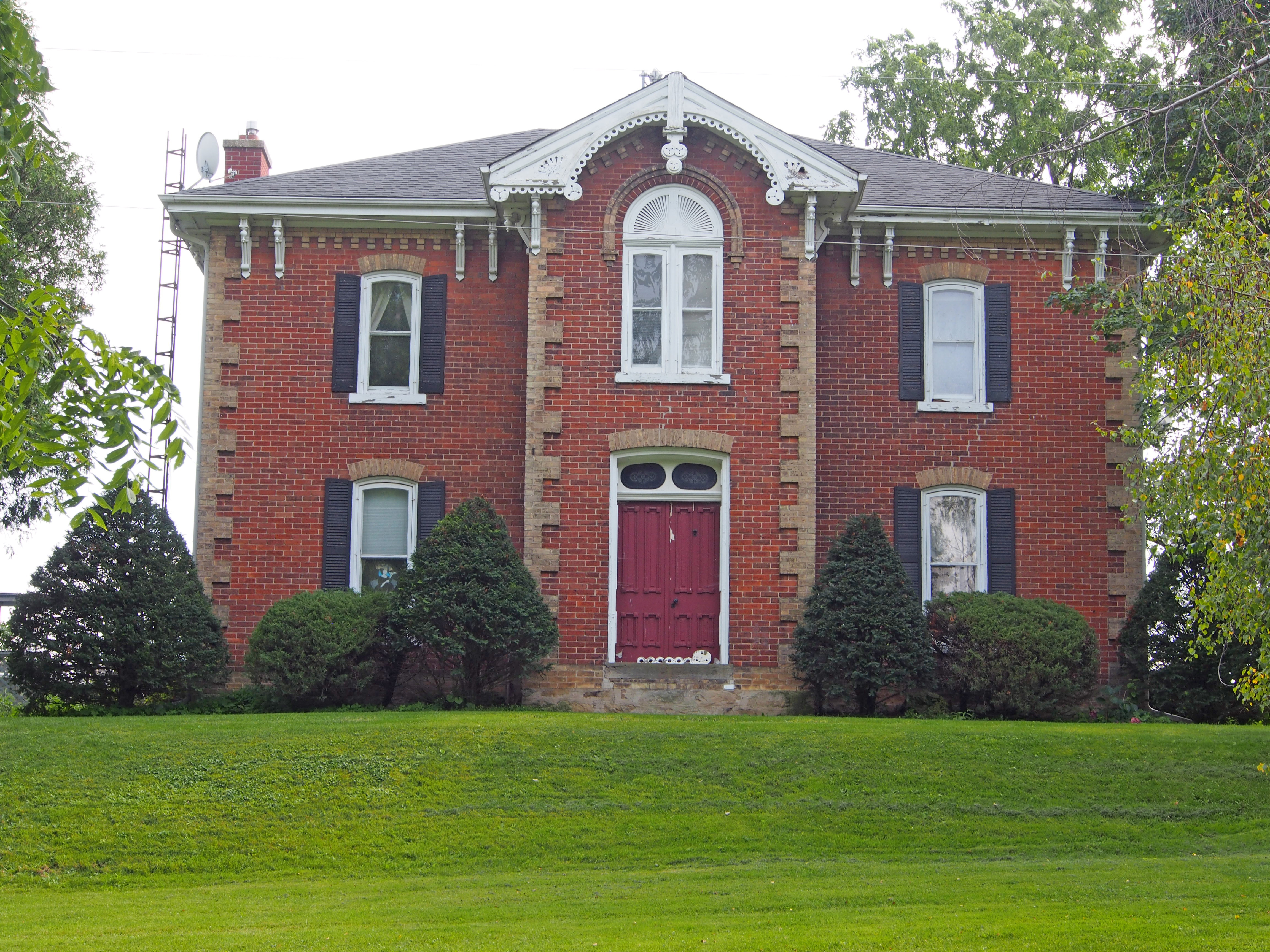
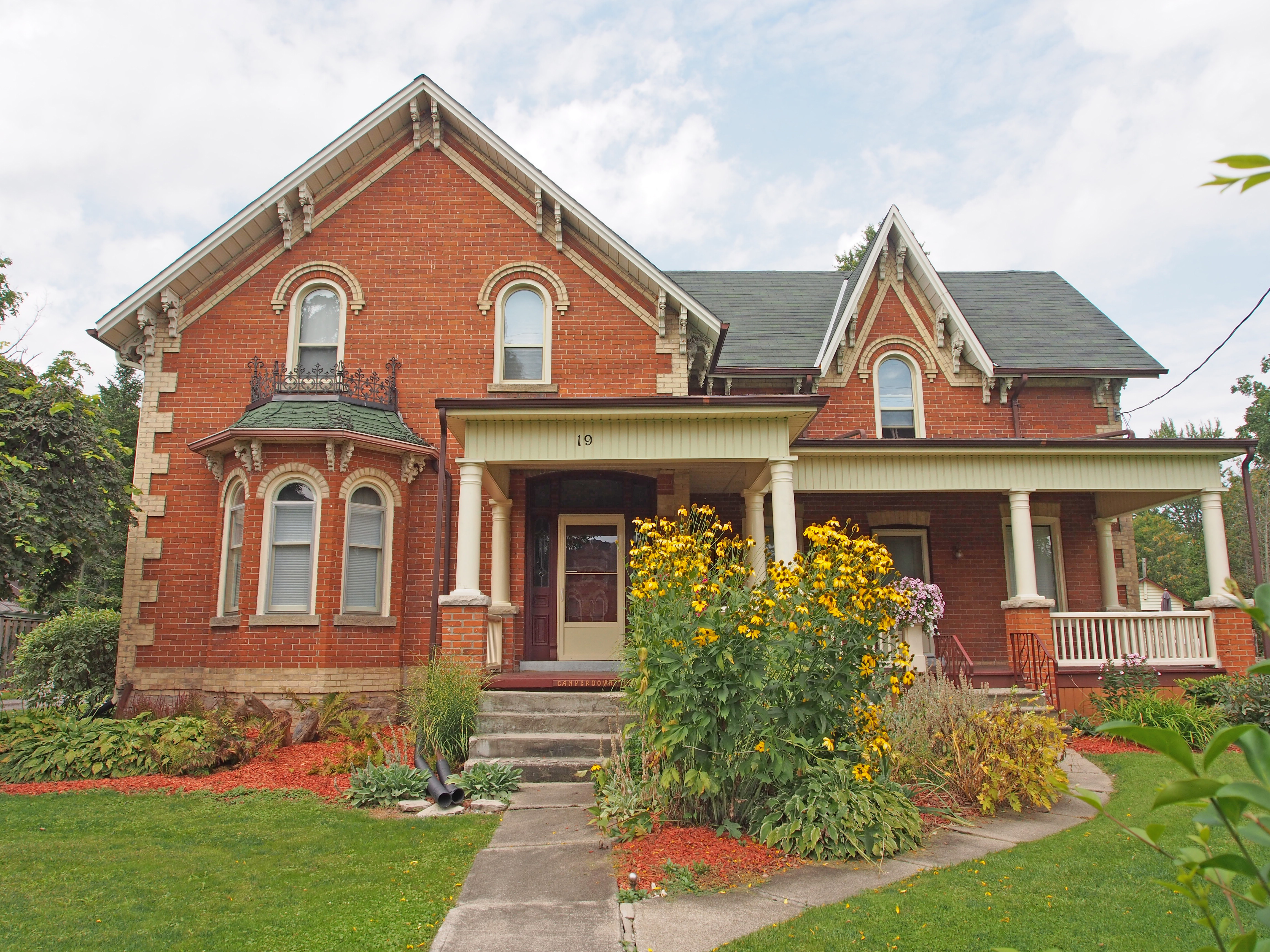
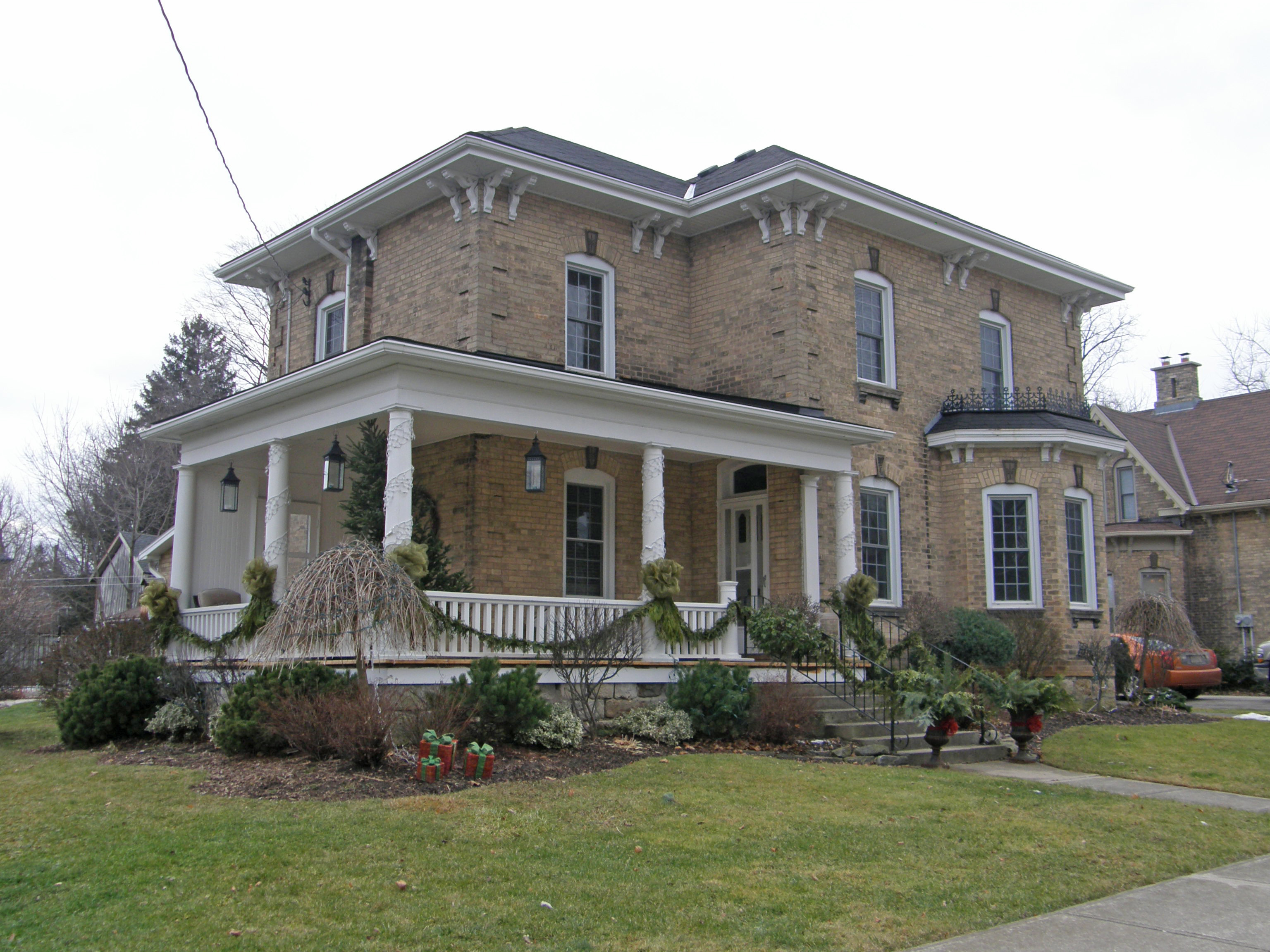
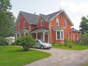
380 Branchton Road – Mayhill Villa/Lewis C. Cope Residence – circa 1867 – Italianate – half-round windows, two sets of original compound chimneys, hipped roof, paired cornice brackets, corner quoins; etched stained glass in the fanlight and sidelights provide an attractive entry
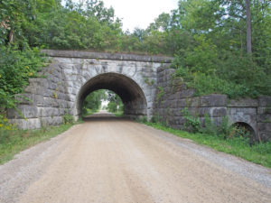
Glen Morris Road East – cut stone railway bridge constructed in 1854 by the Great Western Railway Company over Glen Morris Road East to link Harrisburg with Galt. It is a beautiful example of masonry work with its double arches with keystones which allow both the road and stream to pass under it.

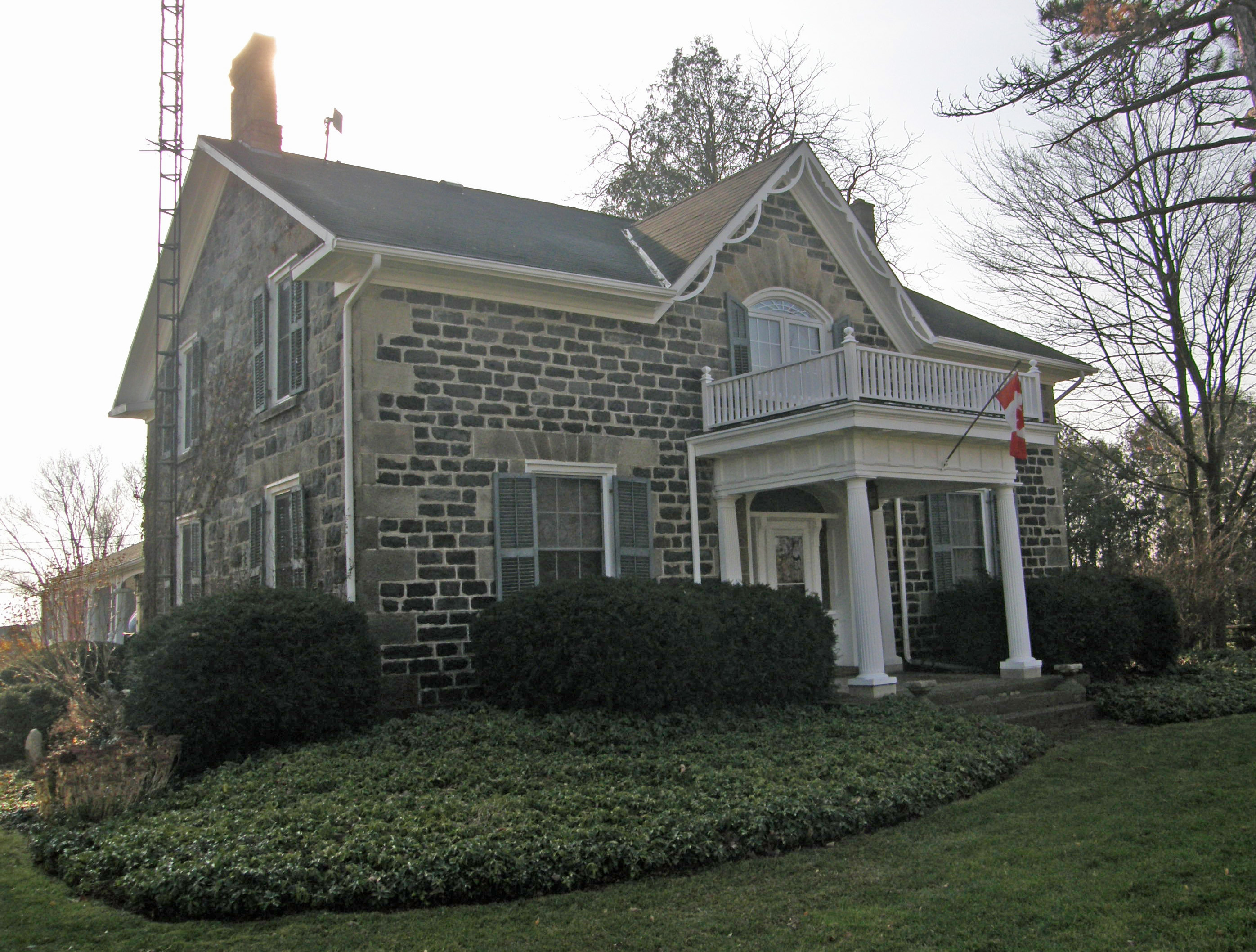
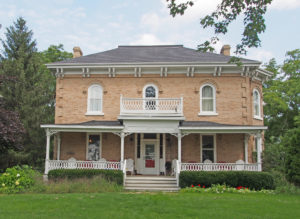
254 Glen Morris Road East – Italianate – two-storey frontispiece, verge board trim and finial on gable, cornice brackets, corner quoins, dentil molding, fanlight
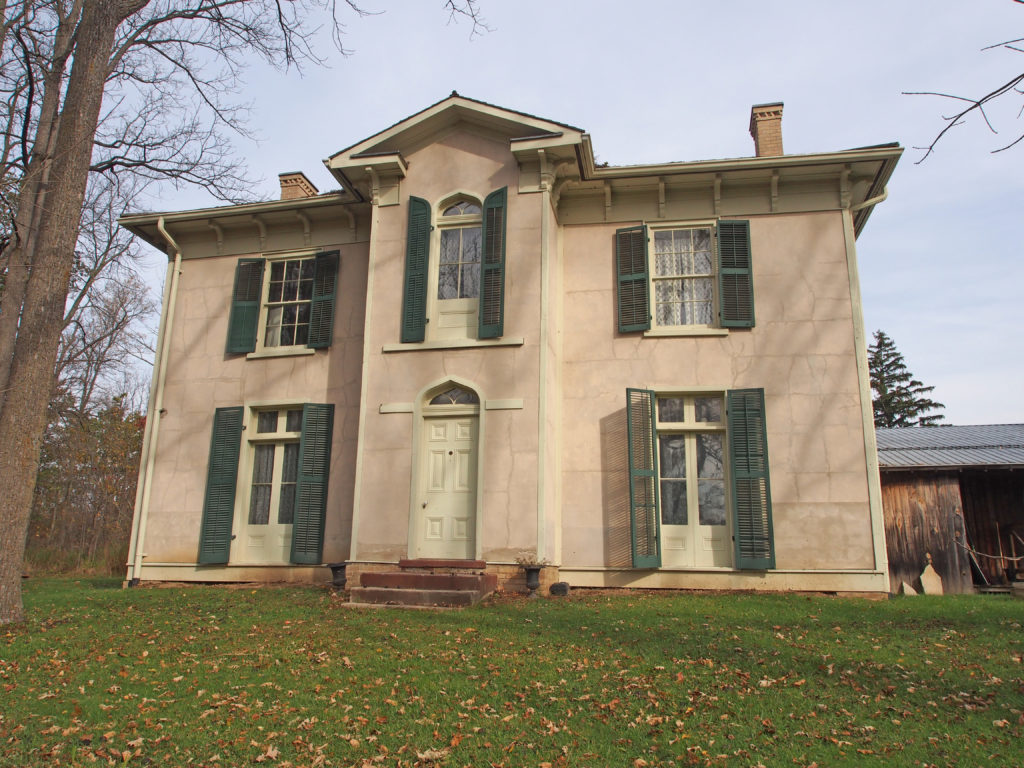
359 Regional Road 35 (Blue Lake Road) – circa 1830 – Neo-Gothic style farmhouse – Adelaide Hoodless was born here in St. George, the youngest of twelve children. Her father died a few months after her birth. Her mother, Jane Hamilton Hunter, was left to manage the farm and a large household. Perhaps the hard work and isolation of her youth inspired Adelaide to take up the cause of domestic reform years later. After her schooling in a one-room schoolhouse, she stayed with her sister Lizzie while attending ‘Ladies College’ in Brantford, Ontario. While there, she met John Hoodless who was also the close friend of her sister Lizzie’s future husband, Seth Charlton. John Hoodless was the only surviving son of a successful Hamilton furniture manufacturer (Joseph Hoodless). Adelaide married John Hoodless and moved to Hamilton. Adelaide and John had four children: Edna, Muriel, Bernard and John Harold.
Bethel Road – Gothic – verge board trim on gable
Bethel Road – multi-colored stone
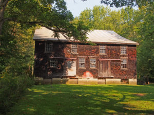
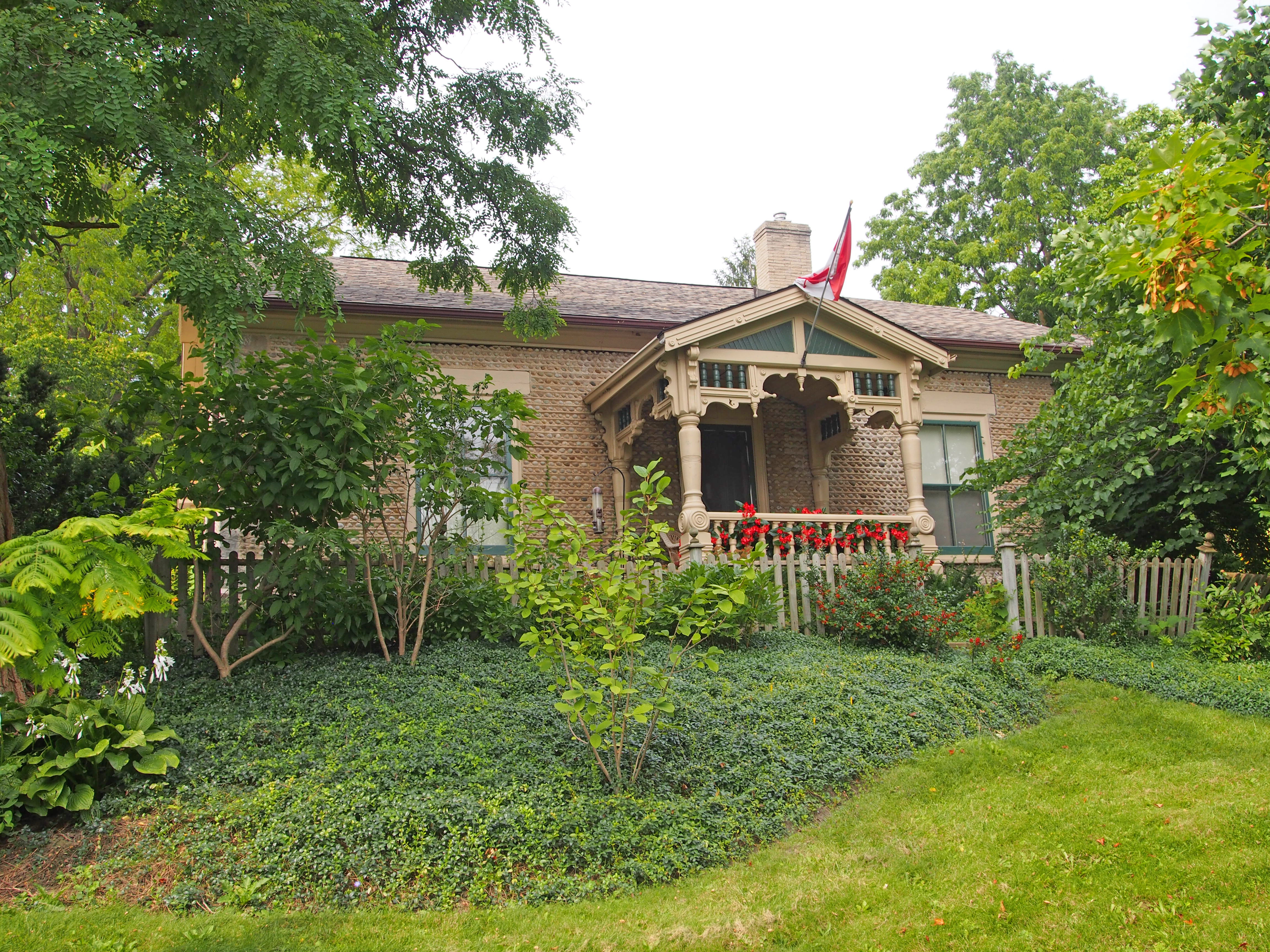
308 Robinson Road – Apps Mill – 1846 – The Apps family operated it as a flour mill using Whiteman Creek for power until 1959 when hurricane Hazel flooded the entire bottom floor. It has horizontal wood siding and six over six windows.
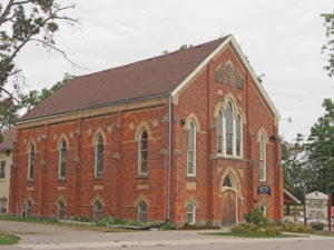
154 Oakland Road – Oakland United Church – (Methodist Church – 1886) – Gothic Revival, lancet windows, dichromatic brickwork, buttresses

129 Oakland Road, Oakland – Built by Mordecai Westbrook, a member of one of the original families of Oakland. Georgian style with original double hung six over six windows and shutters. The walls are triple-bricked with bricks said to have been made on site. The widow’s walk and rear stone coach house are both original.
Oakland Road, Oakland, Ontario
Oakland Road, Scotland – dichromatic brickwork

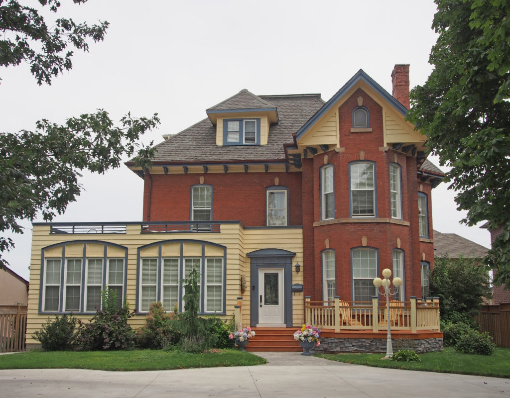
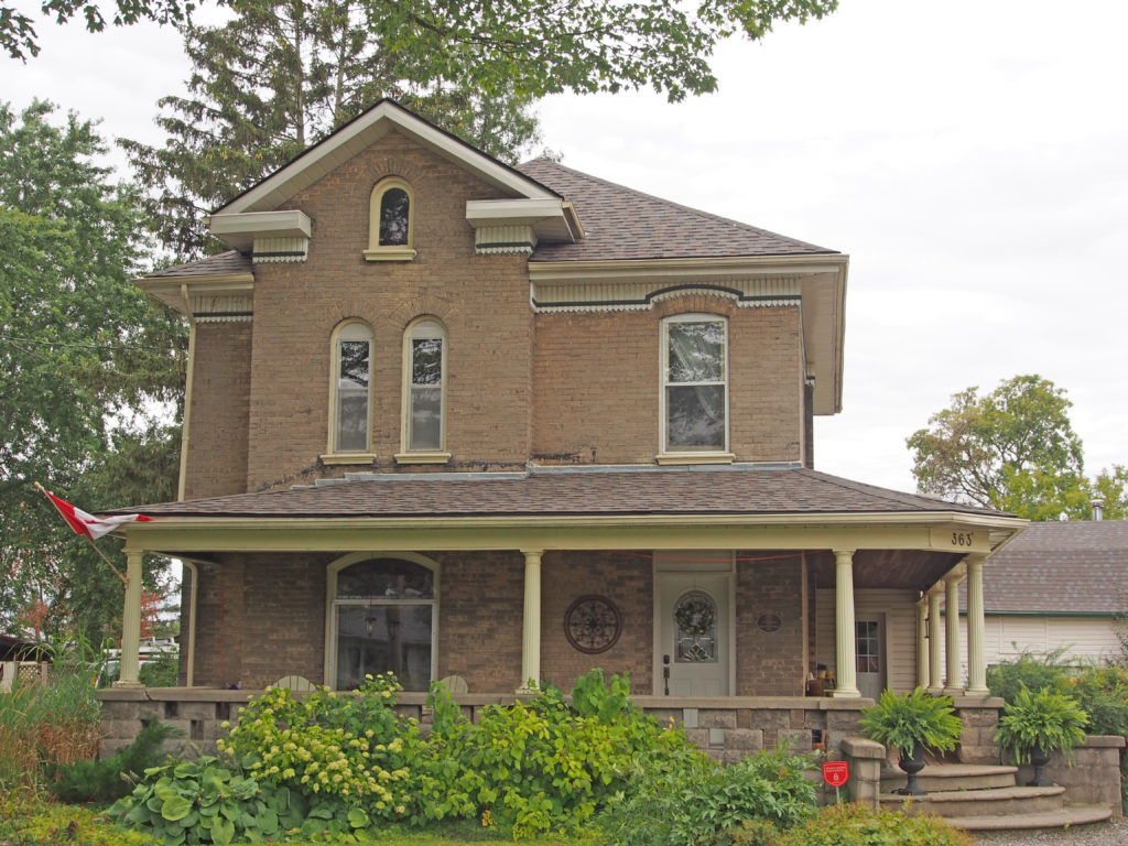
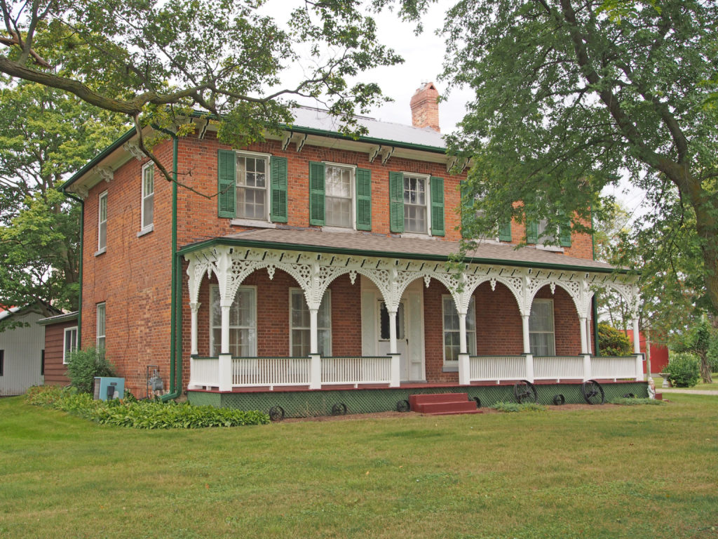
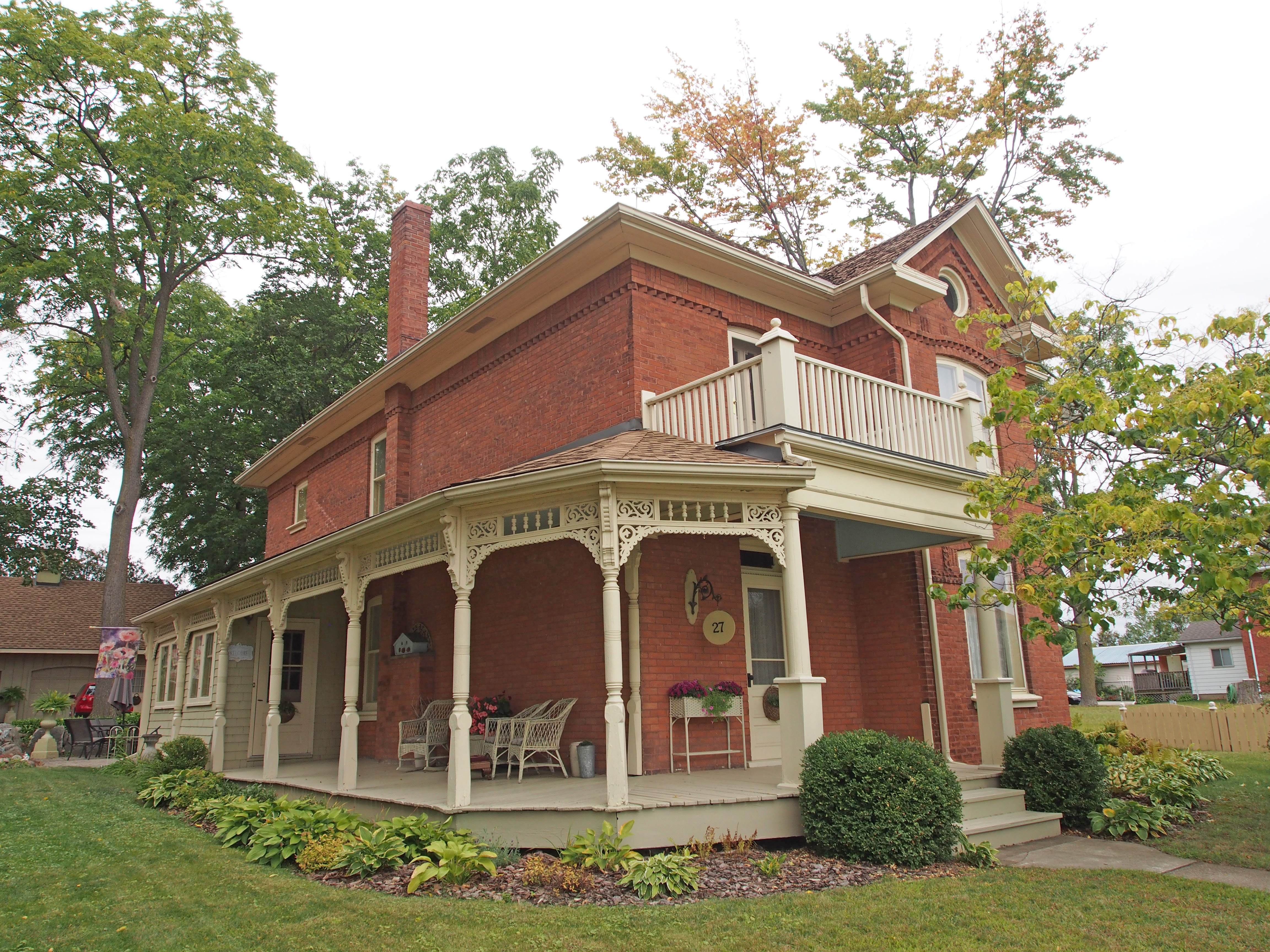
27 Talbot Street – 1890 – is an early Queen Anne style featuring a wraparound veranda with elaborate scroll work, spool work and patterned brick work with a string course at the frieze. Rusticated brick is used to ornament the principal window drip mold. Cornice return around the dormer bulls-eye window.