The Exchange District is in
downtown Winnipeg just north of Portage and Main. It derives its name from the
Winnipeg Grain Exchange, the center of the grain exchange in Canada. The
Exchange District is the historic center of commerce in Western Canada. The District
developed from the banks of the Red River at the foot of Bannatyne and Dermot
Avenues. Most commercial traffic came along the Red River from St. Paul,
Minnesota where the nearest rail line passed. Goods were shipped to Winnipeg by
steamer during high water in spring.
The Canadian Pacific Railway
built its transcontinental line through Winnipeg which arrived in 1881. Thousands
of settlers came west from Europe and Eastern Canada to farm the land. Winnipeg
business developed quickly to meet the needs of the growing western population.
The Winnipeg Grain and Produce Exchange was founded in 1887 and within a few
years Winnipeg was one of the world’s fastest-growing grain centers. Winnipeg
was also one of the largest rail centers in North America with twelve lines
passing through the city by 1890 and there were over eighty wholesale
businesses located in the District. Wholesale goods were shipped in from Lake
Superior ports in the spring and grain was shipped out from Winnipeg to the
Lakehead in the fall. The Exchange represented Canada throughout the world and
it largely financed Winnipeg’s growth. Together with a strong world economy
supported by an increase in gold reserves, the Exchange attracted many British
and Eastern Canadian banks, trust, insurance and mortgage companies to the
District to do business.
Through the Winnipeg Grain
Exchange, the city was linked to other major financial centers of London,
Liverpool, New York and Chicago. Most Canadian financial institutions
established their Western Canadian headquarters in Winnipeg and by 1910 there
were almost twenty banking halls and offices on Main Street between City Hall
and Portage Avenue. Many Winnipeg-based financial companies were also
established.
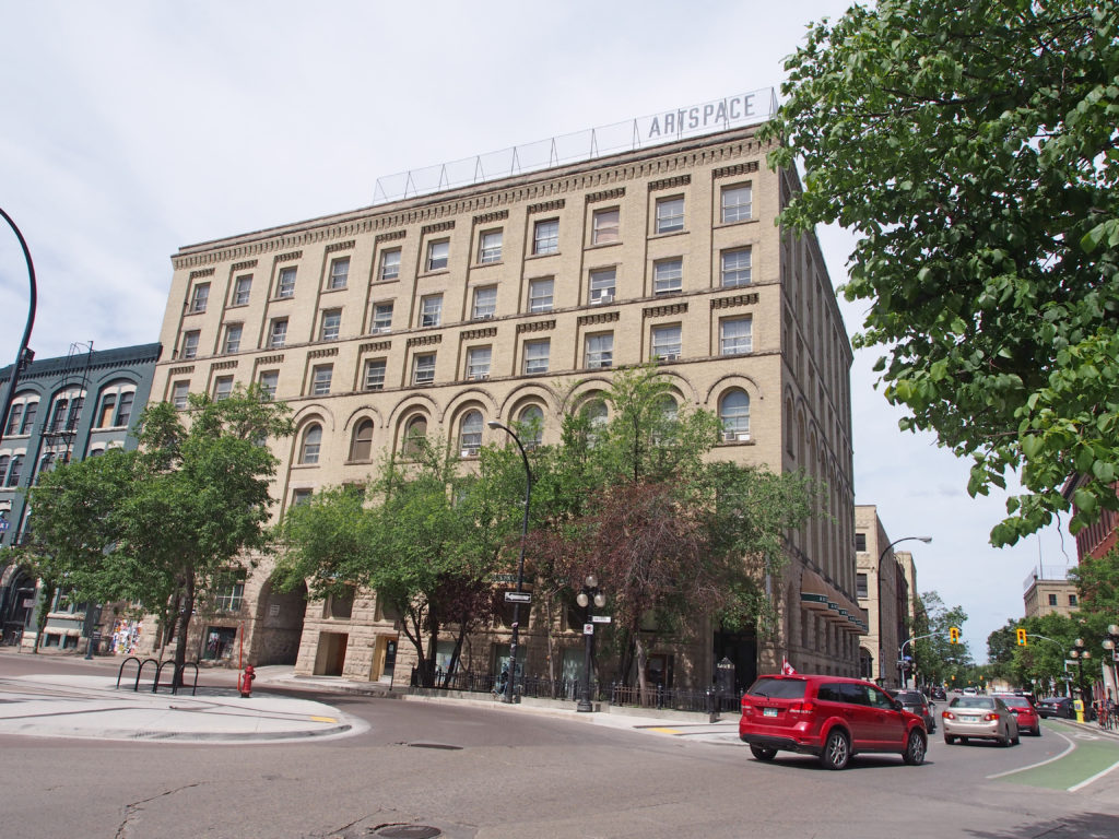
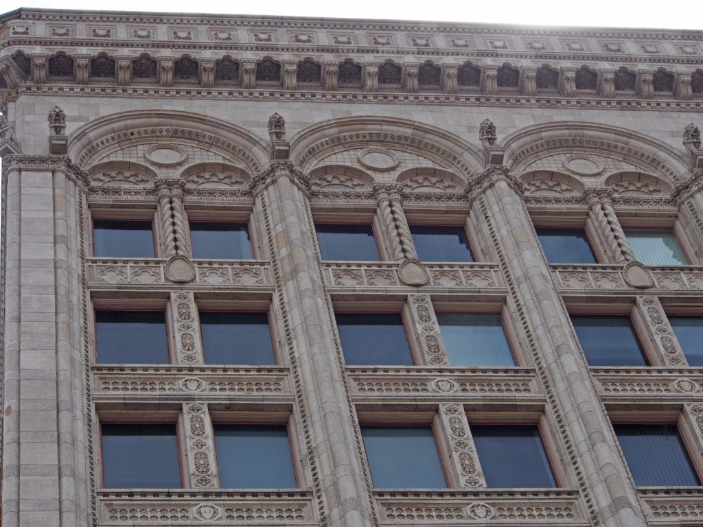
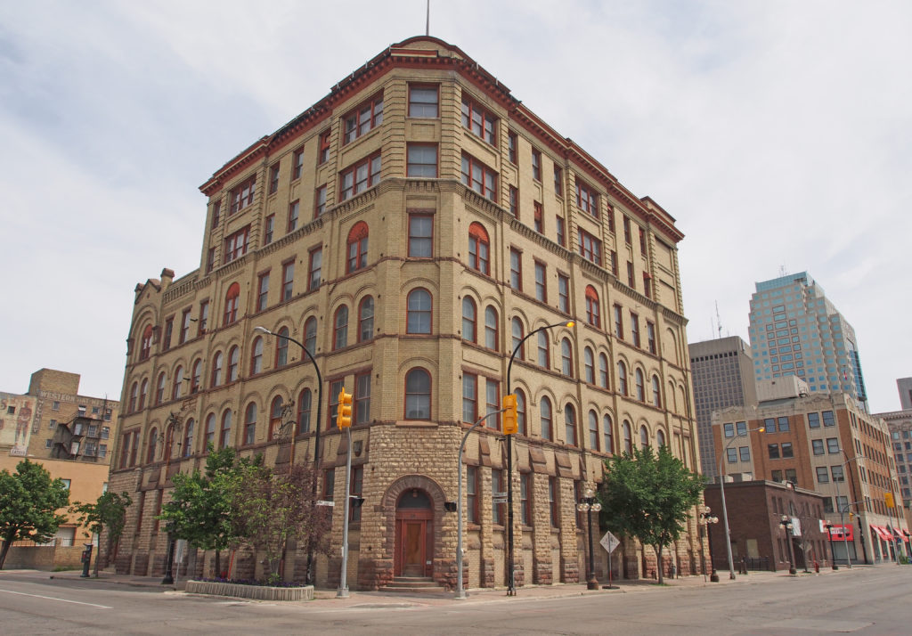
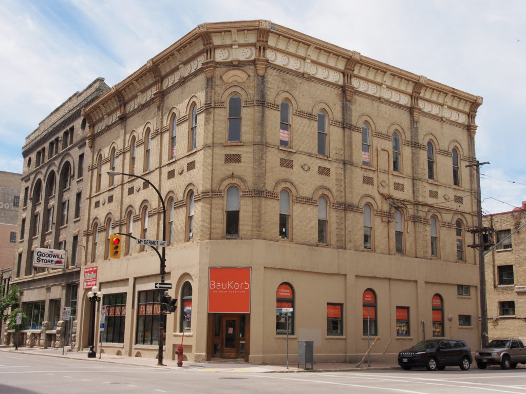
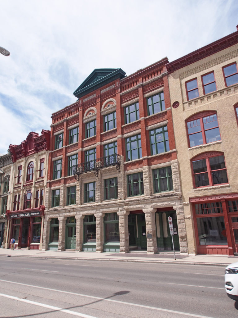
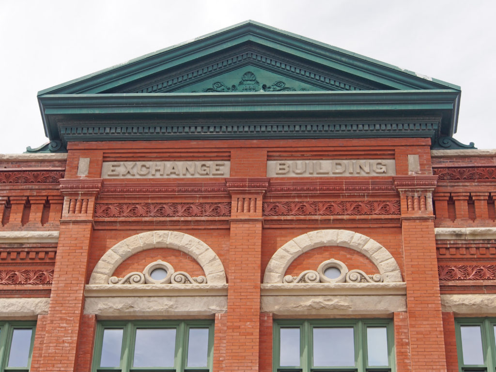
Some of the finest warehouses in North America based on an American Romanesque style can be found in Winnipeg. The Romanesque warehouses are typically of heavy wood post and beam construction with foundations of large rough-faced stone blocks set with deep, recessed joints (called rustication) and brick walls with piers and stone spandrels to support heavy loads. The Romanesque or round-head arch is used in the tunnels through the buildings which provided for protected loading and unloading of goods within, and in the large windows which provided natural light to the interior before electric light was affordable. At the turn of the century, Chicago was the center of North American architecture. Louis Sullivan developed the first steel frame and reinforced concrete buildings. Sullivan used stone and terracotta on the exterior, suspended by metal shelves bolted to the frame. He favored terracotta with simple details which complimented rather than completely covered the surface as in earlier heavily-detailed styles. John D. Atchison was the foremost Chicago School architect in the city.
‘The Gateway to the West’ and ‘The Chicago of the North’ were two of the phrases used to describe Winnipeg’s future in the heady days of the late nineteenth century. Especially important in Winnipeg’s phenomenal growth was its role as middleman between eastern Canadian manufacturers and their new markets in what would become Alberta and Saskatchewan. As waves of homesteaders from central Canada and many European countries poured into Canada’s prairies, dry goods, hardware and groceries all became increasingly important for the consumers, the manufacturers and Winnipeg’s warehouse men and wholesalers, and it became increasingly important for Winnipeg’s wholesalers to have railway connections both to receive raw materials and stock and to ship goods to western markets.
Branch railway lines or spur lines, built to service the wholesalers
were first constructed on the west side of Main Street near City Hall in the
1870s and 1880s. The warehouse district area grew rapidly, and Winnipeg
hardware merchant J.H. Ashdown negotiated a spur line of the Winnipeg Transfer
Railway in 1895 through the area immediately east of City Hall and Main Street.
This line ran up the middle of the land between Bannatyne and Market Avenues
and it was here that Ashdown built his large warehouse (157-179 Bannatyne
Avenue) in 1896.
The Exchange District is a well-established and vibrant neighborhood in
Winnipeg. It features a large and well-preserved collection of heritage
buildings which include huge stone and brick warehouses, elegant
terracotta-clad buildings, narrow angled streets and cobblestone paths. The
Exchange District is an arts and cultural hub which features a thriving film,
arts and music scene with many studios, art spaces, festivals and events.
The Exchange District is in
downtown Winnipeg just north of Portage and Main. It derives its name from the
Winnipeg Grain Exchange, the center of the grain exchange in Canada. The
Exchange District is the historic center of commerce in Western Canada. The
District developed from the banks of the Red River at the foot of Bannatyne and
Dermot Avenues. Most commercial traffic came along the Red River from St. Paul,
Minnesota where the nearest rail line passed. Goods were shipped to Winnipeg by
steamer during high water in spring.
The Canadian Pacific Railway
built its transcontinental line through Winnipeg which arrived in 1881. Thousands
of settlers came west from Europe and Eastern Canada to farm the land. Winnipeg
business developed quickly to meet the needs of the growing western population.
The Winnipeg Grain and Produce Exchange was founded in 1887 and within a few
years Winnipeg was one of the world’s fastest-growing grain centers. Winnipeg
was also one of the largest rail centers in North America with twelve lines
passing through the city by 1890 and there were over eighty wholesale
businesses located in the District. Wholesale goods were shipped in from Lake
Superior ports in the spring and grain was shipped out from Winnipeg to the
Lakehead in the fall. The Exchange represented Canada throughout the world and
it largely financed Winnipeg’s growth. Together with a strong world economy
supported by an increase in gold reserves, the Exchange attracted many British
and Eastern Canadian banks, trust, insurance and mortgage companies to the
District to do business.
Through the Winnipeg Grain
Exchange, the city was linked to other major financial centers of London, Liverpool,
New York and Chicago. Most Canadian financial institutions established their
Western Canadian headquarters in Winnipeg and by 1910 there were almost twenty
banking halls and offices on Main Street between City Hall and Portage Avenue.
Many Winnipeg-based financial companies were also established.
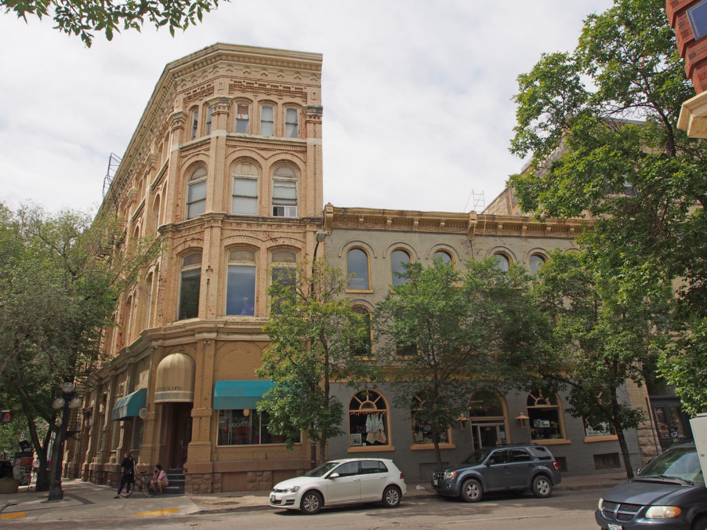
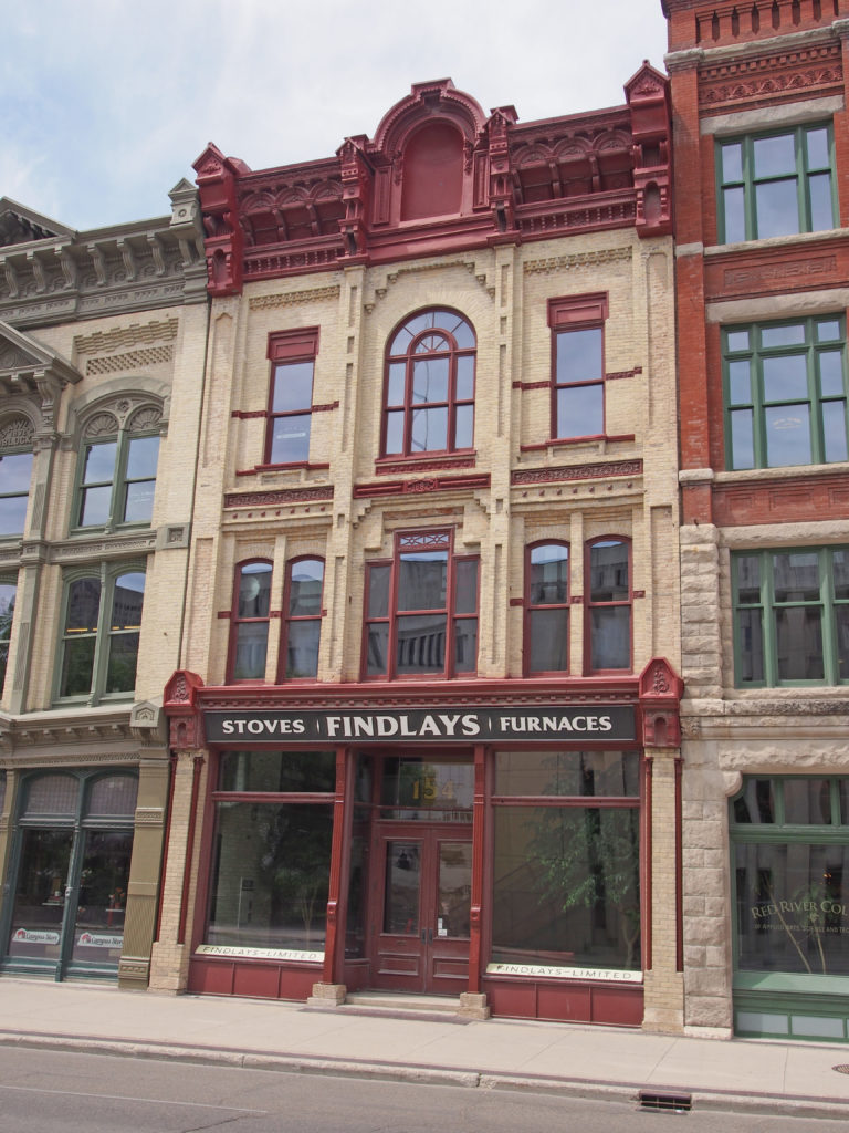
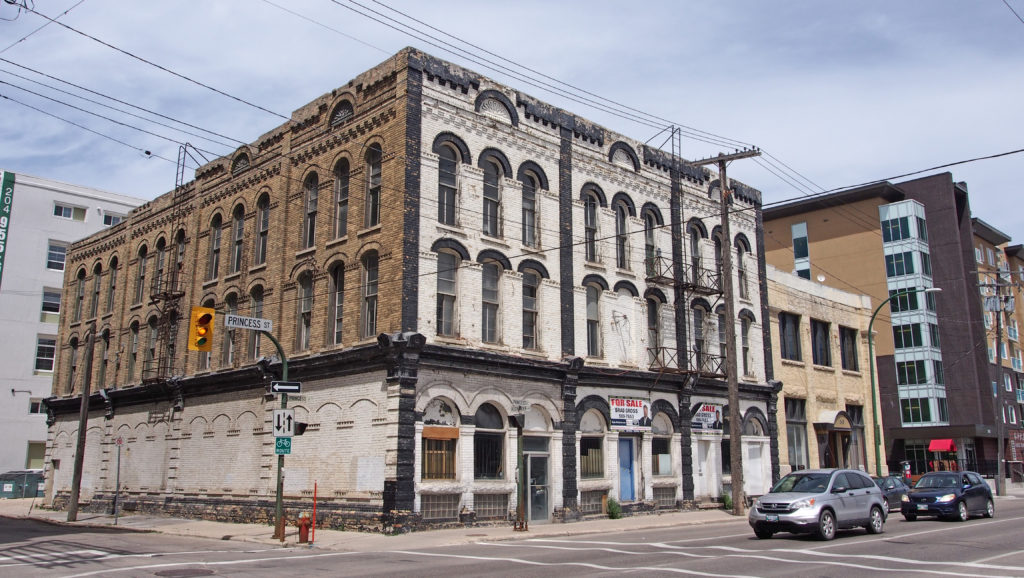
Most Victorian buildings in
Winnipeg were later replaced by larger structures that would serve its
expanding businesses. The Victorian grouping on Princess Street is one of the
best examples of such buildings in Winnipeg while others can be found on Main
Street north of the District. Many Victorian buildings are Italianate in style
and are constructed of heavy wood post and beam (some including fireproof iron
columns) with heavily detailed masonry load-bearing walls, variously arched
windows and metal or corbelled brick cornices.
Some of the finest warehouses in
North America based on an American Romanesque style can be found in Winnipeg.
The Romanesque warehouses are typically of heavy wood post and beam construction
with foundations of large rough-faced stone blocks set with deep, recessed
joints (called rustication) and brick walls with piers and stone spandrels to
support heavy loads. The Romanesque or round-head arch is used in the tunnels
through the buildings which provided for protected loading and unloading of
goods within, and in the large windows which provided natural light to the
interior before electric light was affordable.
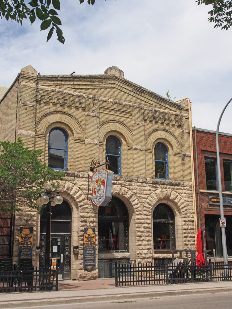
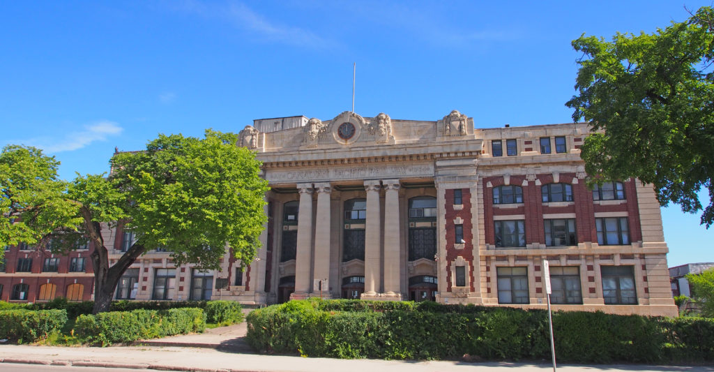
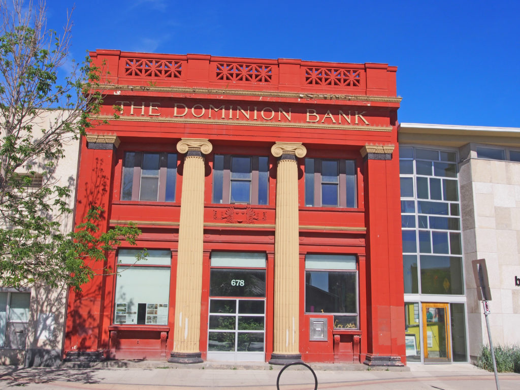
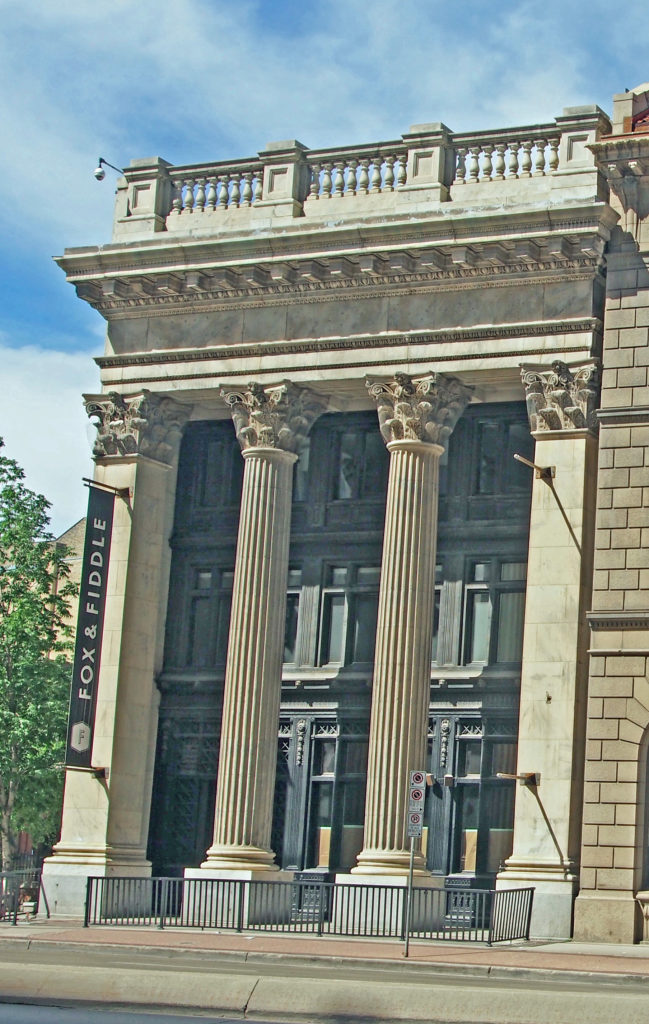
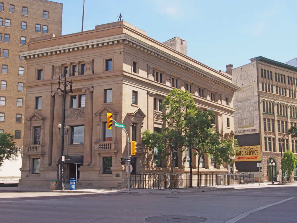
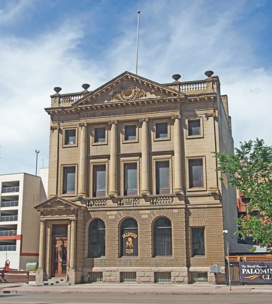
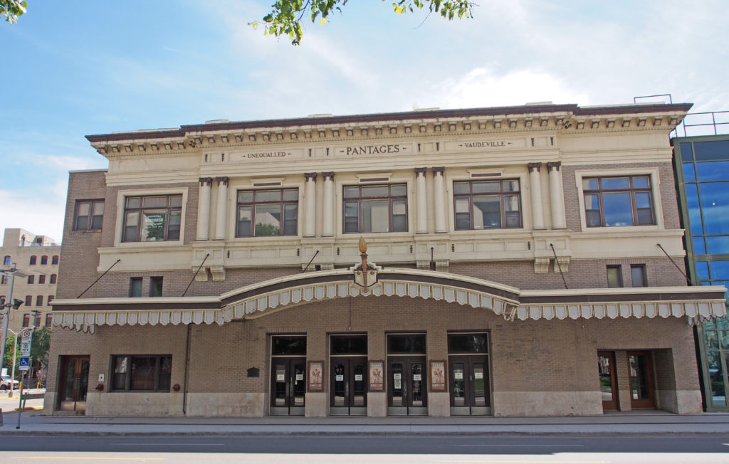
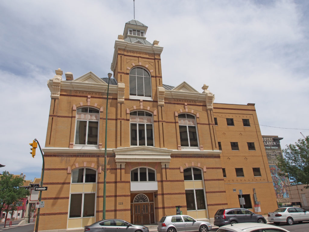
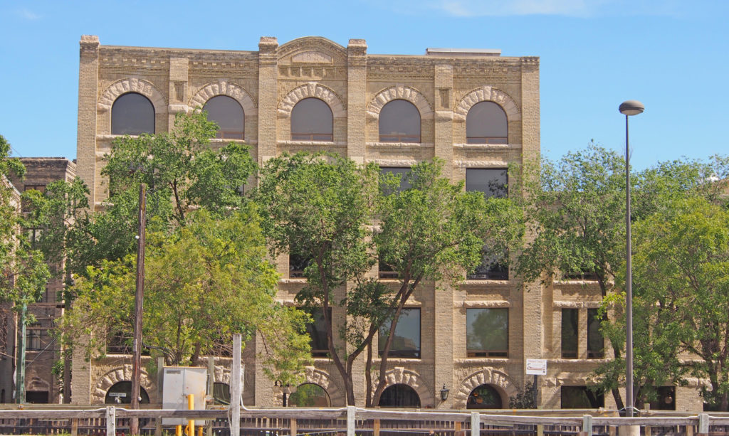
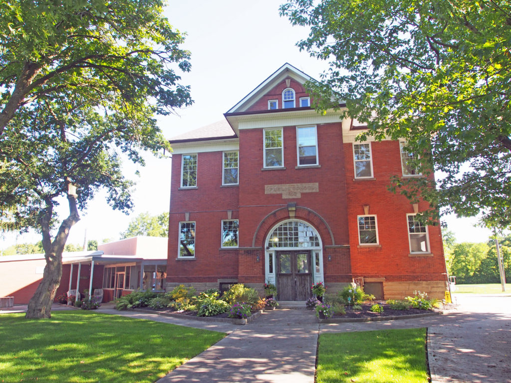
181 Higgins Avenue – The Canadian Pacific Railway Station was erected in 1904-05 and it continued in use as a rail passenger terminus until 1978. Its monumental Beaux Arts facade, elaborate Tyndall stone decoration and extensive facilities reflected both the aspirations of the railway and Winnipeg’s place as the center of transportation and commerce in early twentieth century Western Canada.678 Main Street – The Dominion Bank Building is one of the first branches established by a chartered bank outside Winnipeg’s primary financial district, in this case to capitalize on commercial development near the Canadian Pacific Railway Station. It is an excellent example of Beaux-Arts Classical architecture applied on a reduced scale but still conveying an image of corporate tradition and solidity. An enriched facade made extraordinary by fluted Ionic columns and dark-hued terracotta, along with an ornate banking hall, express the building’s functional and symbolic importance and its aesthetic kinship with the monumental bank headquarters built in the same period further south on Main Street. It was occupied by the Dominion (later Toronto-Dominion) Bank until the early 1980s.456 Main Street –The Bank of Toronto is a three-story steel, concrete and brick structure erected in 1905-06 in Winnipeg’s financial district. It is an arresting Neo-Classical structure with a rare two-part facade of marble and cast iron. Key elements of the style include the basic rectangular form of steel, concrete and brick construction, three stories high with a stepped roof line reflecting the presence of a penthouse. The elegant front (east) colonnade is composed of four white marble Corinthian columns, the outer two square and smooth, the inner two round and fluted resting on shoulder-high bases and extending to a large decorative entablature with a modillioned cornice and a high segmented balustrade. The recessed cast-iron facade features elaborate main-floor screens encasing the entrance and windows, with the two upper levels separated by ornamental friezes and cornices and holding rectilinear Sullivanesque openings with top and side lights. The intricate detailing throughout includes cast-iron geometric designs, banding, panels, frets, floral elements, and marble egg-and-dart molding and beading.441 Main Street at Bannatyne Avenue – The richly appointed Imperial Bank of Canada, a three-story steel, brick and stone banking hall and office building erected in 1906, occupies an important corner site in Winnipeg’s historic Exchange District. The Imperial Bank is an exceptional version of the Classical Revival style, designed by noted Toronto-based architects Darling and Pearson. Key external elements that define the building’s rich Classical Revival style include its rectangular plan, three-story box-like form around a steel frame and flat roof embellished by a complete entablature with modillioned cornice and plain parapet. Grey Bedford, Indiana, ashlar limestone is used on the two primary elevations (south and west). The primary facade (west) is symmetrical and features a two-story recessed entrance bay framed by two massive fluted Ionic columns; there is a simple arrangement of windows on the third-floor level with small rectangular windows and side bays dominated by large mezzanine-level openings with elaborate pseudo-balconies (complete with balustrades, brackets, and pediments).436 Main Street – The Bank of British North America, constructed in 1903-04, is a three-story steel frame, brick and sandstone structure with a one-story 1914 addition. To outshine the bank’s nearby competitors, architect A.T. Taylor of Montreal gave the building a grand Neo-Palladian sandstone front, complete with an Ionic colonnade and, for Winnipeg, a rare vermiculated (wavy lines or markings resembling the tracks of a worm) base. The impressive, highly visible edifice, long occupied by the Royal Trust Company, then by lawyers Newman, MacLean and Associates, retains considerable exterior design integrity while continuing in contemporary commercial use. Key elements that define the bank’s fine Neo-Palladian architecture include the elongated three- and one-story rectangular massing, with the main (east) facade of vermiculated and ashlar sandstone, the other elevations of solid brick and a flat roof, all around a structural steel frame.180 Market Avenue East at Main – The Winnipeg Pantages Playhouse Theatre is among the best of the vaudeville houses built in Canada between 1913 and 1920 and the first large concrete theater in North America. It was built in 1913. Key exterior elements that define the theater’s specialized Classical Revival (Greek Pantages) style include the rectangular box-shaped form, two stories high at the front and rising in stages toward the rear, constructed of brick and reinforced concrete and enclosed by mostly flat roofs. The front is symmetrically composed of a shallow central pavilion with small wings, and divided into two horizontal bands, with the second story clad in cream-colored terracotta and light buff brick and the street level clad with the same brick and smooth-cut limestone for the foundation. The metal marquee stretching across the front includes a central arch and keystone over the main doors. The second story’s five large windows are set in terracotta surrounds and panels, including three middle openings framed by engaged columns. The complete entablature includes a modillioned metal cornice, with terracotta panels that display the name ‘PANTAGES’ between the words ‘UNEQUALLED’ and ‘VAUDEVILLE’. The double entrance doors have transom windows. Ticket prices were 10¢ and 35¢ with 3 shows a day, 7 days a week. Usually there were six new acts a week and a typical day included a juggler, a song and dance team, an animal act, a comedy skit, a novelty of some sort, and a short film.223 James Avenue – Winnipeg Police Court – Built in 1883 at the corner of James Avenue and King Street, this two-story brick building contained eighteen jail cells adjacent to a large courtroom on the main floor, with offices for court officials on the second floor, and a full attic used as a dormitory for police officers. In 1908, when a new police station opened on Rupert Street, this building was renovated into municipal offices.115 Bannatyne Avenue – The Donald H. Bain Building – 1899 – is composed of two Romanesque Revival style buildings joined by a common wall – a five- and three-story brick structure. Features include solid brick-bearing walls with high rusticated stone bases and flat roof lines with parapets. The symmetrical front facade is divided into five bays by brick detailing and the placement of round-arched and lintelled windows, most of which have rusticated stone heads and sills. Details include the buff-colored brick finishes, fanciful straw basket and corbelled brickwork, thin spandrel panels, and brick drip molding. The round-arched openings have stone voussoirs and keystones on the front main and top floors. Brick pilasters, stone pilaster caps, and a heavily ornamented brick parapet with the date ‘1899’ carved into a stone panel are other heritage features.
In 1799, the Township of Norwich was laid out by surveyor William Hambly into lines and concessions and 200-acre lots.
In
1809, Peter Lossing, a member of the Society of Friends from Dutchess County
New York, visited Norwich Township. In June 1910, with his brother-in-law Peter
de Long, purchased 15,000 acres of land in this area. That fall Lossing brought
his family to Upper Canada. The de Long family and nine others soon joined
them. By 1820 an additional group of about fifty had settled here. These
resourceful pioneers founded one of the most successful Quaker communities in
Upper Canada.
The township was divided into North and South
Norwich Townships in 1855.
In 1975, Oxford County underwent countywide
municipal restructuring. The Village of Norwich and the Townships of East
Oxford, North Norwich and South Norwich were amalgamated to create the Township
of Norwich.
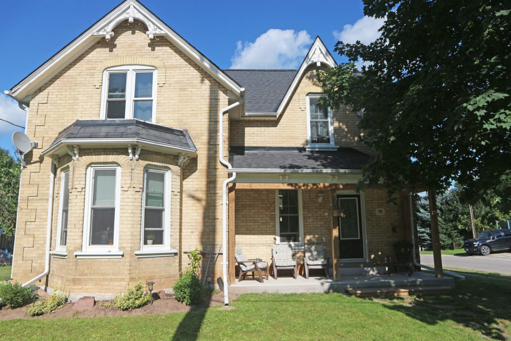
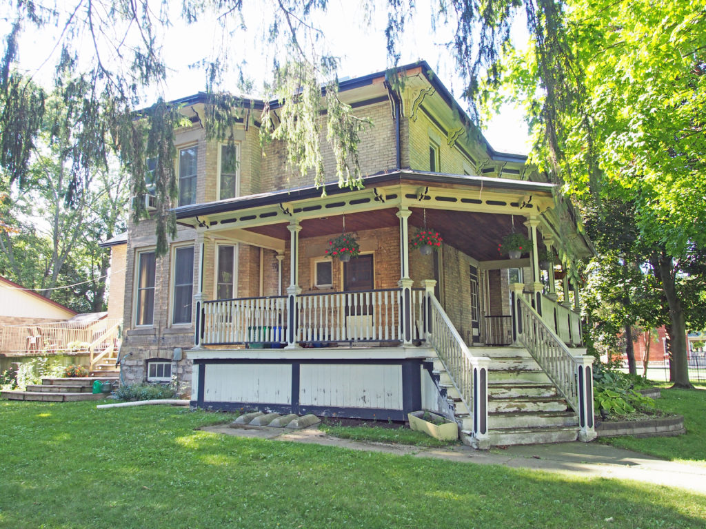
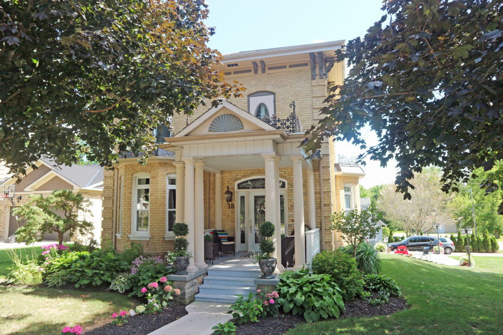
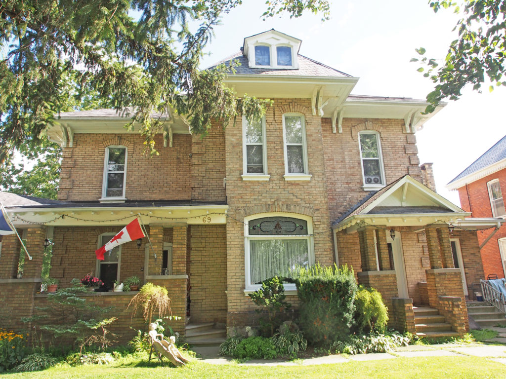
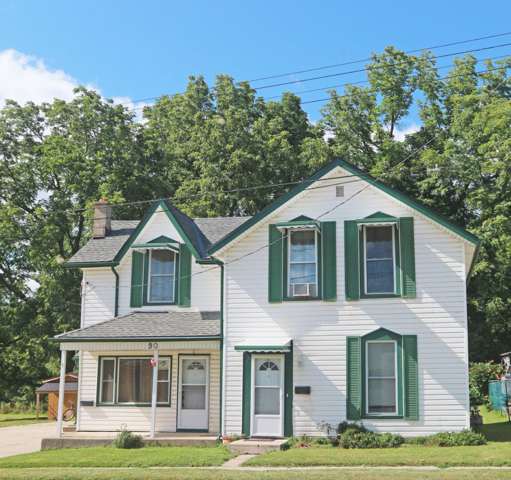
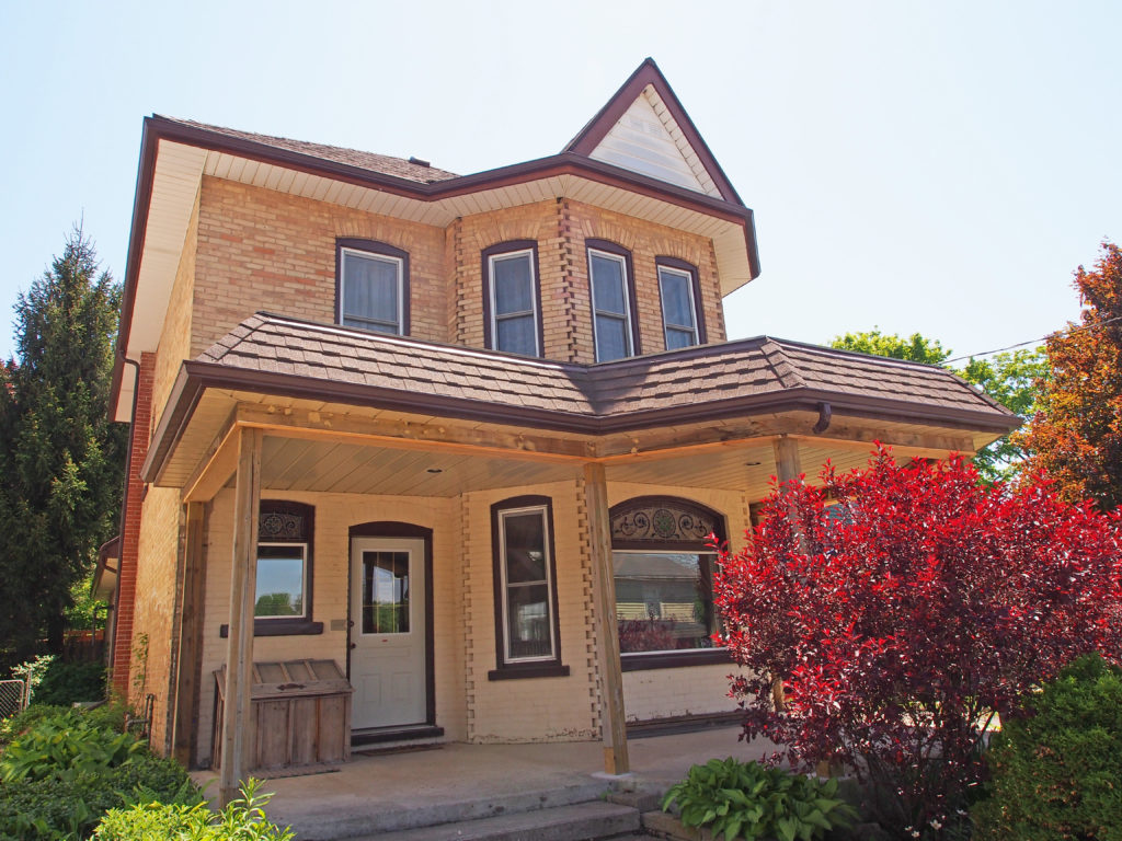
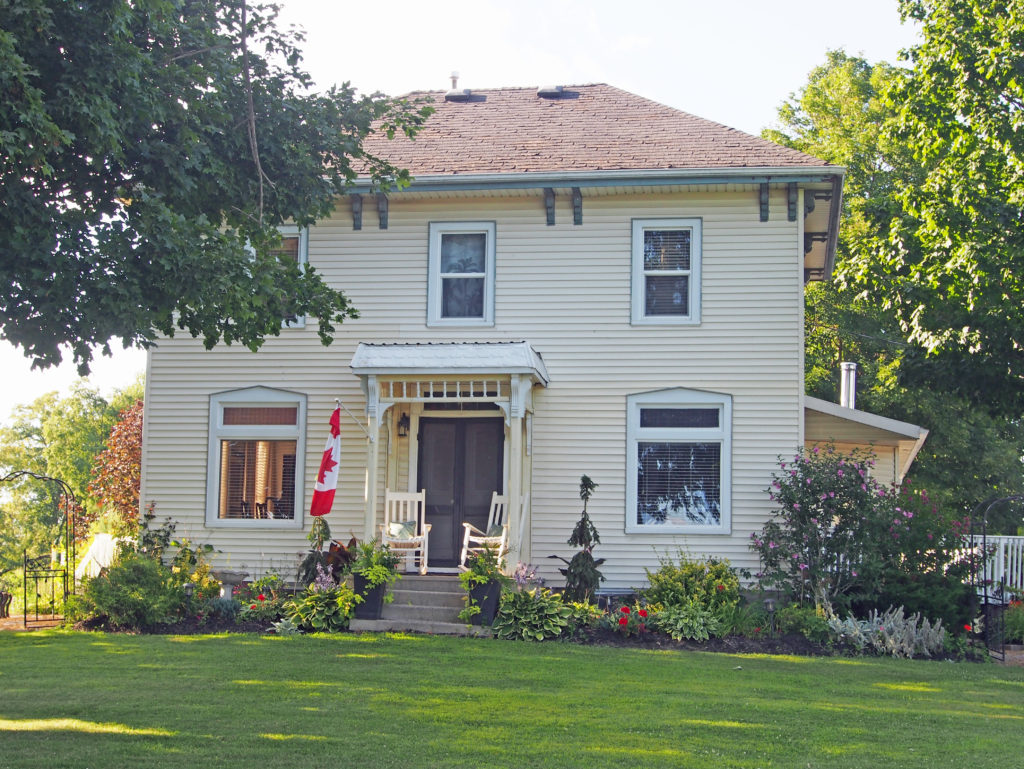
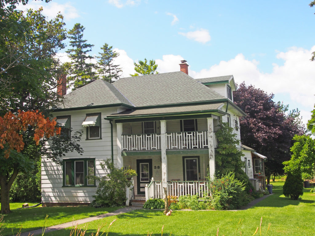
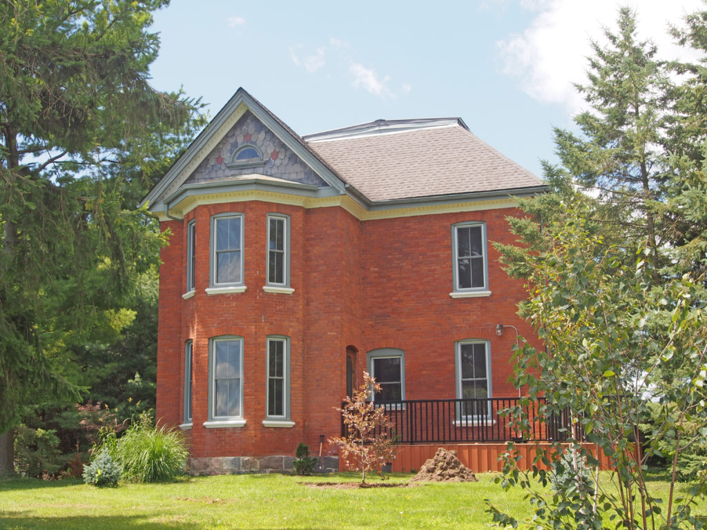
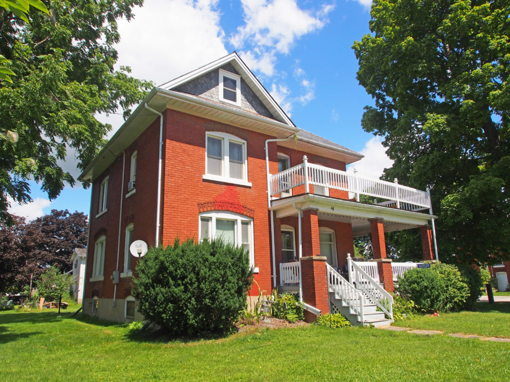
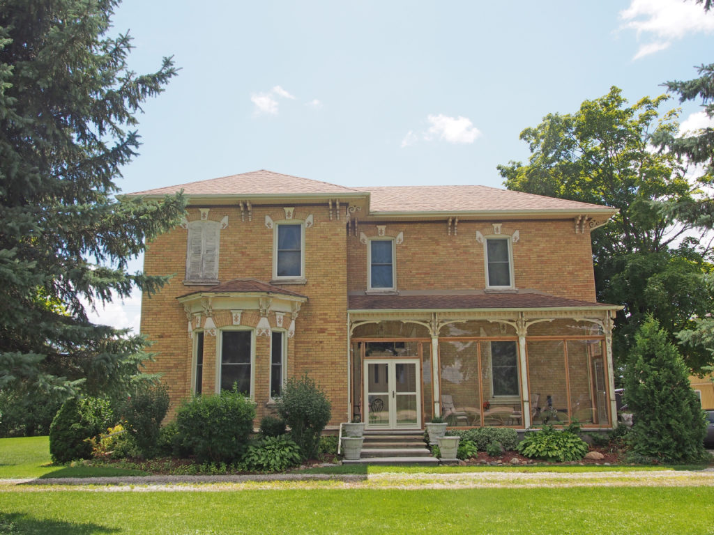
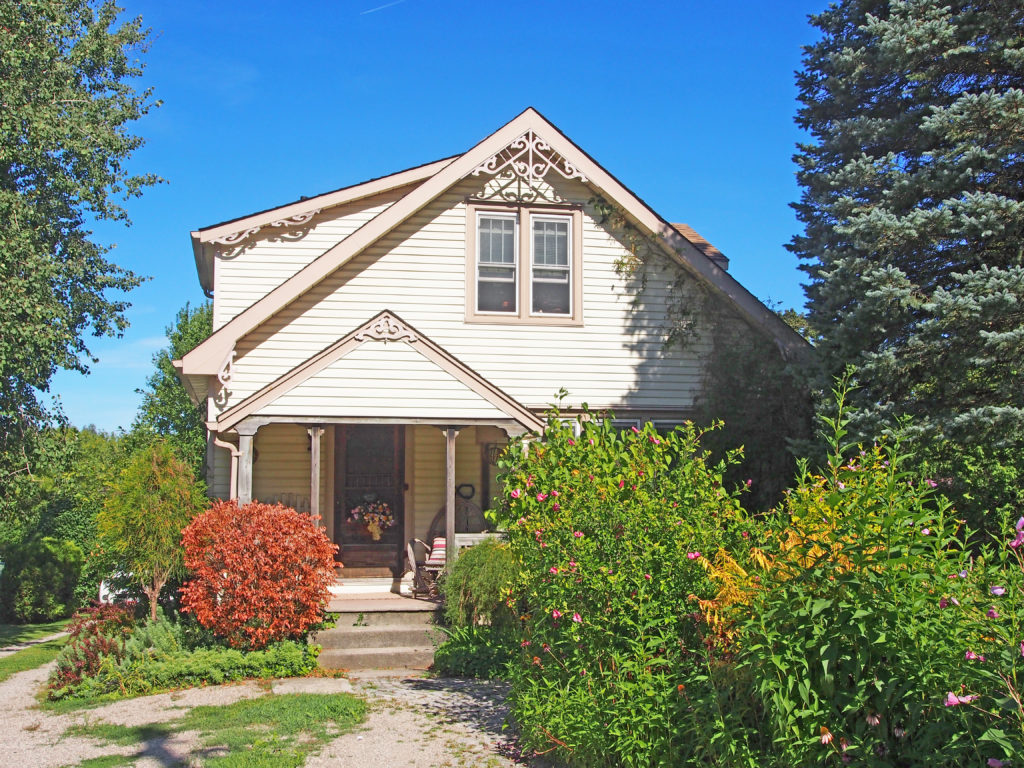
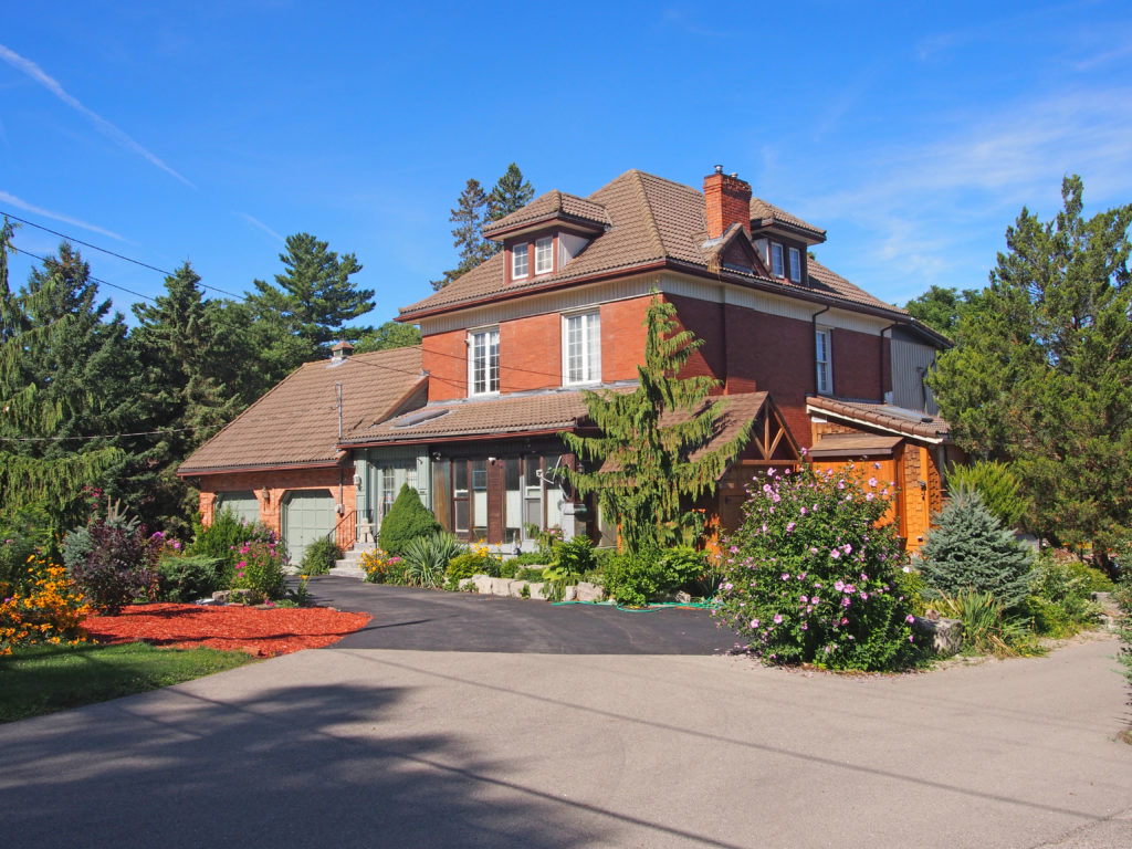
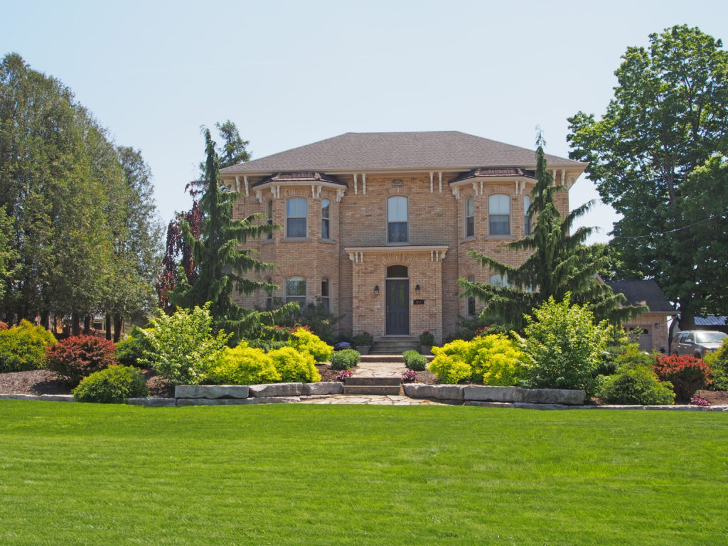
Stover Street – Italianate, hipped roof, two-story bay window, balcony above enclosed front entrance, corner quoins70 Stover Street – Gothic Revival, verge board trim on gables, bay window55 Stover Street – wraparound veranda, paired cornice brackets, decorative cornice, bay windows8 Main Street East – designated – Moore, Chambers House – Gothic, verge board trim on gables, crenelated brick arched veranda with voussoirs and keystones, bay window on side, transom above door16 Main Street East – Gothic – bay window18 Main Street East – Italianate, paired cornice brackets, decorative cornice, corner quoins, pediment with decorated tympanum above Doric pillars, sidelights and transom surround door, bay window on front and side25 Main Street East – Trillium Christian Retirement Home – two-story semi-circular veranda, bay windows, iron cresting, paired cornice brackets, corner quoins69 Main Street West – Italianate, dormer, paired cornice brackets, corner quoins, pediment78 Main Street West – Norwich United Church Manse – two-story white-brick manse was constructed in 1875 – a blocky, Italianate residence with symmetry of paired cornice brackets and twin round-headed windows and doors of second-story90 Main Street West – Gothic
The
Township of Norwich is located in Oxford County in southwestern Ontario.
Pioneering families emigrated from Norwich in upper New York State in the early
19th century. Oxford County Road 59 is the major north–south highway through
much of the township, including the community of Norwich proper. The local
economy is largely agricultural, based on corn, soybean, and wheat production
with dairy farming in the north part of the township and tobacco, vegetable,
and ginseng farming to the south. Slowly, ginseng and traditional cash crops
are replacing the former cash crop – tobacco, as demand shrinks.
In 1799,
the Township of Norwich was laid out by surveyor William Hambly into lines and
concessions and 200-acre lots. The township was divided into North and South
Norwich Townships in 1855.
In 1975,
Oxford County underwent countywide municipal restructuring. The Village of
Norwich and the Townships of East Oxford, North Norwich and South Norwich were
amalgamated to create the Township of Norwich.
Norwich
includes the communities of Beaconsfield, Bond’s Corners, Brown’s Corners,
Burgessville, Cornell, Creditville, Curries, Eastwood, Hawtrey, Hink’s Corners,
Holbrook, Milldale, Muir, Newark, New Durham, Norwich, Oriel, Otterville,
Oxford Centre, Rock’s Mills, Rosanna, Springford, Summerville, Blows, and
Vandecar.
Otterville is a village in Norwich
Township in Oxford County. It is located on the Otter Creek. Otterville was
settled in 1807. Encouraged by local Quakers, free blacks and escaped slaves
fled persecution in the United States and found homes in the Otterville area
beginning in 1829. Otterville African Methodist Episcopal Church and Cemetery
served the local black community until the late 1880s.
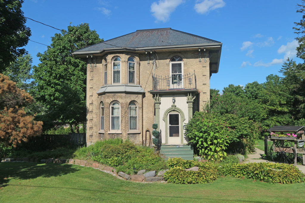
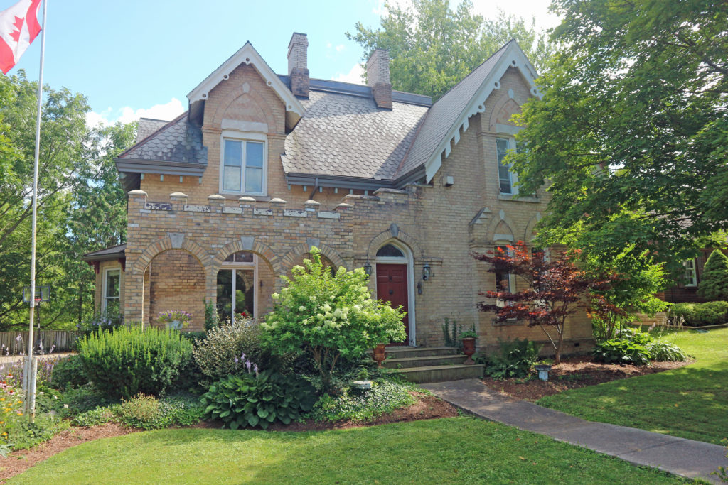
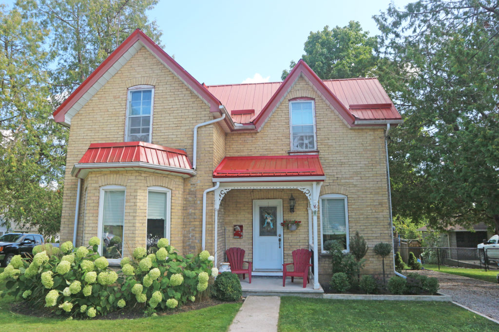
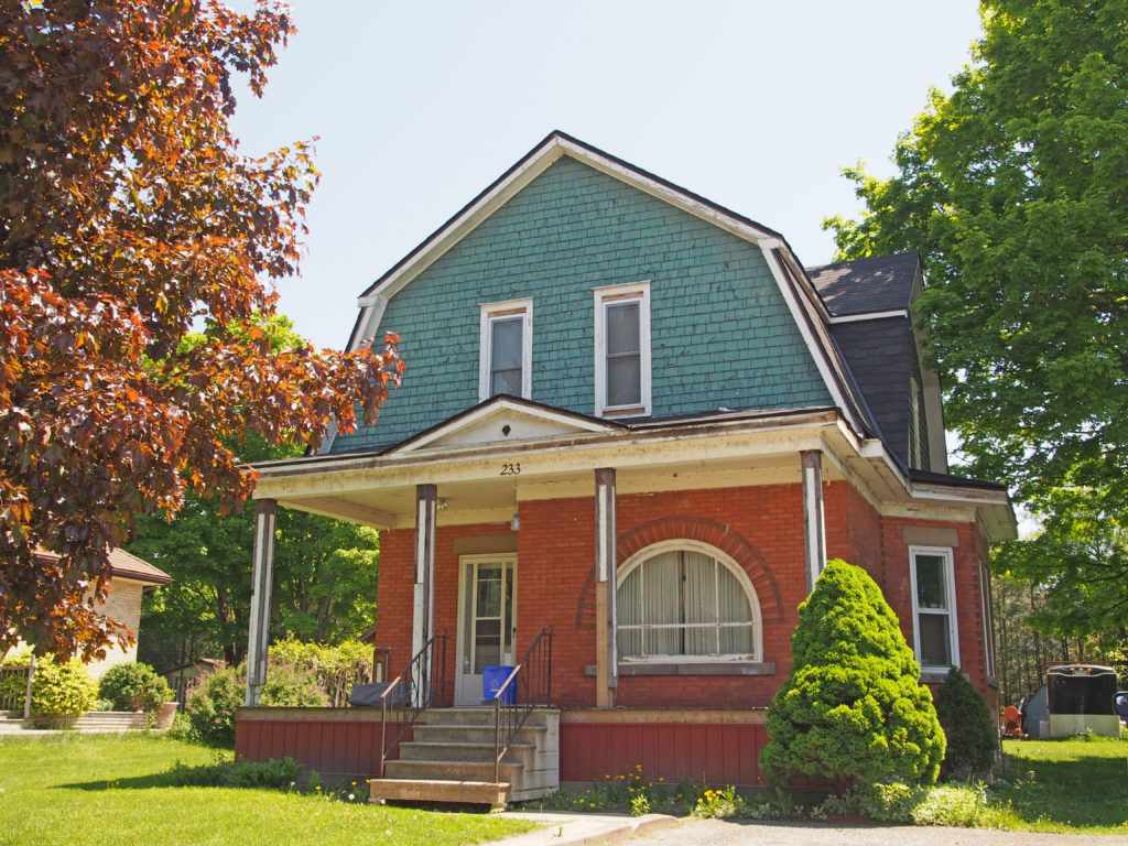
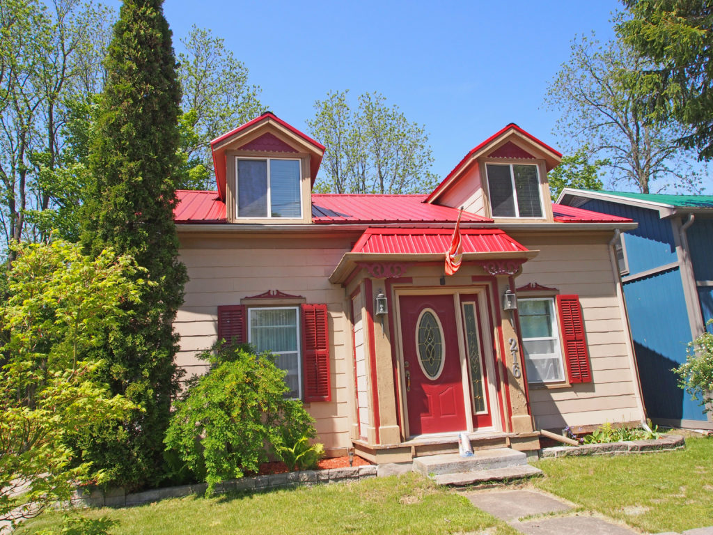
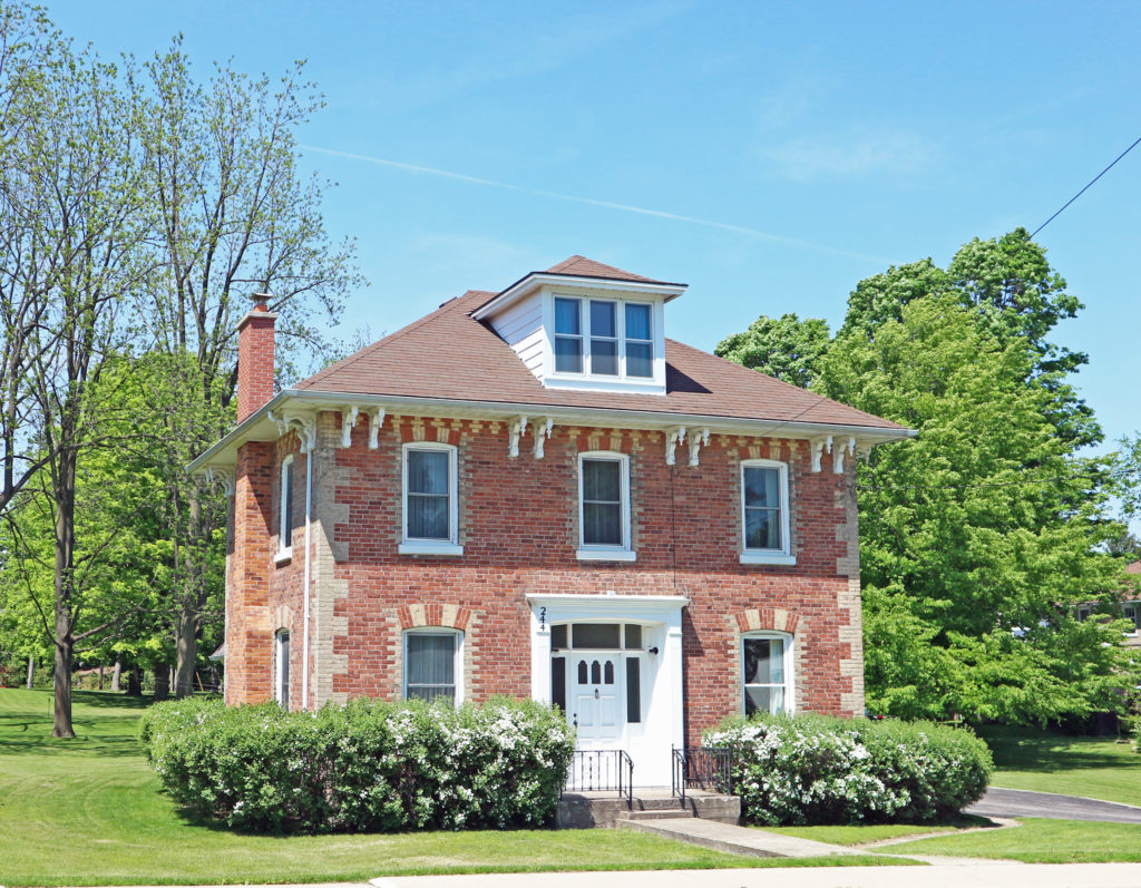
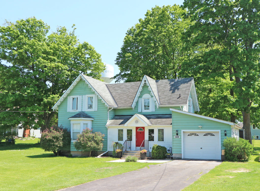
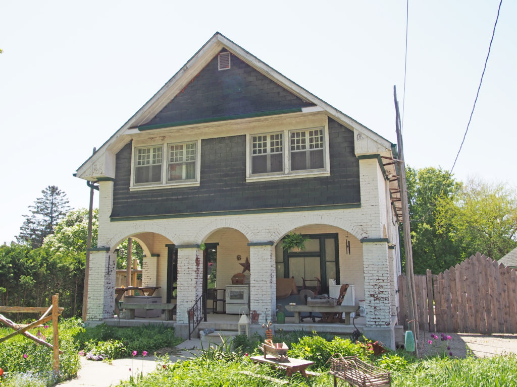
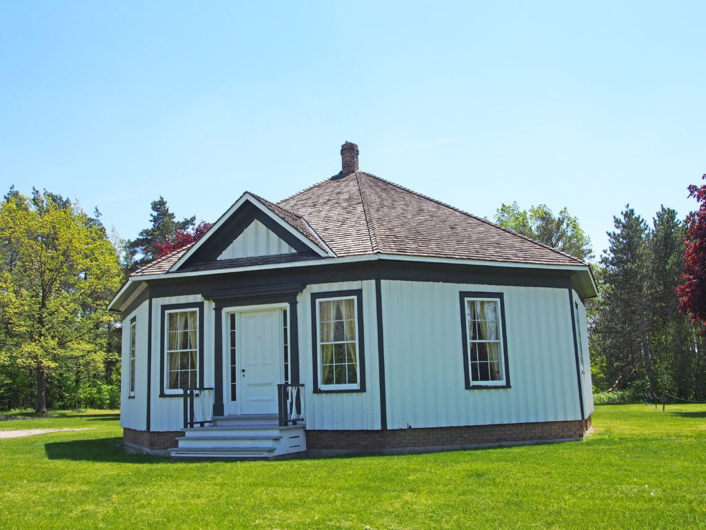
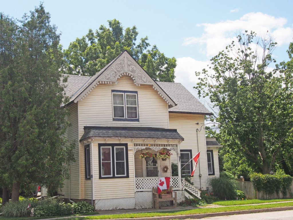
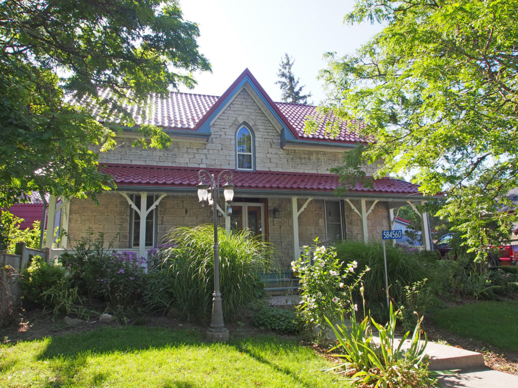
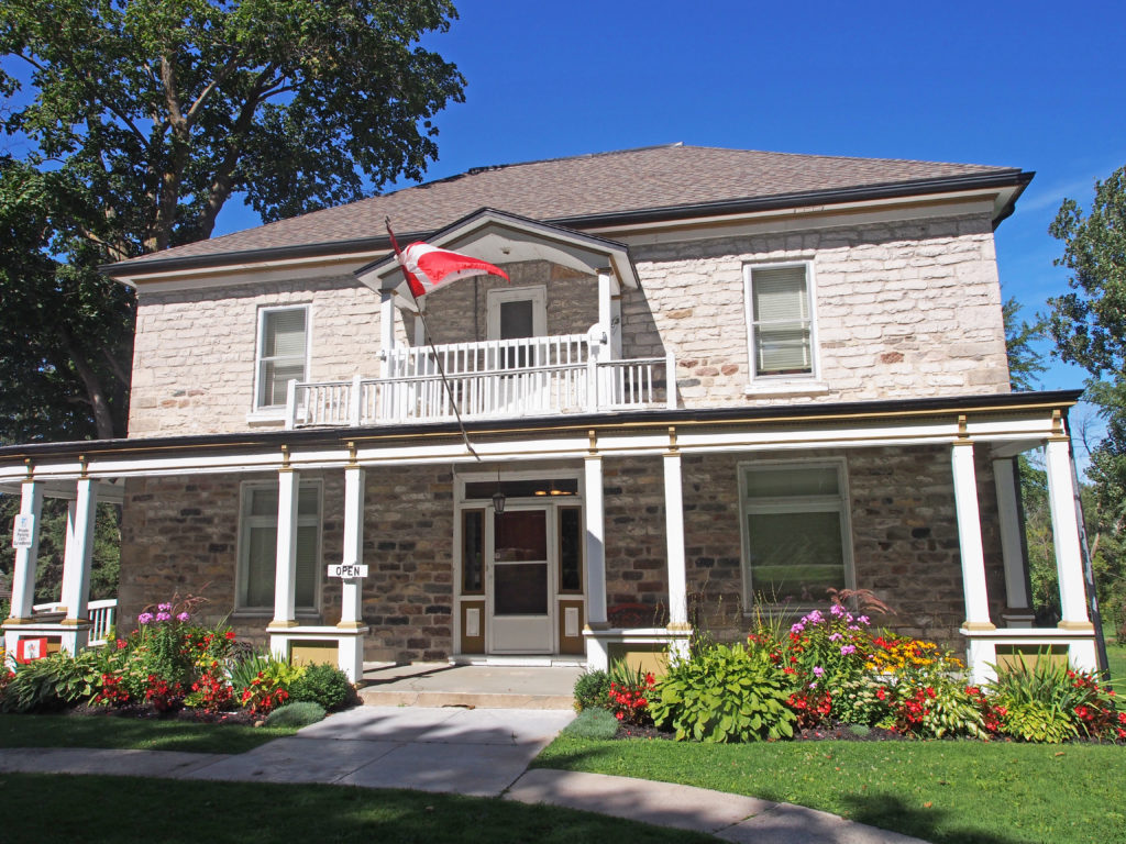
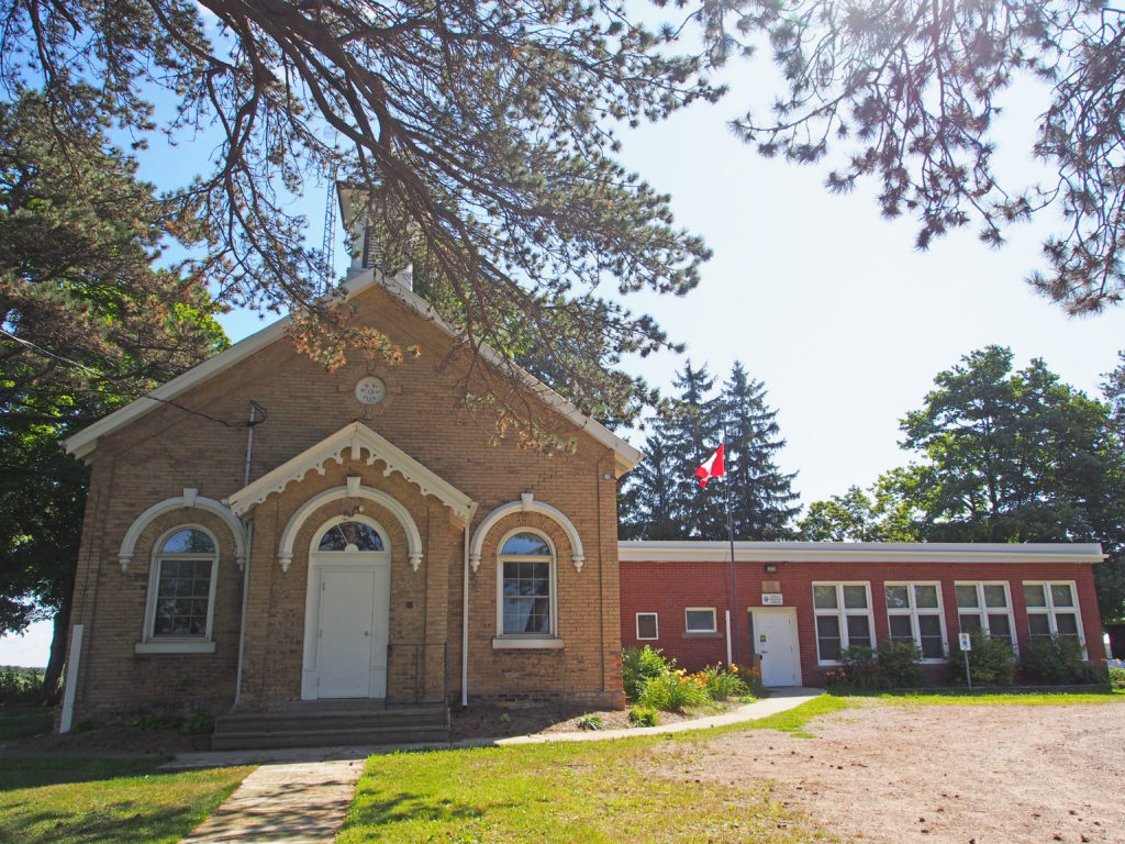
Otterville – 233 Main Street West – Neo-Colonial – gambrel roof, Romanesque-style window voussoirsOtterville – Main Street West – stained glass transomsOtterville – 216 Main Street – dormers, sidelightOtterville – 244 Main Street East – dormer in attic, paired cornice brackets, corner quoins, dichromatic voussoirsOtterville – 249 Main Street East – Gothic – verge board trim on gablesOtterville – 6 Dover StreetOtterville – 225422 Main Street West – Oddy House – constructed in 1861 – Also called Woodlawn Place which is associated with Thomas Wright, a local, prominent inventor who designed and lived in the building in the mid-nineteenth century. Wright was influenced by Dr. Orson Fowler, whose 1853 book, “The Octagonal House –A Home For Allâ€, encouraged the practicality of octagonal dwellings. Fowler argues that these homes were easier to heat and made greater use of the sun’s rays. It is a fine example of the Regency Cottage style of architecture although its octagonal shape makes it unusual. The building is of plank construction with board and batten siding. The overall plan consists of a 45-foot octagon with a 20 foot by 20-foot wing that is situated to form a trapezoidal umbrage at the side of the house. Typical of the Regency style, Woodlawn Place features a wide roof overhang and deep fascia boards. The front door is flanked with sidelights and Doric pilasters, complimented by a simulated entablature above.Burgessville – Church Street – hipped roof, paired cornice bracketsBurgessville – Church Street – Gothic20 Church Street – 2½-story tower-like bay, fretwork
South-West Oxford is a township
in Ontario in Oxford County. A predominantly rural municipality, South-West
Oxford was formed in 1975 through the amalgamation of Dereham and West Oxford
townships and the village of Beachville.
South-West Oxford extends north
to south from the middle of Oxford County along the Thames River/Highway
401/Woodstock-Ingersoll east-west corridor to the southern boundary of the
county along the Delhi-Tillsonburg-Aylmer/Ontario Highway 3 east-west corridor.
The northern boundary follows the course of the Thames River except where
carveouts have extended the boundaries of Ingersoll and Woodstock into former
township lands.
In its wilderness state, the
former Dereham township had thousands of acres of swamp and marsh land which
limited its use for agriculture. Several large drainage projects brought great
improvement and remain as essential parts of the township’s farmland
infrastructure. The township topography still has several large forested areas
which are remnants of the original swamps on which drainage system runoff is
concentrated.
At its north end, the township is
underlain with an unusually pure limestone deposit centered between Ingersoll
and Beachville that extends north-west through most of Zorra and south-east
into Norwich. Open-pit mining of the limestone and kiln-firing to produce lime
has been underway along the Thames River since pioneer days, and since the
1950s heavy industrial operations have led to nearly three thousand acres being
licensed for extraction from pits more than 100 feet deep. The size of the
limestone deposits is sufficient to support these operations for another century
or more.
South-West Oxford includes lands
in the former West Oxford township which were the earliest to be settled in
Oxford County and also lands in the former Dereham township which were the last
in the county to be settled. The greatest cause for slow growth in Dereham was
the provincial government’s decision in 1799 to auction off all the wilderness
land in the township in large blocks, which thereby fell into the hands of
speculators who held the land dormant for decades.
The township of South-West Oxford
comprises a number of villages and hamlets, including the following communities
such as *Beachville, Brownsville, Brownsville Station, Centreville, Culloden,
Delmer, Dereham Centre, Foldens, Hagles Corners, Mount Elgin, Ostrander,
Salford, Sweaburg, Verschoyle and Zenda.
Salford is a small village along
Highway 19; it is surrounded by agricultural land and the Oxford landfill to
the east. There are two churches, and the Salford Community Centre with a ball
diamond.
Sweaburg is located five
kilometers southwest of Woodstock. Its main intersection is Sweaburg Road and
Dodge Line (County Roads 12 and 41). It had a public school for students up to
grade three until 2009, and currently has Sweaburg United Church and cemetery,
a ball diamond, and a convenience store.
The
Township of Norwich is a located in Oxford County in southwestern Ontario.
Oxford County Road 59 is the major north–south highway through much of the
township. The local economy is largely agricultural, based on corn, soybean,
and wheat production with dairy farming in the north part of the township and
tobacco, vegetable, and ginseng farming to the south. Slowly, ginseng and
traditional cash crops are replacing the former cash crop – tobacco, as demand
shrinks.
Upon his
arrival in the province in 1792, the first proclamation issued by John Graves
Simcoe, the Lieutenant Governor of Upper Canada while still at Kingston,
announced the names and boundaries he had decided upon as political boundaries
for Upper Canada. For areas lying to the west of Kingston, he decided that
county names would be a “mirror of Britain”. To accomplish this, the
sequence of names for counties along Lake Ontario became Northumberland,
Durham, York and Lincoln, and for counties along Lake Erie, the names became
Norfolk, Suffolk, Essex and Kent. (This was the same sequence of county names
in place along the eastern seacoast of England, running from the Scottish
boundary down to the English Channel.) The proclamation defined the northern
boundary of Norfolk County as being the Thames River. Norwich and Dereham
townships were originally within the land area designated as belonging to
Norfolk County in Upper Canada, and were named after the towns of Norwich and
Dereham in Norfolk County in England.
Governor
Simcoe with several other government officers, guided by a party of Six Nations
warriors, conducted a wilderness tour on foot up the length of the Thames River
in 1793 and decided to assign additional place names to mirror those they knew
along the Thames River in England. Middlesex County was the name assigned to
the area around a town site reserved at the “lower forks” in the
river, to be called London; Dorchester was the name for a town site at the
“middle forks”, and the area around the “upper forks” was
to be Oxford – the same sequence of names as found along the Thames in England.
When legislation was passed in Upper Canada in 1798 to implement these new
divisions, Norwich and Dereham were separated from Norfolk County and added to
the new Oxford County, which included also Burford, Blenheim, Blandford and
Oxford townships – names drawn from Oxfordshire in England.
Shortly after returning from this tour, in March 1793, Simcoe received a petition from Thomas Ingersoll and associates asking for grant of a township to which they promised to bring settlers from New England. The group was granted the township of Oxford-on-the-Thames. In order to bring settlers into the wilderness area township, a road had to be built from Brantford up to the Thames River, a distance of thirty miles (forty-eight kilometers), and Thomas Ingersoll arranged that work over the course of the next two years. The first ones to become permanently settled in the township were likely Samuel Canfield Sr. and his wife and sons, who agreed to make their new home into a half-way stopping point for travelers along the road, at what became known as Oxford Centre.
Beachville
was the heart of Oxford County with settlement beginning in 1791.
The
Bostwicks, Ingersolls and Canfields were New England families who had made
their start in the New World in the 1600s, and frontier living had been second
nature to them for generations.
Settlement
in the former Norwich Township came more than fifteen years after Oxford
Township. The Norwich settlement was founded by two men: Peter Lossing and
Peter De Long. Both men were from New York. Peter Lossing’s house was the first
one in Norwich. It now stands by the old Quaker Meeting House. Both men where
Quakers. The town of Norwich began as a completely Quaker settlement.
In 1799, the
Township of Norwich was laid out by surveyor William Hambly into lines and
concessions and 200-acre lots. The township was divided into North and South
Norwich Townships in 1855.
In 1975,
Oxford County underwent countywide municipal restructuring. The Village of
Norwich and the Townships of East Oxford, North Norwich and South Norwich were
amalgamated to create the Township of Norwich.
Norwich
includes the communities of Beaconsfield, Bond’s Corners, Brown’s Corners,
Burgessville, Cornell, Creditville, Curries, Eastwood, Hawtrey, Hink’s Corners,
Holbrook, Milldale, Muir, Newark, New Durham, Norwich, Oriel, Otterville,
Oxford Centre, Rock’s Mills, Rosanna, Springford, Summerville, Blows, and
Vandecar.
Sweaburg – 484526 Sweaburg Road – Greek RevivalSalford – 313733 Dereham LineVerschoyle – Culloden Line – two-storey bay window, fish scale patterning and semi-circular window in gableBrownsville – Ontario Cottage with center gableBrownsville – #14 – voussoirs, second floor balconyVerge board trim on gable# 163576 – hipped roof, cornice brackets, dichromatic voussoirs, bay window with brackets, decorative porchDelmer – 312281 Dereham Line – Delmer United Church – A.D. 1900Delmer – 163942 Brownsville RoadBeachville – 584560 Beachville Road – GothicBeachville – 434804 Zorra Line – Central Public School – Palladian window584509 Beachville Road – trim on gables584503 Beachville Road – hipped roof, dormersBeachville District Museum – the former home of one of the managers of the Beachville quarry – The DowningsNorwich Township, Oxford Centre, 714561 Middletown Line – Gothic – verge board trim on gable, corner quoins, dormersNorwich Township, Oxford Centre – 714516 Middletown Line – S.S. No. 5 – A.D. 1872Springford – 431 Main Street – hipped roof, cornice brackets, two-story bay windows